Travel Trouble

Placeholder Content Image

Aussies devastated as travel agency collapses, leaving holidays in ruins

<p>Dozens of Australian travellers have had their holiday dreams shattered and lost tens of thousands of dollars following the sudden collapse of online travel agency Traveldream.</p> <p><a href="https://www.traveldream.com.au/au" target="_blank" rel="noopener">Traveldream</a>, operated under the business name Australian Travel Deals Pty Ltd, went into administration on April 28, ceasing operations immediately and leaving customers stranded across the globe – or worse, never even departing on their long-planned trips.</p> <p>The financial fallout has been severe, <a href="https://www.news.com.au/travel/travel-updates/incidents/aussies-dream-holidays-up-in-the-air-after-travel-agent-collapses/news-story/e4466dea16a9bd796f0e244cfb013597" target="_blank" rel="noopener">according to news.com.au</a>, who spoke to several impacted customers, including a mother and her two daughters who lost $33,000, and a group of Australian travellers who arrived at their overseas accommodation only to be told no booking existed in their name.</p> <p>Among the most devastating stories is that of Donna Lamberth and her husband, who lost $15,500. The Queensland couple had saved for two years to embark on the “trip of a lifetime” through North America, including a cruise in Alaska and a stop in Las Vegas. After fully paying for the holiday in December, Ms Lamberth was stunned to learn only a small deposit had been made on their cruise booking.</p> <p>“I burst into tears,” she said. “My bags were packed. I haven’t even unpacked my bags yet.”</p> <p>Ms Lamberth and her husband were forced to cancel their entire two-month trip.</p> <p>At least 75 customers are confirmed to have lost money due to the collapse, according to Bill Karageozis of insolvency firm Mcleods, who has been appointed administrator. He expects that number could rise to as many as 100 creditors. The company’s total debt is currently estimated to be under $1 million, and it has no tangible assets to recoup losses.</p> <p>Some impacted travellers have managed to salvage elements of their trips by contacting airlines and cruise companies directly. Among the suggested providers are Qantas, Singapore Airlines, Royal Caribbean Cruises and Holland America Cruises.</p> <p>One group of 300 Australians booked through Traveldream for a North American tour set to begin on May 19 now face uncertainty. Lorraine Micairan, a Sydney mother of five, is among them. She and her husband paid $12,000 for their trip and discovered many of their bookings were never paid for, despite receiving an itinerary and booking confirmations.</p> <p>“When I checked in online it said it’s cancelled,” she said. “Qantas told me there was no payment.”</p> <p>Thanks to last-minute scrambles and additional out-of-pocket expenses, Ms Micairan and her travel companions were able to rescue their trip. Still, she says the experience has left them financially and emotionally drained.</p> <p>Meanwhile, other customers were not so fortunate. Friends Michelle Brown and Tammy Meurant, along with their husbands, landed in Vancouver only to find their hotel booking had been cancelled just days earlier – likely by a third party due to non-payment by Traveldream.</p> <p>“They said: ‘Sorry, we don’t have a booking,’” Ms Brown recounted. “It was cancelled on the 6th. We arrived on the 9th.”</p> <p>The group had to scramble to find alternative accommodation via Airbnb and are bracing for more disruptions throughout their trip.</p> <p>Traveldream was founded in 2016 and led by Melbourne-based director Christopher Banson, who has not publicly commented on the situation. Banson also operates Salt Water Hotels and Resorts – a separate travel business with 30 properties nationwide – which remains unaffected by Traveldream’s demise.</p> <p>Another shareholder in the failed company, Travel Dream Australia Pty Ltd, is reportedly owed $49,000. That company is solely directed by Paul Mercuri, Traveldream’s co-founder, who was no longer involved in the business at the time of its collapse.</p> <p>Administrators are now urging affected customers to act swiftly in identifying any prepaid travel services that can be salvaged. For many, however, the damage is already done.</p> <p>“I’m going to have to save again,” Ms Lamberth said. “It’s a lot of money to lose.”</p> <p><em>Image: Traveldream</em></p>

Travel Trouble

Placeholder Content Image

It’s almost winter. Why is Australia still so hot?

<div class="theconversation-article-body"> 
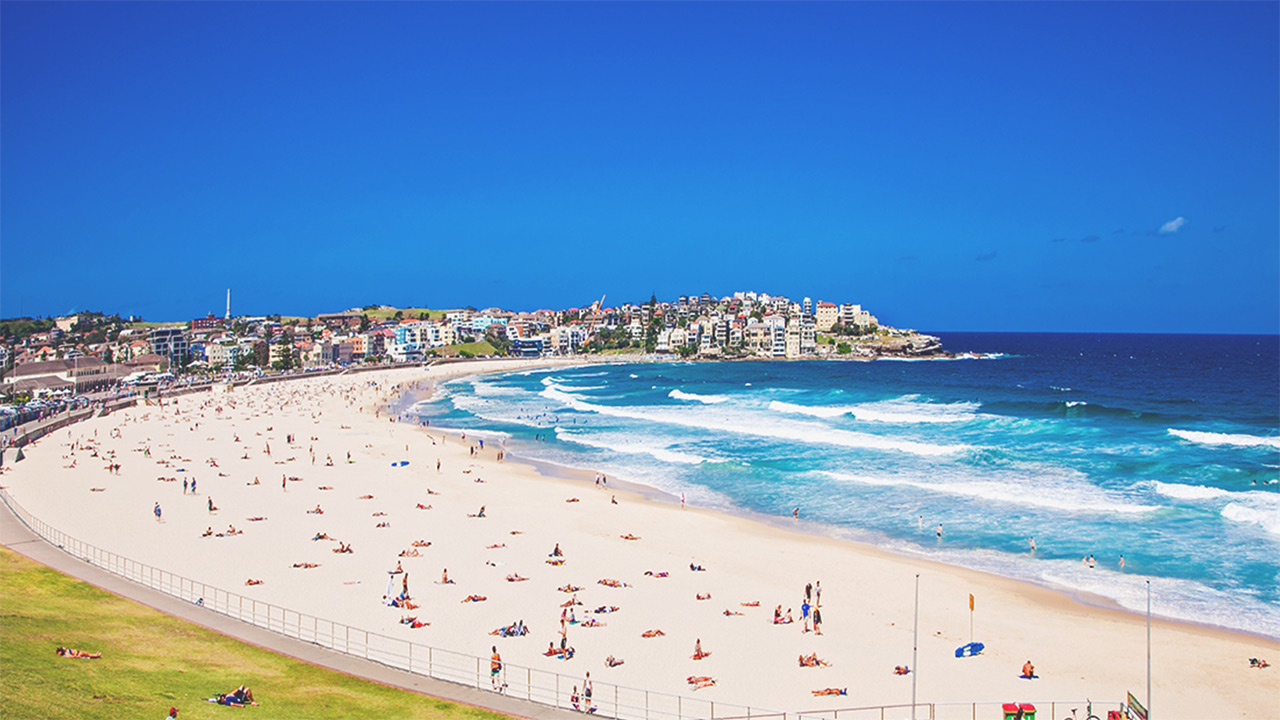
<p>This year, for many Australians, it feels like summer never left. The sunny days and warm nights have continued well into autumn. Even now, in May, it’s still unusually warm.</p> <p>Much of the southern half of the continent is experiencing both unseasonable warmth and dry conditions. This is linked to persistent high atmospheric pressure (called “blocking”) to the south and southeast of Australia.</p> <p>While temperatures will fall across southern Australia as we approach the winter solstice, early indications are that this winter will be a warm one. Rainfall predictions are less certain.</p> <p>The extra warmth we’ve experienced raises obvious questions about the influence of human-caused climate change. The warming signal is clear and it’s a sign of things to come.</p> <h2>A warm and dry autumn for many</h2> <p><a href="http://www.bom.gov.au/jsp/awap/temp/index.jsp?colour=colour&amp;time=latest&amp;step=1&amp;map=meananom&amp;period=month&amp;area=nat">March</a> and <a href="http://www.bom.gov.au/jsp/awap/temp/index.jsp?colour=colour&amp;time=latest&amp;step=0&amp;map=meananom&amp;period=month&amp;area=nat">April</a> brought unseasonal heat to much of Australia.</p> <p>March was widely hot, with temperatures several degrees above normal across much of the country. But April’s heat was largely restricted to the southeast.</p> <figure class="align-center zoomable"><a href="https://images.theconversation.com/files/666591/original/file-20250507-68-vjvcb5.png?ixlib=rb-4.1.0&amp;q=45&amp;auto=format&amp;w=1000&amp;fit=clip"><img src="https://images.theconversation.com/files/666591/original/file-20250507-68-vjvcb5.png?ixlib=rb-4.1.0&amp;q=45&amp;auto=format&amp;w=754&amp;fit=clip" sizes="(min-width: 1466px) 754px, (max-width: 599px) 100vw, (min-width: 600px) 600px, 237px" srcset="https://images.theconversation.com/files/666591/original/file-20250507-68-vjvcb5.png?ixlib=rb-4.1.0&amp;q=45&amp;auto=format&amp;w=600&amp;h=450&amp;fit=crop&amp;dpr=1 600w, https://images.theconversation.com/files/666591/original/file-20250507-68-vjvcb5.png?ixlib=rb-4.1.0&amp;q=30&amp;auto=format&amp;w=600&amp;h=450&amp;fit=crop&amp;dpr=2 1200w, https://images.theconversation.com/files/666591/original/file-20250507-68-vjvcb5.png?ixlib=rb-4.1.0&amp;q=15&amp;auto=format&amp;w=600&amp;h=450&amp;fit=crop&amp;dpr=3 1800w, https://images.theconversation.com/files/666591/original/file-20250507-68-vjvcb5.png?ixlib=rb-4.1.0&amp;q=45&amp;auto=format&amp;w=754&amp;h=566&amp;fit=crop&amp;dpr=1 754w, https://images.theconversation.com/files/666591/original/file-20250507-68-vjvcb5.png?ixlib=rb-4.1.0&amp;q=30&amp;auto=format&amp;w=754&amp;h=566&amp;fit=crop&amp;dpr=2 1508w, https://images.theconversation.com/files/666591/original/file-20250507-68-vjvcb5.png?ixlib=rb-4.1.0&amp;q=15&amp;auto=format&amp;w=754&amp;h=566&amp;fit=crop&amp;dpr=3 2262w" alt="Graph of rising Australian-average temperatures in March from 1900-2025" /></a><figcaption><span class="caption">Australia had its hottest March on record and the heat has continued, especially in Victoria and parts of New South Wales.</span> <span class="attribution"><a class="source" href="http://www.bom.gov.au/cgi-bin/climate/change/timeseries.cgi?graph=tmean&amp;area=aus&amp;season=03&amp;ave_yr=0&amp;ave_period=6190">Bureau of Meteorology</a></span></figcaption></figure> <p>Victoria had its <a href="http://www.bom.gov.au/cgi-bin/climate/change/timeseries.cgi?graph=tmean&amp;area=vic&amp;season=04&amp;ave_yr=0&amp;ave_period=6190">warmest April</a> on record, and parts of the state experienced temperatures more than 3°C above normal across both March and April.</p> <p>Temperatures normally fall quite quickly over the southeast of Australia during April and May as the days shorten and the continent’s interior cools. But this year, southern Australia was unusually warm at the start of May. Some locations experienced days with maximum temperatures more than 10°C above normal for the time of year.</p> <p>Records were broken in <a href="https://www.skynews.com.au/australia-news/weather/hobart-parts-of-melbourne-sweat-through-hottest-may-night-on-record-as-warm-windy-weather-sweeps-across-australias-southeast/news-story/8b1c76fc40c7a84842a5aaf6a57eb038">Hobart</a> and <a href="https://7news.com.au/news/jane-bunn-weather-tuesdays-balmy-morning-in-melbourne-was-just-shy-of-all-time-record-c-18600201">parts of Melbourne</a>, which had their warmest May nights since observations began.</p> <figure class="align-center zoomable"><a href="https://images.theconversation.com/files/666592/original/file-20250507-62-nf86bk.gif?ixlib=rb-4.1.0&amp;q=45&amp;auto=format&amp;w=1000&amp;fit=clip"><img src="https://images.theconversation.com/files/666592/original/file-20250507-62-nf86bk.gif?ixlib=rb-4.1.0&amp;q=45&amp;auto=format&amp;w=754&amp;fit=clip" sizes="(min-width: 1466px) 754px, (max-width: 599px) 100vw, (min-width: 600px) 600px, 237px" srcset="https://images.theconversation.com/files/666592/original/file-20250507-62-nf86bk.gif?ixlib=rb-4.1.0&amp;q=45&amp;auto=format&amp;w=600&amp;h=412&amp;fit=crop&amp;dpr=1 600w, https://images.theconversation.com/files/666592/original/file-20250507-62-nf86bk.gif?ixlib=rb-4.1.0&amp;q=30&amp;auto=format&amp;w=600&amp;h=412&amp;fit=crop&amp;dpr=2 1200w, https://images.theconversation.com/files/666592/original/file-20250507-62-nf86bk.gif?ixlib=rb-4.1.0&amp;q=15&amp;auto=format&amp;w=600&amp;h=412&amp;fit=crop&amp;dpr=3 1800w, https://images.theconversation.com/files/666592/original/file-20250507-62-nf86bk.gif?ixlib=rb-4.1.0&amp;q=45&amp;auto=format&amp;w=754&amp;h=518&amp;fit=crop&amp;dpr=1 754w, https://images.theconversation.com/files/666592/original/file-20250507-62-nf86bk.gif?ixlib=rb-4.1.0&amp;q=30&amp;auto=format&amp;w=754&amp;h=518&amp;fit=crop&amp;dpr=2 1508w, https://images.theconversation.com/files/666592/original/file-20250507-62-nf86bk.gif?ixlib=rb-4.1.0&amp;q=15&amp;auto=format&amp;w=754&amp;h=518&amp;fit=crop&amp;dpr=3 2262w" alt="GIF of Australian daily maximum temperature anomalies for 1st to 6th May" /></a><figcaption><span class="caption">The start of May saw daytime maximum temperatures across much of Australia well above average for the time of year.</span> <span class="attribution"><a class="source" href="http://www.bom.gov.au/jsp/awap/temp/index.jsp?colour=colour&amp;time=history%2Fnat%2F2025050520250505&amp;step=0&amp;map=maxanom&amp;period=daily&amp;area=nat">Bureau of Meteorology</a></span></figcaption></figure> <p>While Queensland and the New South Wales coast have had very wet spells, including downpours from Tropical Cyclone Alfred at the start of March, other parts of Australia have been quite dry.</p> <p>The area between Adelaide and Melbourne has been exceptionally dry. <a href="http://www.bom.gov.au/climate/maps/rainfall/?variable=rainfall&amp;map=drought&amp;period=3month&amp;region=nat&amp;year=2025&amp;month=04&amp;day=30">A drought is unfolding</a> in the region after a <a href="http://www.bom.gov.au/climate/maps/rainfall/?variable=rainfall&amp;map=drought&amp;period=12month&amp;region=nat&amp;year=2025&amp;month=04&amp;day=30">severe lack of rainfall</a>, with deficits stretching back over the past year or so. Western Tasmania is also suffering from a severe lack of rainfall since the start of autumn, although welcome rain fell in the past week.</p> <p>And it’s not just on land that unusual heat has been observed. The seas around Australia have been warmer than normal, causing severe coral bleaching to <a href="https://theconversation.com/synchronised-bleaching-ningaloo-and-the-great-barrier-reef-are-bleaching-in-unison-for-the-first-time-252906">the west and east</a> of the continent, <a href="https://www.epa.sa.gov.au/environmental_info/water_quality/harmful-algal-blooms">harmful algal blooms</a> and other ecosystem disruptions.</p> <h2>Blocking highs largely to blame</h2> <p>A high pressure system has dominated over the south and southeast of Australia over the past few months.</p> <p>High pressure in the Tasman Sea can sometimes get stuck there for a few days. This leads to what’s known as “blocking”, when the usual passage of weather systems moving from west to east is obstructed. This can lock in weather patterns for several days or even a week.</p> <p>Repeated blocking occurred this autumn. As winds move anticlockwise around high pressure systems in the Southern Hemisphere, blocking highs in the Tasman Sea can bring moist, onshore winds to the New South Wales and Queensland coasts, increasing rainfall. But such high pressure systems also bring drier conditions for the interior of the southeast and much of Victoria and South Australia.</p> <p>Often, these high pressure systems also bring northerly winds to Victoria, and this can cause warmer conditions across much of the state.</p> <p>High pressure systems also tend to bring more clear and sunny conditions, which increases daytime temperatures in particular. Air in high pressure systems moves down towards the surface and this process causes warming, too.</p> <p>Australia sits between the Pacific and Indian Oceans and is subject to their variability, so we often look there to help explain what’s happening with Australia’s climate. In autumn though, our climate influences, such as the El Niño-Southern Oscillation and the Indian Ocean Dipole, are less active and have weaker relationships with Australian climate than at other times of year. Neither of these climate influences is <a href="http://www.bom.gov.au/climate/outlooks/#/overview/influences">in a strong phase</a> at the moment.</p> <h2>A warm winter on the cards</h2> <p>One big question is how long the heat will last. In parts of southeast Australia, including <a href="http://www.bom.gov.au/jsp/ncc/cdio/cvg/av?p_stn_num=086071&amp;p_prim_element_index=0&amp;p_display_type=statGraph&amp;period_of_avg=ALL&amp;normals_years=allYearOfData&amp;staticPage=">Melbourne</a>, average temperatures drop quickly at this time of year as we approach the winter solstice.</p> <p>However, the seasonal outlook from the Bureau of Meteorology points to a high likelihood of a relatively <a href="http://www.bom.gov.au/climate/outlooks/#/temperature/maximum/median/seasonal/0">warm winter</a>.</p> <p>Australians rarely escape having a winter without any significant cold spells, but the long-range forecast suggests we should anticipate above-normal temperatures on average. Both daytime maximum temperatures and nighttime minimum temperatures are expected to be above average generally this winter.</p> <figure><iframe src="https://www.youtube.com/embed/Y5NIa7X2H-s?wmode=transparent&amp;start=0" width="440" height="260" frameborder="0" allowfullscreen="allowfullscreen"></iframe><figcaption><span class="caption">Climate and water long-range forecast, issued 1 May 2025 (Bureau of Meteorology)</span></figcaption></figure> <h2>Global warming is here</h2> <p>The elephant in the room is climate change. Human-caused climate change is increasing autumn temperatures and the frequency of late season heat events. As greenhouse gas emissions continue at a <a href="https://theconversation.com/global-carbon-emissions-inch-upwards-in-2024-despite-progress-on-evs-renewables-and-deforestation-243133">record pace</a>, expect continued warming and a greater chance of autumn heatwaves in future.</p> <p>The effect of climate change on rainfall is less clear though. For the vast majority of Australia, there is <a href="https://interactive-atlas.ipcc.ch/regional-information">high uncertainty</a> as to whether autumn will become wetter or drier as the world warms.<!-- Below is The Conversation's page counter tag. Please DO NOT REMOVE. --><img style="border: none !important; box-shadow: none !important; margin: 0 !important; max-height: 1px !important; max-width: 1px !important; min-height: 1px !important; min-width: 1px !important; opacity: 0 !important; outline: none !important; padding: 0 !important;" src="https://counter.theconversation.com/content/256071/count.gif?distributor=republish-lightbox-basic" alt="The Conversation" width="1" height="1" /><!-- End of code. If you don't see any code above, please get new code from the Advanced tab after you click the republish button. The page counter does not collect any personal data. More info: https://theconversation.com/republishing-guidelines --></p> <p><em>By <a href="https://theconversation.com/profiles/andrew-king-103126">Andrew King</a>, Associate Professor in Climate Science, ARC Centre of Excellence for 21st Century Weather, <a href="https://theconversation.com/institutions/the-university-of-melbourne-722">The University of Melbourne</a></em></p> <p><em>This article is republished from <a href="https://theconversation.com">The Conversation</a> under a Creative Commons license. Read the <a href="https://theconversation.com/its-almost-winter-why-is-australia-still-so-hot-256071">original article</a>.</em></p> <p><em>Image: Supplied</em></p> </div>

Travel Trouble

Placeholder Content Image

Another Aussie traveller found dead in Thailand

<p>A 41-year-old Australian man from South Australia has been found dead in the waters off Freedom Beach in Phuket, three days after he was reported missing by his wife while on holiday.</p> <p>According to Thai authorities, the man was last seen on May 7, prompting a search effort after his disappearance. His body was discovered on the morning of May 10 by the chief lifeguard during a routine patrol. The lifeguard spotted the body drifting about 20 metres from the shore amid strong surf conditions.</p> <p>Officers from Karon Police Station responded to the call and retrieved the body using ropes due to the rough seas. The man was found wearing only black underpants, and emergency responders pulled him to shore for formal identification.</p> <p>Police Lieutenant Colonel Wiwat Chamnankit confirmed that the man had been in Thailand since April 20. He told local outlet Asia Pacific Press that the victim’s family has been notified.</p> <p>“We believe that the sea currents were too strong for him to swim back to land,” Lt. Col. Chamnankit said. “Tourists should not go in the sea during these conditions when there are strong waves, unless they are with an experienced guide.”</p> <p>The body has been transferred to Vachira Phuket Hospital, where an autopsy will be conducted to determine the cause of death. The circumstances surrounding the incident remain under investigation. </p> <p>This incident marks the second death of an Australian tourist in Thailand within the past week. On May 3, 22-year-old Melbourne man Corey Walsh died after jumping from a tour boat near the popular snorkelling area of Koh Racha Yai. Authorities said he had consumed a significant amount of alcohol before repeatedly entering the water.</p> <p>Walsh was pulled from the sea unconscious and unresponsive. Despite efforts by tour conductors and emergency responders, he was pronounced dead at Chalong Hospital. No illegal substances were found on board, though empty alcohol bottles were recovered.</p> <p>These back-to-back tragedies come after the drowning of Chinese tourist Zhang Xiaohan, 30, who was scuba diving near Kabakan Island in East Kalimantan, Indonesia. She was swept away by strong currents while attempting to retrieve her GoPro camera. Her body was later found 88 metres underwater, near a known diving route.</p> <p><em>Image: <span style="font-family: -apple-system, BlinkMacSystemFont, 'Segoe UI', Roboto, Oxygen, Ubuntu, Cantarell, 'Open Sans', 'Helvetica Neue', sans-serif;">Asia Pacific Press</span></em></p>

Travel Trouble

Placeholder Content Image

Dire warning issued to Aussie travellers as conflict escalates

<p>Australians are being urged to reconsider travel to Pakistan and brace for possible flight disruptions to India following a dramatic escalation in hostilities between the two nuclear-armed South Asian nations.</p> <p>Updated travel advice issued by <a href="https://www.smartraveller.gov.au/" target="_blank" rel="noopener">Smartraveller</a> early Wednesday warns that the “current security situation” between India and Pakistan presents significant risks for travellers. The Department of Foreign Affairs and Trade (DFAT) is urging Australians to exercise heightened caution in both countries, with particularly stern warnings about travel to Pakistan.</p> <p>“We recommend you monitor local media for updates, stay alert, take official warnings seriously and follow the advice of local authorities,” the advisory reads.</p> <p>The alert highlights a “volatile security situation” in Pakistan, recommending that Australians reconsider any plans to travel there. It also notes that Pakistan has closed the Wagah border crossing with India, halting all cross-border travel indefinitely.</p> <p>“If you have plans to travel to India from Pakistan, reconsider your route and follow the advice of local authorities,” the alert states.</p> <p>The warning follows a major military incident early Wednesday morning, in which India reportedly fired missiles into Pakistani territory. Islamabad has vowed to retaliate, stoking fears of further escalation between the two rivals.</p> <p>The latest outbreak of violence stems from an April 22 attack on tourists in the Indian-administered region of Kashmir. The assault, which occurred in the popular mountain destination of Pahalgam, left 26 people dead. India has blamed Pakistan for backing the militants responsible, a charge Pakistan has denied.</p> <p>Flight disruptions are already being reported, and travellers are being advised to confirm flight details with airlines before heading to the airport. “Some airports in India (particularly in the north-west) may close, and airline schedules may be affected,” the DFAT alert warns.</p> <p>For India, the Australian government maintains a general “exercise a high degree of caution” advisory, but advises against all travel to Jammu and Kashmir and to the India-Pakistan border region, with the exception of the Atari-Wagah crossing and Manipur. The advisory also urges travellers to reconsider their need to visit Chhattisgarh and India’s border regions.</p> <p>The renewed tensions are part of a long and often violent history between India and Pakistan, who have fought multiple wars since gaining independence from Britain in 1947. The latest developments are of particular concern to Australia's large South Asian communities.</p> <p>With tensions rising and uncertainty mounting, the Australian government is urging all travellers to remain vigilant and informed.</p> <p>For the latest updates, Australians are encouraged to monitor <a href="https://www.smartraveller.gov.au/" target="_blank" rel="noopener">Smartraveller</a> and official government communications.</p> <p><em>Image: ABC News</em></p>

Travel Trouble

Placeholder Content Image

Three seriously injured in helicopter crash off Vic coast

<p>Three people have survived a serious helicopter crash that took place near Point Lonsdale on Victoria’s Bellarine Peninsula on Friday morning, according to Victoria Police.</p> <p>Emergency services were called to the scene just after 10:00am, when the helicopter is believed to have crashed into shallow water off Fellows Road, between Point Lonsdale and Ocean Grove. Footage obtained by the Nine News shows the wreckage lying partially submerged on a beach.</p> <p>Police confirmed that all three occupants of the aircraft sustained serious injuries. Two of the individuals – a man and a woman – were airlifted to Royal Melbourne Hospital, while a third man was transported by road to Geelong University Hospital.</p> <p>“The exact circumstances surrounding the incident are yet to be determined at this stage,” a Victoria Police spokesperson said, adding that the identities of the victims are still to be formally confirmed.</p> <p>Ambulance Victoria said paramedics responded swiftly and worked in coordination with other emergency services to stabilise and transport the injured. Fire Rescue Victoria (FRV) reported that its firefighters arrived within two minutes of receiving the call and found the helicopter 30 to 50 metres offshore.</p> <p>FRV personnel, alongside Surf Life Saving teams and paramedics, helped safely bring the three occupants ashore.</p> <p>The Australian Transport Safety Bureau (ATSB) has launched an investigation and is currently gathering information to determine the cause of the crash.</p> <p>Authorities are urging anyone who witnessed the incident or has relevant information to contact Crime Stoppers or the ATSB.</p> <p><em>Images: Nine News</em></p>

Travel Trouble

Placeholder Content Image

Jeep plunges into Swan River after wild Perth standoff

<p>A tense morning in Perth's western suburbs exploded into high drama as a police standoff ended with a man deliberately driving a Jeep off Claremont Jetty and into the Swan River, following hours of chaos, confrontation and confusion.</p> <p>The ordeal began around 9am local time (11am AEST), when a black Jeep was seen mounting the Claremont Jetty, its driver erratic and agitated. Within minutes, police had mobilised in force, positioning a squad car to block the only exit and deploying a full-scale response – including Tactical Response Group officers, police negotiators, the canine unit and a hovering police helicopter.</p> <p>Witnesses described a surreal and frightening scene as the driver shouted at police and bystanders, repeatedly revved the engine, and exited the vehicle several times to yell defiantly.</p> <p>“He was revving the car lots, shouting out at the police – I didn’t know what he was going to do,” said witness Cathy Greatrex. “Pretty scary, really.”</p> <p>The man’s mother arrived on the jetty and was seen pleading with her son from behind the police cordon, while officers attempted to de-escalate the situation. Behind the scenes, police had laid down a stinger device and reinforced their blockade with tactical vehicles.</p> <p>Tensions escalated just before midday when the Jeep suddenly lurched forward, ramming the parked police car and pushing it backwards, crumpling the front of the vehicle in a violent display of defiance.</p> <p>Minutes later, the vehicle's rear wheel slipped off the jetty’s edge as the driver reversed. Seizing the moment, he accelerated again – this time with no turning back. In front of stunned onlookers and dozens of officers, the Jeep launched off the end of the jetty and plunged into the Swan River.</p> <p>Within moments, officers rushed to the edge as the vehicle bobbed in the water, partially submerged. The man climbed onto the overturned Jeep before diving back into the water. Police with guns and Tasers drawn quickly surrounded the area.</p> <p>The Tactical Response Group moved in swiftly, pulling the man from the water and carrying him to a waiting ambulance. He was taken to Sir Charles Gairdner Hospital under police guard. Authorities confirmed that while his injuries were not believed to be serious, he remains under observation.</p> <p>The motive for the dramatic standoff remains unclear. However, new CCTV footage from nearby Walter Street may offer some clues. Earlier that morning, the same Jeep was captured careening through a residential area.</p> <p>“He literally just came right up, ramped up, knocked my green bin again and missed me – went down this concrete path,” resident Carina Robert said. “I just stood here with my jaw hanging on the ground, and then he turned the corner and there were almighty screeches tearing down the road.”</p> <p>As night fell, questions lingered about what drove the man to such a reckless and dangerous act. No charges have been laid, and police continue to investigate the full circumstances leading up to the event.</p> <p><em>Images: Nine News</em></p>

Travel Trouble

Placeholder Content Image

Virgin Australia issuing refunds to 61,000 travellers

<p>Virgin Australia has announced it will refund approximately 61,000 customers after discovering a pricing error that led to overcharges on itinerary changes made over the past five years.</p> <p>The airline revealed that a glitch in its pricing system caused some tickets to be incorrectly repriced when passengers adjusted their bookings. The issue affected bookings made between April 21, 2020, and March 31, 2025, representing around 0.1 per cent of total reservations during that period.</p> <p>Affected customers will be contacted directly by Virgin Australia, with the average refund expected to be around $55.</p> <p>“At Virgin Australia, we have policies that determine when and how we reprice a guest's booking when they make a change to their itinerary," a spokesperson said in a statement. "We recently found that in some instances, bookings were repriced in a way that does not align with our policy, and we are refunding all impacted guests for that amount."</p> <p>The airline has apologised to affected travellers and launched an "itinerary change claim program" to manage the process. Deloitte Australia has been appointed to assist with handling claims and expediting refunds.</p> <p>"We want to do the right thing, and that means acknowledging when we get things wrong and fixing it," the spokesperson added. "Guests will have up to 12 months to make a claim, and any unclaimed amounts will be donated to charity."</p> <p>Virgin Australia has also notified the Australian Competition and Consumer Commission (ACCC) and pledged to work closely with the regulator to meet any further obligations.</p> <p>The airline confirmed it holds the details of all impacted customers and will be sending out communication, in partnership with Deloitte, on how to claim refunds.</p> <p><em>Image: Virgin Australia</em></p>

Travel Trouble

Placeholder Content Image

"Abhorrent behaviour": Newlywed charged after assaulting Jetstar check-in staff

<p>A man who launched a violent attack on an airport worker during a "meltdown" on his wedding day has pleaded guilty to assault.</p> <p>Alok Sharma, 43, an Indian national, was overwhelmed by visa troubles before his "woeful lapse in judgment" at Perth Airport on February 25, according to his defence. Sharma attacked a 24-year-old Jetstar employee at a service counter as he attempted to board a flight to Bali with his wife.</p> <p>The Perth Magistrates Court heard that Sharma used a luggage conveyor belt to jump over the counter before slapping the victim. As she attempted to escape, he pulled her to the ground and kicked her. A female colleague intervened, attempting to shield the victim while shouting at Sharma to leave. Two bystanders assisted in restraining him until federal police arrived and made an arrest.</p> <p>The prosecution described the victim as visibly distressed and in shock following the assault. The altercation began after Sharma became agitated over issues with his visa and passport. Initially, he was told he could not cut in line. After rejoining the queue, he returned an hour later and launched his "entirely unprovoked" attack.</p> <p>Sharma’s lawyer acknowledged that his actions were unacceptable but argued that he had been under immense pressure due to the travel complications. Describing the incident as a "blip" in Sharma’s otherwise clean record, the lawyer said Sharma fully accepted responsibility and deeply regretted his behaviour.</p> <p>Sharma, who holds two master’s degrees and has worked for major global financial institutions such as Citibank, Barclays and Oracle, has lived in Australia for over two years on a student visa. </p> <p>Following the attack, Sharma was charged with one count of common assault and was ordered to pay $7,500 in compensation to the victim. He was granted a spent conviction, which allows him to avoid a criminal record, a crucial factor for future employment and visa applications.</p> <p>Magistrate Steven Heath said that such a conviction is rarely granted and condemned Sharma’s actions. "Those that work in the airport environment are entitled to a safe workplace. This assault went beyond a single slap – it included a kick while the victim was on the ground. Such behaviour is completely unacceptable," Heath said.</p> <p>Australian Federal Police (AFP) Acting Superintendent Aviation Shona Davis reiterated that violence against airport workers and passengers would not be tolerated. "No one should go to work and be subjected to violence or aggression," Davis stated.</p> <p>Jetstar also condemned the attack. "This was an utterly shocking act of violence. Abhorrent behaviour like this can never be tolerated, and we thank the AFP for their response," a spokesperson said.</p> <p><em>Image: Australian Federal Police</em></p>

Travel Trouble

Placeholder Content Image

Cruise passenger facing life sentence after onboard discovery

<p>A Brazilian passenger has been charged with drug-related offences after authorities discovered a significant quantity of cocaine hidden in his cruise ship cabin upon docking in Sydney Harbour on Saturday.</p> <p>The Australian Federal Police (AFP) allege that the 48-year-old man had concealed 10kg of cocaine within the ceiling cavity of his room aboard the vessel, which had arrived from Argentina. During a search conducted by Australian Border Force (ABF) officials, officers reportedly uncovered 28 individually wrapped parcels of the substance, which tested positive for cocaine.</p> <p>In addition to the drugs, authorities also discovered "body packing material" hidden in the ceiling cavity and the wardrobe. According to the AFP, such materials are commonly used by drug couriers attempting to smuggle narcotics across international borders and security checkpoints.</p> <p>An examination of the suspect’s mobile phone allegedly revealed further evidence linked to drug trafficking. The AFP subsequently charged the man with one count of importing a commercial quantity of a border-controlled drug and one count of possessing a commercial quantity of an unlawfully imported border-controlled drug. If convicted, he faces a maximum penalty of life imprisonment.</p> <p>AFP Detective Superintendent Kristie Cressy highlighted the potential impact of the drug haul, noting that the seized cocaine could have been distributed in 10,000 individual street deals, with an estimated street value of $3 million.</p> <p>“This amount of cocaine could have been sold in the community as 10,000 individual street deals of 1 gram for about $3 million,” Cressy stated. “Drug traffickers are motivated by greed, and they do not care about the harm they cause. These drug deals put pressure on the health system.”</p> <p>The Australian Institute of Health and Welfare reports that between 2022 and 2023, there were more than two hospitalisations per day in Australia due to drug-related incidents.</p> <p>ABF Superintendent Matt O’Connor acknowledged the increased risk of drug smuggling during the cruise season but reassured the public of law enforcement's vigilance in tackling such operations.</p> <p>“The cruising season brings with it additional opportunities for criminal syndicates to attempt to smuggle illicit drugs into the country; however, Border Force officers are very attuned to their pivoting tactics,” O’Connor said. “Our ABF officers process and border-clear thousands of passengers and crew members on every international cruise ship which arrives into Sydney and are ready to respond to any threat which may present itself.”</p> <p>The accused is set to appear in court as investigations continue into the broader implications of the smuggling attempt.</p> <p><em>Images: Australian Federal Police</em></p>

Travel Trouble

Placeholder Content Image

New details emerge after Gold Coast Hilton Hotel catches fire

<p>New details have emerged after a massive fire erupted at the Hilton Surfers Paradise Hotel on the Gold Coast overnight, prompting the evacuation of hundreds of guests and staff.</p> <p>The blaze originated on the roof of the hotel's western tower at around 2am, with debris falling onto the second-floor restaurant area, notably affecting establishments like Steampunk Surfers Paradise. </p> <p>Emergency services responded promptly, with multiple fire crews arriving to combat the flames. The Queensland Fire Department reported that the fire on the pool deck was extinguished by around 2:20am, and the roof fire was under control by 2:40am. Guests were then permitted to return to their rooms at around 3am. </p> <p>Surfers Paradise resident Joevy Lyn captured dramatic footage of debris tumbling 120m from the roof to the streets below.  Legendary Australian jockey Shane Dye, who was staying on the 34th floor of a neighbouring tower, witnessed the fire firsthand and told the Courier Mail: "Everything was on fire and in flames, I couldn't believe it. It was right outside my window." Dye evacuated his building amid initial confusion, saying that hotel staff were initially unaware of the severity of the situation. </p> <p>Another guest, Leah Nicholson, who was staying at the Hilton with her wife and three-year-old daughter, reported not hearing any alarms but, upon contacting the front desk, was told of the fire. The family then descended 14 flights of stairs to evacuate, only hearing evacuation alarms upon reaching the ground level. </p> <p>Queensland police assisted in the evacuation, and while the cause of the fire remains under investigation, a woman staying at an apartment across the road reportedly said she believed the Hilton sign had exploded.</p> <p>“The H on top of the Hilton building just started to catch on fire and then it all started to explode,” the woman told 7NEWS. “Parts of it started to fall which caught … other parts of the building on fire. It was quite intense.”</p> <p><em>Images: 7NEWS</em></p>

Travel Trouble

Placeholder Content Image

"Get under your desks!": Incredible moment tornado strikes TV studio during live broadcast

<p>Dramatic footage captured the moment an EF-2 tornado slammed into the FOX 35 television studio in Lake Mary, Florida, on Monday morning. The on-air meteorologist, Brooks Garner, swiftly ordered his colleagues to take cover as the storm bore down on them in real time.</p> <p>Garner, a seasoned meteorologist for FOX 35, remained remarkably composed as the tornado, with winds reaching up to 200km/h, moved directly toward the station. The storm was first spotted on the studio’s outdoor camera, showing it charging across Interstate 4 before closing in on the journalists inside.</p> <p>Once the wind and heavy rain obscured visibility, leaving only swirling debris on the cameras, Garner issued an urgent warning.</p> <p>“We got debris? Okay. Take shelter! Everybody in the FOX 35 building, get to your safe space. Under your desk if you’re not in a designated area. We’re catching debris right now on the roof,” he said during the live broadcast.</p> <p>As debris pounded the building, Garner repeated his instructions with greater urgency. “Seek shelter immediately! Get under your desks, guys, anchors. Under the desks. Producers, everybody get under the desks.”</p> <p>After the storm passed, Garner quickly shifted his focus back to the safety of viewers still in its path.</p> <p>“Get to the ground level, an interior room, away from the windows,” he urged. “This is a very serious situation. This is a real, live tornado. It just hit our station.”</p> <p>According to the National Weather Service (NWS), the tornado formed at 9:35am. near the southeastern edge of Wekiwa Springs State Park. The twister carved a destructive path through residential areas in Longwood, damaging homes, shattering windows and tearing off roofs.</p> <p>Officials later confirmed that at least one home collapsed. Additionally, a semi-truck was overturned with its driver and his dog inside. Fortunately, no fatalities were reported, though the region suffered widespread power outages and fallen trees. Even inside the fortified FOX 35 building, lights flickered as the tornado struck.</p> <p>Emergency crews have since been deployed to assess the damage and assist affected residents. Authorities urge locals to remain alert, as severe weather conditions persist in the area.</p> <p><em>Image: FOX 35</em></p>

Travel Trouble

Placeholder Content Image

Police warn against idiotic cyclone behaviour

<p>As Tropical Cyclone Alfred unleashes powerful storm surges and massive waves along Australia’s coastline, videos have emerged on social media showing people risking their lives for the perfect shot - despite repeated warnings from authorities to stay away from dangerous coastal areas.</p> <p>Footage circulating online captures individuals walking along the shoreline, snapping pictures, and even getting knocked over by monstrous waves. Some videos have amassed hundreds of thousands of views, sparking widespread criticism.</p> <p>One alarming incident occurred at Elephant Rock in Currumbin, where a group of people became trapped at a lookout after massive swells wiped out the road connecting them to the mainland. Viewers of the viral video condemned their reckless actions, with many questioning why they were out sightseeing during such treacherous conditions.</p> <p>Authorities have also reported a missing jet skier on the Gold Coast, heightening concerns about public safety during the storm. Gold Coast Acting Chief Superintendent Peter Miles expressed his frustration over the situation.</p> <p>“We all need to be a bit more smart about this and ensure that we don’t have any unneeded rescues or potentially worse where we’re looking at fatalities,” he said. “This isn’t a sunset where you can take a nice picture. You’re dealing with Mother Nature at her wildest.”</p> <p>Acting Gold Coast Mayor Donna Gates has threatened fines of up to $16,100 for those ignoring safety warnings and engaging in reckless behaviour along the coast. “For all those people that are going down to the beach and standing on the rock walls or on the sand, please stay away,” Gates pleaded on Thursday afternoon.</p> <p>“We’ve been in touch with police today. There’s been some really foolish behaviour, and it’s so important that people stay away from the beach.</p> <p>“We have been declared a disaster zone, which enables police to take action, and anyone performing a reckless action can actually be fined up to $16,100.”</p> <p>She went on to stress the importance of spreading the message widely, hoping to deter further risky actions: “It’s really in an effort to keep people who are a bit stupid, safe. We need to tell them over and over again, stay out of the water. It’s dangerous.”</p> <p>Her concerns were echoed by Lismore Mayor Steve Krieg, who urged residents to avoid becoming “environmental tourists” during the storm.</p> <p>“Don’t put others in danger because you want to become an environmental tourist or take some of these selfies and put yourself in harm’s way,” he said in a press conference alongside NSW Premier Chris Minns. “Heed the warnings, stay at home and protect your loved ones, and please stay safe.”</p> <p><em>Image: TikTok</em></p>

Travel Trouble

Placeholder Content Image

Teen charged after allegedly trying to board Jetstar flight with a gun

<p>A 17-year-old has been arrested after he allegedly attempted to board a Jetstar flight at Avalon Airport armed with a gun. </p> <p>The incident occurred around 2.20pm on Thursday, and it is believed that the teenager from Ballarat hid in his car before cutting a hole through a fence around the airport’s perimeter.</p> <p>The teenager wore a  high-vis jacket and tool belt, and reportedly told crew members that he was there to carry out maintenance work. </p> <p>Crew members and passengers managed to detain the teenager near the front door of the plane, after passenger Barry Clark noticed the teenager was carrying a shotgun and detained the boy in a headlock until police arrived. </p> <p>“Before we knew it, a shotgun appeared, and I was worried about it being shot, so all I could do was push her out of the way, get the gun out of the way, break that gun and throw it down the stairs, and then put him in a hold, throw him to the ground until the police came,” he told <em>ABC Radio Melbourne</em>.</p> <p>Police also allegedly found two bags and a vehicle belonging to the boy, with the bomb squad called in to assist. </p> <p>The boy has since been charged with eight offences including unlawfully taking control of an aircraft, endangering the safety of an aircraft and taking part in a bomb hoax.</p> <p>He was remanded in custody to appear at a children’s court at a later date.</p> <p>Victoria Police Superintendent Michael Reid released a statement saying it was "very concerning" that the teen was able to breach security.</p> <p>“It would have been a very frightening experience for those passengers involved, but once again I do really commend the bravery of those civilian passengers that helped assist to overpower him.”</p> <p>Avalon Airport has reopened following the incident, with chief executive Ari Suss assuring that further security measures have been implemented. </p> <p>“We want to reassure the public that the safety of our passengers, staff, and community remains our highest priority,” he said.</p> <p>“We continue to work closely with authorities to ensure a safe and secure environment for all travellers.</p> <p>“This matter continues to be managed by Victoria Police, and we are fully supporting their ongoing investigation.”</p> <p><em>Image: 7News</em></p>

Travel Trouble

Placeholder Content Image

Why Alfred is such an "unusual" cyclone

<div class="theconversation-article-body"> <p>Cyclone Alfred has now been delayed, as the slow-moving system <a href="https://www.theguardian.com/australia-news/2025/mar/06/cyclone-alfred-news-update-landfall-when-will-it-hit-why-did-it-slow-down">stalls</a> in warm seas off southeast Queensland. Unfortunately, the expected slow pace of the cyclone will bring even more rain to affected communities.</p> <p>This is because it will linger for longer over the same location, dumping more rain before it moves on. Alfred’s slowing means the <a href="https://www.abc.net.au/news/2025-03-06/cyclone-alfred-stalling-at-sea-later-landfall/105016522">huge waves</a> triggered by the cyclone will last longer too, likely making coastal erosion and flooding worse.</p> <p>Cyclone Alfred is unusual – the first cyclone in half a century to come this far south and make expected landfall.</p> <p>When unusual disasters strike, people naturally want to know what role climate change played – a process known as “climate attribution”. Unfortunately, this process takes time if you want details on a specific event.</p> <p>We can’t yet say if Alfred’s unusual path and slow speed are linked to climate change. But climate change <em>is</em> driving very clear trends which can load the dice for more intense cyclones arriving in subtropical regions. These include the warm waters which fuel cyclones spreading further south, and cyclones dumping more rain than they used to.</p> <p>So, let’s unpick what’s driving Cyclone Alfred’s behaviour – including the potential role of climate change.</p> <figure><iframe src="https://www.youtube.com/embed/ADuTsiDlMh8?wmode=transparent&amp;start=0" width="440" height="260" frameborder="0" allowfullscreen="allowfullscreen"></iframe><figcaption><span class="caption">A Bureau of Meteorology update on Cyclone Alfred dated Thursday, March 6.</span></figcaption></figure> <h2>Not necessarily climate linked: Alfred’s southerly path</h2> <p>Many cyclones make it as far south as Brisbane – but they’re nearly all far out at sea. Weather patterns mean most cyclones heading south are diverted to the east, where remnants can hit New Zealand as large extratropical storms.</p> <p>The fact that Alfred is set to make landfall is very unusual. But we can’t yet definitively say this is due to climate change. Cyclones are steered by winds and weather patterns, and the Coral Sea’s complex weather makes cyclone paths here very hard to predict.</p> <p>Alfred’s abrupt westward shift is due to a large region of high pressure to its south, which has pushed it directly towards heavily populated areas of southeast Queensland and northern New South Wales. These steering winds are not very strong, which is why Alfred is moving slowly.</p> <p>In 2014, <a href="https://www.nature.com/articles/nature13278">researchers showed</a> cyclones are reaching their maximum intensity in areas further south in the southern hemisphere and north in the northern hemisphere than they used to. In 2021, researchers also found cyclones were reaching their <a href="https://www.science.org/doi/10.1126/science.abb9038">maximum intensity</a> closer to coasts, moving about 30 km closer per decade.</p> <h2>Climate link: Warmer seas</h2> <p>Cyclones typically need water temperatures of 26.5°C or more <a href="https://www.csiro.au/en/news/All/Articles/2025/March/things-to-know-about-tropical-cyclones">to form</a>.</p> <p>More than 90% of all extra heat trapped by greenhouse gas emissions is stored <a href="https://www.climate.gov/news-features/understanding-climate/climate-change-ocean-heat-content">in the seas</a>. The oceans are the <a href="https://theconversation.com/2024s-extreme-ocean-heat-breaks-records-again-leaving-2-mysteries-to-solve-246843">hottest on record</a>, and records keep falling. But normal seasonal variability and shifting ocean currents are still at work too, and we can get unusually warm waters without climate change as a cause.</p> <p>What we do know is that ocean temperatures around much of Australia have been unusually warm.</p> <p>The northeastern Coral Sea, where Cyclone Alfred formed, <a href="http://www.bom.gov.au/cgi-bin/climate/change/timeseries.cgi?graph=sst&amp;area=cor&amp;season=01&amp;ave_yr=0&amp;ave_period=6190">experienced</a> the fourth-hottest temperatures on record for February and the hottest on record for January.</p> <figure class="align-center zoomable"><a href="https://images.theconversation.com/files/653437/original/file-20250306-56-z5mg7o.png?ixlib=rb-4.1.0&amp;q=45&amp;auto=format&amp;w=1000&amp;fit=clip"><img src="https://images.theconversation.com/files/653437/original/file-20250306-56-z5mg7o.png?ixlib=rb-4.1.0&amp;q=45&amp;auto=format&amp;w=754&amp;fit=clip" sizes="(min-width: 1466px) 754px, (max-width: 599px) 100vw, (min-width: 600px) 600px, 237px" srcset="https://images.theconversation.com/files/653437/original/file-20250306-56-z5mg7o.png?ixlib=rb-4.1.0&amp;q=45&amp;auto=format&amp;w=600&amp;h=450&amp;fit=crop&amp;dpr=1 600w, https://images.theconversation.com/files/653437/original/file-20250306-56-z5mg7o.png?ixlib=rb-4.1.0&amp;q=30&amp;auto=format&amp;w=600&amp;h=450&amp;fit=crop&amp;dpr=2 1200w, https://images.theconversation.com/files/653437/original/file-20250306-56-z5mg7o.png?ixlib=rb-4.1.0&amp;q=15&amp;auto=format&amp;w=600&amp;h=450&amp;fit=crop&amp;dpr=3 1800w, https://images.theconversation.com/files/653437/original/file-20250306-56-z5mg7o.png?ixlib=rb-4.1.0&amp;q=45&amp;auto=format&amp;w=754&amp;h=566&amp;fit=crop&amp;dpr=1 754w, https://images.theconversation.com/files/653437/original/file-20250306-56-z5mg7o.png?ixlib=rb-4.1.0&amp;q=30&amp;auto=format&amp;w=754&amp;h=566&amp;fit=crop&amp;dpr=2 1508w, https://images.theconversation.com/files/653437/original/file-20250306-56-z5mg7o.png?ixlib=rb-4.1.0&amp;q=15&amp;auto=format&amp;w=754&amp;h=566&amp;fit=crop&amp;dpr=3 2262w" alt="figure showing rising sea temperatures in february in coral sea." /></a><figcaption><span class="caption">In the Coral Sea, sea surface temperatures were the fourth highest on record in February 2025 and the highest on record in January 2025. This figure shows the trend over time for February.</span> <span class="attribution"><a class="source" href="http://www.bom.gov.au/cgi-bin/climate/change/timeseries.cgi?graph=sst&amp;area=cor&amp;season=02&amp;ave_yr=0&amp;ave_period=6190">Bureau of Meteorology</a>, <a class="license" href="http://creativecommons.org/licenses/by-nc-nd/4.0/">CC BY-NC-ND</a></span></figcaption></figure> <p>We also know Australia’s southern waters are <a href="http://www.bom.gov.au/cgi-bin/climate/change/timeseries.cgi?graph=sst&amp;area=sth&amp;season=1202&amp;ave_yr=0&amp;ave_period=6190">warming up</a> too.</p> <p>The energy available to power tropical cyclones in subtropical regions has also increased in recent decades, due largely to rising ocean temperatures.</p> <figure class="align-center zoomable"><a href="https://images.theconversation.com/files/653417/original/file-20250305-56-8v9737.png?ixlib=rb-4.1.0&amp;q=45&amp;auto=format&amp;w=1000&amp;fit=clip"><img src="https://images.theconversation.com/files/653417/original/file-20250305-56-8v9737.png?ixlib=rb-4.1.0&amp;q=45&amp;auto=format&amp;w=754&amp;fit=clip" sizes="(min-width: 1466px) 754px, (max-width: 599px) 100vw, (min-width: 600px) 600px, 237px" srcset="https://images.theconversation.com/files/653417/original/file-20250305-56-8v9737.png?ixlib=rb-4.1.0&amp;q=45&amp;auto=format&amp;w=600&amp;h=492&amp;fit=crop&amp;dpr=1 600w, https://images.theconversation.com/files/653417/original/file-20250305-56-8v9737.png?ixlib=rb-4.1.0&amp;q=30&amp;auto=format&amp;w=600&amp;h=492&amp;fit=crop&amp;dpr=2 1200w, https://images.theconversation.com/files/653417/original/file-20250305-56-8v9737.png?ixlib=rb-4.1.0&amp;q=15&amp;auto=format&amp;w=600&amp;h=492&amp;fit=crop&amp;dpr=3 1800w, https://images.theconversation.com/files/653417/original/file-20250305-56-8v9737.png?ixlib=rb-4.1.0&amp;q=45&amp;auto=format&amp;w=754&amp;h=618&amp;fit=crop&amp;dpr=1 754w, https://images.theconversation.com/files/653417/original/file-20250305-56-8v9737.png?ixlib=rb-4.1.0&amp;q=30&amp;auto=format&amp;w=754&amp;h=618&amp;fit=crop&amp;dpr=2 1508w, https://images.theconversation.com/files/653417/original/file-20250305-56-8v9737.png?ixlib=rb-4.1.0&amp;q=15&amp;auto=format&amp;w=754&amp;h=618&amp;fit=crop&amp;dpr=3 2262w" alt="sea surface temperature map queensland" /></a><figcaption><span class="caption">Average sea surface temperatures in central and southern Queensland on Thursday March 6th. Point Danger is on the Gold Coast.</span> <span class="attribution"><a class="source" href="http://www.bom.gov.au/oceanography/forecasts/idyoc300.shtml?region=SEQLD&amp;forecast=SST">Bureau of Meteorology</a>, <a class="license" href="http://creativecommons.org/licenses/by-nc-nd/4.0/">CC BY-NC-ND</a></span></figcaption></figure> <h2>Climate link: Fewer cyclones but more likely to be intense</h2> <p>In the northern hemisphere, researchers have found a trend towards fewer cyclones over time. But of those which do form, a higher proportion are more intense.</p> <p>It’s not fully clear if the same trend exists in the southern hemisphere, though we are seeing fewer cyclones forming over time.</p> <p>This summer, eight tropical cyclones have formed in Australian waters. Six were classified as severe (category 3 and up). Historically, Australia has experienced a higher proportion of category 1 and 2 cyclones, which bring weaker wind speeds.</p> <p>On average, <a href="https://www.csiro.au/en/news/All/Articles/2025/March/things-to-know-about-tropical-cyclones">we see</a> about 11 cyclones form and 4-5 make landfall. There has been a <a href="https://theconversation.com/why-hurricanes-like-milton-in-the-us-and-cyclones-in-australia-are-becoming-more-intense-and-harder-to-predict-241000">downward trend</a> in the number of cyclones forming in the Australian region in recent decades.</p> <figure class="align-center zoomable"><a href="https://images.theconversation.com/files/653438/original/file-20250306-56-nk34gw.png?ixlib=rb-4.1.0&amp;q=45&amp;auto=format&amp;w=1000&amp;fit=clip"><img src="https://images.theconversation.com/files/653438/original/file-20250306-56-nk34gw.png?ixlib=rb-4.1.0&amp;q=45&amp;auto=format&amp;w=754&amp;fit=clip" sizes="(min-width: 1466px) 754px, (max-width: 599px) 100vw, (min-width: 600px) 600px, 237px" srcset="https://images.theconversation.com/files/653438/original/file-20250306-56-nk34gw.png?ixlib=rb-4.1.0&amp;q=45&amp;auto=format&amp;w=600&amp;h=391&amp;fit=crop&amp;dpr=1 600w, https://images.theconversation.com/files/653438/original/file-20250306-56-nk34gw.png?ixlib=rb-4.1.0&amp;q=30&amp;auto=format&amp;w=600&amp;h=391&amp;fit=crop&amp;dpr=2 1200w, https://images.theconversation.com/files/653438/original/file-20250306-56-nk34gw.png?ixlib=rb-4.1.0&amp;q=15&amp;auto=format&amp;w=600&amp;h=391&amp;fit=crop&amp;dpr=3 1800w, https://images.theconversation.com/files/653438/original/file-20250306-56-nk34gw.png?ixlib=rb-4.1.0&amp;q=45&amp;auto=format&amp;w=754&amp;h=492&amp;fit=crop&amp;dpr=1 754w, https://images.theconversation.com/files/653438/original/file-20250306-56-nk34gw.png?ixlib=rb-4.1.0&amp;q=30&amp;auto=format&amp;w=754&amp;h=492&amp;fit=crop&amp;dpr=2 1508w, https://images.theconversation.com/files/653438/original/file-20250306-56-nk34gw.png?ixlib=rb-4.1.0&amp;q=15&amp;auto=format&amp;w=754&amp;h=492&amp;fit=crop&amp;dpr=3 2262w" alt="figure showing falling number of tropical cyclones in Australia over time" /></a><figcaption><span class="caption">Fewer cyclones, but more likely to be intense: this figure shows the number of severe (Category 3 and up) and non-severe tropical cyclones (Category 1 and 2) since 1970/71.</span> <span class="attribution"><a class="source" href="http://www.bom.gov.au/cyclone/tropical-cyclone-knowledge-centre/history/climatology/">Bureau of Meteorology</a>, <a class="license" href="http://creativecommons.org/licenses/by-nc-nd/4.0/">CC BY-NC-ND</a></span></figcaption></figure> <h2>Climate link: Cyclones dumping more rain</h2> <p>The intensity of a cyclone refers to the speed of the wind and size of the wind-affected area.</p> <p>But a cyclone’s rain field is also important. This refers to the area of heavy rain produced by storms when they’re at cyclone intensity and afterwards as they decay into tropical lows.</p> <p>The rate of rainfall brought by cyclones in Australia isn’t necessarily increasing, but more cyclones are <a href="https://www.nature.com/articles/s41558-018-0227-5">moving slowly</a>, such as Alfred. This means more rain per cyclone, on average.</p> <p>Rising ocean temperatures mean more water evaporates off the sea surface, meaning forming cyclones can absorb more moisture and dump more rain when it reaches land.</p> <p>Why are cyclones slowing down? This is likely because air current circulation in the tropics has weakened. This has a clear link to climate change. Wind speeds have fallen <a href="https://www.nature.com/articles/s41558-018-0227-5">5 to 15%</a> in the tropics, depending on where you are in the world. It’s hard to pinpoint the change clearly in our region, because the historic record of cyclone tracks isn’t very long.</p> <p>For every degree (°C) of warming, rainfall intensity increases 7%. This is <a href="https://wmo.int/topics/extreme-weather">well established</a>. But <a href="https://theconversation.com/supercharged-thunderstorms-have-we-underestimated-how-climate-change-drives-extreme-rain-and-floods-228896">newer research</a> is showing the rate may actually be <a href="https://hess.copernicus.org/articles/28/1251/2024/hess-28-1251-2024-assets.html">double this</a> or <a href="https://doi.org/10.1029/2024EF004808">even higher</a>, as the process of condensation releases heat which can trigger more rain.</p> <h2>Clear climate link: Bigger storm surges due to sea level rise</h2> <p>Sea levels are on average about <a href="https://www.climate.gov/news-features/understanding-climate/climate-change-global-sea-level">20 centimetres higher</a> than they were before 1880.</p> <p>When a cyclone is about to make landfall, its intense winds push up a body of seawater ahead of it – the storm surge. In low lying areas, this can spill out and flood streets.</p> <p>Because climate change is causing baseline sea levels to rise, storm surges can reach further inland. Sea-level rise will also make coastal erosion more destructive.</p> <h2>What should we take from this?</h2> <p>We can’t say definitively that climate change is behind Cyclone Alfred’s unusual track.</p> <p>But factors such as rising sea levels, slower cyclones and warmer oceans are changing how cyclones behave and the damage they can do.</p> <p>Over time, we can expect to see cyclones arriving in regions not historically affected – and carrying more rain when they arrive.<!-- Below is The Conversation's page counter tag. Please DO NOT REMOVE. --><img style="border: none !important; box-shadow: none !important; margin: 0 !important; max-height: 1px !important; max-width: 1px !important; min-height: 1px !important; min-width: 1px !important; opacity: 0 !important; outline: none !important; padding: 0 !important;" src="https://counter.theconversation.com/content/251594/count.gif?distributor=republish-lightbox-basic" alt="The Conversation" width="1" height="1" /><!-- End of code. If you don't see any code above, please get new code from the Advanced tab after you click the republish button. The page counter does not collect any personal data. More info: https://theconversation.com/republishing-guidelines --></p> <p><a href="https://theconversation.com/profiles/liz-ritchie-tyo-1509061"><em>Liz Ritchie-Tyo</em></a><em>, Professor of Atmospheric Sciences, <a href="https://theconversation.com/institutions/monash-university-1065">Monash University</a>; <a href="https://theconversation.com/profiles/andrew-dowdy-119002">Andrew Dowdy</a>, Principal Research Scientist in Extreme Weather, <a href="https://theconversation.com/institutions/the-university-of-melbourne-722">The University of Melbourne</a>, and <a href="https://theconversation.com/profiles/hamish-ramsay-19549">Hamish Ramsay</a>, Principal Research Scientist, Environment, <a href="https://theconversation.com/institutions/csiro-1035">CSIRO</a></em></p> <p><em>This article is republished from <a href="https://theconversation.com">The Conversation</a> under a Creative Commons license. Read the <a href="https://theconversation.com/cyclone-alfred-is-slowing-and-that-could-make-it-more-destructive-heres-how-climate-change-might-have-influenced-it-251594">original article</a>.</em></p> <p><em>Image: Windy.com</em></p> </div>

Travel Trouble

Placeholder Content Image

Flight attendant's act after touchdown divides social media users

<p>A United Airlines flight attendant has copped some flak online for playing the violin after touching down in California. </p> <p>The unnamed crew member welcomed travellers to the Bay Area by playing a cheery tune as people got up to disembark from the flight, and while his performance was met with a round of applause from passengers, others weren't quite as pleased. </p> <p>“It was a definite pleasant surprise and welcome change compared to all the news we hear from airlines these days,” the Redditor captioned the clip of the performance shared online. </p> <p>While some viewers agreed it was “lovely” and “awesome,” others found the behaviour “unsettling,” calling the flight attendant “self-indulgent”.</p> <p>“What a sly move,” one wrote. “He has everyone sitting, captivated by his music, while he slowly walks down the aisle with anyone in his way and exiting the plane first.”</p> <p>“Just because I’m trapped and sitting doesn’t mean I have any desire to be serenaded,” another commented. </p> <p>“This would be annoying as hell,” wrote a third. “Can’t imagine breaking out into song on any instrument on a flight."</p> <p>“Honestly I’d struggle not to tell him to sit down and shut the f**k up,” commented another. </p> <p>However, others jumped to the flight attendant's defence, saying: “Of course super mean people as usual telling him to sit down and shut up." </p> <p>“My guess is he actually likes the passengers and is very friendly and kind,” another added, praising the crew member for trying to "entertain passengers." </p> <p>“Not like he’s making much with working at one of the lowest paying mainlines. Yet he has a good attitude despite it.”</p> <p><em>Images: Reddit</em></p> <p> </p>

Travel Trouble

Placeholder Content Image

‘Don’t panic, do prepare’: why it’s not too late to plan for Cyclone Alfred

<div class="theconversation-article-body"><em><a href="https://theconversation.com/profiles/yetta-gurtner-2337172">Yetta Gurtner</a>, <a href="https://theconversation.com/institutions/james-cook-university-1167">James Cook University</a></em></p> <p>For millions of people in southeast Queensland and northern New South Wales, Cyclone Alfred will be their first experience living through a cyclone. Alfred is forecast to make landfall about 2am on Friday morning.</p> <p>I am a disaster expert based in northern Queensland, which regularly experiences cyclones. In my other role as an acting SES public information officer, I’m heading south to the Gold Coast to help residents prepare and respond.</p> <p>Here’s what I want you to know. First, don’t panic. Second, do prepare.</p> <p>Preparation has several steps. It’s important to clearly assess your specific threat. If you live near the sea, storm surges – where the sea spills inland – could be a significant threat, while flooding might pose a large risk if you live near a river – especially in the few days after Alfred passes. The highest rainfall is likely on Alfred’s southern flank from the Gold Coast down to northern New South Wales.</p> <p>Having enough food, water and medication is vital. Be ready to evacuate too, in case authorities deem it necessary. Check your local council’s disaster website, disaster apps and stay tuned to the ABC, which will run disaster alerts.</p> <figure><iframe src="https://www.youtube.com/embed/EN_yKcjlF20?wmode=transparent&amp;start=0" width="440" height="260" frameborder="0" allowfullscreen="allowfullscreen"></iframe><figcaption><span class="caption">The Bureau of Meteorology’s latest update on Cyclone Alfred’s path and likely impact, as of the morning of Wed 5th March.</span></figcaption></figure> <h2>What should I do right now?</h2> <p>If you’re in the <a href="http://www.bom.gov.au/products/IDQ65002.shtml">danger zone</a>, make preparations now, before the full intensity of the cyclone arrives.</p> <p>Tie down loose objects. Clean gutters to avoid overflow from torrential rain. And prepare your “go bag” – a bag of essentials you can throw in the car if authorities tell you to leave immediately. Don’t take too much – just the bare necessities.</p> <p>Buy an AM/FM radio and tune it to ABC National, as you cannot be sure mobile networks will function. Radio is a reliable way to get good information from the ABC, Australia’s designated <a href="https://www.abc.net.au/emergency">emergency channel</a>.</p> <p>Make sure the car is fuelled or charged. If you’ve got a generator, make sure you have fuel and the generator is positioned outside in a well-ventilated area.</p> <p>Water is often unreliable after disasters. Fill your bathtub or front-loader washing machine with water. Put containers of water in your freezer, to keep food cold if the power goes out and as another water source. Plan for days of power outages. Protect windows with plywood, heavy blankets or mattresses. Put a mattress between your car and garage roller door to stop it blowing in.</p> <p>Turn off gas, electricity and solar power.</p> <p>Authorities recommend using sandbags to reduce the chance of water getting in. You can get sacks from hardware stores or council-run emergency centres, if available, who also provide sand. You also need plastic sheeting.</p> <p>If there’s a shortage of sand, you can use garden soil or commercial bagged soil. If you can’t get sacks, large plastic shopping bags will do.</p> <p>Tape strong plastic sheeting around the door or low window where water might get in. This is the barrier that actually keeps water out – sandbags keep it in place.</p> <p>Fill sandbags and lay them <a href="https://www.ses.nsw.gov.au/during-emergency/sandbags">like bricks</a>. Lay one row, and lay the next row offset for strength.</p> <p>Sandbags are good, but they have limits. There’s little point in piling sandbags higher than about 30 centimetres. If floodwaters edge higher, water will get through.</p> <p>Many people have had the unpleasant experience of having effluent come back up through toilets during cyclones and subsequent flooding. To stop this, cover your toilet with plastic sheeting (directly on the porcelain) and put a sandbag on top for weight. Do the same for any drains where water might flow back up.</p> <p>To reduce water damage, put valuable or important items up high, atop tables or bunk beds or upstairs if you have a second storey.</p> <h2>What will it be like when Alfred hits?</h2> <p>When the cyclone first hits, it can be overwhelming. The sound is like a roaring jet engine.</p> <p>If you haven’t been advised to evacuate by authorities, you will be sheltering in place.</p> <p>This means finding the safest room in the house, to avoid damage from flying objects. Choose the smallest room with the fewest windows – a bathroom or a room under the stairs. Basements are very safe, but will be the first affected by water.</p> <p>As the cyclone picks up intensity, set up inside this safe room with your pets and children. Do not leave this room until you have been told it’s safe by authorities.</p> <p>At the centre of strong cyclones is the eye of the storm, which we experience as a period of sudden calm. People often make the mistake of thinking it’s over. But in fact, it’s just a brief reprieve before the intense winds pick up again. Don’t make the mistake of leaving the house – check with authoritative sources.</p> <p>Cyclone Alfred is a <a href="https://www.abc.net.au/news/2025-03-05/cyclone-alfred-unusual-triplet-storm-climate-change-factors/105008704">slow-moving cyclone</a>, which means you might be stuck inside for a while. Be prepared to be inside your house for up to 24 hours, even after the worst has passed. This is because there may well be downed powerlines with live electricity, broken glass, falling trees and so on.</p> <p>For your children (and yourself), being in the cyclone is frightening. Young kids find the sound chilling. You can play music through headphones to help soothe them. Board games, books and puzzles can help pass the time. You will need distraction. Have a bucket in the corner for emergency toilet needs.</p> <p>Keep track of the storm and any emerging dangers through your radio and internet-enabled phone (if still functioning).</p> <h2>What if I have to evacuate?</h2> <p>Authorities are working to set up evacuation centres for people whose homes may not be safe. Authorities will go door-to-door to tell affected residents to leave, as well as broadcasting the information on radio and online.</p> <p>You’re more likely to have to evacuate if your house is on low-lying land near the sea, as a storm surge is likely. How much water is pushed ashore will depend on the tide, but it could be as high as 70cm above the high tide line if we’re unlucky.</p> <p>Evacuations can happen after the cyclone too. Alfred is packing a lot of rain – <a href="https://www.weatherzone.com.au/news/tropical-cyclone-alfred-could-disrupt-afl-and-nrl-matches/1890420">up to a metre</a> in some areas. That’s very likely to cause flooding, both flash floods and rivers breaking their banks.</p> <p>If you are asked to evacuate, you can go to the house of a friend or family member if it’s on higher ground and outside the flood risk zones. Or you can go to a local evacuation centre – check your council website to see where your closest one is. Take as little as possible with you.</p> <p>Many people who choose not to evacuate do so because they’re worried about their pets. This is risky. Some evacuation centres do take pets, so check now. If they don’t, look for other options with friends and family. Staying put after an evacuation order is dangerous.</p> <h2>What will happen after the cyclone?</h2> <p>Cyclone Alfred brings three threats: intense winds, high seas and heavy rain.</p> <p>After the intense winds die down, the seas will be dangerous for days after Alfred. There are coastal hazard warnings for about 1,000km of coastline.</p> <p>Cyclones also often decay into tropical low weather systems, which dump heavy rain for days. This is likely.</p> <p>As you move into recovery phase, don’t relax your guard. In far north Queensland, 16 people have <a href="https://www.abc.net.au/news/2025-03-04/melioidosis-death-toll-rises-in-queensland/105009772">now died</a> after being infected with melioidosis, a bacterium found in mud. The bug is <a href="https://theconversation.com/theres-an-outbreak-of-melioidosis-in-north-queensland-heres-what-to-know-about-this-deadly-mud-bug-250392">more prevalent</a> after heavy rainfall.</p> <p>Wear protective gear such as gloves and face masks when dealing with water-damaged goods and mud, and pay close attention to the latest advice authorities are giving.</p> <p>But remember – don’t panic. We will get through this.<!-- Below is The Conversation's page counter tag. Please DO NOT REMOVE. --><img style="border: none !important; box-shadow: none !important; margin: 0 !important; max-height: 1px !important; max-width: 1px !important; min-height: 1px !important; min-width: 1px !important; opacity: 0 !important; outline: none !important; padding: 0 !important;" src="https://counter.theconversation.com/content/251463/count.gif?distributor=republish-lightbox-basic" alt="The Conversation" width="1" height="1" /><!-- End of code. If you don't see any code above, please get new code from the Advanced tab after you click the republish button. The page counter does not collect any personal data. More info: https://theconversation.com/republishing-guidelines --></p> <p><em><a href="https://theconversation.com/profiles/yetta-gurtner-2337172">Yetta Gurtner</a>, Adjunct Senior Lecturer, Centre for Disaster Studies, <a href="https://theconversation.com/institutions/james-cook-university-1167">James Cook University</a></em></p> <p><em>Image credits: LUKAS COCH/EPA-EFE/Shutterstock Editorial </em></p> <p><em>This article is republished from <a href="https://theconversation.com">The Conversation</a> under a Creative Commons license. Read the <a href="https://theconversation.com/dont-panic-do-prepare-why-its-not-too-late-to-plan-for-cyclone-alfred-251463">original article</a>.</em></p> </div>

Travel Trouble

Placeholder Content Image

Stranded NASA astronauts close in on their return to Earth

<p>Two NASA astronauts are just weeks away from their much-anticipated return to Earth after a gruelling nine months <a href="https://oversixty.com.au/travel/travel-trouble/nasa-astronauts-stranded-in-space" target="_blank" rel="noopener">stuck</a> on the International Space Station. </p> <p>Butch Wilmore and Suni Williams are waiting for their replacements to arrive at the ISS before they can depart later this month.</p> <p>They'll be joined on their SpaceX ride home by two astronauts who launched by themselves last September alongside two empty seats.</p> <p>During a news conference on Tuesday, Wilmore said that while politics is part of life, it did not play into his and Williams' return, moved up a couple weeks thanks to a change in SpaceX capsules.</p> <p>US President Donald Trump and SpaceX's Elon Musk said at the end of January that they wanted to accelerate the astronauts' return, blaming the Biden administration for their unfortunate situation. </p> <p>Williams said she can't wait to be reunited with her labrador retrievers, sharing that the hardest part about the unexpected extended stay was the wait by their families back home.</p> <div> <div>"It's been a roller coaster for them, probably a little bit more so than for us," she said. "We're here. We have a mission. We're just just doing what we do every day, and every day is interesting because we're up in space and it's a lot of fun."</div> </div> <div> <div> <p>The astronauts first encountered technical issues with Boeing’s Starliner spacecraft days after departing for their eight-day trip in June.</p> <p>The trip Mr Wilmore, 61, and Ms Williams, 58, were on was designed to see how the new spacecraft performs before it is used more regularly.</p> <p>However, problems emerged as it made its approach to the ISS, including leaks in its propulsion system and some of its thrusters shutting down.</p> <p><em>Image credits: NASA</em></p> </div> </div>

Travel Trouble

Placeholder Content Image

Millions in danger as Cyclone Alfred changes course

<p>Tropical Cyclone Alfred is expected to make landfall in Australia's east coast, with millions of people being told to prepare, as the cyclone could bring more than half a metre of rain in some places. </p> <p>“This is a really significant event,” said the Bureau of Meteorology’s (BOM) Angus Hines late on Tuesday.</p> <p>“The main hazards we are expecting are heavy rain and flooding for large areas of Queensland and New South Wales, damaging to destructive winds as well as storm surge and coastal inundation”.</p> <p>A severe weather warning has also been put in place for almost 1000km of the coast, with water levels expected to exceed the highest tide of the year by around half a metre, according to the BOM. </p> <p>Due to it hitting a high pressure area, the cyclone has switched from heading north to south, and is now heading west. </p> <p>As of 4am on Wednesday morning, the cyclone was at category 2 strength, 465km east of Brisbane and 430km from the Gold Coast.</p> <p>A warning zone has been put in place from Double Island Point in Queensland to north of Grafton in New South Wales, as well as Brisbane, the Gold Coast, the Sunshine Coast, Byron Bay and Ballina.</p> <p>BOM meteorologist Jonathon How said it would make landfall anytime from late Thursday into Friday. </p> <p>“The location of landfall will be critical because we are expecting to see the worst of the impacts, or most significant impacts, on the southern flank of the cyclone.</p> <p>“That does include places like Brisbane, the Gold Coast, and also the Northern Rivers.”</p> <p>Brisbane City Council has a flood modelling system in place, and according to the Courier Mail, as many as 20,000 properties could be at risk from inundation.  In the Gold Coast, 6000 properties could be at risk. </p> <p>The maps of potential flood  zones in the Brisbane City LGA show suburbs including Brighton, Windsor, Ashgrove, Indooroopilly, Sandgate are Rocklea at risk, while in the Gold Coast, Biggara Waters among others could be impacted by floods. </p> <p>Queensland Premier David Crisafulli has urged residents to take the warnings seriously. </p> <p>“In the last few days we’ve spoken to people about having days to prepare, we’re moving into that phase where it’s now about hours,” he told <em>ABC News Breakfast</em> on Wednesday morning.</p> <p>“Do all the little things now, it’ll make a world of difference.”</p> <p>He added that if they are told to evacuate,  “you should leave and I can’t be more blunt than that”. </p> <p>“The idea about replacing property, well, that’s another story for another day. Your priority is you. So if somebody tells you to leave, you should heed that advice.”</p> <p>Residents in northern NSW have also been urged to prepare. </p> <p>“What we need is the community to start being alert and preparing themselves,” NSW SES Deputy Commissioner Deb Platz told Today on Wednesday morning.</p> <p><em>Image: BOM</em></p>

Travel Trouble

Placeholder Content Image

"Critical": Cyclone Alfred's new landfall location revealed

<p data-pm-slice="1 1 []">New forecasts reveal that Tropical Cyclone Alfred is set to make landfall in Brisbane’s northern suburbs as it turns "directly" towards Queensland’s coast. The cyclone, upgraded to a category two system overnight, is expected to shift westward on Tuesday evening, putting Brisbane and the Sunshine Coast at risk.</p> <p>As of Tuesday morning, Cyclone Alfred was about 560km east of Brisbane. Bureau of Meteorology meteorologist Jonathon How indicated that landfall is expected between late Thursday and Friday.</p> <p>“The location of landfall will be critical because we are expecting to see the worst of the impacts, or most significant impacts, on the southern flank of the cyclone,” Mr How said.</p> <p>Areas likely to experience severe weather include Brisbane, the Gold Coast, and Northern Rivers, with heavy rainfall expected across multiple regions. The Sunshine Coast may receive 200mm to 400mm of rain, while the Gold Coast and Northern Rivers could see extreme downpours between 500mm and 700mm.</p> <p>Southeast Queensland and northeastern NSW residents, particularly those between Tewantin and Grafton, have been advised to prepare for damaging winds up to 120km/h starting Wednesday. Heavy rainfall, potentially causing "dangerous and life-threatening flash flooding," is forecast from Thursday into Friday.</p> <p>Despite possible fluctuations in the cyclone’s intensity, the Bureau of Meteorology expects Alfred to remain a category two system upon landfall.</p> <p>Energex regional field delivery general manager Kev Lavender urged residents to prepare for potential power outages lasting up to three days.</p> <p>“We are ready to respond to any impacts from severe weather when it is safe to do so,” he stated, noting that strong winds and floods could extensively damage the electricity network.</p> <p>Residents of North Stradbroke Island and Moreton Bay Islands face the risk of being cut off from the mainland. With ferry services being suspended, many must decide whether to stay or evacuate. The last scheduled ferry departures from Victoria Point and Coochie were planned for Tuesday, with potential resumption on Friday, depending on weather conditions.</p> <p>SeaLink Bay Islands also announced possible service disruptions on Tuesday and additional cancellations on Wednesday and Thursday as the cyclone approaches.</p> <p>Coastal areas between Sandy Cape and Yamba have been warned about abnormally high tides and "significant beach erosion" caused by damaging surf. Multiple flood watches are in effect for rivers and catchments across both Queensland and New South Wales.</p> <p>Experts warn that sustained damaging winds and prolonged heavy rainfall could cause major property damage.</p> <p>“These damaging to destructive winds will be sustained over quite a long period of time, meaning we could see quite significant damage to properties and also trees,” Mr How explained.</p> <p>Supermarkets have already seen a surge in demand, with reports of empty shelves and water selling out across multiple Queensland suburbs. Essentials like milk and bread are also in short supply. Queensland Premier David Crisafulli urged supermarkets to keep shelves stocked and encouraged residents to prepare by gathering water, spare batteries, and phone chargers.</p> <p>NSW Premier Chris Minns stressed the importance of heeding emergency warnings and avoiding unnecessary risks, particularly driving through floodwaters.</p> <p>“We hope for the best, but we prepare for the worst,” Mr. Minns said, acknowledging that the cyclone warning brings back memories of the devastating 2022 Lismore floods.</p> <p>With widespread flooding and severe weather expected, authorities are urging all residents in the affected regions to remain vigilant, stay informed, and prepare for potentially significant disruptions in the coming days.</p> <p><em>Image: Windy.com</em></p>

Travel Trouble

Our Partners