Travel Trouble
Millions warned to prepare for "bomb cyclone"
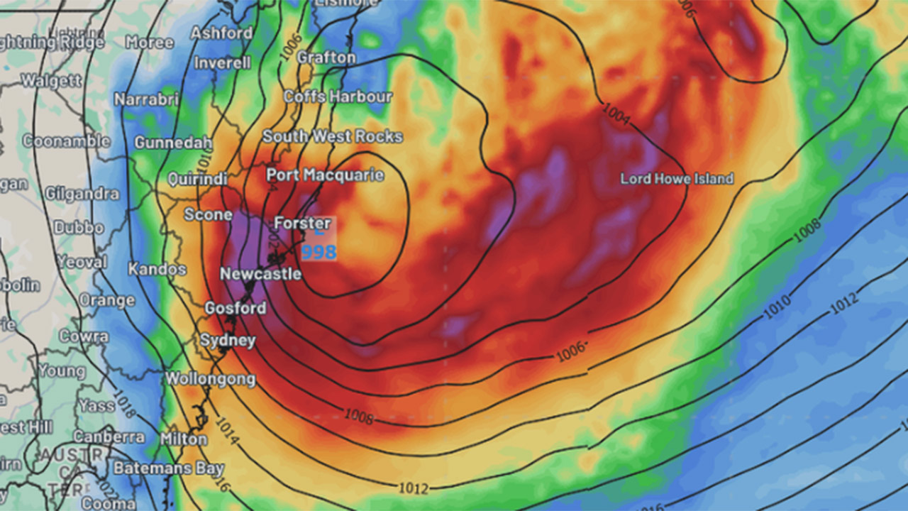
Eastern New South Wales is on high alert as a rapidly forming weather system threatens to bring dangerous conditions to a vast stretch of the state’s coast – including the heaviest rainfall Sydney has seen in years.
The Bureau of Meteorology has warned of a potential east coast low – possibly a “bomb cyclone” – developing off the coastline. The intense system is already impacting the Mid North Coast today and is expected to deliver its most severe weather to Sydney on Tuesday.
Hazardous wind and surf warnings have been issued for large sections of the NSW coast, and an initial flood watch is in place for the Hawkesbury-Nepean, Georges, Cooks, Sydney Coast and Illawarra Coast catchments.
A “bomb cyclone” is a rapidly intensifying weather system that can form in just a matter of days and bring destructive conditions. If it continues to strengthen, this could be the first east coast low to directly strike Sydney since 2022.
Rain and strong winds are forecast to escalate over the next 24 hours, with up to 90mm of rain predicted to fall over Sydney tomorrow. The Bureau is forecasting sustained winds of 45km/h, with gusts reaching a dangerous 125km/h.
Mummified body of missing climber found after 22 years
The NSW State Emergency Service has issued a broad warning to residents from Bega to Coffs Harbour, urging millions to prepare for cyclonic conditions.
“We are urging the public to take this threat seriously,” an SES spokesperson said on Monday morning. “Now is the time to secure outdoor items, check on neighbours, and have a plan in case of flash flooding.”
Authorities are closely monitoring the system, which is continuing to develop off the coast and could rapidly intensify overnight.
Image: Weatherzone
Our Partners