
"Critical": Cyclone Alfred's new landfall location revealed
New forecasts reveal that Tropical Cyclone Alfred is set to make landfall in Brisbane’s northern suburbs as it turns "directly" towards Queensland’s coast. The cyclone, upgraded to a category two system overnight, is expected to shift westward on Tuesday evening, putting Brisbane and the Sunshine Coast at risk.
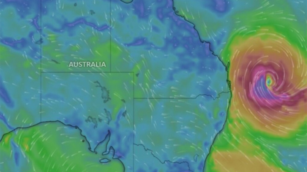
As of Tuesday morning, Cyclone Alfred was about 560km east of Brisbane. Bureau of Meteorology meteorologist Jonathon How indicated that landfall is expected between late Thursday and Friday.
“The location of landfall will be critical because we are expecting to see the worst of the impacts, or most significant impacts, on the southern flank of the cyclone,” Mr How said.
Areas likely to experience severe weather include Brisbane, the Gold Coast, and Northern Rivers, with heavy rainfall expected across multiple regions. The Sunshine Coast may receive 200mm to 400mm of rain, while the Gold Coast and Northern Rivers could see extreme downpours between 500mm and 700mm.
Southeast Queensland and northeastern NSW residents, particularly those between Tewantin and Grafton, have been advised to prepare for damaging winds up to 120km/h starting Wednesday. Heavy rainfall, potentially causing "dangerous and life-threatening flash flooding," is forecast from Thursday into Friday.
Despite possible fluctuations in the cyclone’s intensity, the Bureau of Meteorology expects Alfred to remain a category two system upon landfall.
Energex regional field delivery general manager Kev Lavender urged residents to prepare for potential power outages lasting up to three days.
“We are ready to respond to any impacts from severe weather when it is safe to do so,” he stated, noting that strong winds and floods could extensively damage the electricity network.
Residents of North Stradbroke Island and Moreton Bay Islands face the risk of being cut off from the mainland. With ferry services being suspended, many must decide whether to stay or evacuate. The last scheduled ferry departures from Victoria Point and Coochie were planned for Tuesday, with potential resumption on Friday, depending on weather conditions.
SeaLink Bay Islands also announced possible service disruptions on Tuesday and additional cancellations on Wednesday and Thursday as the cyclone approaches.
Coastal areas between Sandy Cape and Yamba have been warned about abnormally high tides and "significant beach erosion" caused by damaging surf. Multiple flood watches are in effect for rivers and catchments across both Queensland and New South Wales.
Experts warn that sustained damaging winds and prolonged heavy rainfall could cause major property damage.
“These damaging to destructive winds will be sustained over quite a long period of time, meaning we could see quite significant damage to properties and also trees,” Mr How explained.
Supermarkets have already seen a surge in demand, with reports of empty shelves and water selling out across multiple Queensland suburbs. Essentials like milk and bread are also in short supply. Queensland Premier David Crisafulli urged supermarkets to keep shelves stocked and encouraged residents to prepare by gathering water, spare batteries, and phone chargers.
NSW Premier Chris Minns stressed the importance of heeding emergency warnings and avoiding unnecessary risks, particularly driving through floodwaters.
“We hope for the best, but we prepare for the worst,” Mr. Minns said, acknowledging that the cyclone warning brings back memories of the devastating 2022 Lismore floods.
With widespread flooding and severe weather expected, authorities are urging all residents in the affected regions to remain vigilant, stay informed, and prepare for potentially significant disruptions in the coming days.
Image: Windy.com