Placeholder Content Image

Police warn against idiotic cyclone behaviour

<p>As Tropical Cyclone Alfred unleashes powerful storm surges and massive waves along Australia’s coastline, videos have emerged on social media showing people risking their lives for the perfect shot - despite repeated warnings from authorities to stay away from dangerous coastal areas.</p> <p>Footage circulating online captures individuals walking along the shoreline, snapping pictures, and even getting knocked over by monstrous waves. Some videos have amassed hundreds of thousands of views, sparking widespread criticism.</p> <p>One alarming incident occurred at Elephant Rock in Currumbin, where a group of people became trapped at a lookout after massive swells wiped out the road connecting them to the mainland. Viewers of the viral video condemned their reckless actions, with many questioning why they were out sightseeing during such treacherous conditions.</p> <p>Authorities have also reported a missing jet skier on the Gold Coast, heightening concerns about public safety during the storm. Gold Coast Acting Chief Superintendent Peter Miles expressed his frustration over the situation.</p> <p>“We all need to be a bit more smart about this and ensure that we don’t have any unneeded rescues or potentially worse where we’re looking at fatalities,” he said. “This isn’t a sunset where you can take a nice picture. You’re dealing with Mother Nature at her wildest.”</p> <p>Acting Gold Coast Mayor Donna Gates has threatened fines of up to $16,100 for those ignoring safety warnings and engaging in reckless behaviour along the coast. “For all those people that are going down to the beach and standing on the rock walls or on the sand, please stay away,” Gates pleaded on Thursday afternoon.</p> <p>“We’ve been in touch with police today. There’s been some really foolish behaviour, and it’s so important that people stay away from the beach.</p> <p>“We have been declared a disaster zone, which enables police to take action, and anyone performing a reckless action can actually be fined up to $16,100.”</p> <p>She went on to stress the importance of spreading the message widely, hoping to deter further risky actions: “It’s really in an effort to keep people who are a bit stupid, safe. We need to tell them over and over again, stay out of the water. It’s dangerous.”</p> <p>Her concerns were echoed by Lismore Mayor Steve Krieg, who urged residents to avoid becoming “environmental tourists” during the storm.</p> <p>“Don’t put others in danger because you want to become an environmental tourist or take some of these selfies and put yourself in harm’s way,” he said in a press conference alongside NSW Premier Chris Minns. “Heed the warnings, stay at home and protect your loved ones, and please stay safe.”</p> <p><em>Image: TikTok</em></p>

Travel Trouble

Placeholder Content Image

Why Alfred is such an "unusual" cyclone

<div class="theconversation-article-body"> 
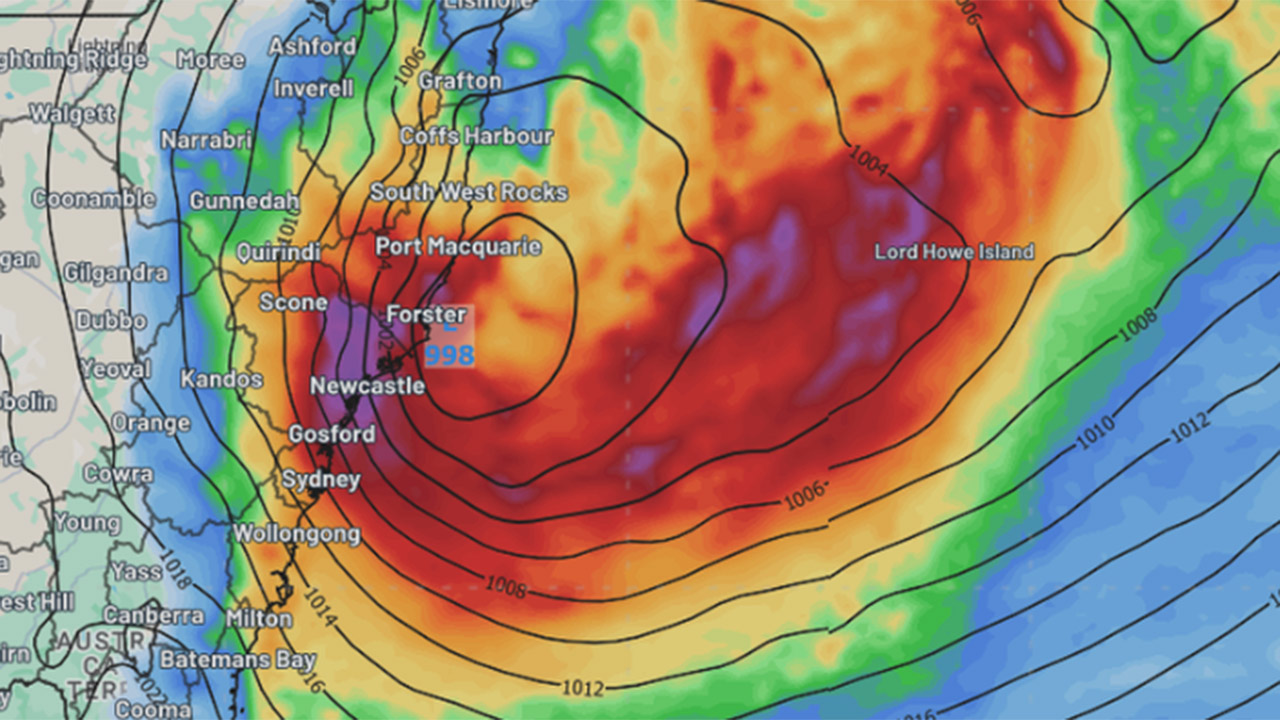
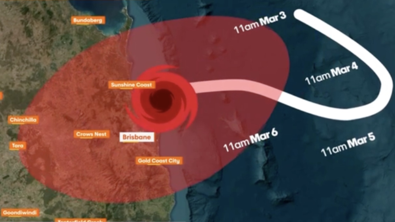
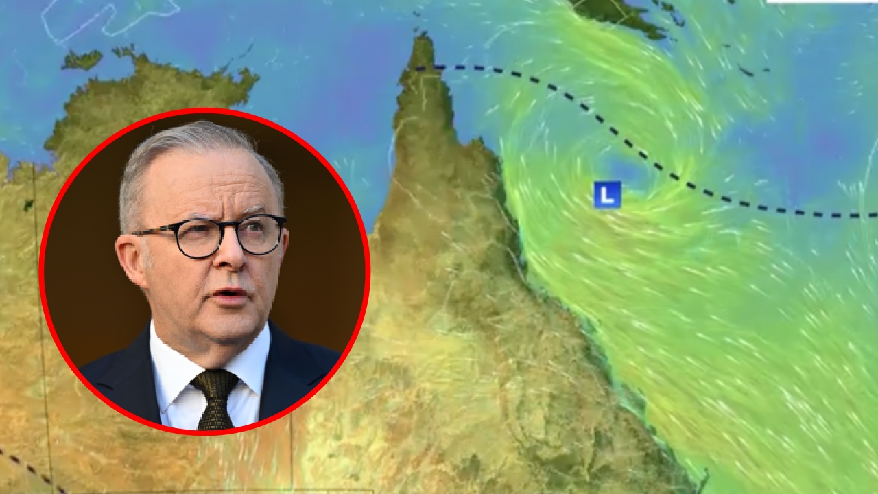
<p>Cyclone Alfred has now been delayed, as the slow-moving system <a href="https://www.theguardian.com/australia-news/2025/mar/06/cyclone-alfred-news-update-landfall-when-will-it-hit-why-did-it-slow-down">stalls</a> in warm seas off southeast Queensland. Unfortunately, the expected slow pace of the cyclone will bring even more rain to affected communities.</p> 
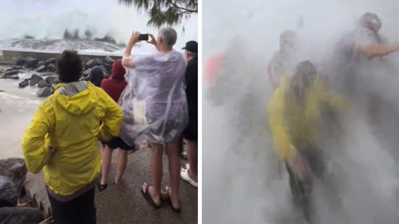
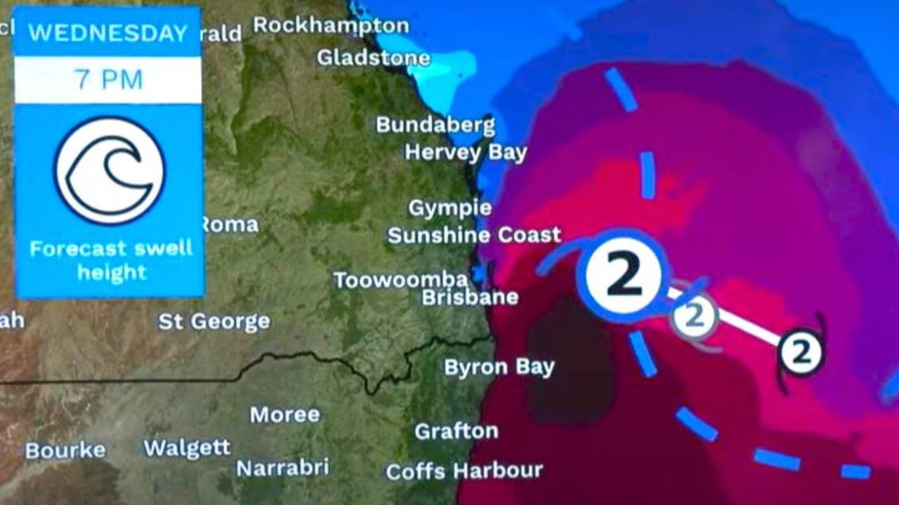
<p>This is because it will linger for longer over the same location, dumping more rain before it moves on. Alfred’s slowing means the <a href="https://www.abc.net.au/news/2025-03-06/cyclone-alfred-stalling-at-sea-later-landfall/105016522">huge waves</a> triggered by the cyclone will last longer too, likely making coastal erosion and flooding worse.</p> 
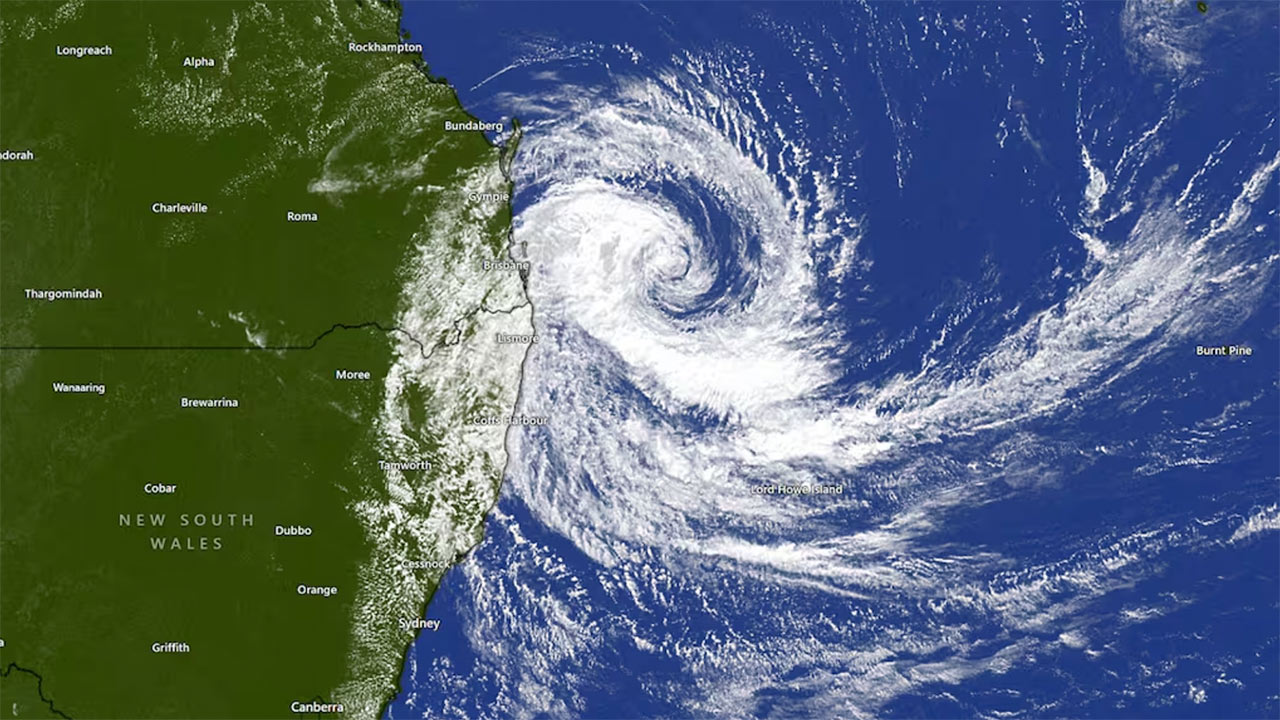
<p>Cyclone Alfred is unusual – the first cyclone in half a century to come this far south and make expected landfall.</p> <p>When unusual disasters strike, people naturally want to know what role climate change played – a process known as “climate attribution”. Unfortunately, this process takes time if you want details on a specific event.</p> <p>We can’t yet say if Alfred’s unusual path and slow speed are linked to climate change. But climate change <em>is</em> driving very clear trends which can load the dice for more intense cyclones arriving in subtropical regions. These include the warm waters which fuel cyclones spreading further south, and cyclones dumping more rain than they used to.</p> <p>So, let’s unpick what’s driving Cyclone Alfred’s behaviour – including the potential role of climate change.</p> <figure><iframe src="https://www.youtube.com/embed/ADuTsiDlMh8?wmode=transparent&amp;start=0" width="440" height="260" frameborder="0" allowfullscreen="allowfullscreen"></iframe><figcaption><span class="caption">A Bureau of Meteorology update on Cyclone Alfred dated Thursday, March 6.</span></figcaption></figure> <h2>Not necessarily climate linked: Alfred’s southerly path</h2> <p>Many cyclones make it as far south as Brisbane – but they’re nearly all far out at sea. Weather patterns mean most cyclones heading south are diverted to the east, where remnants can hit New Zealand as large extratropical storms.</p> <p>The fact that Alfred is set to make landfall is very unusual. But we can’t yet definitively say this is due to climate change. Cyclones are steered by winds and weather patterns, and the Coral Sea’s complex weather makes cyclone paths here very hard to predict.</p> <p>Alfred’s abrupt westward shift is due to a large region of high pressure to its south, which has pushed it directly towards heavily populated areas of southeast Queensland and northern New South Wales. These steering winds are not very strong, which is why Alfred is moving slowly.</p> <p>In 2014, <a href="https://www.nature.com/articles/nature13278">researchers showed</a> cyclones are reaching their maximum intensity in areas further south in the southern hemisphere and north in the northern hemisphere than they used to. In 2021, researchers also found cyclones were reaching their <a href="https://www.science.org/doi/10.1126/science.abb9038">maximum intensity</a> closer to coasts, moving about 30 km closer per decade.</p> <h2>Climate link: Warmer seas</h2> <p>Cyclones typically need water temperatures of 26.5°C or more <a href="https://www.csiro.au/en/news/All/Articles/2025/March/things-to-know-about-tropical-cyclones">to form</a>.</p> <p>More than 90% of all extra heat trapped by greenhouse gas emissions is stored <a href="https://www.climate.gov/news-features/understanding-climate/climate-change-ocean-heat-content">in the seas</a>. The oceans are the <a href="https://theconversation.com/2024s-extreme-ocean-heat-breaks-records-again-leaving-2-mysteries-to-solve-246843">hottest on record</a>, and records keep falling. But normal seasonal variability and shifting ocean currents are still at work too, and we can get unusually warm waters without climate change as a cause.</p> <p>What we do know is that ocean temperatures around much of Australia have been unusually warm.</p> 
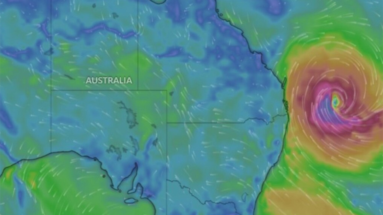
<p>The northeastern Coral Sea, where Cyclone Alfred formed, <a href="http://www.bom.gov.au/cgi-bin/climate/change/timeseries.cgi?graph=sst&amp;area=cor&amp;season=01&amp;ave_yr=0&amp;ave_period=6190">experienced</a> the fourth-hottest temperatures on record for February and the hottest on record for January.</p> <figure class="align-center zoomable"><a href="https://images.theconversation.com/files/653437/original/file-20250306-56-z5mg7o.png?ixlib=rb-4.1.0&amp;q=45&amp;auto=format&amp;w=1000&amp;fit=clip"><img src="https://images.theconversation.com/files/653437/original/file-20250306-56-z5mg7o.png?ixlib=rb-4.1.0&amp;q=45&amp;auto=format&amp;w=754&amp;fit=clip" sizes="(min-width: 1466px) 754px, (max-width: 599px) 100vw, (min-width: 600px) 600px, 237px" srcset="https://images.theconversation.com/files/653437/original/file-20250306-56-z5mg7o.png?ixlib=rb-4.1.0&amp;q=45&amp;auto=format&amp;w=600&amp;h=450&amp;fit=crop&amp;dpr=1 600w, https://images.theconversation.com/files/653437/original/file-20250306-56-z5mg7o.png?ixlib=rb-4.1.0&amp;q=30&amp;auto=format&amp;w=600&amp;h=450&amp;fit=crop&amp;dpr=2 1200w, https://images.theconversation.com/files/653437/original/file-20250306-56-z5mg7o.png?ixlib=rb-4.1.0&amp;q=15&amp;auto=format&amp;w=600&amp;h=450&amp;fit=crop&amp;dpr=3 1800w, https://images.theconversation.com/files/653437/original/file-20250306-56-z5mg7o.png?ixlib=rb-4.1.0&amp;q=45&amp;auto=format&amp;w=754&amp;h=566&amp;fit=crop&amp;dpr=1 754w, https://images.theconversation.com/files/653437/original/file-20250306-56-z5mg7o.png?ixlib=rb-4.1.0&amp;q=30&amp;auto=format&amp;w=754&amp;h=566&amp;fit=crop&amp;dpr=2 1508w, https://images.theconversation.com/files/653437/original/file-20250306-56-z5mg7o.png?ixlib=rb-4.1.0&amp;q=15&amp;auto=format&amp;w=754&amp;h=566&amp;fit=crop&amp;dpr=3 2262w" alt="figure showing rising sea temperatures in february in coral sea." /></a><figcaption><span class="caption">In the Coral Sea, sea surface temperatures were the fourth highest on record in February 2025 and the highest on record in January 2025. This figure shows the trend over time for February.</span> <span class="attribution"><a class="source" href="http://www.bom.gov.au/cgi-bin/climate/change/timeseries.cgi?graph=sst&amp;area=cor&amp;season=02&amp;ave_yr=0&amp;ave_period=6190">Bureau of Meteorology</a>, <a class="license" href="http://creativecommons.org/licenses/by-nc-nd/4.0/">CC BY-NC-ND</a></span></figcaption></figure> <p>We also know Australia’s southern waters are <a href="http://www.bom.gov.au/cgi-bin/climate/change/timeseries.cgi?graph=sst&amp;area=sth&amp;season=1202&amp;ave_yr=0&amp;ave_period=6190">warming up</a> too.</p> <p>The energy available to power tropical cyclones in subtropical regions has also increased in recent decades, due largely to rising ocean temperatures.</p> <figure class="align-center zoomable"><a href="https://images.theconversation.com/files/653417/original/file-20250305-56-8v9737.png?ixlib=rb-4.1.0&amp;q=45&amp;auto=format&amp;w=1000&amp;fit=clip"><img src="https://images.theconversation.com/files/653417/original/file-20250305-56-8v9737.png?ixlib=rb-4.1.0&amp;q=45&amp;auto=format&amp;w=754&amp;fit=clip" sizes="(min-width: 1466px) 754px, (max-width: 599px) 100vw, (min-width: 600px) 600px, 237px" srcset="https://images.theconversation.com/files/653417/original/file-20250305-56-8v9737.png?ixlib=rb-4.1.0&amp;q=45&amp;auto=format&amp;w=600&amp;h=492&amp;fit=crop&amp;dpr=1 600w, https://images.theconversation.com/files/653417/original/file-20250305-56-8v9737.png?ixlib=rb-4.1.0&amp;q=30&amp;auto=format&amp;w=600&amp;h=492&amp;fit=crop&amp;dpr=2 1200w, https://images.theconversation.com/files/653417/original/file-20250305-56-8v9737.png?ixlib=rb-4.1.0&amp;q=15&amp;auto=format&amp;w=600&amp;h=492&amp;fit=crop&amp;dpr=3 1800w, https://images.theconversation.com/files/653417/original/file-20250305-56-8v9737.png?ixlib=rb-4.1.0&amp;q=45&amp;auto=format&amp;w=754&amp;h=618&amp;fit=crop&amp;dpr=1 754w, https://images.theconversation.com/files/653417/original/file-20250305-56-8v9737.png?ixlib=rb-4.1.0&amp;q=30&amp;auto=format&amp;w=754&amp;h=618&amp;fit=crop&amp;dpr=2 1508w, https://images.theconversation.com/files/653417/original/file-20250305-56-8v9737.png?ixlib=rb-4.1.0&amp;q=15&amp;auto=format&amp;w=754&amp;h=618&amp;fit=crop&amp;dpr=3 2262w" alt="sea surface temperature map queensland" /></a><figcaption><span class="caption">Average sea surface temperatures in central and southern Queensland on Thursday March 6th. Point Danger is on the Gold Coast.</span> <span class="attribution"><a class="source" href="http://www.bom.gov.au/oceanography/forecasts/idyoc300.shtml?region=SEQLD&amp;forecast=SST">Bureau of Meteorology</a>, <a class="license" href="http://creativecommons.org/licenses/by-nc-nd/4.0/">CC BY-NC-ND</a></span></figcaption></figure> <h2>Climate link: Fewer cyclones but more likely to be intense</h2> <p>In the northern hemisphere, researchers have found a trend towards fewer cyclones over time. But of those which do form, a higher proportion are more intense.</p> <p>It’s not fully clear if the same trend exists in the southern hemisphere, though we are seeing fewer cyclones forming over time.</p> <p>This summer, eight tropical cyclones have formed in Australian waters. Six were classified as severe (category 3 and up). Historically, Australia has experienced a higher proportion of category 1 and 2 cyclones, which bring weaker wind speeds.</p> <p>On average, <a href="https://www.csiro.au/en/news/All/Articles/2025/March/things-to-know-about-tropical-cyclones">we see</a> about 11 cyclones form and 4-5 make landfall. There has been a <a href="https://theconversation.com/why-hurricanes-like-milton-in-the-us-and-cyclones-in-australia-are-becoming-more-intense-and-harder-to-predict-241000">downward trend</a> in the number of cyclones forming in the Australian region in recent decades.</p> <figure class="align-center zoomable"><a href="https://images.theconversation.com/files/653438/original/file-20250306-56-nk34gw.png?ixlib=rb-4.1.0&amp;q=45&amp;auto=format&amp;w=1000&amp;fit=clip"><img src="https://images.theconversation.com/files/653438/original/file-20250306-56-nk34gw.png?ixlib=rb-4.1.0&amp;q=45&amp;auto=format&amp;w=754&amp;fit=clip" sizes="(min-width: 1466px) 754px, (max-width: 599px) 100vw, (min-width: 600px) 600px, 237px" srcset="https://images.theconversation.com/files/653438/original/file-20250306-56-nk34gw.png?ixlib=rb-4.1.0&amp;q=45&amp;auto=format&amp;w=600&amp;h=391&amp;fit=crop&amp;dpr=1 600w, https://images.theconversation.com/files/653438/original/file-20250306-56-nk34gw.png?ixlib=rb-4.1.0&amp;q=30&amp;auto=format&amp;w=600&amp;h=391&amp;fit=crop&amp;dpr=2 1200w, https://images.theconversation.com/files/653438/original/file-20250306-56-nk34gw.png?ixlib=rb-4.1.0&amp;q=15&amp;auto=format&amp;w=600&amp;h=391&amp;fit=crop&amp;dpr=3 1800w, https://images.theconversation.com/files/653438/original/file-20250306-56-nk34gw.png?ixlib=rb-4.1.0&amp;q=45&amp;auto=format&amp;w=754&amp;h=492&amp;fit=crop&amp;dpr=1 754w, https://images.theconversation.com/files/653438/original/file-20250306-56-nk34gw.png?ixlib=rb-4.1.0&amp;q=30&amp;auto=format&amp;w=754&amp;h=492&amp;fit=crop&amp;dpr=2 1508w, https://images.theconversation.com/files/653438/original/file-20250306-56-nk34gw.png?ixlib=rb-4.1.0&amp;q=15&amp;auto=format&amp;w=754&amp;h=492&amp;fit=crop&amp;dpr=3 2262w" alt="figure showing falling number of tropical cyclones in Australia over time" /></a><figcaption><span class="caption">Fewer cyclones, but more likely to be intense: this figure shows the number of severe (Category 3 and up) and non-severe tropical cyclones (Category 1 and 2) since 1970/71.</span> <span class="attribution"><a class="source" href="http://www.bom.gov.au/cyclone/tropical-cyclone-knowledge-centre/history/climatology/">Bureau of Meteorology</a>, <a class="license" href="http://creativecommons.org/licenses/by-nc-nd/4.0/">CC BY-NC-ND</a></span></figcaption></figure> <h2>Climate link: Cyclones dumping more rain</h2> <p>The intensity of a cyclone refers to the speed of the wind and size of the wind-affected area.</p> <p>But a cyclone’s rain field is also important. This refers to the area of heavy rain produced by storms when they’re at cyclone intensity and afterwards as they decay into tropical lows.</p> 
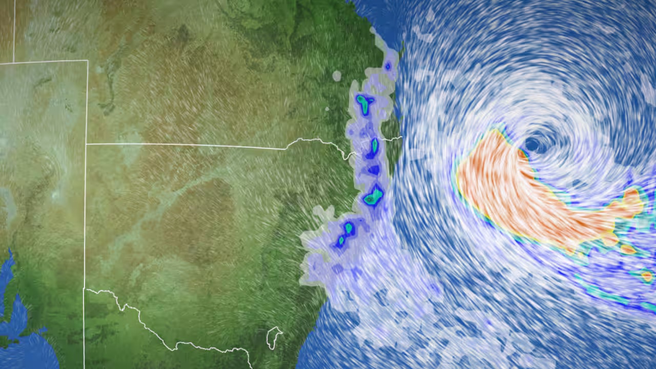
<p>The rate of rainfall brought by cyclones in Australia isn’t necessarily increasing, but more cyclones are <a href="https://www.nature.com/articles/s41558-018-0227-5">moving slowly</a>, such as Alfred. This means more rain per cyclone, on average.</p> <p>Rising ocean temperatures mean more water evaporates off the sea surface, meaning forming cyclones can absorb more moisture and dump more rain when it reaches land.</p> <p>Why are cyclones slowing down? This is likely because air current circulation in the tropics has weakened. This has a clear link to climate change. Wind speeds have fallen <a href="https://www.nature.com/articles/s41558-018-0227-5">5 to 15%</a> in the tropics, depending on where you are in the world. It’s hard to pinpoint the change clearly in our region, because the historic record of cyclone tracks isn’t very long.</p> <p>For every degree (°C) of warming, rainfall intensity increases 7%. This is <a href="https://wmo.int/topics/extreme-weather">well established</a>. But <a href="https://theconversation.com/supercharged-thunderstorms-have-we-underestimated-how-climate-change-drives-extreme-rain-and-floods-228896">newer research</a> is showing the rate may actually be <a href="https://hess.copernicus.org/articles/28/1251/2024/hess-28-1251-2024-assets.html">double this</a> or <a href="https://doi.org/10.1029/2024EF004808">even higher</a>, as the process of condensation releases heat which can trigger more rain.</p> <h2>Clear climate link: Bigger storm surges due to sea level rise</h2> <p>Sea levels are on average about <a href="https://www.climate.gov/news-features/understanding-climate/climate-change-global-sea-level">20 centimetres higher</a> than they were before 1880.</p> <p>When a cyclone is about to make landfall, its intense winds push up a body of seawater ahead of it – the storm surge. In low lying areas, this can spill out and flood streets.</p> <p>Because climate change is causing baseline sea levels to rise, storm surges can reach further inland. Sea-level rise will also make coastal erosion more destructive.</p> <h2>What should we take from this?</h2> <p>We can’t say definitively that climate change is behind Cyclone Alfred’s unusual track.</p> <p>But factors such as rising sea levels, slower cyclones and warmer oceans are changing how cyclones behave and the damage they can do.</p> <p>Over time, we can expect to see cyclones arriving in regions not historically affected – and carrying more rain when they arrive.<!-- Below is The Conversation's page counter tag. Please DO NOT REMOVE. --><img style="border: none !important; box-shadow: none !important; margin: 0 !important; max-height: 1px !important; max-width: 1px !important; min-height: 1px !important; min-width: 1px !important; opacity: 0 !important; outline: none !important; padding: 0 !important;" src="https://counter.theconversation.com/content/251594/count.gif?distributor=republish-lightbox-basic" alt="The Conversation" width="1" height="1" /><!-- End of code. If you don't see any code above, please get new code from the Advanced tab after you click the republish button. The page counter does not collect any personal data. More info: https://theconversation.com/republishing-guidelines --></p> <p><a href="https://theconversation.com/profiles/liz-ritchie-tyo-1509061"><em>Liz Ritchie-Tyo</em></a><em>, Professor of Atmospheric Sciences, <a href="https://theconversation.com/institutions/monash-university-1065">Monash University</a>; <a href="https://theconversation.com/profiles/andrew-dowdy-119002">Andrew Dowdy</a>, Principal Research Scientist in Extreme Weather, <a href="https://theconversation.com/institutions/the-university-of-melbourne-722">The University of Melbourne</a>, and <a href="https://theconversation.com/profiles/hamish-ramsay-19549">Hamish Ramsay</a>, Principal Research Scientist, Environment, <a href="https://theconversation.com/institutions/csiro-1035">CSIRO</a></em></p> <p><em>This article is republished from <a href="https://theconversation.com">The Conversation</a> under a Creative Commons license. Read the <a href="https://theconversation.com/cyclone-alfred-is-slowing-and-that-could-make-it-more-destructive-heres-how-climate-change-might-have-influenced-it-251594">original article</a>.</em></p> <p><em>Image: Windy.com</em></p> </div>

Travel Trouble

Placeholder Content Image

‘Don’t panic, do prepare’: why it’s not too late to plan for Cyclone Alfred

<div class="theconversation-article-body"><em><a href="https://theconversation.com/profiles/yetta-gurtner-2337172">Yetta Gurtner</a>, <a href="https://theconversation.com/institutions/james-cook-university-1167">James Cook University</a></em></p> <p>For millions of people in southeast Queensland and northern New South Wales, Cyclone Alfred will be their first experience living through a cyclone. Alfred is forecast to make landfall about 2am on Friday morning.</p> <p>I am a disaster expert based in northern Queensland, which regularly experiences cyclones. In my other role as an acting SES public information officer, I’m heading south to the Gold Coast to help residents prepare and respond.</p> <p>Here’s what I want you to know. First, don’t panic. Second, do prepare.</p> <p>Preparation has several steps. It’s important to clearly assess your specific threat. If you live near the sea, storm surges – where the sea spills inland – could be a significant threat, while flooding might pose a large risk if you live near a river – especially in the few days after Alfred passes. The highest rainfall is likely on Alfred’s southern flank from the Gold Coast down to northern New South Wales.</p> <p>Having enough food, water and medication is vital. Be ready to evacuate too, in case authorities deem it necessary. Check your local council’s disaster website, disaster apps and stay tuned to the ABC, which will run disaster alerts.</p> <figure><iframe src="https://www.youtube.com/embed/EN_yKcjlF20?wmode=transparent&amp;start=0" width="440" height="260" frameborder="0" allowfullscreen="allowfullscreen"></iframe><figcaption><span class="caption">The Bureau of Meteorology’s latest update on Cyclone Alfred’s path and likely impact, as of the morning of Wed 5th March.</span></figcaption></figure> <h2>What should I do right now?</h2> <p>If you’re in the <a href="http://www.bom.gov.au/products/IDQ65002.shtml">danger zone</a>, make preparations now, before the full intensity of the cyclone arrives.</p> <p>Tie down loose objects. Clean gutters to avoid overflow from torrential rain. And prepare your “go bag” – a bag of essentials you can throw in the car if authorities tell you to leave immediately. Don’t take too much – just the bare necessities.</p> <p>Buy an AM/FM radio and tune it to ABC National, as you cannot be sure mobile networks will function. Radio is a reliable way to get good information from the ABC, Australia’s designated <a href="https://www.abc.net.au/emergency">emergency channel</a>.</p> <p>Make sure the car is fuelled or charged. If you’ve got a generator, make sure you have fuel and the generator is positioned outside in a well-ventilated area.</p> <p>Water is often unreliable after disasters. Fill your bathtub or front-loader washing machine with water. Put containers of water in your freezer, to keep food cold if the power goes out and as another water source. Plan for days of power outages. Protect windows with plywood, heavy blankets or mattresses. Put a mattress between your car and garage roller door to stop it blowing in.</p> <p>Turn off gas, electricity and solar power.</p> <p>Authorities recommend using sandbags to reduce the chance of water getting in. You can get sacks from hardware stores or council-run emergency centres, if available, who also provide sand. You also need plastic sheeting.</p> <p>If there’s a shortage of sand, you can use garden soil or commercial bagged soil. If you can’t get sacks, large plastic shopping bags will do.</p> <p>Tape strong plastic sheeting around the door or low window where water might get in. This is the barrier that actually keeps water out – sandbags keep it in place.</p> <p>Fill sandbags and lay them <a href="https://www.ses.nsw.gov.au/during-emergency/sandbags">like bricks</a>. Lay one row, and lay the next row offset for strength.</p> <p>Sandbags are good, but they have limits. There’s little point in piling sandbags higher than about 30 centimetres. If floodwaters edge higher, water will get through.</p> <p>Many people have had the unpleasant experience of having effluent come back up through toilets during cyclones and subsequent flooding. To stop this, cover your toilet with plastic sheeting (directly on the porcelain) and put a sandbag on top for weight. Do the same for any drains where water might flow back up.</p> <p>To reduce water damage, put valuable or important items up high, atop tables or bunk beds or upstairs if you have a second storey.</p> <h2>What will it be like when Alfred hits?</h2> <p>When the cyclone first hits, it can be overwhelming. The sound is like a roaring jet engine.</p> <p>If you haven’t been advised to evacuate by authorities, you will be sheltering in place.</p> <p>This means finding the safest room in the house, to avoid damage from flying objects. Choose the smallest room with the fewest windows – a bathroom or a room under the stairs. Basements are very safe, but will be the first affected by water.</p> <p>As the cyclone picks up intensity, set up inside this safe room with your pets and children. Do not leave this room until you have been told it’s safe by authorities.</p> <p>At the centre of strong cyclones is the eye of the storm, which we experience as a period of sudden calm. People often make the mistake of thinking it’s over. But in fact, it’s just a brief reprieve before the intense winds pick up again. Don’t make the mistake of leaving the house – check with authoritative sources.</p> <p>Cyclone Alfred is a <a href="https://www.abc.net.au/news/2025-03-05/cyclone-alfred-unusual-triplet-storm-climate-change-factors/105008704">slow-moving cyclone</a>, which means you might be stuck inside for a while. Be prepared to be inside your house for up to 24 hours, even after the worst has passed. This is because there may well be downed powerlines with live electricity, broken glass, falling trees and so on.</p> <p>For your children (and yourself), being in the cyclone is frightening. Young kids find the sound chilling. You can play music through headphones to help soothe them. Board games, books and puzzles can help pass the time. You will need distraction. Have a bucket in the corner for emergency toilet needs.</p> <p>Keep track of the storm and any emerging dangers through your radio and internet-enabled phone (if still functioning).</p> <h2>What if I have to evacuate?</h2> <p>Authorities are working to set up evacuation centres for people whose homes may not be safe. Authorities will go door-to-door to tell affected residents to leave, as well as broadcasting the information on radio and online.</p> <p>You’re more likely to have to evacuate if your house is on low-lying land near the sea, as a storm surge is likely. How much water is pushed ashore will depend on the tide, but it could be as high as 70cm above the high tide line if we’re unlucky.</p> <p>Evacuations can happen after the cyclone too. Alfred is packing a lot of rain – <a href="https://www.weatherzone.com.au/news/tropical-cyclone-alfred-could-disrupt-afl-and-nrl-matches/1890420">up to a metre</a> in some areas. That’s very likely to cause flooding, both flash floods and rivers breaking their banks.</p> <p>If you are asked to evacuate, you can go to the house of a friend or family member if it’s on higher ground and outside the flood risk zones. Or you can go to a local evacuation centre – check your council website to see where your closest one is. Take as little as possible with you.</p> <p>Many people who choose not to evacuate do so because they’re worried about their pets. This is risky. Some evacuation centres do take pets, so check now. If they don’t, look for other options with friends and family. Staying put after an evacuation order is dangerous.</p> <h2>What will happen after the cyclone?</h2> <p>Cyclone Alfred brings three threats: intense winds, high seas and heavy rain.</p> <p>After the intense winds die down, the seas will be dangerous for days after Alfred. There are coastal hazard warnings for about 1,000km of coastline.</p> <p>Cyclones also often decay into tropical low weather systems, which dump heavy rain for days. This is likely.</p> <p>As you move into recovery phase, don’t relax your guard. In far north Queensland, 16 people have <a href="https://www.abc.net.au/news/2025-03-04/melioidosis-death-toll-rises-in-queensland/105009772">now died</a> after being infected with melioidosis, a bacterium found in mud. The bug is <a href="https://theconversation.com/theres-an-outbreak-of-melioidosis-in-north-queensland-heres-what-to-know-about-this-deadly-mud-bug-250392">more prevalent</a> after heavy rainfall.</p> <p>Wear protective gear such as gloves and face masks when dealing with water-damaged goods and mud, and pay close attention to the latest advice authorities are giving.</p> <p>But remember – don’t panic. We will get through this.<!-- Below is The Conversation's page counter tag. Please DO NOT REMOVE. --><img style="border: none !important; box-shadow: none !important; margin: 0 !important; max-height: 1px !important; max-width: 1px !important; min-height: 1px !important; min-width: 1px !important; opacity: 0 !important; outline: none !important; padding: 0 !important;" src="https://counter.theconversation.com/content/251463/count.gif?distributor=republish-lightbox-basic" alt="The Conversation" width="1" height="1" /><!-- End of code. If you don't see any code above, please get new code from the Advanced tab after you click the republish button. The page counter does not collect any personal data. More info: https://theconversation.com/republishing-guidelines --></p> <p><em><a href="https://theconversation.com/profiles/yetta-gurtner-2337172">Yetta Gurtner</a>, Adjunct Senior Lecturer, Centre for Disaster Studies, <a href="https://theconversation.com/institutions/james-cook-university-1167">James Cook University</a></em></p> <p><em>Image credits: LUKAS COCH/EPA-EFE/Shutterstock Editorial </em></p> <p><em>This article is republished from <a href="https://theconversation.com">The Conversation</a> under a Creative Commons license. Read the <a href="https://theconversation.com/dont-panic-do-prepare-why-its-not-too-late-to-plan-for-cyclone-alfred-251463">original article</a>.</em></p> </div>

Travel Trouble

Placeholder Content Image

Millions in danger as Cyclone Alfred changes course

<p>Tropical Cyclone Alfred is expected to make landfall in Australia's east coast, with millions of people being told to prepare, as the cyclone could bring more than half a metre of rain in some places. </p> <p>“This is a really significant event,” said the Bureau of Meteorology’s (BOM) Angus Hines late on Tuesday.</p> <p>“The main hazards we are expecting are heavy rain and flooding for large areas of Queensland and New South Wales, damaging to destructive winds as well as storm surge and coastal inundation”.</p> <p>A severe weather warning has also been put in place for almost 1000km of the coast, with water levels expected to exceed the highest tide of the year by around half a metre, according to the BOM. </p> <p>Due to it hitting a high pressure area, the cyclone has switched from heading north to south, and is now heading west. </p> <p>As of 4am on Wednesday morning, the cyclone was at category 2 strength, 465km east of Brisbane and 430km from the Gold Coast.</p> <p>A warning zone has been put in place from Double Island Point in Queensland to north of Grafton in New South Wales, as well as Brisbane, the Gold Coast, the Sunshine Coast, Byron Bay and Ballina.</p> <p>BOM meteorologist Jonathon How said it would make landfall anytime from late Thursday into Friday. </p> <p>“The location of landfall will be critical because we are expecting to see the worst of the impacts, or most significant impacts, on the southern flank of the cyclone.</p> <p>“That does include places like Brisbane, the Gold Coast, and also the Northern Rivers.”</p> <p>Brisbane City Council has a flood modelling system in place, and according to the Courier Mail, as many as 20,000 properties could be at risk from inundation.  In the Gold Coast, 6000 properties could be at risk. </p> <p>The maps of potential flood  zones in the Brisbane City LGA show suburbs including Brighton, Windsor, Ashgrove, Indooroopilly, Sandgate are Rocklea at risk, while in the Gold Coast, Biggara Waters among others could be impacted by floods. </p> <p>Queensland Premier David Crisafulli has urged residents to take the warnings seriously. </p> <p>“In the last few days we’ve spoken to people about having days to prepare, we’re moving into that phase where it’s now about hours,” he told <em>ABC News Breakfast</em> on Wednesday morning.</p> <p>“Do all the little things now, it’ll make a world of difference.”</p> <p>He added that if they are told to evacuate,  “you should leave and I can’t be more blunt than that”. </p> <p>“The idea about replacing property, well, that’s another story for another day. Your priority is you. So if somebody tells you to leave, you should heed that advice.”</p> <p>Residents in northern NSW have also been urged to prepare. </p> <p>“What we need is the community to start being alert and preparing themselves,” NSW SES Deputy Commissioner Deb Platz told Today on Wednesday morning.</p> <p><em>Image: BOM</em></p>

Travel Trouble

Placeholder Content Image

How to prepare for a cyclone, according to an expert

<div class="theconversation-article-body"><em><a href="https://theconversation.com/profiles/yetta-gurtner-2337172">Yetta Gurtner</a>, <a href="https://theconversation.com/institutions/james-cook-university-1167">James Cook University</a></em></p> <p>Tropical Cyclone Alfred is predicted to make landfall anywhere <a href="https://www.abc.net.au/news/2025-03-03/tropical-cyclone-alfred-landfall-thursday-live-updates/105002038">between Bundaberg and northern New South Wales</a> this week. The Australian Bureau of Meteorology <a href="http://www.bom.gov.au/cgi-bin/wrap_fwo.pl?IDQ20023.html">has warned</a> it may bring severe hazards and “dangerous and life-threatening flash flooding”.</p> <p>So, how do you prepare for a cyclone – and what do you do if it’s too late to leave?</p> <h2>How to prepare</h2> <p>Your starting point is to consider the risk to yourself and everyone in your household (including pets). Consider ensuring you have:</p> <ul> <li>non-perishable food that everyone in the family will eat (enough for five to seven days)</li> <li>water for drinking and cleaning (three litres per person per day)</li> <li>medication (two weeks worth)</li> <li>toiletries and first aid kit</li> <li>pet food/supplies</li> <li>torches</li> <li>batteries</li> <li>a back up battery for your phone</li> <li>baby formula and nappies if needed</li> <li>protective clothing and closed-in shoes</li> <li>cash in small denominations</li> <li>valuable documents such as passports, title deeds, ID, insurance details, photos (these can be photographed or packed in weather-proof container or envelope)</li> <li>kids’ books, card games, board games, headphones</li> <li>anything else you may need or really value (and isn’t too heavy to carry).</li> </ul> <p>Make sure you have a grab-and-go kit that you can carry by yourself if authorities suddenly tell you to evacuate immediately.</p> <p>Conventional wisdom used to be to prepare enough supplies for three days of disruption. Now, experts recommend having enough for five to seven days. After the initial disaster there may be road blockages or supply chain problems.</p> <p>Ensure you have enough medication for a week or two, because pharmacies may take days or weeks to re-open. And remember that many medications, such as insulin, need to be refrigerated, so consider how you’d keep them cool if the power went out.</p> <p>Fill containers with water and stick them in your freezer now; they can keep your freezer cool if you lose power. They can also become drinking water in future.</p> <p>Talk to your neighbours. Do they have a generator or a camping fridge you can use? This is a great opportunity to get to know your community and pool your resources.</p> <p>Ask yourself if you have friends with whom you or a pet can stay. One of the main reasons people don’t evacuate is because they can’t bring their pets (not all evacuation shelters allow them, so check in advance).</p> <p>Consider what you can do now to prepare your house. One of the most common call-outs the SES receives is about blocked drains and gutters, so check if there’s time to clean your gutters now. You won’t be able to do it during the storm.</p> <h2>Stay informed – and don’t rely on hearsay</h2> <p>Have a plan for getting truthful information before, during and after the cyclone.</p> <p>Rely on the information provided by official sources, as they will tell you when it’s too late to evacuate or when it’s safe to come out. This is highly context-specific and will depend on where you are located.</p> <p>Get advice where possible from your local council’s <a href="https://www.qld.gov.au/community/disasters-emergencies/disasters/resources-translations/local-government-disaster-dashboards">disaster dashboard</a> (most councils have one).</p> <p>It should provide information such as where to get sandbags, which roads are closed (which can affect your evacuation plan) and evacuation centre openings and locations.</p> <p>Anyone who monitors social media will see how many amateur meteorologists and maps are out there, but these are often not the best source. Always rely on official sources rather than hearsay, trending footage or amateur “experts”.</p> <p>Always have an battery-operated AM-FM radio. If power goes out, relying on your phone to track information will drain your phone battery very quickly.</p> <p>You may be able to charge it via your car or laptop, but telecommunications networks may not be active.</p> <p>So having a battery-operated radio on hand – and plenty of batteries – is crucial.</p> <h2>What if the cyclone hits while you’re at home?</h2> <p>If it’s too late to evacuate, have a plan for sheltering in place.</p> <p>Find the smallest room in your house with the least windows (which can shatter in a storm). This is often the bathroom, but it could be under the stairs. It is usually on the lowest level of the house.</p> <p>Bring your food, water, radio, blankets and supplies there. Avoid walking around the house during the cyclone to fetch things; there could be glass on the floor or debris flying around.</p> <p>It’s hard to predict how long you will need to shelter there, but it’s important not to leave until official sources say it is safe to do so.</p> <p>Cyclones come in stages. They arrive from one direction, then comes an eerie calm as the “eye of the storm” passes over. Next, the other half of the cyclone arrives. Don’t go outside during the eye of the storm, because it’s not over.</p> <p>Outside the house, there may be powerlines down, broken glass and other hazards. Don’t venture out until you get official clearance from the disaster dashboard or official sources on the radio saying it is safe.</p> <p>For <a href="https://www.ses.qld.gov.au/ses-assistance">non-life threatening emergencies</a> – such as a tree on your roof, or water running through your house – call the SES on 132 500 or register on the <a href="https://apps.apple.com/au/app/ses-assistance-qld/id704964892">SES Assistance app</a> (if you’re in Queensland). They will not come during the event itself but will come later.</p> <p>If it’s a life threatening emergency, always call triple 0.</p> <h2>After the storm</h2> <p>After the storm, consider how to make your house more cyclone-ready in future. Many houses in North Queensland are designed for cyclone zones, but not as many further south will be.</p> <p>Climate change means cyclones are likely to be more severe in future. These days, be cyclone-ready 365 days a year.<!-- Below is The Conversation's page counter tag. Please DO NOT REMOVE. --><img style="border: none !important; box-shadow: none !important; margin: 0 !important; max-height: 1px !important; max-width: 1px !important; min-height: 1px !important; min-width: 1px !important; opacity: 0 !important; outline: none !important; padding: 0 !important;" src="https://counter.theconversation.com/content/251251/count.gif?distributor=republish-lightbox-basic" alt="The Conversation" width="1" height="1" /><!-- End of code. If you don't see any code above, please get new code from the Advanced tab after you click the republish button. The page counter does not collect any personal data. More info: https://theconversation.com/republishing-guidelines --></p> <p><em><a href="https://theconversation.com/profiles/yetta-gurtner-2337172">Yetta Gurtner</a>, Adjunct senior lecturer, Centre for Disaster Studies, <a href="https://theconversation.com/institutions/james-cook-university-1167">James Cook University</a></em></p> <p><em>Image credits: SBS News</em></p> <p><em>This article is republished from <a href="https://theconversation.com">The Conversation</a> under a Creative Commons license. Read the <a href="https://theconversation.com/how-to-prepare-for-a-cyclone-according-to-an-expert-251251">original article</a>.</em></p> </div>

Travel Tips

Placeholder Content Image

"Critical": Cyclone Alfred's new landfall location revealed

<p data-pm-slice="1 1 []">New forecasts reveal that Tropical Cyclone Alfred is set to make landfall in Brisbane’s northern suburbs as it turns "directly" towards Queensland’s coast. The cyclone, upgraded to a category two system overnight, is expected to shift westward on Tuesday evening, putting Brisbane and the Sunshine Coast at risk.</p> <p>As of Tuesday morning, Cyclone Alfred was about 560km east of Brisbane. Bureau of Meteorology meteorologist Jonathon How indicated that landfall is expected between late Thursday and Friday.</p> <p>“The location of landfall will be critical because we are expecting to see the worst of the impacts, or most significant impacts, on the southern flank of the cyclone,” Mr How said.</p> <p>Areas likely to experience severe weather include Brisbane, the Gold Coast, and Northern Rivers, with heavy rainfall expected across multiple regions. The Sunshine Coast may receive 200mm to 400mm of rain, while the Gold Coast and Northern Rivers could see extreme downpours between 500mm and 700mm.</p> <p>Southeast Queensland and northeastern NSW residents, particularly those between Tewantin and Grafton, have been advised to prepare for damaging winds up to 120km/h starting Wednesday. Heavy rainfall, potentially causing "dangerous and life-threatening flash flooding," is forecast from Thursday into Friday.</p> <p>Despite possible fluctuations in the cyclone’s intensity, the Bureau of Meteorology expects Alfred to remain a category two system upon landfall.</p> <p>Energex regional field delivery general manager Kev Lavender urged residents to prepare for potential power outages lasting up to three days.</p> <p>“We are ready to respond to any impacts from severe weather when it is safe to do so,” he stated, noting that strong winds and floods could extensively damage the electricity network.</p> <p>Residents of North Stradbroke Island and Moreton Bay Islands face the risk of being cut off from the mainland. With ferry services being suspended, many must decide whether to stay or evacuate. The last scheduled ferry departures from Victoria Point and Coochie were planned for Tuesday, with potential resumption on Friday, depending on weather conditions.</p> <p>SeaLink Bay Islands also announced possible service disruptions on Tuesday and additional cancellations on Wednesday and Thursday as the cyclone approaches.</p> <p>Coastal areas between Sandy Cape and Yamba have been warned about abnormally high tides and "significant beach erosion" caused by damaging surf. Multiple flood watches are in effect for rivers and catchments across both Queensland and New South Wales.</p> <p>Experts warn that sustained damaging winds and prolonged heavy rainfall could cause major property damage.</p> <p>“These damaging to destructive winds will be sustained over quite a long period of time, meaning we could see quite significant damage to properties and also trees,” Mr How explained.</p> <p>Supermarkets have already seen a surge in demand, with reports of empty shelves and water selling out across multiple Queensland suburbs. Essentials like milk and bread are also in short supply. Queensland Premier David Crisafulli urged supermarkets to keep shelves stocked and encouraged residents to prepare by gathering water, spare batteries, and phone chargers.</p> <p>NSW Premier Chris Minns stressed the importance of heeding emergency warnings and avoiding unnecessary risks, particularly driving through floodwaters.</p> <p>“We hope for the best, but we prepare for the worst,” Mr. Minns said, acknowledging that the cyclone warning brings back memories of the devastating 2022 Lismore floods.</p> <p>With widespread flooding and severe weather expected, authorities are urging all residents in the affected regions to remain vigilant, stay informed, and prepare for potentially significant disruptions in the coming days.</p> <p><em>Image: Windy.com</em></p>

Travel Trouble

Placeholder Content Image

Millions urged to prepare for Cyclone Alfred

<p>Millions of residents in Queensland and Northern New South Wales have been urged to prepare for a historic storm, as tropical Cyclone Alfred is just days away from approaching land. </p> <p>Tropical Cyclone Alfred is expected to cross anywhere from Bundaberg in Queensland and northern NSW on Thursday as a category two system, bringing up to 600 millimetres of rain per day.</p> <p>Authorities urged residents to stay vigilant and pay attention to warnings, while also urging locals to have a stash of food ready and to prepare their homes as best they can. </p> <p>Queensland Premier David Crisafulli said residents should do “everything they can” including having tinned food, making an emergency kit, gathering up passports and clearing debris from properties.</p> <p>The state government has requested telecommunication companies to increase network capacity to cope with an expected jump in internet usage and millions of messages throughout the emergency.</p> <p>Many homes in southeast Queensland are not built to withstand cyclones, with Mr Crisafulli urging residents to listen to warnings from authorities.</p> <p>“This part of the state has had its fair share of flooding challenges and has responded well, and I genuinely believe that people will heed warnings and will do the right thing,” he said.</p> <p>SES NSW urged residents to prepare for damaging winds, large surf and heavy rainfall with major riverine and flash flooding expected from Wednesday.</p> <p>“We are asking the community to take steps now to ensure that if you are asked to evacuate you have a plan for yourselves, your families and your pets and know where you will go,” NSW SES Assistant Commissioner Dean Storey said.</p> <p>The cyclone is hundreds of kilometres off Rockhampton and is expected to travel southeast until Tuesday, when it will swing west and make its way towards land. </p> <p><em>Image credits: Sunrise</em></p>

Travel Trouble

Placeholder Content Image

Anthony Albanese avoids cyclone namesake

<p>A tropical cyclone heading for North Queensland won't be called 'Anthony' as previously planned to help "avoid any confusion" ahead of the upcoming election. </p> <p>The Bureau of Meteorology shuffled the name to avoid any confusion with Prime Minister Anthony Albanese, announcing that next cyclone will be titled "Alfred".</p> <p>Following Tropical Cyclone Zelia in Western Australia, the next name on the list was planned to be the prime minister's first name "Anthony".</p> <p>"When a name matches a prominent person of the time, we reorder to the next name starting with that same letter to avoid any confusion, " a bureau spokesperson said.</p> <p>However, the bureau plans to retain the long tradition of alternating alphabetically with male and female names, and the next cyclone will be titled "Alfred".</p> <p>The name could potentially go to the low-pressure system in the Coral Sea off North Queensland, if it grows to tropical cyclone level over the weekend.</p> <p>The bureau has been christening tropical cyclones in Australia with human names since 1963, with some of the most destructive cyclones in Australian history have been named Tracy, Larry, Ada, Glenda, Mahina and Debbie.</p> <p>Initially, the cyclones were only given female names with the first official names being Audrey and Bessie in 1964, before the bureau broadened its options to include male names in 1975.</p> <p>Authorities decided to name tropical cyclones to raise public awareness of the powerful weather systems and to help the bureau easily communicate information and warnings for those impacted by severe storm systems. </p> <p><em>Image credits: Today/LUKAS COCH/EPA-EFE/Shutterstock Editorial </em></p>

Travel Trouble

Placeholder Content Image

Why hurricanes like Milton in the US and cyclones in Australia are becoming more intense and harder to predict

<div class="theconversation-article-body"><em><a href="https://theconversation.com/profiles/andrew-dowdy-119002">Andrew Dowdy</a>, <a href="https://theconversation.com/institutions/the-university-of-melbourne-722">The University of Melbourne</a>; <a href="https://theconversation.com/profiles/liz-ritchie-tyo-1509061">Liz Ritchie-Tyo</a>, <a href="https://theconversation.com/institutions/monash-university-1065">Monash University</a>, and <a href="https://theconversation.com/profiles/savin-chand-1351050">Savin Chand</a>, <a href="https://theconversation.com/institutions/federation-university-australia-780">Federation University Australia</a></em></p> <p>Tropical cyclones, known as hurricanes and typhoons in other parts of the world, have caused huge damage in many places recently. The United States has just been hit by <a href="https://www.nhc.noaa.gov/graphics_at4.shtml?start">Hurricane Milton</a>, within two weeks of <a href="https://theconversation.com/how-hurricane-helene-became-a-deadly-disaster-across-six-states-240522">Hurricane Helene</a>. Climate change <a href="https://www.worldweatherattribution.org/climate-change-key-driver-of-catastrophic-impacts-of-hurricane-helene-that-devastated-both-coastal-and-inland-communities/">likely made their impacts worse</a>.</p> <p>In Australia, the tropical cyclone season (November to April) is approaching. The Bureau of Meteorology this week released its <a href="http://www.bom.gov.au/climate/cyclones/australia/">long-range forecast</a> for this season.</p> <p>It predicts an average number of tropical cyclones, 11, are likely to form in the region. Four are expected to cross the Australian coast. However, the risk of severe cyclones is higher than average.</p> <p>So what does an average number actually mean in our rapidly changing climate? And why is there a higher risk of intense cyclones?</p> <p>The bureau’s forecast is consistent with scientific evidence suggesting climate change is likely to result in fewer but more severe tropical cyclones. They are now more likely to bring stronger winds and <a href="https://hess.copernicus.org/articles/28/1251/2024/hess-28-1251-2024.pdf">more intense rain and flooding</a>.</p> <h2>Climate change is making prediction harder</h2> <p>Our knowledge of tropical cyclones and climate change is based on multiple lines of evidence <a href="https://doi.org/10.1175/BAMS-D-18-0189.1">globally</a> and for the Australian region. This work includes our studies based on <a href="https://www.nature.com/articles/s41558-022-01388-4">observations</a> and <a href="https://link.springer.com/article/10.1007/s00382-018-4497-4">modelling</a>.</p> <p>The bureau’s seasonal outlook in recent years has assumed an average of 11 tropical cyclones occurring in our region (covering an area of the southern tropics between longitudes 90°E and 160°E). It’s based on the average value for all years back to 1969.</p> <p>However, for the past couple of decades the annual average is below nine tropical cyclones. In earlier decades, it was over 12. This long-term downward trend adds to the challenge of seasonal predictions.</p> <p>The most recent above-average season (assuming an average of 11) was almost 20 years ago, in the <a href="http://www.bom.gov.au/cyclone/tropical-cyclone-knowledge-centre/history/climatology/">2005–06 summer with 12 tropical cyclones</a>. Since then, any prediction of above-average tropical cyclone seasons has not eventuated.</p> <h2>El Niño and La Niña influences may be changing too</h2> <p>Historical observations suggest more tropical cyclones tend to occur near Australia during La Niña events. This is a result of warm, moist water and air near Australia, compared with El Niño events. The shifting between El Niño and La Niña states in the Pacific region is known as the El Niño-Southern Oscillation (ENSO).</p> <p>Such events can be predicted with a useful degree of accuracy several months ahead in some cases. For example, the US National Oceanic and Atmospheric Administration (NOAA) has <a href="https://www.cpc.ncep.noaa.gov/products/analysis_monitoring/lanina/enso_evolution-status-fcsts-web.pdf">forecast</a>:</p> <blockquote> <p>La Niña is favored to emerge in September–November (71% chance) and is expected to persist through January–March 2025.</p> </blockquote> <p>Based on that, one might expect a higher-than-average number of tropical cyclones for the Australian region. However, the <a href="https://rmets.onlinelibrary.wiley.com/doi/abs/10.1002/asl2.502">ENSO influence on tropical cyclones has weakened</a> in our region. It’s another factor that’s making long-range predictions harder.</p> <p>The <a href="http://www.bom.gov.au/climate/enso/outlook/">bureau’s ENSO outlook</a> is somewhat closer to neutral ENSO conditions, based on its modelling, compared to NOAA’s leaning more toward La Niña. The bureau says:</p> <blockquote> <p>Should La Niña form in the coming months, it is forecast to be relatively weak and short-lived.</p> </blockquote> <p>The bureau’s prediction of an average number of tropical cyclones this season is broadly consistent with its prediction of close-to-average ENSO conditions.</p> <h2>So what does this all mean for this cyclone season?</h2> <p>If we end up getting an average Australian season for the current climate, this might actually mean fewer tropical cyclones than the historical average. The number might be closer to eight or nine rather than 11 or 12. (Higher or lower values than this range are still possible.)</p> <p>However, those that do occur could have an increased chance of being <a href="http://www.bom.gov.au/cyclone/tropical-cyclone-knowledge-centre/understanding/categories/">category 4 or 5 tropical cyclones</a>. These have stronger winds, with gusts typically exceeding 225km per hour, and are more likely to cause severe floods and coastal damage.</p> <p>If we end up getting more than the recent average of eight to nine tropical cyclones, which could happen if NOAA predictions of La Niña conditions eventuate, that increases the risk of impacts. However, there is one partially good news story from climate change relating to this, if the influence of La Niña is less than it used to be on increasing tropical cyclone activity.</p> <p>Another factor is that the <a href="http://www.bom.gov.au/climate/ocean/sst/#/anom/global/weekly/20241006">world’s oceans are much warmer than usual</a>. Warm ocean water is one of several factors that provide the energy needed for a tropical cyclone to form.</p> <p>Many ocean heat <a href="https://climatereanalyzer.org/clim/sst_daily/?dm_id=world2">records have been set</a> recently. This means we have been in “uncharted waters” from a temperature perspective. It adds further uncertainty if relying on what occurred in the past when making predictions for the current climate.</p> <h2>Up-to-date evidence is vital as climate changes</h2> <p>The science makes it clear we need to plan for tropical cyclone impacts in a different way from what might have worked in the past. This includes being prepared for potentially fewer tropical cyclones overall, but with those that do occur being more likely to cause more damage. This means there are higher risks of damaging winds, flooding and coastal erosion.</p> <p>Seasonal prediction guidance can be part of improved planning. There’s also a need for enhanced design standards and other climate change adaptation activities. All can be updated regularly to stay consistent with the best available scientific knowledge.</p> <p>Increased preparedness is more important than ever to help reduce the potential for disasters caused by tropical cyclones in the current and future climate.</p> <hr /> <p><em>The authors acknowledge the contribution of CSIRO researcher <a href="https://theconversation.com/profiles/hamish-ramsay-19549">Hamish Ramsay</a> during the writing of this article.</em><!-- Below is The Conversation's page counter tag. Please DO NOT REMOVE. --><img style="border: none !important; box-shadow: none !important; margin: 0 !important; max-height: 1px !important; max-width: 1px !important; min-height: 1px !important; min-width: 1px !important; opacity: 0 !important; outline: none !important; padding: 0 !important;" src="https://counter.theconversation.com/content/241000/count.gif?distributor=republish-lightbox-basic" alt="The Conversation" width="1" height="1" /><!-- End of code. If you don't see any code above, please get new code from the Advanced tab after you click the republish button. The page counter does not collect any personal data. More info: https://theconversation.com/republishing-guidelines --></p> <p><a href="https://theconversation.com/profiles/andrew-dowdy-119002"><em>Andrew Dowdy</em></a><em>, Principal Research Scientist in Extreme Weather, <a href="https://theconversation.com/institutions/the-university-of-melbourne-722">The University of Melbourne</a>; <a href="https://theconversation.com/profiles/liz-ritchie-tyo-1509061">Liz Ritchie-Tyo</a>, Professor of Atmospheric Sciences, <a href="https://theconversation.com/institutions/monash-university-1065">Monash University</a>, and <a href="https://theconversation.com/profiles/savin-chand-1351050">Savin Chand</a>, Associate Professor, Applied Mathematics and Statistics, <a href="https://theconversation.com/institutions/federation-university-australia-780">Federation University Australia</a></em></p> <p><em>Image credits: Shutterstock </em></p> <p><em>This article is republished from <a href="https://theconversation.com">The Conversation</a> under a Creative Commons license. Read the <a href="https://theconversation.com/why-hurricanes-like-milton-in-the-us-and-cyclones-in-australia-are-becoming-more-intense-and-harder-to-predict-241000">original article</a>.</em></p> </div>

Travel Trouble

Placeholder Content Image

Aussies brave flood waters for a drink at the pub

<p>A group of flood-stricken Queenslanders are braving the aftermath of the devastating Cyclone Jasper, and risking it all to head out to their local pub. </p> <p>On the banks of the Tully River, 155km south of Cairns, locals flocked to the Hotel Euramo to wait out the storm, with everyone arriving by boat.</p> <p>Instead of the carpark being full of cars, 18 tinnies brought thirsty locals to their watering hole, in what has become a tradition for when the area is impacted by floods. </p> <p>Hotel owner Ollie Muzic told <em>ABC News Breakfast</em> on Monday that it was a local tradition for patrons to turn up at the by either boat or tractor when the town was flooded.</p> <p>"We had no tractors turn up yesterday, but the water level was higher than it ever was before," she said.</p> <p>"Everyone was very high-spirited. We are lucky our water disperses very quickly."</p> <p>Hotel manager Tish Ottone said patrons made the best of the bad situation, and did what they could do enjoy their day at the pub. </p> <p>"It was really good, the atmosphere was amazing," she said.</p> <p>"It was definitely on my bucket list (to arrive by boat) and it is ticked off now so it was surreal, it was pretty cool."</p> <p id="ext-gen32">Six people stayed at the pu8b overnight on Sunday and Ms Muzic said she and staff would be on the premises until waters recede, providing what they could to locals who need help. </p> <p>"The majority of people who are here say they got everything sorted yesterday morning before coming here, everything high and dry and there’s pretty well nothing much you can do except sit around until the water drops down," she said.</p> <p>Although the atmosphere at the pub was festive, Ms Muzic said she was mindful of those in more catastrophic conditions in Queensland, as Cyclone Jasper continues to wreak havoc.</p> <p>"We do understand there are a lot of places in north Queensland absolutely devastated by these floods," she said.</p> <p>"Our hearts go to everybody in Cairns and the surrounding areas who have lost their homes and roads."</p> <p>"Hopefully our government gets in to fix everything up as quick as possible, it’s the week of Christmas."</p> <p><em>Image credits: Facebook</em></p>

Travel Trouble

Placeholder Content Image

Floods, cyclones, thunderstorms: is climate change to blame for New Zealand’s summer of extreme weather?

<p>The final months of New Zealand’s summer carried a massive sting, bringing “unprecedented” rainfalls several times over, from widespread flooding in Auckland at the end of January to ex-tropical Cyclone Gabrielle dumping record rains and causing devastating floods across the east coast of the North Island.</p> <p>After all that, New Zealand experienced spells of thunderstorms, bringing repeat floods to parts of Auckland and then Gisborne.</p> <p>The obvious question is what role climate change plays in these record-breaking rainfalls.</p> <p>Some answers come from the international <a href="https://www.worldweatherattribution.org/">World Weather Attribution</a> team, which today released a <a href="https://spiral.imperial.ac.uk/bitstream/10044/1/102624/10/Scientific%20report%20New%20Zealand%20Floods.pdf">rapid assessment</a> which shows very heavy rain, like that associated with Cyclone Gabrielle, has become about four times more common in the region and extreme downpours now drop 30% more rain.</p> <p>The team analysed weather data from several stations, which show the observed increase in heavy rain. It then used computer models to compare the climate as it is today, after about 1.2℃ of global warming since the late 1800s, with the climate of the past.</p> <p>The small size of the analysed region meant the team could not quantify the extent to which human-caused warming is responsible for the observed increase in heavy rain in this part of New Zealand, but concluded it was the likely cause.</p> <h2>More energy in the atmosphere and ocean</h2> <p>Many factors add to the strength of a storm and the intensity of rainfall, especially for short bursts. A crucial factor is always the amount of energy available.</p> <p>Climate change is increasing that amount of energy in two main ways. First, everything is getting warmer. Rising sea surface temperatures provide <a href="https://sciencebrief.org/uploads/reviews/ScienceBrief_Review_CYCLONES_Mar2021.pdf">extra fuel for the development of tropical cyclones</a> because they grow by heating from below.</p> <p>Warmer seas mean potentially faster development of tropical cyclones, and stronger, more vigorous storms overall. Sea temperatures must be at least 26.5℃ to support the build-up of a tropical cyclone. So, as the oceans warm, these storms can reach farther from the equator.</p> <p>Second, warmer air can hold more water vapour. Every degree of warming increases the maximum amount of water vapour by around 7%. That extra water vapour tends to fall out as extra rain, but it also provides extra energy to a storm.</p> <h2>Driving waves further inland</h2> <p>The energy it takes to evaporate the water from the ocean surface and turn it into vapour is released again when the vapour condenses back into liquid water. A moister airmass heats the atmosphere more when clouds and rain form, making the air more buoyant and able to rise up more. This creates deeper, more vigorous clouds with stronger updrafts, and again more rain.</p> <p>Stronger updrafts in a storm mean more air will have to be drawn into the storm near the Earth’s surface, ensuring more “convergence” of air and moisture (water vapour). That’s why, even though a degree of warming translates to 7% more water vapour in the air, we can get 20% increases, or larger, in extreme rainfalls.</p> <p>All of this extra energy can contribute to making the storm stronger overall, with stronger winds and lower air pressures in its centre. This seems to have happened with Cyclone Gabrielle. Record low pressures were recorded at a few North Island locations as the storm passed.</p> <p>The low pressures act like a vacuum cleaner, sucking the sea surface up above normal sea level. The strong winds can then drive waves much further inland. Add in a bit of sea-level rise, and coastal inundation can get a lot worse a lot quicker.</p> <p>As the climate continues to change, storm intensity is likely to increase on average, as sea levels continue to rise. Those effects together are bound to lead to more dramatic coastal erosion and inundation.</p> <h2>Thunderstorms riding warming seas</h2> <p>These processes work for thunderstorms as well. A thunder cloud often starts as a buoyant mass of air over a warm surface. As the air rises (or convects), it cools and forces water vapour to condense back to liquid water, releasing heat and increasing the buoyancy and speed of the rising air.</p> <p>Again, that allows more moist air to be drawn into the cloud, and that convergence of moist air can increase rainfall amounts well above the 7% per degree of warming, for short bursts of very intense convection. The more intense the convection, the stronger the convergence of moisture and the heavier the resulting rainfall.</p> <p>Tropical cyclones have rings of thunderstorms around their eye during the time when they are truly tropical storms. As they transition out of the tropics into our neighbourhood, they change their structure but retain a lot of the moisture and buoyancy of the air. An ex-tropical cyclone like Gabrielle, moving over very warm water, can pack a devastating punch.</p> <p>Why has New Zealand had so much of this very heavy rain during the weeks from late January? Partly it’s the very warm ocean waters around Aotearoa (up to marine heatwave conditions) and farther north into the Coral Sea. That itself is partly related to the ongoing La Niña event in the tropical Pacific, which tends to pile up warm water (and tropical cyclones) in the west.</p> <p>But it is also related to ongoing global warming. As sea temperatures increase, it becomes easier to reach heatwave conditions. Warmer seas load the atmosphere with water vapour.</p> <p>Partly, too, the air over the North Island has been unusually “unstable” lately, very warm near ground level but cooler than normal higher up. That makes the buoyance in thunderstorms work even better and more strongly, encouraging very heavy rainfall.</p> <p>These conditions seem to have eased now, but severe thunderstorms continue to develop. As we move from summer into autumn, as the warmest seas move eastwards away from us and as La Niña fades in the tropics, the chances of a repeat event are diminishing. For now at least.</p> <p>But if we continue to warm the climate with more greenhouse gas emissions, we will continue to load the dice towards more very heavy rain over Aotearoa. Let us hope those regions and communities so badly affected by recent events have a chance to dry out, rebuild and recover before the next extreme weather.</p> <p><em>This article originally appeared on <a href="https://theconversation.com/floods-cyclones-thunderstorms-is-climate-change-to-blame-for-new-zealands-summer-of-extreme-weather-201161" target="_blank" rel="noopener">The Conversation</a>.</em></p> <p><em>Images: Getty</em></p>

Travel Trouble

Placeholder Content Image

Psycho turns 60 – Hitchcock’s famous fright film broke all the rules

<p>November 1959. Film director <a href="https://www.imdb.com/name/nm0000033/?ref_=nv_sr_srsg_0">Alfred Hitchcock</a> is at his commercial and critical peak after the successes of <a href="https://www.imdb.com/title/tt0052357/?ref_=nm_knf_i2">Vertigo</a> (1958) and <a href="https://www.imdb.com/title/tt0053125/?ref_=nm_knf_i3">North by Northwest</a> (1959). So what does he do next? A black-and-white made-for-TV movie hastily shot, with no big-name actors and a leading actress who takes a shower, and … well, we’ll come to that.</p> <p><a href="https://www.imdb.com/title/tt0054215/?ref_=nm_knf_i1">Psycho</a> (1960) remains Hitchcock’s most celebrated film. But it is really two films, glued together by the most iconic scene in cinema history.</p> <p>Part one is a run-of-the-mill morality tale. Marion Crane (Janet Leigh) steals $40,000 from her Phoenix employee, and goes on the run. Guilt-stricken, she pulls into a deserted motel and chats with the owner, Norman Bates (Anthony Perkins).</p> <p>He seems friendly enough – he makes her sandwiches and talks fondly about his mother – and Marion resolves to return the money.</p> <p>Part two is a whodunnit. Marion’s sister (Vera Miles) and her lover (John Gavin) investigate her disappearance, and trace her steps back to the motel. Soon, they begin to have suspicions about Norman.</p> <p>‘She just goes … a little mad sometimes.’</p> <p><strong>Thriller with a twist</strong></p> <p>A few years earlier, Hitchcock had watched Henri-Georges Clouzot’s 1955 psychological masterpiece <a href="https://www.imdb.com/title/tt0046911/?ref_=nv_sr_srsg_0">Les Diaboliques</a> and sought out a similar project – a horrific thriller with a twist ending. He read <a href="https://www.goodreads.com/book/show/156427.Psycho">Robert Bloch’s novel Psycho</a> – itself inspired by the real-life <a href="https://www.biography.com/crime-figure/ed-gein">Wisconsin killer Ed Gein</a> – and optioned the film rights.</p> <p>Audiences saw things in Psycho that had never been shown before on screen. A toilet flushing. A murderer who goes unpunished. A post-coital Leigh, lying on a bed, dressed only in white underwear, while Gavin stands topless over her.</p> <p>All of Hitchcock’s trademark obsessions are on show: voyeurism, the dominant matriarchal figure, the blonde heroine, the untrustworthy cop.</p> <p>Over his career, Hitchcock had always flouted Hollywood’s <a href="https://www.npr.org/templates/story/story.php?storyId=93301189">Production Code</a>, those rigid rules that had been in place since the 1930s that prohibited onscreen nudity, sex and violence. Nowhere is Hitchcock’s brazen censor-defying clearer than in Psycho’s “shower scene”.</p> <p>Marion steps into the shower, a shadowy figure rips back the curtain, and cinema’s most visceral scene unspools, brutally, before our very eyes.</p> <p>Hitchcock, the master of suspense, never actually shows knife slicing flesh. Everything is implied, through liberal doses of chocolate sauce, hacked watermelons, Bernard Herrmann’s screeching violins, and Leigh’s blood-curdling screams.</p> <p>In one 60-second scene, Hitchcock shatters all the rules. It’s the most famous of all bait and switches: you expect one thing, but get another. Up to that point, no film had killed off its lead character so early in the story (nowadays, such an audacious twist shows up everywhere, from The Lion King to Games of Thrones). As Leigh slides down the blinding white tiles, arm outstretched, a new kind of cinema is born: twisted, shocking, primal.</p> <p><strong>Inventing the cinema event</strong></p> <p>Hitchcock famously ordered cinemas to not let any latecomers into screenings of Psycho, to keep the element of surprise.</p> <p>Previously, cinema-goers could wander into a film midway through, watch the last half, and then stick around for the restart to catch up on what they had missed. When your leading lady is butchered 45 minutes in, the film makes little sense if you arrive late – hence Hitchcock’s decree.</p> <p>While the reviews at the time of its cinema release were lukewarm, cinema as an “event”, as a communal experience shared by hundreds of people in the dark, began. There were queues around the blocks in cities across America as word of mouth grew. Grossing US$32 million (equivalent to A$468 million today) off a budget of US$800,000 (A$12 million today), Psycho made Hitchcock a very wealthy man.</p> <p>Other elements contributed to Psycho’s enduring influence. Saul Bass’s opening credits, all intersecting lines and sans-serif titles, anticipate the film’s fixation with duality and overlap.</p> <p>Budget constraints meant that Bernard Herrmann could only rely on his orchestra’s string section. Even people who have never seen the film instantly recognise his score.</p> <p>And Anthony Perkins, typecast forever after as the nervous mother’s boy with a dark secret, crafts a performance that is both sweetly disarming and deeply unsettling.</p> <p><strong>Psycho sequels</strong></p> <p>Its reputation has only grown since 1960. Critics and audiences remain transfixed by Psycho’s storytelling verve and its queasy tonal shifts (murder mystery to black comedy to horror).</p> <p><a href="https://www.tate.org.uk/whats-on/tate-britain/exhibition/turner-prize-1996/turner-prize-1996-artists-douglas-gordon">Douglas Gordon’s 1993 art installation 24 Psycho</a> slowed the film down to last a full day.</p> <p>Douglas Gordon’s 24 Psycho (1993) video installation pays homage to every frame of the film.</p> <p>Academics have had a field day too, from <a href="https://books.google.com.au/books?id=qx9dDwAAQBAJ&amp;lpg=PA4&amp;ots=3sAjXQ_r40&amp;dq=Raymond%20Durgnat%20micro-analysis%20psycho&amp;pg=PP1#v=onepage&amp;q=Raymond%20Durgnat%20micro-analysis%20psycho&amp;f=false">Raymond Durgnat’s lengthy micro-analysis</a> to <a href="https://egs.edu/biography/slavoj-zizek/">Slavoj Žižek</a>’s reading of Bates’s house as an illustration of Freud’s concept of the id, ego and superego.</p> <p>Three progressively sillier sequels were made, as well as a colour <a href="https://www.imdb.com/title/tt0155975/?ref_=vp_back">shot-for-shot remake </a>by Gus van Sant in 1998. Brian De Palma’s entire back catalogue pays homage to Hitchcock, with whole sections of <a href="https://www.imdb.com/title/tt0070698/?ref_=nm_flmg_dr_30">Sisters</a> (1972) to <a href="https://www.imdb.com/title/tt0080661/?ref_=nm_flmg_dr_24">Dressed to Kill</a> (1980) reworking Psycho’s delirious excesses.</p> <p>Psycho’s box office success undoubtedly contributed to Hollywood’s abiding fascination with true-crime stories, serial killers, and slasher films.</p> <p>More recently, the TV prequel series <a href="https://www.imdb.com/title/tt2188671/?ref_=nv_sr_srsg_0">Bates Motel</a> ran for four seasons, deepening Norman’s relationship with his mother and tracking his developing mental illness.</p> <p>That series provides a set up for the events at the Bates Motel. Sixty years on, the setting for Psycho continues to exert such a pulsating thrill, even as we watch from behind the sofa.</p> <p><em>Written by Ben McCann. Republished with permission of <a href="https://theconversation.com/psycho-turns-60-hitchcocks-famous-fright-film-broke-all-the-rules-140175">The Conversation.</a> </em></p>

Movies

Placeholder Content Image

“It’s a very exciting time”: How the Whitsundays is rebuilding after damaging cyclones

<p><span style="font-weight: 400;">A billion-dollar transformation is underway for the Whitsundays as the once-popular tourist destination works hard to bring families back to the area.</span></p> <p><span style="font-weight: 400;">Marine biologist Johnny Gaskell was one of the first to return back to the Whitsundays after the destructive Cyclone Debbie first hit the island back in 2017.</span></p> <p><span style="font-weight: 400;">According to </span><a href="https://travel.nine.com.au/latest/whitsundays-transformation-a-current-affair/0c1cb522-9144-48f9-9c3d-97007b27c2b9"><span style="font-weight: 400;"><em>A Current Affair</em></span></a><span style="font-weight: 400;">, </span><span style="font-weight: 400;">Gaskell, who runs the island's living reef, returned to the island expecting the worst. </span></p> <p><span style="font-weight: 400;">"The one pump that we had on for the living reef which got submerged, had big waves crashing all over it, it's not a pump that's supposed to go under water. Somehow kept running," he said.</span></p> <p><span style="font-weight: 400;">Daydream Island’s living reef is now the centrepiece of the resort after it underwent a $120-million-dollar upgrade with families at the forefront.</span></p> <p><span style="font-weight: 400;">There are upgraded rooms and facilities as well as a larger focus on reef restoration and education. There is also a coral garden that is supporting the restoration of three Whitsunday reefs that were damaged by Cyclone Debbie.</span></p> <p><span style="font-weight: 400;">"It takes about a year to get the corals to a point where we can out plant them into a damaged site and then hopefully nature does the rest," Mr Gaskell said.</span></p> <p><iframe src="https://www.facebook.com/plugins/video.php?href=https%3A%2F%2Fwww.facebook.com%2FACurrentAffair9%2Fvideos%2F423994431654777%2F&amp;show_text=0&amp;width=560" width="560" height="315" style="border: none; overflow: hidden;" scrolling="no" frameborder="0" allowtransparency="true" allowfullscreen="true"></iframe></p> <p><span style="font-weight: 400;">Tourism Whitsundays CEO Tash Wheeler says it is part of a $1.2 billion rebuild.</span></p> <p><span style="font-weight: 400;">"We've got new hotels, we've got revitalised hotels, we have new experiences for people to enjoy, we have a new airport, it's a very very exciting time," she said.</span></p> <p><span style="font-weight: 400;">"The rebound and resilience of the community and the development that's happened right now is spectacular,” says Venue Manager Brad Henstock.</span></p>

Domestic Travel

Placeholder Content Image

Dunk Island in Queensland sells for $32 million

<p><span style="font-weight: 400;">London-based group Mayfair 101 has bought once-popular Dunk Island for nearly $32 million.</span></p> <p><span style="font-weight: 400;">The group has promised to bring the Queensland resort island back to its former glory and are hopeful they can turn things around.</span></p> <p><span style="font-weight: 400;">Mayfair 101’s ambitions are to create “one of the most sought-after island destinations in the Asia-Pacific region,” with the resort an international attraction.</span></p> <p><span style="font-weight: 400;">“Located between two world-heritage areas, our vision is to create a tourism mecca with Dunk Island becoming one of the most sought-after island destinations in the Asia-Pacific region,” James Mawhinney said to </span><a href="https://www.news.com.au/travel/australian-holidays/queensland/dunk-island-sells-for-32-million-as-part-of-a-queensland-tourism-vision-for-investment-group/news-story/c17a0786ff4db9c0152cd3bcf26b61da"><span style="font-weight: 400;">news.com.au</span></a><span style="font-weight: 400;">.</span></p> <p><span style="font-weight: 400;">The island appeared on </span><span style="font-weight: 400;">60 Minutes </span><span style="font-weight: 400;">on a segment that visited “eerie resorts” that have been left scattered around Queensland.</span></p> <blockquote class="twitter-tweet" data-lang="en-gb"> <p dir="ltr">Dunk Island was left in ruins after Cyclone Yasi more than eight years ago. Now, the commercial real estate agent trying to sell the island to the highest bidder is banking on the resort being a renovators delight. <a href="https://twitter.com/hashtag/60Mins?src=hash&amp;ref_src=twsrc%5Etfw">#60Mins</a> <a href="https://t.co/0Wg24Kxt0H">pic.twitter.com/0Wg24Kxt0H</a></p> — 60 Minutes Australia (@60Mins) <a href="https://twitter.com/60Mins/status/1147833667747627009?ref_src=twsrc%5Etfw">7 July 2019</a></blockquote> <p><span style="font-weight: 400;">“Mayfair 101 will be working to revitalise the local economy, support upgrades to local infrastructure and create new local jobs,” he added.</span></p> <p><span style="font-weight: 400;">Cassowary Coast Major John Kremastos is hopeful that the reboot of the island will bring success to the local tourism industry.</span></p> <p><span style="font-weight: 400;">“We welcome this type of investment into our region, which reinforces this Council’s decision to develop a strong local tourism strategy and offer development incentives to drive investment to our region, and in particular, Mission Beach,” Mr Kremastos said.</span></p> <blockquote class="twitter-tweet" data-lang="en-gb"> <p dir="ltr">Dunk Island vision includes plans for budget accommodation and high end Beach Club on mainland .. also want to upgrade local airports to get jets to fly in.. allege $1.6b investment ⁦<a href="https://twitter.com/abcbrisbane?ref_src=twsrc%5Etfw">@abcbrisbane</a>⁩ ⁦<a href="https://twitter.com/abcnews?ref_src=twsrc%5Etfw">@abcnews</a>⁩ <a href="https://t.co/fMWVLqM2eo">pic.twitter.com/fMWVLqM2eo</a></p> — Lexy Hamilton-Smith (@LexyHS1) <a href="https://twitter.com/LexyHS1/status/1175562936225431552?ref_src=twsrc%5Etfw">22 September 2019</a></blockquote> <p><span style="font-weight: 400;">With significant redevelopment to the island’s resort and upgrades to infrastructure on the mainland, Mayfair 101 have predicted that it would be creating 10,500 jobs over the next 15 years as well as facilitating over $1.6 billion into the region. </span></p>

Domestic Travel

Placeholder Content Image

Cyclone Oma wreaks havoc: Cruise ship passengers stranded off the coast of Australia

<p>A cruise liner through P&amp;O will be forced to stay at sea at least one extra night to avoid rough swells and high winds as Tropical cyclone Oma tears through waters.</p> <p>Passengers onboard the Pacific Dawn cruise ship were set to dock in Brisbane on Saturday but forecasts are forcing the vessel to wait out the waters in less harsher seas in New Caledonia.</p> <p>One stranded passenger told the <span><em><a href="https://www.9news.com.au/2019/02/22/06/15/cyclone-oma-live-coverage-queensland-coast-hit-by-storm">Today show</a></em></span> that the cyclone's unpredictable conditions meant the ship captain is taking all precautions necessary.</p> <p>“We’re experiencing five metre swells just outside of New Caledonia,” Nakayla Murnane said.</p> <p>“P&amp;O are trying to work out a way to get us all home safely, but at the moment we don’t really know much except for captains' updates at 9 am and 12 pm daily.”</p> <blockquote class="twitter-tweet" data-lang="en"> <p dir="ltr">Tropical Cyclone <a href="https://twitter.com/hashtag/Oma?src=hash&amp;ref_src=twsrc%5Etfw">#Oma</a>, South Pacific ocean, near <a href="https://twitter.com/hashtag/Australia?src=hash&amp;ref_src=twsrc%5Etfw">#Australia</a>, taken from space, the <a href="https://twitter.com/hashtag/ISS?src=hash&amp;ref_src=twsrc%5Etfw">#ISS</a> by <a href="https://twitter.com/hashtag/NASA?src=hash&amp;ref_src=twsrc%5Etfw">#NASA</a> astronaut <a href="https://twitter.com/AstroAnnimal?ref_src=twsrc%5Etfw">@AstroAnnimal</a> on February 20, 2019 <a href="https://twitter.com/hashtag/CycloneOma?src=hash&amp;ref_src=twsrc%5Etfw">#CycloneOma</a>. <a href="https://t.co/O7NtRduRL4">pic.twitter.com/O7NtRduRL4</a></p> — HGRh Space Science☀️ (@InterstelSpace) <a href="https://twitter.com/InterstelSpace/status/1098694587361648640?ref_src=twsrc%5Etfw">February 21, 2019</a></blockquote> <p>Meanwhile, P&amp;O Cruises Australia’s official Facebook page has alerted passengers set to leave Brisbane on Saturday for a three-night cruise that the departure date has been “unavoidably cancelled”.</p> <p>While customers were disappointed with the outcome, many took to Facebook to share their relief.  </p> <p>“Naww this Saturday was going to be my first cruise. Understandable that it's been cancelled... safety first of course,” Melissa commented below the post.</p> <p>Barbara said: “I understand why they have cancelled but one very disappointed boy as it is his 10th birthday on Monday. Need to think of [a] plan B.”</p> <p>A cruise liner through P&amp;O will be forced to stay at sea at least one extra night to avoid rough swells and high winds as Tropical cyclone Oma tears through waters.</p> <p>Passengers onboard the Pacific Dawn cruise ship were set to dock in Brisbane on Saturday but forecasts are forcing the vessel to wait out the waters in less harsher seas in New Caledonia.</p> <p>One stranded passenger told the <span><em><a href="https://www.9news.com.au/2019/02/22/06/15/cyclone-oma-live-coverage-queensland-coast-hit-by-storm">Today show</a></em></span> that the cyclone's unpredictable conditions meant the ship captain is taking all precautions necessary.</p> <p>“We’re experiencing five metre swells just outside of New Caledonia,” Nakayla Murnane said.</p> <p>“P&amp;O are trying to work out a way to get us all home safely, but at the moment we don’t really know much except for captains' updates at 9 am and 12 pm daily.”</p> <p>Meanwhile, P&amp;O Cruises Australia’s official Facebook page has alerted passengers set to leave Brisbane on Saturday for a three-night cruise that the departure date has been “unavoidably cancelled”.</p> <p><iframe src="https://www.facebook.com/plugins/post.php?href=https%3A%2F%2Fwww.facebook.com%2FPOCruises%2Fposts%2F10156670094891187&amp;width=500" width="500" height="270" style="border: none; overflow: hidden;" scrolling="no" frameborder="0" allowtransparency="true" allow="encrypted-media"></iframe></p> <p>While customers were disappointed with the outcome, many took to Facebook to share their relief.  </p> <p>“Naww this Saturday was going to be my first cruise. Understandable that it's been cancelled... safety first of course,” Melissa commented below the post.</p> <p>Barbara said: “I understand why they have cancelled but one very disappointed boy as it is his 10th birthday on Monday. Need to think of [a] plan B.”</p>

Travel Trouble

Placeholder Content Image

Cruise ship forced to divert after dangerous encounter with cyclone

<p>The P&amp;O cruise ship, which was recently forced to turn back to Sydney to kick off seven passengers involved in a buck’s party brawl, has encountered trouble again.</p> <p>The Pacific Explorer has been diverted after heading towards the eye of a category four tropical cyclone.</p> <p>Crew members were caught off guard as the ship rerouted to Nouméa, New Caledonia, instead of stopping in the Isle of Pines.</p> <p>The cyclone is expected to pass through Vanuatu and New Caledonian before making its way toward Auckland.</p> <p>Residents in Vanuatu, New Caledonia and New Zealand have been instructed to monitor the storm as it is expected to be destructive.</p> <p>A spokesman for Carnival Cruises said, “Our marine operations people have been tracking the development of this weather system for several days.</p> <p>“As a general principle our ships sail away from severe weather systems and this one is no exception. </p> <p>“Pacific Explorer is alongside at Noumea today instead of making a scheduled call to Isle of Pines. We will continue to monitor conditions and respond accordingly on the basis that safety is, as always, the first priority.”</p> <p>Recently, the same ship returned to Sydney after two different <span style="text-decoration: underline;"><a href="http://www.oversixty.com.au/travel/cruising/2018/02/woman-charged-cruise-ship-returns-to-sydney-after-alcohol-fuelled-brawl/" target="_blank"><strong>bucks parties started fighting</strong></a></span> after an argument over a queue for the toilet.</p> <p>Six men and one woman were kicked off the cruise when it arrived in Sydney.</p> <p>The 37-year-old woman was later charged for allegedly smashing an empty wine bottle over a man’s head.</p> <p>Witnesses of the fight said it broke out at a bar on the ship in front of 100 other passengers.</p> <p>“It was just a very good bucks party,” one of the men later told 7 News.</p> <p>Have you ever been on a cruise and encountered bad weather? Tell us in the comments below. </p>

Travel Trouble

Placeholder Content Image

Terrified passengers feared massive cyclone would sink cruise ship

<p>A terrified passenger on the Norwegian Breakaway has captured the moment she feared a massive storm would sink her cruise ship as it was pummelled by nine-metre swells.</p> <p>The vessel, which holds 4,000 holidaymakers, docked safely in New York on Saturday, but not after passengers enduring two frightening days of massive swells.</p> <p>New York mother and model Christina Mendez captured every moment of the cruise from hell on Twitter, which left her young boys with a nasty bout of sea sickness.</p> <blockquote class="twitter-video"> <p dir="ltr"><a href="https://twitter.com/hashtag/BOMBCYLONE?src=hash&amp;ref_src=twsrc%5Etfw">#BOMBCYLONE</a> at sea aboard the <a href="https://twitter.com/hashtag/NCLbreakaway?src=hash&amp;ref_src=twsrc%5Etfw">#NCLbreakaway</a> <a href="https://t.co/o2T4s7iv5M">pic.twitter.com/o2T4s7iv5M</a></p> — Christina Mendez (@christinamendez) <a href="https://twitter.com/christinamendez/status/949004705790943236?ref_src=twsrc%5Etfw">January 4, 2018</a></blockquote> <p>Mendez’s videos show the vessel lurching from side-to-side in the rough seas, as screeching winds can be heard from deep within the bowels of the ship.</p> <blockquote class="twitter-video"> <p dir="ltr"><a href="https://twitter.com/hashtag/NCLbreakaway?src=hash&amp;ref_src=twsrc%5Etfw">#NCLbreakaway</a> still fighting the good fight against these wild <a href="https://twitter.com/hashtag/BOMBCYLONE?src=hash&amp;ref_src=twsrc%5Etfw">#BOMBCYLONE</a> winds. Both kids are sea sick now...I am on barf duties tonight. Jeez. <a href="https://t.co/qqGRFCmGvK">pic.twitter.com/qqGRFCmGvK</a></p> — Christina Mendez (@christinamendez) <a href="https://twitter.com/christinamendez/status/949105002693451777?ref_src=twsrc%5Etfw">January 5, 2018</a></blockquote> <p>Passenger Karoline Ross described the terrifying experience in an interview with <a href="http://www.cbs.com/" target="_blank"><span style="text-decoration: underline;"><em><strong>CBS</strong></em></span></a>.</p> <p>"When you're on a boat in the middle of the ocean and water is pouring down the stairs, you're thinking 'this is not going to end well," Ms Ross said.</p> <p>"This was the worst moment of my life."</p> <p>What are your thoughts? Do you think the cruise is as terrifying as the passengers made it out to be? Or do you think they’re being a tad melodramatic?</p> <p><a href="http://www.oversixty.com.au/travel/travel-insurance/?utm_source=over60&amp;utm_campaign=travel-insurance&amp;utm_medium=in-article-banner&amp;utm_content=travel-insurance" target="_blank"><img src="http://media.oversixty.com.au/images/banners/Travel-Insurance_Website_GIF_468x602.gif" alt="Over60 Travel Insurance"/></a></p>

Travel Trouble

Placeholder Content Image

Fruit and veggie prices to rise after Cyclone Debbie

<p>The price of your weekly grocery shop is set to rise, with the havoc caused by Cyclone Debbie increasing fruit and veggie prices by up to 400 per cent.</p> <p>The tropic storm struck far north Queensland in March, ravaging the nation’s “produce capital” of Bowen. Despite the cyclone hitting three months ago, the impact of the storm is still being felt across Australia.</p> <p>The Queensland Farmers' Federation estimates 20 per cent of crops were lost and consumers on the east coast are only now feeling the $100 million hit.</p> <p>The prices of tomatoes have soared to as much as $10 a kilogram.</p> <p> “It's mainly tomatoes, capsicums and beans – all of those crops that were grown on the eastern seaboard along Queensland,” produce farmer Wayne Shields told the Today Show.</p> <p>“It was the middle of planting season when the cyclone came through so that pushed everyone's season back by two, three, four weeks.”</p> <p>Although the price increase so far has only affected tomatoes, capsicums and beans, Bowen farms also produce chillies, corn, cucumbers, eggplant, pumpkins, zucchini and squash.</p> <p>However, Mr Shields remains optimistic and says that it may just be a few weeks before supplies return to normal levels. However, the price rise may be here to stay.</p> <p>“They're probably at the peak at the moment and I suspect in a couple of weeks there could be a bit better supply, but how long before prices drop back,” he said.</p>

Money & Banking

Placeholder Content Image

Target slammed after shocking photo goes viral

<p>A Target store has been accused of price gouging customers in Bowen, one of the Queensland towns that has been left ravaged in the <a href="http://www.oversixty.com.au/news/news/2017/03/shark-found-in-puddle-after-cyclone-debbie/"><span style="text-decoration: underline;"><strong>wake of Cyclone Debbie</strong></span></a>.</p> <p>The retailer was slammed after a photo depicted a 24 pack of bottled water being sold for double the normal price went viral. The pack, which normally retails for $36.99 at other outlets, was being sold at this Target for an extortionate $72.</p> <p>Natalie Maher originally posted the picture of Facebook, enquiring to the worker if the labelling was a mistake, and was shocked when they confirmed the pricing.</p> <p><iframe src="https://www.facebook.com/plugins/post.php?href=https%3A%2F%2Fwww.facebook.com%2Fkurt.engelhardt.1%2Fposts%2F1639623996062716&amp;width=500" width="500" height="603" style="border: none; overflow: hidden;" scrolling="no" frameborder="0" allowtransparency="true"></iframe></p> <p>Water concerns continue to be a problem<a href="http://www.oversixty.com.au/travel/travel-tips/2017/03/what-to-do-if-your-plans-have-been-affected-by-cyclone-debbie/"><span style="text-decoration: underline;"><strong> in the wake of Cyclone Debbie</strong></span></a>, and while tap water has been restored to Bowen residents have been told to boil it, with the local council warning it could still contain dangerous levels of bacteria.</p> <p>A Target spokeswoman told <a href="http://www.couriermail.com.au/"><em><span style="text-decoration: underline;"><strong>News Corp</strong></span></em></a> that sign was a “misunderstanding”.</p> <p>“It was an unfortunate misunderstanding at store level. A worker thought they were helping the community by selling the water by the slab,” she said.</p> <p>“But we don’t sell water by the slab, only individually.”</p> <p>What’s your take? Do you buy Target’s response? Or do you think it’s not good enough?</p>

News

Our Partners