Placeholder Content Image

Millions warned to prepare for "bomb cyclone"

<p>Eastern New South Wales is on high alert as a rapidly forming weather system threatens to bring dangerous conditions to a vast stretch of the state’s coast – including the heaviest rainfall Sydney has seen in years.</p> <p>The Bureau of Meteorology has warned of a potential east coast low – possibly a “bomb cyclone” – developing off the coastline. The intense system is already impacting the Mid North Coast today and is expected to deliver its most severe weather to Sydney on Tuesday.</p> <p>Hazardous wind and surf warnings have been issued for large sections of the NSW coast, and an initial flood watch is in place for the Hawkesbury-Nepean, Georges, Cooks, Sydney Coast and Illawarra Coast catchments.</p> <p>A “bomb cyclone” is a rapidly intensifying weather system that can form in just a matter of days and bring destructive conditions. If it continues to strengthen, this could be the first east coast low to directly strike Sydney since 2022.</p> <p>Rain and strong winds are forecast to escalate over the next 24 hours, with up to 90mm of rain predicted to fall over Sydney tomorrow. The Bureau is forecasting sustained winds of 45km/h, with gusts reaching a dangerous 125km/h.</p> <p>The NSW State Emergency Service has issued a broad warning to residents from Bega to Coffs Harbour, urging millions to prepare for cyclonic conditions.</p> <p>“We are urging the public to take this threat seriously,” an SES spokesperson said on Monday morning. “Now is the time to secure outdoor items, check on neighbours, and have a plan in case of flash flooding.”</p> <p>Authorities are closely monitoring the system, which is continuing to develop off the coast and could rapidly intensify overnight.</p> <p><em>Image: Weatherzone</em></p>

Travel Trouble

Placeholder Content Image

Eight dead as hot-air balloon erupts in flames

<p>At least eight people have died after a hot-air balloon carrying 21 passengers caught fire mid-flight over southern Brazil, in what authorities have described as a tragic accident.</p> <p>The incident occurred early Sunday near the coastal town of Praia Grande in Santa Catarina state. Santa Catarina governor Jorginho Mello confirmed the toll in a statement on X, writing: “Eight fatalities and 13 survivors.”</p> <p>Dramatic footage captured by bystanders and aired on Brazilian television showed the balloon engulfed in flames, swinging violently before the passenger basket broke off and plummeted to the ground in flames. The weather was reported to be clear at the time of the disaster.</p> <p><iframe title="YouTube video player" src="https://www.youtube.com/embed/nqz8c6VS-Jo?si=cMv3w7kUfME2vRs9" width="560" height="315" frameborder="0" allowfullscreen="allowfullscreen"></iframe></p> <p>According to local fire officials, 13 people – including the pilot – miraculously survived and were taken to hospitals. Our Lady of Fatima hospital said five survivors were treated there; three remained in stable condition with minor injuries while two had already been discharged. Details on the other survivors were not immediately available.</p> <p>An investigation is now underway to determine the cause of the fire. The pilot told local media that the blaze may have started with a blowtorch used in the basket. “I don’t know if it stayed lit or if it reignited on its own, but it was the torch that started it all,” he told Jornal Razao.</p> <p>The pilot said he attempted an emergency landing as soon as the fire broke out and urged passengers to jump once they were close to the ground. “Once it was close to the ground, [the pilot] told the passengers to jump from the basket. But some of them couldn’t do it and the fire grew,” Tiago Luiz Lemos, a police official in Praia Grande, told reporters.</p> <p>Fire department official Zevir Cipriano Junior said four victims died from burns and four others died from injuries sustained in the fall.</p> <p>In a video statement, Governor Mello said: “We are in mourning. It’s a tragedy that happened. We will check the developments, what happened, and why it happened.”</p> <p>Brazilian President Luiz Inacio Lula da Silva also expressed condolences and offered federal support for the rescue and recovery efforts.</p> <p>Praia Grande, known for its scenic coastline, is a popular hotspot for hot-air ballooning. This is Brazil’s second fatal ballooning accident in under a week; just days earlier, a woman was killed during a flight in Sao Paulo state.</p> <p>Authorities say investigations will focus on safety protocols and equipment standards in the ballooning industry.</p> <p><em>Images: NBC / Youtube</em></p>

Travel Trouble

Placeholder Content Image

It’s almost winter. Why is Australia still so hot?

<div class="theconversation-article-body"> <p>This year, for many Australians, it feels like summer never left. The sunny days and warm nights have continued well into autumn. Even now, in May, it’s still unusually warm.</p> <p>Much of the southern half of the continent is experiencing both unseasonable warmth and dry conditions. This is linked to persistent high atmospheric pressure (called “blocking”) to the south and southeast of Australia.</p> <p>While temperatures will fall across southern Australia as we approach the winter solstice, early indications are that this winter will be a warm one. Rainfall predictions are less certain.</p> <p>The extra warmth we’ve experienced raises obvious questions about the influence of human-caused climate change. The warming signal is clear and it’s a sign of things to come.</p> <h2>A warm and dry autumn for many</h2> <p><a href="http://www.bom.gov.au/jsp/awap/temp/index.jsp?colour=colour&amp;time=latest&amp;step=1&amp;map=meananom&amp;period=month&amp;area=nat">March</a> and <a href="http://www.bom.gov.au/jsp/awap/temp/index.jsp?colour=colour&amp;time=latest&amp;step=0&amp;map=meananom&amp;period=month&amp;area=nat">April</a> brought unseasonal heat to much of Australia.</p> <p>March was widely hot, with temperatures several degrees above normal across much of the country. But April’s heat was largely restricted to the southeast.</p> <figure class="align-center zoomable"><a href="https://images.theconversation.com/files/666591/original/file-20250507-68-vjvcb5.png?ixlib=rb-4.1.0&amp;q=45&amp;auto=format&amp;w=1000&amp;fit=clip"><img src="https://images.theconversation.com/files/666591/original/file-20250507-68-vjvcb5.png?ixlib=rb-4.1.0&amp;q=45&amp;auto=format&amp;w=754&amp;fit=clip" sizes="(min-width: 1466px) 754px, (max-width: 599px) 100vw, (min-width: 600px) 600px, 237px" srcset="https://images.theconversation.com/files/666591/original/file-20250507-68-vjvcb5.png?ixlib=rb-4.1.0&amp;q=45&amp;auto=format&amp;w=600&amp;h=450&amp;fit=crop&amp;dpr=1 600w, https://images.theconversation.com/files/666591/original/file-20250507-68-vjvcb5.png?ixlib=rb-4.1.0&amp;q=30&amp;auto=format&amp;w=600&amp;h=450&amp;fit=crop&amp;dpr=2 1200w, https://images.theconversation.com/files/666591/original/file-20250507-68-vjvcb5.png?ixlib=rb-4.1.0&amp;q=15&amp;auto=format&amp;w=600&amp;h=450&amp;fit=crop&amp;dpr=3 1800w, https://images.theconversation.com/files/666591/original/file-20250507-68-vjvcb5.png?ixlib=rb-4.1.0&amp;q=45&amp;auto=format&amp;w=754&amp;h=566&amp;fit=crop&amp;dpr=1 754w, https://images.theconversation.com/files/666591/original/file-20250507-68-vjvcb5.png?ixlib=rb-4.1.0&amp;q=30&amp;auto=format&amp;w=754&amp;h=566&amp;fit=crop&amp;dpr=2 1508w, https://images.theconversation.com/files/666591/original/file-20250507-68-vjvcb5.png?ixlib=rb-4.1.0&amp;q=15&amp;auto=format&amp;w=754&amp;h=566&amp;fit=crop&amp;dpr=3 2262w" alt="Graph of rising Australian-average temperatures in March from 1900-2025" /></a><figcaption><span class="caption">Australia had its hottest March on record and the heat has continued, especially in Victoria and parts of New South Wales.</span> <span class="attribution"><a class="source" href="http://www.bom.gov.au/cgi-bin/climate/change/timeseries.cgi?graph=tmean&amp;area=aus&amp;season=03&amp;ave_yr=0&amp;ave_period=6190">Bureau of Meteorology</a></span></figcaption></figure> <p>Victoria had its <a href="http://www.bom.gov.au/cgi-bin/climate/change/timeseries.cgi?graph=tmean&amp;area=vic&amp;season=04&amp;ave_yr=0&amp;ave_period=6190">warmest April</a> on record, and parts of the state experienced temperatures more than 3°C above normal across both March and April.</p> <p>Temperatures normally fall quite quickly over the southeast of Australia during April and May as the days shorten and the continent’s interior cools. But this year, southern Australia was unusually warm at the start of May. Some locations experienced days with maximum temperatures more than 10°C above normal for the time of year.</p> <p>Records were broken in <a href="https://www.skynews.com.au/australia-news/weather/hobart-parts-of-melbourne-sweat-through-hottest-may-night-on-record-as-warm-windy-weather-sweeps-across-australias-southeast/news-story/8b1c76fc40c7a84842a5aaf6a57eb038">Hobart</a> and <a href="https://7news.com.au/news/jane-bunn-weather-tuesdays-balmy-morning-in-melbourne-was-just-shy-of-all-time-record-c-18600201">parts of Melbourne</a>, which had their warmest May nights since observations began.</p> <figure class="align-center zoomable"><a href="https://images.theconversation.com/files/666592/original/file-20250507-62-nf86bk.gif?ixlib=rb-4.1.0&amp;q=45&amp;auto=format&amp;w=1000&amp;fit=clip"><img src="https://images.theconversation.com/files/666592/original/file-20250507-62-nf86bk.gif?ixlib=rb-4.1.0&amp;q=45&amp;auto=format&amp;w=754&amp;fit=clip" sizes="(min-width: 1466px) 754px, (max-width: 599px) 100vw, (min-width: 600px) 600px, 237px" srcset="https://images.theconversation.com/files/666592/original/file-20250507-62-nf86bk.gif?ixlib=rb-4.1.0&amp;q=45&amp;auto=format&amp;w=600&amp;h=412&amp;fit=crop&amp;dpr=1 600w, https://images.theconversation.com/files/666592/original/file-20250507-62-nf86bk.gif?ixlib=rb-4.1.0&amp;q=30&amp;auto=format&amp;w=600&amp;h=412&amp;fit=crop&amp;dpr=2 1200w, https://images.theconversation.com/files/666592/original/file-20250507-62-nf86bk.gif?ixlib=rb-4.1.0&amp;q=15&amp;auto=format&amp;w=600&amp;h=412&amp;fit=crop&amp;dpr=3 1800w, https://images.theconversation.com/files/666592/original/file-20250507-62-nf86bk.gif?ixlib=rb-4.1.0&amp;q=45&amp;auto=format&amp;w=754&amp;h=518&amp;fit=crop&amp;dpr=1 754w, https://images.theconversation.com/files/666592/original/file-20250507-62-nf86bk.gif?ixlib=rb-4.1.0&amp;q=30&amp;auto=format&amp;w=754&amp;h=518&amp;fit=crop&amp;dpr=2 1508w, https://images.theconversation.com/files/666592/original/file-20250507-62-nf86bk.gif?ixlib=rb-4.1.0&amp;q=15&amp;auto=format&amp;w=754&amp;h=518&amp;fit=crop&amp;dpr=3 2262w" alt="GIF of Australian daily maximum temperature anomalies for 1st to 6th May" /></a><figcaption><span class="caption">The start of May saw daytime maximum temperatures across much of Australia well above average for the time of year.</span> <span class="attribution"><a class="source" href="http://www.bom.gov.au/jsp/awap/temp/index.jsp?colour=colour&amp;time=history%2Fnat%2F2025050520250505&amp;step=0&amp;map=maxanom&amp;period=daily&amp;area=nat">Bureau of Meteorology</a></span></figcaption></figure> <p>While Queensland and the New South Wales coast have had very wet spells, including downpours from Tropical Cyclone Alfred at the start of March, other parts of Australia have been quite dry.</p> <p>The area between Adelaide and Melbourne has been exceptionally dry. <a href="http://www.bom.gov.au/climate/maps/rainfall/?variable=rainfall&amp;map=drought&amp;period=3month&amp;region=nat&amp;year=2025&amp;month=04&amp;day=30">A drought is unfolding</a> in the region after a <a href="http://www.bom.gov.au/climate/maps/rainfall/?variable=rainfall&amp;map=drought&amp;period=12month&amp;region=nat&amp;year=2025&amp;month=04&amp;day=30">severe lack of rainfall</a>, with deficits stretching back over the past year or so. Western Tasmania is also suffering from a severe lack of rainfall since the start of autumn, although welcome rain fell in the past week.</p> <p>And it’s not just on land that unusual heat has been observed. The seas around Australia have been warmer than normal, causing severe coral bleaching to <a href="https://theconversation.com/synchronised-bleaching-ningaloo-and-the-great-barrier-reef-are-bleaching-in-unison-for-the-first-time-252906">the west and east</a> of the continent, <a href="https://www.epa.sa.gov.au/environmental_info/water_quality/harmful-algal-blooms">harmful algal blooms</a> and other ecosystem disruptions.</p> <h2>Blocking highs largely to blame</h2> <p>A high pressure system has dominated over the south and southeast of Australia over the past few months.</p> <p>High pressure in the Tasman Sea can sometimes get stuck there for a few days. This leads to what’s known as “blocking”, when the usual passage of weather systems moving from west to east is obstructed. This can lock in weather patterns for several days or even a week.</p> <p>Repeated blocking occurred this autumn. As winds move anticlockwise around high pressure systems in the Southern Hemisphere, blocking highs in the Tasman Sea can bring moist, onshore winds to the New South Wales and Queensland coasts, increasing rainfall. But such high pressure systems also bring drier conditions for the interior of the southeast and much of Victoria and South Australia.</p> <p>Often, these high pressure systems also bring northerly winds to Victoria, and this can cause warmer conditions across much of the state.</p> <p>High pressure systems also tend to bring more clear and sunny conditions, which increases daytime temperatures in particular. Air in high pressure systems moves down towards the surface and this process causes warming, too.</p> <p>Australia sits between the Pacific and Indian Oceans and is subject to their variability, so we often look there to help explain what’s happening with Australia’s climate. In autumn though, our climate influences, such as the El Niño-Southern Oscillation and the Indian Ocean Dipole, are less active and have weaker relationships with Australian climate than at other times of year. Neither of these climate influences is <a href="http://www.bom.gov.au/climate/outlooks/#/overview/influences">in a strong phase</a> at the moment.</p> <h2>A warm winter on the cards</h2> <p>One big question is how long the heat will last. In parts of southeast Australia, including <a href="http://www.bom.gov.au/jsp/ncc/cdio/cvg/av?p_stn_num=086071&amp;p_prim_element_index=0&amp;p_display_type=statGraph&amp;period_of_avg=ALL&amp;normals_years=allYearOfData&amp;staticPage=">Melbourne</a>, average temperatures drop quickly at this time of year as we approach the winter solstice.</p> <p>However, the seasonal outlook from the Bureau of Meteorology points to a high likelihood of a relatively <a href="http://www.bom.gov.au/climate/outlooks/#/temperature/maximum/median/seasonal/0">warm winter</a>.</p> <p>Australians rarely escape having a winter without any significant cold spells, but the long-range forecast suggests we should anticipate above-normal temperatures on average. Both daytime maximum temperatures and nighttime minimum temperatures are expected to be above average generally this winter.</p> <figure><iframe src="https://www.youtube.com/embed/Y5NIa7X2H-s?wmode=transparent&amp;start=0" width="440" height="260" frameborder="0" allowfullscreen="allowfullscreen"></iframe><figcaption><span class="caption">Climate and water long-range forecast, issued 1 May 2025 (Bureau of Meteorology)</span></figcaption></figure> <h2>Global warming is here</h2> <p>The elephant in the room is climate change. Human-caused climate change is increasing autumn temperatures and the frequency of late season heat events. As greenhouse gas emissions continue at a <a href="https://theconversation.com/global-carbon-emissions-inch-upwards-in-2024-despite-progress-on-evs-renewables-and-deforestation-243133">record pace</a>, expect continued warming and a greater chance of autumn heatwaves in future.</p> <p>The effect of climate change on rainfall is less clear though. For the vast majority of Australia, there is <a href="https://interactive-atlas.ipcc.ch/regional-information">high uncertainty</a> as to whether autumn will become wetter or drier as the world warms.<!-- Below is The Conversation's page counter tag. Please DO NOT REMOVE. --><img style="border: none !important; box-shadow: none !important; margin: 0 !important; max-height: 1px !important; max-width: 1px !important; min-height: 1px !important; min-width: 1px !important; opacity: 0 !important; outline: none !important; padding: 0 !important;" src="https://counter.theconversation.com/content/256071/count.gif?distributor=republish-lightbox-basic" alt="The Conversation" width="1" height="1" /><!-- End of code. If you don't see any code above, please get new code from the Advanced tab after you click the republish button. The page counter does not collect any personal data. More info: https://theconversation.com/republishing-guidelines --></p> <p><em>By <a href="https://theconversation.com/profiles/andrew-king-103126">Andrew King</a>, Associate Professor in Climate Science, ARC Centre of Excellence for 21st Century Weather, <a href="https://theconversation.com/institutions/the-university-of-melbourne-722">The University of Melbourne</a></em></p> <p><em>This article is republished from <a href="https://theconversation.com">The Conversation</a> under a Creative Commons license. Read the <a href="https://theconversation.com/its-almost-winter-why-is-australia-still-so-hot-256071">original article</a>.</em></p> <p><em>Image: Supplied</em></p> </div>

Travel Trouble

Placeholder Content Image

Pagan loaves, Christian bread, a secular treat: a brief history of hot cross buns

<div class="theconversation-article-body">Hot cross buns aren’t just a sweet snack that appears around Easter. They carry centuries of storytelling in their dough. From ancient gods to modern supermarkets, these sticky spiced buns have crossed many borders and beliefs.</p> <p>Today, you can buy them in all kinds of flavours. But their story is far richer than chocolate chips and salted caramel.</p> <h2>Ancient beginnings</h2> <p>In some ancient cultures, bread was more than just food. It was a symbol of faith. Ancient Greeks baked small round loaves marked with crosses to honour their gods. According to some historians, these marks could represent the four seasons or <a href="https://www.ravenhook.com/bread-blog/hot-cross-buns">four phases of the moon</a>.</p> <p>Jewish people have also shared special bread during holy times like Passover, and scholars have debated whether these customs influenced <a href="https://catholiccuisine.blogspot.com/2009/04/hot-cross-buns-history.html">early Christian bread traditions</a>.</p> <p>Pagan Saxons worshipped a spring goddess named <a href="https://en.wikipedia.org/wiki/%C4%92ostre">Eostre</a>. They baked bread during springtime festivals to celebrate new life and longer days. The name “Eostre” is where we get the English word “Easter”. Over time, some of these springtime bread traditions blended with Christian customs.</p> <h2>From Pagan loaves to Christian buns</h2> <p>Early Christians started marking bread with a cross to show their devotion, and ate it throughout the year.</p> <p>They believed <a href="https://www.smh.com.au/goodfood/easter-2016-the-history-of-hot-cross-buns-and-where-to-find-the-best-20160314-gnc8od.html">the cross kept away evil spirits</a> and helped the dough rise. Over time, the Christian view of the bread marked with the cross shifted to focus on <a href="https://theconversation.com/the-roots-of-the-easter-story-where-did-christian-beliefs-about-jesus-resurrection-come-from-221071">Jesus’ crucifixion and became associated with Easter</a>.</p> <figure class="align-right zoomable"><figcaption></figcaption></figure> <p>By the Middle Ages, many bakers only kept the <a href="https://catholiccuisine.blogspot.com/2009/04/hot-cross-buns-history.html">cross on Good Friday bread</a>.</p> <p>According to popular tales, one 12th-century English monk made spiced buns marked with a cross on Good Friday, because that day is the “<a href="https://www.cathedralatl.org/goodfaithpostings/god-defeats-violence-at-the-cross/">Day of the Cross</a>”.</p> <p>Monks often used spices to show <a href="https://austenvariations.com/hot-cross-buns-a-good-friday-tradition/">the day was special</a>. These <a href="https://www.lavenderandlovage.com/2012/03/baking-for-easter-the-history-of-traditional-hot-cross-buns-and-hot-cross-bun-recipe.html">spiced buns</a> helped people remember the crucifixion of Christ and the <a href="https://biblestudylessons.net/articles/BurialSpices.html">spices used in his burial</a>.</p> <p>In 1592, Queen Elizabeth I restricted the sale of spiced bread and buns, perhaps because of religious tensions. England had broken away from the Catholic Church, and new Church of England officials worried that “holy” buns looked too much like <a href="https://www.english-heritage.org.uk/easter/a-history-of-hot-cross-buns/">Catholic superstition</a>. Others say it was an issue of bread prices and profits. Then again maybe they were just <a href="https://www.sandylanefarm.co.uk/c/bakery/easter-hot-cross-buns">too special</a> for just everyday.</p> <p>Under these laws, commercial bakers could only make spiced bread on Christmas, Easter and for funerals.</p> <h2>Good Friday and magic buns</h2> <p>By the 18th century, English street vendors sold “hot cross buns” on Good Friday. We even see an <a href="https://en.wikipedia.org/wiki/Hot_Cross_Buns_(song)">old rhyme</a> about them in Poor Robin’s Almanac in 1733, which says:</p> <blockquote> <p>Good Friday comes this month, the old woman runs, <br />With one a penny, two a penny, hot cross buns.</p> </blockquote> <p>Soon, people believed these Good Friday buns had <a href="https://anglicanfocus.org.au/2020/04/05/raisin-the-curtain-on-the-humble-hot-cross-bun/">magical powers</a>. Some hung them from kitchen rafters, believing they would never go mouldy. They kept them for protection against evil or illness. If someone felt sick, they <a href="https://food52.com/blog/19462-were-hot-cross-buns-the-first-food-fad-a-brief-and-fascinating-history?srsltid=AfmBOorsFIsP1cYUDsCRMIshNIU7Lh2Gq00L0OOgL-VwSAhw_O5Uc7I8">crumbled part of an old hot cross bun</a> into water, hoping it would cure them. Others placed buns in their grain stores to keep pests away.</p> <p>These beliefs might sound odd today, but they were part of daily life for many.</p> <figure class="align-center zoomable"><a href="https://images.theconversation.com/files/657956/original/file-20250327-56-yehmhv.jpeg?ixlib=rb-4.1.0&q=45&auto=format&w=1000&fit=clip"><img src="https://images.theconversation.com/files/657956/original/file-20250327-56-yehmhv.jpeg?ixlib=rb-4.1.0&q=45&auto=format&w=754&fit=clip" sizes="(min-width: 1466px) 754px, (max-width: 599px) 100vw, (min-width: 600px) 600px, 237px" srcset="https://images.theconversation.com/files/657956/original/file-20250327-56-yehmhv.jpeg?ixlib=rb-4.1.0&q=45&auto=format&w=600&h=740&fit=crop&dpr=1 600w, https://images.theconversation.com/files/657956/original/file-20250327-56-yehmhv.jpeg?ixlib=rb-4.1.0&q=30&auto=format&w=600&h=740&fit=crop&dpr=2 1200w, https://images.theconversation.com/files/657956/original/file-20250327-56-yehmhv.jpeg?ixlib=rb-4.1.0&q=15&auto=format&w=600&h=740&fit=crop&dpr=3 1800w, https://images.theconversation.com/files/657956/original/file-20250327-56-yehmhv.jpeg?ixlib=rb-4.1.0&q=45&auto=format&w=754&h=930&fit=crop&dpr=1 754w, https://images.theconversation.com/files/657956/original/file-20250327-56-yehmhv.jpeg?ixlib=rb-4.1.0&q=30&auto=format&w=754&h=930&fit=crop&dpr=2 1508w, https://images.theconversation.com/files/657956/original/file-20250327-56-yehmhv.jpeg?ixlib=rb-4.1.0&q=15&auto=format&w=754&h=930&fit=crop&dpr=3 2262w" alt="Three children and their mother reach for buns in a basket." /></a><figcaption><span class="caption">This hand-coloured etching from 1799 shows a woman selling hot cross buns in London.</span> <span class="attribution"><a class="source" href="https://www.metmuseum.org/art/collection/search/739498">The Metropolitan Museum of Art</a></span></figcaption></figure> <p>In Victorian England, people <a href="https://blog.library.villanova.edu/2016/03/24/hot-cross-buns-a-lenten-treat/">exchanged hot cross buns with friends</a> on Good Friday and said, “Half for you and half for me, between us two good luck shall be”.</p> <p>Whatever ancient superstition the cross once warded off, today it’s the flavour roulette that keeps us coming back. Proof that tradition now serves taste, not fear.</p> <h2>An enduring symbol</h2> <p>Traditional buns contain dried fruit and spices like cinnamon and nutmeg, but many modern versions <a href="https://bakingwithgranny.co.uk/recipe/chocolate-chip-hot-cross-buns/">swap sultanas for chocolate chips</a> or add flavours like salted caramel, orange – or even <a href="https://vegemite.com.au/recipe/cheesy-vegemite-hot-cross-buns/#newsletter">Vegemite and cheese</a>. They have become a secular treat. Yet the crisscross pattern remains on top, hinting at the Christian origins.</p> <p>When you smell a fresh batch of these buns, you’re sharing an experience people enjoyed centuries ago. Ancient Egyptians, Greeks, Poles, Romans, Saxons, medieval monks and 18th-century street sellers all had their versions of spiced, crossed bread. Each group gave the buns its own meaning, from honouring gods to celebrating Christ’s crucifixion and resurrection.</p> <figure class="align-center zoomable"><a href="https://images.theconversation.com/files/659209/original/file-20250402-62-oa1v6d.jpg?ixlib=rb-4.1.0&q=45&auto=format&w=1000&fit=clip"><img src="https://images.theconversation.com/files/659209/original/file-20250402-62-oa1v6d.jpg?ixlib=rb-4.1.0&q=45&auto=format&w=754&fit=clip" sizes="(min-width: 1466px) 754px, (max-width: 599px) 100vw, (min-width: 600px) 600px, 237px" srcset="https://images.theconversation.com/files/659209/original/file-20250402-62-oa1v6d.jpg?ixlib=rb-4.1.0&q=45&auto=format&w=600&h=603&fit=crop&dpr=1 600w, https://images.theconversation.com/files/659209/original/file-20250402-62-oa1v6d.jpg?ixlib=rb-4.1.0&q=30&auto=format&w=600&h=603&fit=crop&dpr=2 1200w, https://images.theconversation.com/files/659209/original/file-20250402-62-oa1v6d.jpg?ixlib=rb-4.1.0&q=15&auto=format&w=600&h=603&fit=crop&dpr=3 1800w, https://images.theconversation.com/files/659209/original/file-20250402-62-oa1v6d.jpg?ixlib=rb-4.1.0&q=45&auto=format&w=754&h=758&fit=crop&dpr=1 754w, https://images.theconversation.com/files/659209/original/file-20250402-62-oa1v6d.jpg?ixlib=rb-4.1.0&q=30&auto=format&w=754&h=758&fit=crop&dpr=2 1508w, https://images.theconversation.com/files/659209/original/file-20250402-62-oa1v6d.jpg?ixlib=rb-4.1.0&q=15&auto=format&w=754&h=758&fit=crop&dpr=3 2262w" alt="Colour illustration." /></a><figcaption><span class="caption">A woman giving hot cross buns to two children, in an illustration from 1899.</span> <span class="attribution"><a class="source" href="http://blogs.bl.uk/untoldlives/2015/04/hot-cross-buns.html">British Library</a></span></figcaption></figure> <p>Eating hot cross buns at Easter also shows how traditions change with each generation. At first, they were hard to find outside Good Friday. Now, you might see them in shops just after New Year’s. They once symbolised pagan festivals, then moved into Christian rites, survived royal bans, and sailed through waves of superstition. Yet they remain a symbol of Easter in Australia and around the world.<!-- Below is The Conversation's page counter tag. Please DO NOT REMOVE. --><img style="border: none !important; box-shadow: none !important; margin: 0 !important; max-height: 1px !important; max-width: 1px !important; min-height: 1px !important; min-width: 1px !important; opacity: 0 !important; outline: none !important; padding: 0 !important;" src="https://counter.theconversation.com/content/246782/count.gif?distributor=republish-lightbox-basic" alt="The Conversation" width="1" height="1" /><!-- End of code. If you don't see any code above, please get new code from the Advanced tab after you click the republish button. The page counter does not collect any personal data. More info: https://theconversation.com/republishing-guidelines --></p> <p><em>By <a href="https://theconversation.com/profiles/darius-von-guttner-sporzynski-112147">Darius von Guttner Sporzynski</a>, Historian, <a href="https://theconversation.com/institutions/australian-catholic-university-747">Australian Catholic University</a></em></p> <p><em>This article is republished from <a href="https://theconversation.com">The Conversation</a> under a Creative Commons license. Read the <a href="https://theconversation.com/pagan-loaves-christian-bread-a-secular-treat-a-brief-history-of-hot-cross-buns-246782">original article</a>.</em></p> <p><em>Image: Shutterstock</em></p> </div>

Food & Wine

Placeholder Content Image

The anatomy of a hot flush – and whether it can really make your head steam

<div class="theconversation-article-body"> <p><em><a href="https://theconversation.com/profiles/michelle-spear-172043">Michelle Spear</a>, <a href="https://theconversation.com/institutions/university-of-bristol-1211">University of Bristol</a></em></p> <p>A hot flush is a phenomenon as disruptive as it is commonplace. One moment, life proceeds as usual. The next, a wave of heat rises, spreading from the chest to the face – leaving behind flushed skin and beads of sweat. For many, this sudden warmth is accompanied by an <a href="https://www.mayoclinic.org/diseases-conditions/hot-flashes/symptoms-causes/syc-20352790">accelerated heartbeat and a faint sense of unease</a>. Though brief – typically lasting anywhere from 30 seconds to five minutes – its intensity can be startling and made worse by unpredictable timing.</p> <p>A recent viral video has brought attention to just how intense a hot flush can be. The video depicts a woman named Tracey Monique <a href="https://uk.style.yahoo.com/menopause-hot-flush-flash-symptoms-134536113.html?guccounter=1">experiencing a hot flush</a> while at an outdoor event. In the video, her head is literally steaming.</p> <p>The sight of wisps of vapour escaping her head highlighted the dramatic effects of this common <a href="https://www.nhs.uk/conditions/menopause/symptoms/">perimenopausal symptom</a>. Often misunderstood or trivialised, the image of a hot flush brings fresh attention to a phenomenon that affects an estimated <a href="https://www.hopkinsmedicine.org/health/conditions-and-diseases/introduction-to-menopause">75% of people experiencing perimenopause</a>.</p> <p>The video has also sparked debate on social media – reflecting the complexity of hot flushes themselves. Some argue the steam escaping Monique’s head was caused by her removing her hat while being in the cold. But many women have commented, saying the video perfectly encapsulates what a hot flush feels like.</p> <p>Let’s take a look at what’s actually happening during a hot flush and why they can feel so severe.</p> <h2>Hormonal instigators</h2> <p>At the heart of a hot flush lies oestrogen – a hormone critical role in regulating body temperature in women. Oestrogen directly <a href="https://my.clevelandclinic.org/health/body/22566-hypothalamus">influences the hypothalamus</a>, a small but essential structure in the brain often referred to as the <a href="https://pmc.ncbi.nlm.nih.gov/articles/PMC6397692/">body’s thermostat</a>. The hypothalamus monitors and adjusts body temperature to maintain balance.</p> <p>Under normal circumstances, the hypothalamus keeps the body within a narrow temperature range – adjusting blood flow and sweat production as needed. But during perimenopause, <a href="https://www.rcog.org.uk/for-the-public/browse-our-patient-information/treatment-for-symptoms-of-the-menopause/?utm_source=chatgpt.com">oestrogen levels fluctuate</a> unpredictably and eventually decline. These hormonal shifts disrupt the hypothalamus’s ability to maintain its usual set temperature.</p> <p>Declining oestrogen levels also make the hypothalamus overly sensitive to small changes in body temperature – misinterpreting these as <a href="https://pubmed.ncbi.nlm.nih.gov/31001050/">signs of overheating</a>. This triggers an exaggerated response aimed at cooling the body down: a hot flush. The result is a sudden dilation of blood vessels, particularly in the skin of the upper body, to allow heat to radiate outward. Simultaneously, sweat glands activate – intensifying the sensation of heat.</p> <p><a href="https://pmc.ncbi.nlm.nih.gov/articles/PMC3956631/">Luteinising hormone</a>, which primarily regulates ovulation, also plays a secondary role in hot flushes. As oestrogen levels decline, the pituitary gland (which regulates key hormones that control growth, reproduction and metabolism) <a href="https://academic.oup.com/endo/article/163/2/bqab268/6490154">releases erratic surges</a> of lutenising hormone. These spikes appear to further heighten the hypothalamus’s sensitivity, amplifying its misinterpretation of normal body temperature as overheating.</p> <h2>The cooling response</h2> <p>During a hot flush the hypothalamus sends urgent signals to the autonomic nervous system, which governs involuntary functions such as heart rate, blood pressure and sweating. This prompts blood vessels near the skin to dilate – a <a href="https://www.ncbi.nlm.nih.gov/books/NBK557562/">process called vasodilation</a>. This allows more blood to flow to the surface to release heat. This is why the face, neck and chest can feel intensely warm and look visibly flushed during a hot flush.</p> <p>Almost simultaneously, the hypothalamus activates sweat glands in the upper body. Sweating is meant to <a href="https://pmc.ncbi.nlm.nih.gov/articles/PMC6773238/">cool the body</a> through evaporation. In cold environments, this sweat may produce visible steam – as seen in Monique’s viral video.</p> <p>But once the hypothalamus realises the body isn’t actually overheated, vasodilation subsides and blood vessels return to their normal state. But the rapid cooling effect from sweating can leave women <a href="https://pmc.ncbi.nlm.nih.gov/articles/PMC4612529/">feeling chilled</a>. This creates a rollercoaster of sensations during and after the hot flush.</p> <p>This sequence – heat, flush, sweat and chill – reflects the body’s struggle to regain equilibrium in response to a misfiring thermostat.</p> <h2>The debate</h2> <p>While the sensation of heat is undeniable, whether hot flushes significantly raise skin temperature remains debated.</p> <p><a href="https://www.maturitas.org/article/0378-5122(79)90009-4/abstract">Thermographic studies</a>, which use infrared imaging to measure heat patterns and surface temperature, have demonstrated measurable skin temperature rises – particularly in the face, neck and chest.</p> <p>But other research has found only <a href="https://www.obgproject.com/2019/07/24/are-menopausal-hot-flushes-really-triggered-by-core-temperature/">minor or negligible changes</a> in skin temperature. This raises questions about whether the perception of heat correlates directly with physiological changes.</p> <p>Critics suggest that the sensation of heat stems more from the brain’s altered thermoregulation than from actual warming of the skin. Tools such as thermographic imaging may also miss subtle or transient temperature changes – or these changes may be masked by sweat evaporation.</p> <p>It may also be the case that <a href="https://pmc.ncbi.nlm.nih.gov/articles/PMC4612529/">skin temperature changes</a>, like other perimenopausal symptoms, vary widely between people. The <a href="https://bmcwomenshealth.biomedcentral.com/articles/10.1186/1472-6874-9-13">variability in oestrogen levels</a> contributes significantly – with those experiencing more erratic hormonal changes often reporting more intense or frequent flushes. Factors such as <a href="https://www.mdpi.com/2072-6643/16/5/655">genetics, lifestyle and environmental triggers</a>, all add to the diversity of experiences and how intense symptoms might be.</p> <p>Hot flushes are a complex interplay of hormonal, neurological and vascular responses. While the scientific debate about skin temperature changes remains unresolved, the lived experience of heat and discomfort is undeniable. For many, these symptoms are disruptive and even debilitating, profoundly affecting daily life.</p> <p>Monique’s viral video, with the striking image of steam rising from her head, has resonated deeply with countless women – offering stark visual evidence of what they’ve felt but often struggled to articulate. Understanding the anatomy of a hot flush not only sheds light on its mechanisms but also underscores the importance of empathy and tailored approaches to managing this multifaceted symptom.<!-- Below is The Conversation's page counter tag. Please DO NOT REMOVE. --><img style="border: none !important; box-shadow: none !important; margin: 0 !important; max-height: 1px !important; max-width: 1px !important; min-height: 1px !important; min-width: 1px !important; opacity: 0 !important; outline: none !important; padding: 0 !important;" src="https://counter.theconversation.com/content/244452/count.gif?distributor=republish-lightbox-basic" alt="The Conversation" width="1" height="1" /><!-- End of code. If you don't see any code above, please get new code from the Advanced tab after you click the republish button. The page counter does not collect any personal data. More info: https://theconversation.com/republishing-guidelines --></p> <p><em><a href="https://theconversation.com/profiles/michelle-spear-172043">Michelle Spear</a>, Professor of Anatomy, <a href="https://theconversation.com/institutions/university-of-bristol-1211">University of Bristol</a></em></p> <p><em>Image credits: Shutterstock </em></p> <p><em>This article is republished from <a href="https://theconversation.com">The Conversation</a> under a Creative Commons license. Read the <a href="https://theconversation.com/the-anatomy-of-a-hot-flush-and-whether-it-can-really-make-your-head-steam-244452">original article</a>.</em></p> </div>

Body

Placeholder Content Image

‘It’s time to give up on normal’: what winter’s weird weather means for the warm months ahead

<div class="theconversation-article-body"><em><a href="https://theconversation.com/profiles/david-bowman-4397">David Bowman</a>, <a href="https://theconversation.com/institutions/university-of-tasmania-888">University of Tasmania</a></em></p> <p>Heavy winds struck south-east Australia over the weekend as a series of cold fronts moved across the continent. It followed a <a href="https://www.9news.com.au/national/australia-weather-update-nsw-and-victoria-damaging-winds-high-fire-danger-warnings/0f9b19d8-dc81-44c9-8df4-679cbb67c055">high fire danger</a> in Sydney and other parts of New South Wales last week, and <a href="https://www.abc.net.au/news/2024-08-28/fire-grass-emergency-warning-firefighter-horningsea-park/104281180">a fire in south-west Sydney</a> that threatened homes.</p> <p>The severe weather rounds out a weird winter across Australia. The nation’s <a href="https://www.theguardian.com/australia-news/article/2024/aug/26/winter-heat-records-broken-as-australia-set-for-more-temperatures-over-10c-above-average">hottest ever winter temperature was recorded</a> when Yampi Sound in Western Australia reached 41.6C on Tuesday. Elsewhere across Australia, winter temperatures have been <a href="https://www.theguardian.com/australia-news/article/2024/aug/28/nsw-weather-forecast-fire-danger-warnings-sydney-bom">way above average</a>.</p> <p>We can look to the positives: spring <a href="https://www.theguardian.com/australia-news/article/2024/aug/26/australias-early-spring-brings-budding-flowers-chirping-birds-and-climate-alarm">flowers are blooming early</a>, and people have donned t-shirts and <a href="https://www.smh.com.au/environment/climate-change/spring-comes-early-after-warm-winter-with-more-heat-on-the-way-20240828-p5k63i.html">hit the beach</a>. But there’s a frightening undercurrent to this weather.</p> <p>Earth’s climate has become dangerously <a href="https://science.nasa.gov/climate-change/extreme-weather/">unstable</a>, and it’s only a matter of time before we get the bad combination of hot and dry weather, strong winds and a spark. None of this should come as a surprise. The sooner we stop expecting Australia’s weather to be “normal”, the sooner we can prepare for life in a wild climate.</p> <figure><iframe src="https://www.youtube.com/embed/003XSg5AZBk?wmode=transparent&amp;start=0" width="440" height="260" frameborder="0" allowfullscreen="allowfullscreen"></iframe></figure> <h2>The green is deceiving</h2> <p>The landscape around Sydney – and in fact, across much of south-east Australia – is very green at the moment. That’s because we’ve had a couple of years of good rains which triggered an explosion of vegetation growth.</p> <p>The below NASA satellite image reveals the picture in stark detail. It’s certainly lush out there at the moment.</p> <p>But the problem with climate change is that weather conditions can turn on a dime. This August was a case in point. At month’s end, much of Australia was hit by a record-breaking heatwave and <a href="http://www.bom.gov.au/australia/charts/synoptic_col.shtml">damaging winds</a> – conditions that can dry out a green landscape with devastating efficiency, turning it into fuel for a bushfire.</p> <p>The dangerous fire weather that struck Sydney this week came as a surprise to many. But in reality, these abnormal conditions are the new normal.</p> <p>We must open our minds to this, if we want to be prepared.</p> <h2>A climate off the rails</h2> <p>The year 2023 was Earth’s <a href="https://www.climate.gov/news-features/featured-images/2023-was-warmest-year-modern-temperature-record#:%7E:text=The%20year%202023%20was%20the,decade%20(2014%E2%80%932023).">hottest on record</a>. And <a href="https://www.carbonbrief.org/state-of-the-climate-2024-now-very-likely-to-be-warmest-year-on-record/">2024 looks likely</a> to be hotter still.</p> <p>In Australia, the last 12 months have provided all the evidence we need that our climate is wobbling on its rails.</p> <p>In October 2023, Victoria’s Gippsland region suffered unseasonably early bushfires, then soon after battled <a href="https://www.abc.net.au/news/2023-12-05/gippsland-fires-and-multiple-floods-breeding-resilience/103179368">heavy rain and flooding</a>.</p> <p>And Tasmania, where I live, <a href="https://www.abc.net.au/news/2024-03-07/tas-drought-conditions-as-dry-tasmania-looking-very-brown/103546058">has been gripped by drought</a>. This February was Hobart’s third driest in 143 years. But over the weekend we were hammered by a <a href="https://www.abc.net.au/news/2024-09-01/tas-flood-warnings-severe-weather-sunday/104296092">deluge of rain and wind</a>.</p> <p>This climate instability is setting up bad fire conditions. Not everywhere in south-east Australia will be hit by fire, but it will happen somewhere. It could be the hinterlands or the coast. It will depend on how our erratic climate behaves in the coming months.</p> <p>Let’s stick with the Tasmania example. Sure, the surface soils are now nicely saturated. But that will lead to a burst of grass and other vegetation in spring. If the dry weather returns and the temperatures heat up in summer, the fine fuels will dry out and become dangerously combustible.</p> <p>All we need then is a windy day and a spark, and a nightmare fire will soon be racing across the landscape.</p> <h2>Canada on fire</h2> <p>Of course, Australia is not the only country facing climate instability and a worsening fire risk.</p> <p>Canada suffered a catastrophic wildfire season in 2023 – one of the most severe on record. It burnt almost 15 million hectares and forced the evacuation of 232,000 people.</p> <p>Smoke produced by the fires affected communities up to 1,000 km away, such as in southern Canada and on the east coast of the United States.</p> <p>A <a href="https://www.nature.com/articles/d41586-024-02653-6">recent paper</a> in the journal Nature Communications outlined why. It pinpointed early snowmelt, early-season drought conditions and intense heat. In fact, the average temperature in Canada from May to October last year was 2.2°C higher than the 30-year average.</p> <p>The researchers said human-caused climate change exacerbated the fire’s effects. It went on:</p> <blockquote> <p>The disproportionate effect a few days of extreme weather can have on the total area burned is also evident in this fire season, leading to worrisome prospects given projected future conditions.</p> </blockquote> <h2>Normal no longer exists</h2> <p>It’s always been difficult to forecast fire seasons in Australia, due to our natural climate variability.</p> <p>But now we are seeing climate instability <a href="https://www.csiro.au/en/research/environmental-impacts/climate-change/state-of-the-climate/previous/state-of-the-climate-2018/australias-changing-climate">layering over itself</a>: background dryness, wet seasons bringing a proliferation of fuels, and above-average temperatures.</p> <p>Eventually we’ll get unlucky and experience extremely strong winds thrown into the mix. That’s when catastrophic fires are most likely to occur.</p> <p>As we saw in the <a href="https://theconversation.com/australias-black-summer-of-fire-was-not-normal-and-we-can-prove-it-172506">Black Summer of 2019–20</a>, and again in Canada last year, some fires are so intense they completely overwhelm fire suppression strategies.</p> <p>Under climate change, the likelihood of getting a bad combination of weather conditions is increasing. So what’s the remedy?</p> <p>Australia really must start making our communities more resilient. Serious and sustained adaptation is needed. As my <a href="https://www.science.org/doi/full/10.1126/science.adi8066">research has outlined</a>, this requires the careful integration of:</p> <ul> <li>community education programs</li> <li>research and development to design fire-safe homes, gardens, communities and bushland</li> <li>incentives and penalties to ensure adaptation measures are implemented.</li> </ul> <p>As this winter has shown, Australia’s climate is entering a different phase. It’s time to give up on “normal” weather. The game is changing and we have to adapt.<!-- Below is The Conversation's page counter tag. Please DO NOT REMOVE. --><img style="border: none !important; box-shadow: none !important; margin: 0 !important; max-height: 1px !important; max-width: 1px !important; min-height: 1px !important; min-width: 1px !important; opacity: 0 !important; outline: none !important; padding: 0 !important;" src="https://counter.theconversation.com/content/237857/count.gif?distributor=republish-lightbox-basic" alt="The Conversation" width="1" height="1" /><!-- End of code. If you don't see any code above, please get new code from the Advanced tab after you click the republish button. The page counter does not collect any personal data. More info: https://theconversation.com/republishing-guidelines --></p> <p><em><a href="https://theconversation.com/profiles/david-bowman-4397">David Bowman</a>, Professor of Pyrogeography and Fire Science, <a href="https://theconversation.com/institutions/university-of-tasmania-888">University of Tasmania</a></em></p> <p><em>Image credits: Shutterstock </em></p> <p><em>This article is republished from <a href="https://theconversation.com">The Conversation</a> under a Creative Commons license. Read the <a href="https://theconversation.com/its-time-to-give-up-on-normal-what-winters-weird-weather-means-for-the-warm-months-ahead-237857">original article</a>.</em></p> </div>

Travel Trouble

Placeholder Content Image

Manhunt after stranger pours scalding hot coffee on baby in public park

<p>Queensland Police have released footage of the man they believe burned a baby with a scalding hot drink in a public park. </p> <p>On Wednesday, the unknown man approached the family at Hanlon Park in Brisbane and poured hot coffee on the nine-month-old baby boy.</p> <p>He was rushed to the Queensland Children’s Hospital with burns to his face, upper body and arms, with the burns covering 60 per cent of his body.</p> <p>Queensland Police have now released CCTV footage from the area, showing a man running from the park.</p> <p>He appears approximately 30 to 40 years old, with a proportionate build and tanned skin, and was wearing a black hat, glasses, a shirt and shorts.</p> <p>Anyone who recognises the man has been urged to contact the police with information. </p> <p>An off-duty nurse heard the commotion in the park from the balcony of her apartment, telling <em><a href="https://7news.com.au/news/footage-of-man-who-burnt-baby-with-hot-drink-at-hanlon-park-in-stones-corner-released-c-15856522" target="_blank" rel="noopener">7News</a></em> she went outside to investigate when she heard screaming. </p> <p>She said she heard the child’s mother yelling “my baby, my baby”.</p> <p>The nurse rushed down to the park to help the boy, taking him to her nearby apartment where he was placed under a cold shower before paramedics arrived.</p> <p>Locals told 7News the attack was “terrible” and they were shocked it had happened in their community.</p> <p>“It’s really scary when you think that we haven’t got a community that looks after our young and vulnerable,” one woman said.</p> <p><em>Image credits: Queensland Police</em></p>

Legal

Placeholder Content Image

40°C in August? A climate expert explains why Australia is ridiculously hot right now

<div class="theconversation-article-body"><a href="https://theconversation.com/profiles/andrew-king-103126">Andrew King</a>, <em><a href="https://theconversation.com/institutions/the-university-of-melbourne-722">The University of Melbourne</a></em></p> <p>It’s winter in Australia, but as you’ve probably noticed, the weather is unusually warm. The top temperatures over large parts of the country this weekend were well above average for this time of year.</p> <p>The outback town of Oodnadatta in South Australia recorded 38.5°C on Friday and 39.4°C on Saturday – about 16°C above average. Both days were well above the state’s previous winter temperature record. In large parts of Australia, the heat is expected to persist into the coming week.</p> <p>A high pressure system is bringing this unusual heat – and it’s hanging around. So temperature records have already fallen and may continue to be broken for some towns in the next few days.</p> <p>It’s no secret the world is warming. In fact, 2024 is shaping up to be <a href="https://www.carbonbrief.org/state-of-the-climate-2024-now-very-likely-to-be-warmest-year-on-record/">the hottest year on record</a>. Climate change is upon us. Historical averages are becoming just that: a thing of the past.</p> <p>That’s why this winter heat is concerning. The warming trend will continue for at least as long as we keep burning fossil fuels and polluting the atmosphere. Remember, this is only August. The heatwaves of spring and summer are only going to be hotter.</p> <figure><iframe src="https://www.youtube.com/embed/GmhMKjxEGQo?wmode=transparent&amp;start=0" width="440" height="260" frameborder="0" allowfullscreen="allowfullscreen"></iframe><figcaption><span class="caption">Widespread heat forecast for Australia in August, 2024 (Bureau of Meteorology)</span></figcaption></figure> <h2>Records broken across Australia</h2> <p>The Bureau of Meteorology was expecting many records to be broken over the weekend across several states. On Thursday, bureau meteorologist Angus Hines described:</p> <blockquote> <p>A scorching end to winter, with widespread heat around the country in coming days, including the chance of winter records across multiple states for maximum temperature.</p> </blockquote> <p>The amount of heat plunging into central Australia was particularly unusual, Hines said.</p> <p>On Friday, temperatures across northern South Australia and southern parts of the Northern Territory were as much as 15°C above average.</p> <p>Temperatures continued to soar across northern parts of Western Australia over the weekend, with over 40°C recorded at Fitzroy Crossing on Sunday. It has been 2–12°C above average from Townsville all the way down to Melbourne for several days in a row.</p> <figure class="align-center zoomable"><a href="https://images.theconversation.com/files/615457/original/file-20240825-18-d8f6ho.gif?ixlib=rb-4.1.0&amp;q=45&amp;auto=format&amp;w=1000&amp;fit=clip"><img src="https://images.theconversation.com/files/615457/original/file-20240825-18-d8f6ho.gif?ixlib=rb-4.1.0&amp;q=45&amp;auto=format&amp;w=754&amp;fit=clip" sizes="(min-width: 1466px) 754px, (max-width: 599px) 100vw, (min-width: 600px) 600px, 237px" srcset="https://images.theconversation.com/files/615457/original/file-20240825-18-d8f6ho.gif?ixlib=rb-4.1.0&amp;q=45&amp;auto=format&amp;w=600&amp;h=412&amp;fit=crop&amp;dpr=1 600w, https://images.theconversation.com/files/615457/original/file-20240825-18-d8f6ho.gif?ixlib=rb-4.1.0&amp;q=30&amp;auto=format&amp;w=600&amp;h=412&amp;fit=crop&amp;dpr=2 1200w, https://images.theconversation.com/files/615457/original/file-20240825-18-d8f6ho.gif?ixlib=rb-4.1.0&amp;q=15&amp;auto=format&amp;w=600&amp;h=412&amp;fit=crop&amp;dpr=3 1800w, https://images.theconversation.com/files/615457/original/file-20240825-18-d8f6ho.gif?ixlib=rb-4.1.0&amp;q=45&amp;auto=format&amp;w=754&amp;h=518&amp;fit=crop&amp;dpr=1 754w, https://images.theconversation.com/files/615457/original/file-20240825-18-d8f6ho.gif?ixlib=rb-4.1.0&amp;q=30&amp;auto=format&amp;w=754&amp;h=518&amp;fit=crop&amp;dpr=2 1508w, https://images.theconversation.com/files/615457/original/file-20240825-18-d8f6ho.gif?ixlib=rb-4.1.0&amp;q=15&amp;auto=format&amp;w=754&amp;h=518&amp;fit=crop&amp;dpr=3 2262w" alt="Animated maximum temperature anomaly map showing heat building across central Australia" /></a><figcaption><span class="caption">Maximum temperature anomalies from August 19-24, showing heat building across Australia.</span> <span class="attribution"><span class="source">Bureau of Meteorology</span>, <a class="license" href="http://creativecommons.org/licenses/by/4.0/">CC BY</a></span></figcaption></figure> <p>Bear in mind, it’s only August. As Hines said, the fire weather season hasn’t yet hit most of Australia – but the current conditions – hot, dry and sometimes windy – are bringing moderate to high fire danger across Australia. It may also bring dusty conditions to central Australia.</p> <p>And for latitudes north of Sydney and Perth, most of the coming week will be warm.</p> <h2>What’s causing the winter warmth?</h2> <p><a href="http://www.bom.gov.au/australia/charts/synoptic_col.shtml">In recent days</a> a stubborn high pressure system has sat over eastern Australia and the Tasman Sea. It has kept skies clear over much of the continent and brought northerly winds over many areas, transporting warm air to the south.</p> <p>High pressure promotes warm weather – both through clearer skies that bring more sunshine, and by promoting the descent of air which <a href="https://media.bom.gov.au/social/blog/2544/explainer-what-influences-air-temperature/">causes heating</a>.</p> <p>By late August, both the intensity of the sun and the length of the day has increased. So the centre of Australia can really warm up when under the right conditions.</p> <p>High pressure in June can be associated with cooler conditions, because more heat is lost from the surface during those long winter nights. But that’s already less of an issue by late August.</p> <p>This kind of weather setup has occurred in the past. Late-winter or early-spring heat does sometimes occur in Australia. However, this warm spell is exceptional, as highlighted by the broken temperature records across the country.</p> <figure class="align-center zoomable"><a href="https://images.theconversation.com/files/615284/original/file-20240823-20-1mu7h0.png?ixlib=rb-4.1.0&amp;q=45&amp;auto=format&amp;w=1000&amp;fit=clip"><img src="https://images.theconversation.com/files/615284/original/file-20240823-20-1mu7h0.png?ixlib=rb-4.1.0&amp;q=45&amp;auto=format&amp;w=754&amp;fit=clip" sizes="(min-width: 1466px) 754px, (max-width: 599px) 100vw, (min-width: 600px) 600px, 237px" srcset="https://images.theconversation.com/files/615284/original/file-20240823-20-1mu7h0.png?ixlib=rb-4.1.0&amp;q=45&amp;auto=format&amp;w=600&amp;h=450&amp;fit=crop&amp;dpr=1 600w, https://images.theconversation.com/files/615284/original/file-20240823-20-1mu7h0.png?ixlib=rb-4.1.0&amp;q=30&amp;auto=format&amp;w=600&amp;h=450&amp;fit=crop&amp;dpr=2 1200w, https://images.theconversation.com/files/615284/original/file-20240823-20-1mu7h0.png?ixlib=rb-4.1.0&amp;q=15&amp;auto=format&amp;w=600&amp;h=450&amp;fit=crop&amp;dpr=3 1800w, https://images.theconversation.com/files/615284/original/file-20240823-20-1mu7h0.png?ixlib=rb-4.1.0&amp;q=45&amp;auto=format&amp;w=754&amp;h=566&amp;fit=crop&amp;dpr=1 754w, https://images.theconversation.com/files/615284/original/file-20240823-20-1mu7h0.png?ixlib=rb-4.1.0&amp;q=30&amp;auto=format&amp;w=754&amp;h=566&amp;fit=crop&amp;dpr=2 1508w, https://images.theconversation.com/files/615284/original/file-20240823-20-1mu7h0.png?ixlib=rb-4.1.0&amp;q=15&amp;auto=format&amp;w=754&amp;h=566&amp;fit=crop&amp;dpr=3 2262w" alt="Graph of August Australian-average temperatures increasing since 1910" /></a><figcaption><span class="caption">August temperatures have been rising over the past century.</span> <span class="attribution"><span class="source">Bureau of Meteorology</span></span></figcaption></figure> <h2>Feeling the heat</h2> <p>The consequences of humanity’s continued greenhouse gas emissions are clear. Australia’s winters are getting warmer overall. And winter “heatwaves” are becoming warmer.</p> <p>Australia’s three warmest Augusts on record have all occurred since 2000 – and <a href="https://theconversation.com/why-is-australia-having-such-a-warm-winter-a-climate-expert-explains-210693">last August was the second-warmest since 1910</a>. When the right weather conditions occur for winter warmth across Australia, the temperatures are higher than a century ago.</p> <p>The warmth we are experiencing now comes off the back of <a href="https://theconversation.com/earth-has-just-ended-a-13-month-streak-of-record-heat-heres-what-to-expect-next-236655">a recent run of global temperature records</a> and <a href="https://theconversation.com/extreme-heat-is-breaking-global-records-why-this-isnt-just-summer-and-what-climate-change-has-to-do-with-it-234249">extreme heat events across the Northern Hemisphere</a>.</p> <p>This warm spell is set to continue, with temperatures above 30°C forecast from Wednesday through to Sunday in Brisbane. The outlook for spring points to continued <a href="http://www.bom.gov.au/climate/outlooks/#/temperature/maximum/median/seasonal/0">above-normal temperatures</a> across the continent, but as always we will likely see both warm and cold spells at times.</p> <p>Such winter warmth is exceptional and already breaking records. Climate change is already increasing the frequency and intensity of this kind of winter heat – and future warm spells will be hotter still, if humanity’s greenhouse gas emissions continue.<!-- Below is The Conversation's page counter tag. Please DO NOT REMOVE. --><img style="border: none !important; box-shadow: none !important; margin: 0 !important; max-height: 1px !important; max-width: 1px !important; min-height: 1px !important; min-width: 1px !important; opacity: 0 !important; outline: none !important; padding: 0 !important;" src="https://counter.theconversation.com/content/237398/count.gif?distributor=republish-lightbox-basic" alt="The Conversation" width="1" height="1" /><!-- End of code. If you don't see any code above, please get new code from the Advanced tab after you click the republish button. The page counter does not collect any personal data. More info: https://theconversation.com/republishing-guidelines --></p> <p><em><a href="https://theconversation.com/profiles/andrew-king-103126">Andrew King</a>, Senior Lecturer in Climate Science, <a href="https://theconversation.com/institutions/the-university-of-melbourne-722">The University of Melbourne</a></em></p> <p><em>Image credits: Shutterstock </em></p> <p><em>This article is republished from <a href="https://theconversation.com">The Conversation</a> under a Creative Commons license. Read the <a href="https://theconversation.com/40-c-in-august-a-climate-expert-explains-why-australia-is-ridiculously-hot-right-now-237398">original article</a>.</em></p> </div>

Domestic Travel

Placeholder Content Image

Antarctic heat, wild Australian winter: what’s happening to the weather and what it means for the rest of the year

<div class="theconversation-article-body"><em><a href="https://theconversation.com/profiles/martin-jucker-379172">Martin Jucker</a>, <a href="https://theconversation.com/institutions/unsw-sydney-1414">UNSW Sydney</a></em></p> <p>Australia’s south and east have seen <a href="https://theconversation.com/southern-australia-is-freezing-how-can-it-be-so-cold-in-a-warming-climate-233977">freezing temperatures</a> and <a href="https://www.theguardian.com/australia-news/article/2024/jul/29/australia-winter-weather-forecast-east-coast-colder-records">wild weather</a> this winter. At the same time, the continent as a whole – and the globe – have <a href="https://www.abc.net.au/news/2024-08-03/australia-suffers-cold-winter-weather-despite-mild-forecast/104176284">continued to warm</a>.</p> <p>What’s going on? As ever, it’s hard to pinpoint a single cause for weather events. But a key player is likely an event unfolding high above Antarctica, which itself may have been triggered by a heatwave at surface level on the frozen continent.</p> <p>Here’s what’s happening – and what it might mean for the rest of this year’s weather.</p> <h2>When the stratosphere heats up</h2> <p>Out story begins in the cold air over Antarctica. July temperatures in the stratosphere, the layer of air stretching between altitudes of around 10 and 50 kilometres, are typically around –80°C.</p> <p>The winds are also very strong, averaging about 300 kilometres per hour in winter. These cold, fast winds loop around above the pole in what is called the <a href="https://sites.krieger.jhu.edu/waugh/research/polarvortex">stratospheric polar vortex</a>.</p> <p>Occasionally, persistent high air pressure in the lower atmosphere can influence large-scale waves that extend around the globe and up into the stratosphere. There they cause the strong winds to slow down, and the air high above the pole to become much warmer than normal.</p> <p>In extreme situations the stratospheric winds can completely break down, in what is called a “sudden stratospheric warming” event. These events occur every few years in the northern hemisphere, but only one has ever been observed in the south, in 2002 (though another <a href="https://theconversation.com/the-air-above-antarctica-is-suddenly-getting-warmer-heres-what-it-means-for-australia-123080">almost happened in 2019</a>).</p> <h2>Pushing polar weather our way</h2> <p>Once the polar vortex is disturbed, it can in turn influence the weather at the surface by steering weather systems from the Southern Ocean towards the Equator. However, this is a slow process.</p> <p>The impact at the surface may not be felt until <a href="https://doi.org/10.1175/JCLI-D-22-0425.1">a few weeks or even months</a> after the initial weakening of the stratospheric polar vortex. Once it begins, the stratospheric influence can prevail for more weeks or months, and helps meteorologists make <a href="https://doi.org/10.5194/acp-22-2601-2022">long-range weather forecasts</a>.</p> <p>In climate science terms, the weak stratospheric winds put an atmospheric system called the <a href="http://www.bom.gov.au/climate/sam/">Southern Annular Mode</a> into a negative phase. The main effect of this on surface weather is to bring westerly winds further north.</p> <p>In winter, this means polar air outbreaks can reach places like Sydney more easily. As a result, we see more <a href="https://doi.org/10.1175/JCLI4134.1">rain over much of southern Australia</a>, and snowfall in alpine regions. In spring and summer it means westerly winds blow over the continent before reaching the east coast, bringing warm and dry air to southeastern Australia.</p> <p>The exact impact of a weaker polar vortex depends on how much and for how long the weather systems are being pushed further northward. It will also depend on other weather influencers such as El Niño and the Indian Ocean Dipole.</p> <h1>This winter’s weirdness</h1> <p>Unpicking exactly why any weather event occurs is tricky at the moment, because global weather has been absolutely crazy over the past 12 months or so. Global temperatures are <a href="https://theconversation.com/we-just-blew-past-1-5-degrees-game-over-on-climate-not-yet-213364">much higher than usual</a>, which is making unusual weather very common.</p> <p>But there are indications that the stratosphere is having some influence on our weather this winter.</p> <p>The stratospheric polar vortex started to warm in mid-July, and is about 20°C warmer than the long-term average. At the time of writing, the winds slowed down to about 230 kilometres per hour, 70 kilometres per hour slower than average.</p> <p>These numbers mean that, technically, the event does not qualify as a sudden stratospheric warming. However, further warming may still occur.</p> <p>If we look at how southern hemisphere winds have evolved in the past few weeks, we see a pattern which looks like what we would expect from a sudden stratospheric warming.</p> <p>First, we see warming in the stratosphere which is <a href="https://doi.org/10.1029/2021GL095270">at first accompanied by a poleward shift of weather systems</a>.</p> <p>The stratosphere’s influence then propagates downward and seems to <a href="https://doi.org/10.1175/JCLI-D-22-0425.1">induce many weeks</a> of weather systems shifted towards the equator.</p> <p>This coincides with the period of cold and rainy weather along Australia’s east coast in late July and the beginning of August. Forecasts suggest the Southern Annular Mode will be a long way from normal conditions in the first half of August – four standard deviations below average, which is extremely rare.</p> <figure class="align-center zoomable"><a href="https://images.theconversation.com/files/611211/original/file-20240804-19-sp862a.png?ixlib=rb-4.1.0&amp;q=45&amp;auto=format&amp;w=1000&amp;fit=clip"><img src="https://images.theconversation.com/files/611211/original/file-20240804-19-sp862a.png?ixlib=rb-4.1.0&amp;q=45&amp;auto=format&amp;w=754&amp;fit=clip" sizes="(min-width: 1466px) 754px, (max-width: 599px) 100vw, (min-width: 600px) 600px, 237px" srcset="https://images.theconversation.com/files/611211/original/file-20240804-19-sp862a.png?ixlib=rb-4.1.0&amp;q=45&amp;auto=format&amp;w=600&amp;h=300&amp;fit=crop&amp;dpr=1 600w, https://images.theconversation.com/files/611211/original/file-20240804-19-sp862a.png?ixlib=rb-4.1.0&amp;q=30&amp;auto=format&amp;w=600&amp;h=300&amp;fit=crop&amp;dpr=2 1200w, https://images.theconversation.com/files/611211/original/file-20240804-19-sp862a.png?ixlib=rb-4.1.0&amp;q=15&amp;auto=format&amp;w=600&amp;h=300&amp;fit=crop&amp;dpr=3 1800w, https://images.theconversation.com/files/611211/original/file-20240804-19-sp862a.png?ixlib=rb-4.1.0&amp;q=45&amp;auto=format&amp;w=754&amp;h=377&amp;fit=crop&amp;dpr=1 754w, https://images.theconversation.com/files/611211/original/file-20240804-19-sp862a.png?ixlib=rb-4.1.0&amp;q=30&amp;auto=format&amp;w=754&amp;h=377&amp;fit=crop&amp;dpr=2 1508w, https://images.theconversation.com/files/611211/original/file-20240804-19-sp862a.png?ixlib=rb-4.1.0&amp;q=15&amp;auto=format&amp;w=754&amp;h=377&amp;fit=crop&amp;dpr=3 2262w" alt="Diagram showing atmospheric warming and winds" /></a><figcaption><span class="caption">How initial warming high in the stratosphere ends up changing winds near the surface and pushing polar weather further north.</span> <span class="attribution"><a class="source" href="https://stratobserve.com">Z.D. Lawrence / StratObserve / Annotated by Martin Jucker</a></span></figcaption></figure> <h1>A surface disturbance</h1> <p>The main reason for the polar vortex to slow down is disturbances from the surface. Weather over the Amundsen Sea near Antarctica in the South Pacific is <a href="https://doi.org/10.1175/JCLI-D-22-0425.1">an important source</a> of these disturbances.</p> <p>This year, we have seen disturbances of this sort. There have been <a href="https://www.theguardian.com/world/article/2024/aug/01/antarctic-temperatures-rise-10c-above-average-in-near-record-heatwave">near-record surface temperatures around Antarctica</a>.</p> <p>These disturbances may be due to the globally high ocean temperatures, or even lingering effects of the <a href="https://doi.org/10.1175/JCLI-D-23-0437.1">eruption of the Hunga Tonga volcano in 2022</a>. But more research will be required to confirm the causes.</p> <h1>What should we expect for the rest of the year?</h1> <p>There are two pathways until the end of the year. One is that the stratospheric winds and temperatures recover to their usual values and no longer influence surface weather. This is what the forecasts from <a href="https://ozonewatch.gsfc.nasa.gov">Ozone Watch</a> seem to suggest.</p> <p>Another is that the stratosphere keeps warming and the winds keep being slower all the way into summer. In this scenario, we would expect a persistent negative Southern Annular Mode, which would mean a spring and potentially even summer with warmer and drier than usual weather over southeastern Australia, and a small ozone hole.</p> <p>The seasonal forecasting models from the European Centre for Medium Range Weather Forecasts <a href="https://x.com/drahbutler/status/1819142206348759170?s=46&amp;t=sayfGwpo3_s310BwYpcdcQ">seem to favour this second scenario</a>.<!-- End of code. If you don't see any code above, please get new code from the Advanced tab after you click the republish button. The page counter does not collect any personal data. More info: https://theconversation.com/republishing-guidelines --></p> <p><em><a href="https://theconversation.com/profiles/martin-jucker-379172">Martin Jucker</a>, Senior Lecturer in Atmospheric Science, <a href="https://theconversation.com/institutions/unsw-sydney-1414">UNSW Sydney</a></em></p> <p><em>Image credits: Shutterstock </em></p> <p><em>This article is republished from <a href="https://theconversation.com">The Conversation</a> under a Creative Commons license. Read the <a href="https://theconversation.com/antarctic-heat-wild-australian-winter-whats-happening-to-the-weather-and-what-it-means-for-the-rest-of-the-year-236067">original article</a>.</em></p> </div>

Travel Trouble

Placeholder Content Image

Is Australia’s climate confusing you? Here’s why rainfall and temperatures don’t always behave as expected

<div class="theconversation-article-body"><em><a href="https://theconversation.com/profiles/carly-tozer-1404662">Carly Tozer</a>, <a href="https://theconversation.com/institutions/csiro-1035">CSIRO</a> and <a href="https://theconversation.com/profiles/james-risbey-2011">James Risbey</a>, <a href="https://theconversation.com/institutions/csiro-1035">CSIRO</a></em></p> <p>In the past few years in Australia, seasonal rainfall and temperatures have left a lot of people confused. Sometimes, the hot, dry conditions usually associated with an El Niño have not eventuated. Similarly, there have been years where a La Niña did not lead to the cool, wet conditions expected.</p> <p>It’s important for scientists to better understand all weather processes at play, so we can manage expectations around what Australia might experience when climate drivers such as El Niño and La Niña are forecast in future. That’s where our <a href="https://journals.ametsoc.org/view/journals/mwre/aop/MWR-D-23-0112.1/MWR-D-23-0112.1.xml">new research</a> comes in.</p> <p>We examined the state of play in November 2020 and November 2021. La Niña conditions occurred in both years. November 2021 followed the La Niña script and was wet and cool, but November 2020 departed from expectations and was dry and warm. We set out to determine why.</p> <p>We found the differences could be explained by fluctuations in the path of storms over the Australian continent. These fluctuations can be hard to predict well in advance, which makes it difficult to say for certain how a particular La Niña or El Niño event will affect Australia.</p> <h2>A tale of two Novembers</h2> <p>For large parts of Australia, the presence of a La Niña or El Niño <a href="https://theconversation.com/what-to-expect-when-youre-expecting-an-el-nino-the-answer-might-surprise-you-198510">shifts the odds</a> of experiencing wet or dry conditions. Our analysis of Novembers 2020 and 2021 shows how actual outcomes can differ from, or align with, expectations.</p> <p>The first step in our analysis was to examine <a href="https://theconversation.com/what-does-el-nino-do-to-the-weather-in-your-state-218257">other climate drivers</a>, including the Indian Ocean Dipole and Southern Annular Mode. We wanted to know if these drivers were in the same phase – negative, neutral or positive – during those two Novembers a year apart.</p> <p>So what did we find? In addition to La Nina, both Novembers occurred during positive Southern Annular Mode phases and very weak negative Indian Ocean Dipole phases. These phases are typically associated with more rainfall in Australia. So this didn’t explain why November 2020 was hot and dry.</p> <p>Next, we looked to the <a href="http://www.bom.gov.au/climate/about/?bookmark=mjo">Madden Julian Oscillation</a>. When this driver is located in the Australian region, it has been linked to more rainfall in Australia. Although the oscillation was in different phases during November 2020 and 2021, we found in general, this driver does not strongly influence rainfall across all of Australia in November.</p> <p>It was time to look for answers elsewhere.</p> <h2>Jet streams: a key piece in the puzzle</h2> <p>Next, we examined weather systems – in other words, the movement of high and low pressure systems across the globe.</p> <p>These systems are partly controlled by jet streams, which are bands of wind in the upper atmosphere. The effect of jet streams on weather systems, including storms, means they influence rainfall in the regions they pass over.</p> <p>We found there was a strong jet stream over Australia in November 2021. This would have assisted the development of any rain-bearing low-pressure systems moving in from the west, allowing these systems to travel across the Australian continent. These systems brought rain and contributed to the very wet conditions.</p> <p>In November 2020, the jet stream was largely absent over Australia. Instead, it was pushed south of the continent, which means rainfall systems received little help and were also largely steered south. That contributed to the dry month.</p> <p>But why did the jet streams develop in the first place? They form in part due to temperature differences, and are found in the zones where the temperature contrast between warm and cool air is strongest.</p> <p>In November 2021, Australia experienced cooler temperatures over land, but above-average sea surface temperatures in the waters off northern Australia. This pattern set up the zone of strongest temperature contrasts over the continent, which led to a persistent jet stream there.</p> <p>In November 2020, Australia was relatively warm both over land and on the sea surface to the north. This meant that the strongest temperature contrasts (and the jet stream) now sat at the junction between the warm continent and cooler Southern Ocean.</p> <h2>But wait, there’s more</h2> <p>So why were temperatures over Australia so different?</p> <p>To help answer this question we shifted our analysis from the monthly timescale to the daily timescale. That’s because atmospheric features such as jet streams vary strongly from day to day.</p> <p>We found for about the first three weeks of November 2021, a large low-pressure system – also known as a trough – was sitting south of Australia. It pumped cold air onto the continent, cooling it down.</p> <p>This maximised the north-south temperature difference between the warm sea surface temperatures to the north of Australia and the cool of the continent. And as we know, this aided the development of the jet stream over Australia.</p> <p>In November 2020, the continent started off relatively warm. And for a large portion of the month, there was a large high-pressure system over Australia, pulling warmer air from the tropics over the continent.</p> <p>This system would have also promoted clear skies over Australia and enhanced heating coming from the sun, contributing to the warm Australian continent in November 2020.</p> <h2>More puzzle pieces to fit</h2> <p>November 2020’s hot, dry conditions were not the only time a climate driver has failed to bring the conditions some had anticipated. Just last year El Niño <a href="https://www.theguardian.com/australia-news/2024/jan/03/experts-warned-el-nino-was-likely-to-bring-australia-a-hot-dry-summer-what-happened">did not deliver</a> expected dry conditions, leaving many people scratching their heads.</p> <p>Climate drivers play an important role in shaping rainfall. But they’re not the whole story. As our research shows, sometimes they are confounded by changes in weather patterns, which might mean that our expectations of a wet month or season don’t always play out.</p> <p>When it comes to Australia’s climate puzzle, these findings show there’s more to understand about the role of weather.<!-- Below is The Conversation's page counter tag. Please DO NOT REMOVE. --><img style="border: none !important; box-shadow: none !important; margin: 0 !important; max-height: 1px !important; max-width: 1px !important; min-height: 1px !important; min-width: 1px !important; opacity: 0 !important; outline: none !important; padding: 0 !important;" src="https://counter.theconversation.com/content/233345/count.gif?distributor=republish-lightbox-basic" alt="The Conversation" width="1" height="1" /><!-- End of code. If you don't see any code above, please get new code from the Advanced tab after you click the republish button. The page counter does not collect any personal data. More info: https://theconversation.com/republishing-guidelines --></p> <p><em><a href="https://theconversation.com/profiles/carly-tozer-1404662">Carly Tozer</a>, Senior Research Scientist, <a href="https://theconversation.com/institutions/csiro-1035">CSIRO</a> and <a href="https://theconversation.com/profiles/james-risbey-2011">James Risbey</a>, Researcher, Oceans and Atmosphere, <a href="https://theconversation.com/institutions/csiro-1035">CSIRO</a></em></p> <p><em>Image credits: Shutterstock </em></p> <p><em>This article is republished from <a href="https://theconversation.com">The Conversation</a> under a Creative Commons license. Read the <a href="https://theconversation.com/is-australias-climate-confusing-you-heres-why-rainfall-and-temperatures-dont-always-behave-as-expected-233345">original article</a>.</em></p> </div>

Domestic Travel

Placeholder Content Image

Southern Australia is freezing. How can it be so cold in a warming climate?

<div class="theconversation-article-body"><em><a href="https://theconversation.com/profiles/andrew-king-103126">Andrew King</a>, <a href="https://theconversation.com/institutions/the-university-of-melbourne-722">The University of Melbourne</a></em></p> <p>People living in southern Australia won’t have failed to notice how cold it is. Frosty nights and chilly days have been the weather for many of us since the start of July.</p> <p>As winter continues, we are left wondering how unusual the cold is and whether we can expect several more months of this. Warmer conditions are in the forecast but winter has a long way to go. Further cold snaps could occur.</p> <p>Cold conditions have been in place across southern Australia for the past few days. Temperatures have fallen below zero overnight in many places.</p> <p>It’s not just the nights that have been cold. Maximum temperatures have also been below or well below average across most of the country.</p> <figure class="align-center zoomable"><a href="https://images.theconversation.com/files/604809/original/file-20240704-20-l50kpt.gif?ixlib=rb-4.1.0&amp;q=45&amp;auto=format&amp;w=1000&amp;fit=clip"><img src="https://images.theconversation.com/files/604809/original/file-20240704-20-l50kpt.gif?ixlib=rb-4.1.0&amp;q=45&amp;auto=format&amp;w=754&amp;fit=clip" sizes="(min-width: 1466px) 754px, (max-width: 599px) 100vw, (min-width: 600px) 600px, 237px" srcset="https://images.theconversation.com/files/604809/original/file-20240704-20-l50kpt.gif?ixlib=rb-4.1.0&amp;q=45&amp;auto=format&amp;w=600&amp;h=412&amp;fit=crop&amp;dpr=1 600w, https://images.theconversation.com/files/604809/original/file-20240704-20-l50kpt.gif?ixlib=rb-4.1.0&amp;q=30&amp;auto=format&amp;w=600&amp;h=412&amp;fit=crop&amp;dpr=2 1200w, https://images.theconversation.com/files/604809/original/file-20240704-20-l50kpt.gif?ixlib=rb-4.1.0&amp;q=15&amp;auto=format&amp;w=600&amp;h=412&amp;fit=crop&amp;dpr=3 1800w, https://images.theconversation.com/files/604809/original/file-20240704-20-l50kpt.gif?ixlib=rb-4.1.0&amp;q=45&amp;auto=format&amp;w=754&amp;h=518&amp;fit=crop&amp;dpr=1 754w, https://images.theconversation.com/files/604809/original/file-20240704-20-l50kpt.gif?ixlib=rb-4.1.0&amp;q=30&amp;auto=format&amp;w=754&amp;h=518&amp;fit=crop&amp;dpr=2 1508w, https://images.theconversation.com/files/604809/original/file-20240704-20-l50kpt.gif?ixlib=rb-4.1.0&amp;q=15&amp;auto=format&amp;w=754&amp;h=518&amp;fit=crop&amp;dpr=3 2262w" alt="" /></a><figcaption><span class="caption">Maximum temperatures have been below average across most of the continent since the last day of June.</span> <span class="attribution"><a class="source" href="http://www.bom.gov.au/jsp/awap/temp/index.jsp">Bureau of Meteorology</a>, <a class="license" href="http://creativecommons.org/licenses/by/4.0/">CC BY</a></span></figcaption></figure> <h2>What’s causing the cold?</h2> <p>A <a href="http://www.bom.gov.au/australia/charts/synoptic_col.shtml">persistent and strong high-pressure system</a> has been hanging around over southeast Australia. The atmospheric pressure was so high it approached the Australian record of 1,044.3 hPa set on June 7 1967. An <a href="https://www.abc.net.au/news/2024-07-04/australias-highest-air-pressure-recorded-weather/104055462">initial observation</a> of a new record has since been disregarded, but nonetheless this is an exceptional, near-record high-pressure pattern.</p> <p>This high-pressure system has kept the weather dry but clear nights have allowed strong cooling of the land surface. The long nights and short days of early July mean that temperatures struggle to rise during the day and can fall quickly in the evenings.</p> <p>In winter we expect cold weather across most of Australia and occasional cold snaps that bring widespread frosty and icy conditions. However, this current cold weather is pretty unusual and we are seeing some records fall.</p> <p>Notably, Tasmania has had its <a href="https://www.weatherzone.com.au/news/tasmanias-2ndcoldest-night-on-record/1889603">lowest July temperature on record</a> and the second-lowest minimum temperature for any time of year with –13.5°C at Liawenee in central Tasmania early on Thursday morning.</p> <p>While Tasmania has produced the most remarkable records, the cold conditions have been unusual elsewhere too. Adelaide recorded its lowest temperature in 18 years on Wednesday morning. And many suburbs of Melbourne experienced a sub-zero night and consecutive nights of <a href="https://www.metoffice.gov.uk/weather/learn-about/weather/types-of-weather/frost-and-ice/frost">ground frost</a>.</p> <h2>Winters are warming but cold spells still occur</h2> <p>As the world is warming, it might seem surprising we can still break cold records. Indeed, across Australia <a href="http://www.bom.gov.au/cgi-bin/climate/change/timeseries.cgi?graph=tmean&amp;area=aus&amp;season=0608&amp;ave_yr=0&amp;ave_period=6190">winters have been warming</a>. The <a href="http://www.bom.gov.au/cgi-bin/climate/change/extremes/trendmaps.cgi?map=CN05&amp;period=1950">frequency</a> and <a href="http://www.bom.gov.au/cgi-bin/climate/change/extremes/trendmaps.cgi?map=TNmn&amp;period=1950">intensity</a> of very low temperatures have been decreasing over the past few decades.</p> <p>We also see many more hot records than cold records being set in Australia and around the globe. This is <a href="https://theconversation.com/why-hot-weather-records-continue-to-tumble-worldwide-86158">due to human-caused climate change</a>. However, when we have the right weather conditions, cold records are still occasionally broken locally.</p> <p>As we continue to warm the planet, it’s getting harder for us to find cold records, particularly over larger regions or longer time periods. While we still see record cold temperatures at individual weather stations, we won’t see another cold record in the global average temperature and probably not even in the Australian average temperature.</p> <p>As this week shows, we still occasionally get daily cold records in the current climate. But it’s much harder to get record cold months, and record cold years at a given location are almost impossible.</p> <p>As we average weather conditions across locations or over time, the climate change signal becomes clearer over background weather variability. It makes new cold records much less likely to occur.</p> <figure class="align-center zoomable"><a href="https://images.theconversation.com/files/605048/original/file-20240704-21-7ep1rt.png?ixlib=rb-4.1.0&amp;q=45&amp;auto=format&amp;w=1000&amp;fit=clip"><img src="https://images.theconversation.com/files/605048/original/file-20240704-21-7ep1rt.png?ixlib=rb-4.1.0&amp;q=45&amp;auto=format&amp;w=754&amp;fit=clip" sizes="(min-width: 1466px) 754px, (max-width: 599px) 100vw, (min-width: 600px) 600px, 237px" srcset="https://images.theconversation.com/files/605048/original/file-20240704-21-7ep1rt.png?ixlib=rb-4.1.0&amp;q=45&amp;auto=format&amp;w=600&amp;h=426&amp;fit=crop&amp;dpr=1 600w, https://images.theconversation.com/files/605048/original/file-20240704-21-7ep1rt.png?ixlib=rb-4.1.0&amp;q=30&amp;auto=format&amp;w=600&amp;h=426&amp;fit=crop&amp;dpr=2 1200w, https://images.theconversation.com/files/605048/original/file-20240704-21-7ep1rt.png?ixlib=rb-4.1.0&amp;q=15&amp;auto=format&amp;w=600&amp;h=426&amp;fit=crop&amp;dpr=3 1800w, https://images.theconversation.com/files/605048/original/file-20240704-21-7ep1rt.png?ixlib=rb-4.1.0&amp;q=45&amp;auto=format&amp;w=754&amp;h=536&amp;fit=crop&amp;dpr=1 754w, https://images.theconversation.com/files/605048/original/file-20240704-21-7ep1rt.png?ixlib=rb-4.1.0&amp;q=30&amp;auto=format&amp;w=754&amp;h=536&amp;fit=crop&amp;dpr=2 1508w, https://images.theconversation.com/files/605048/original/file-20240704-21-7ep1rt.png?ixlib=rb-4.1.0&amp;q=15&amp;auto=format&amp;w=754&amp;h=536&amp;fit=crop&amp;dpr=3 2262w" alt="A graphic showing the increase in annual average temperature for Australia from 1910 to 2023" /></a><figcaption><span class="caption">The climate change signal is becoming clearer as Australia’s annual average temperature continues to increase with each decade, widening the difference from the long-term mean.</span> <span class="attribution"><a class="source" href="http://www.bom.gov.au/climate/current/annual/aus/#tabs=Temperature">Bureau of Meteorology</a>, <a class="license" href="http://creativecommons.org/licenses/by/4.0/">CC BY</a></span></figcaption></figure> <h2>How much longer will this cold snap last?</h2> <p>Southern Australia is experiencing a cold snap at close to the coldest time of year. It’s not long after the winter solstice, when we experience the longest night of the year. We still have a few more cold days and nights ahead in parts of southeastern Australia.</p> <p>By early next week, the forecast suggests <a href="http://www.bom.gov.au/australia/charts/viewer/index.shtml">warmer conditions</a> will return as the high-pressure system moves east and winds turn northerly.</p> <p>The outlook for the rest of winter points firmly to <a href="http://www.bom.gov.au/climate/outlooks/#/overview/summary">above-average daytime and night-time temperatures</a>. This is partly because a historical average (1981–2018) is used and warming since then means above-average temperatures are going to happen most of the time.</p> <p>In any winter, Australia has cold outbreaks. So, even if the next few months are likely to be warmer than normal, we should expect a few cold days and nights at some point. Learning to live with the cold and improving the <a href="https://www.theguardian.com/news/ng-interactive/2024/jul/03/why-so-many-australian-homes-are-either-too-hot-or-too-cold">quality of insulation in Australian homes</a> would help make our winter cold snaps seem a lot less harsh.<!-- Below is The Conversation's page counter tag. Please DO NOT REMOVE. --><img style="border: none !important; box-shadow: none !important; margin: 0 !important; max-height: 1px !important; max-width: 1px !important; min-height: 1px !important; min-width: 1px !important; opacity: 0 !important; outline: none !important; padding: 0 !important;" src="https://counter.theconversation.com/content/233977/count.gif?distributor=republish-lightbox-basic" alt="The Conversation" width="1" height="1" /><!-- End of code. If you don't see any code above, please get new code from the Advanced tab after you click the republish button. The page counter does not collect any personal data. More info: https://theconversation.com/republishing-guidelines --></p> <p><a href="https://theconversation.com/profiles/andrew-king-103126"><em>Andrew King</em></a><em>, Senior Lecturer in Climate Science, <a href="https://theconversation.com/institutions/the-university-of-melbourne-722">The University of Melbourne</a></em></p> <p><em>Image credits: Shutterstock </em></p> <p><em>This article is republished from <a href="https://theconversation.com">The Conversation</a> under a Creative Commons license. Read the <a href="https://theconversation.com/southern-australia-is-freezing-how-can-it-be-so-cold-in-a-warming-climate-233977">original article</a>.</em></p> </div>

Domestic Travel

Placeholder Content Image

Dog care below freezing − how to keep your pet warm and safe from cold weather, road salt and more this winter

<div class="theconversation-article-body"> <p><em><a href="https://theconversation.com/profiles/erik-christian-olstad-1505284">Erik Christian Olstad</a>, <a href="https://theconversation.com/institutions/university-of-california-davis-1312">University of California, Davis</a></em></p> <p>Time outside with your dog in the spring, summer and fall can be lovely. Visiting your favorite downtown café on a cool spring morning, going to a favorite dog park on a clear summer evening or going on walks along a river when the leaves are changing color are all wonderful when the weather is favorable. But in much of the country, when winter rolls around, previously hospitable conditions can <a href="https://theconversation.com/is-winter-miserable-for-wildlife-108734">quickly turn chilly and dangerous</a> for people and pups alike.</p> <p>Winter brings some unique challenges for dog owners, since dogs still need activity and socialization during colder seasons. Studies have shown that dog owners are almost 50% less likely to walk their dogs <a href="https://doi.org/10.3390/ani11113302">when the weather gets cold</a>. Knowing the basics of winter safety is critical to maintaining a healthy lifestyle for your dog.</p> <p>I am an <a href="https://www.vetmed.ucdavis.edu/faculty/erik-olstad">assistant professor</a> at the University of California Davis School of Veterinary Medicine who weathered polar vortexes with my dog while living in Michigan early in my career. While I’ve since moved to sunny California, I’ve seen how quickly frigid temperatures can turn dangerous for pets.</p> <h2>Breed and age differences</h2> <p>Not all dogs have the same abilities to deal with cold weather. A short-coated dog like a Chihuahua is much more susceptible to the dangers of cold weather than a thick-coated husky. When the weather dips below 40 degrees Fahrenheit (4 degrees Celsius), the well-acclimated husky may be comfortable, whereas the Chihuahua would shiver and be at risk of hypothermia.</p> <p>Additionally, if your dog is used to warm weather, but you decide to move to a colder region, the dog will need time to acclimate to that colder weather, even if they have a thick coat.</p> <p>Age also affects cold-weather resilience. Puppies and elderly dogs can’t withstand the chill as well as other dogs, but every dog is unique – each may have individual health conditions or physical attributes that make them more or less resilient to cold weather.</p> <h2>When is my dog too cold?</h2> <p>Pet owners should be able to recognize the symptoms of a dog that is getting too cold. Dogs will shiver, and some may vocalize or whine. Dogs may resist putting their feet down on the cold ground, or burrow, or try to find warmth in their environment when they are uncomfortable.</p> <p>Just like people, <a href="https://vcahospitals.com/know-your-pet/frostbite-in-dogs">dogs can get frostbite</a>. And just like people, the signs can take days to appear, making it hard to assess them in the moment. The most common sites for frostbite in dogs are their ears and the tips of their tails. Some of the initial signs of frostbite are skin discoloring, turning paler than normal, or purple, gray or even black; red, blistered skin; swelling; pain at the site; <a href="https://www.britannica.com/science/ulcer">or ulceration</a>.</p> <p>Other <a href="https://vcahospitals.com/know-your-pet/frostbite-in-dogs">serious signs of hypothermia</a> include sluggishness or lethargy, and if you observe them, please visit your veterinarian immediately. A good rule to live by is if it is too cold for you, it is too cold for your dog.</p> <p>Getting your dog a <a href="https://www.cnn.com/cnn-underscored/pets/best-winter-dog-coats-jackets">sweater or jacket</a> and <a href="https://www.akc.org/expert-advice/vets-corner/protect-dogs-paws-snow-ice-salt/">paw covers</a> can provide them with protection from the elements and keep them comfortable. Veterinarians also recommend closely monitoring your dog and limiting their time outside when the temperature nears the freezing point or drops below it.</p> <h2>Road salt dangers</h2> <p>Road salt that treats ice on streets and sidewalks <a href="https://www.cbc.ca/news/canada/kitchener-waterloo/ice-salt-toxic-for-pets-1.5020088">can also harm dogs</a>. When dogs walk on the salt, the sharp, rough edges of the salt crystals can irritate the sensitive skin on their paws.</p> <p>Dogs will often lick their feet when they’re dirty, wet or irritated, and if they ingest any salt doing that, they may face GI upset, dehydration, kidney failure, seizures or even death. Even small amounts of pure salt can <a href="https://www.petpoisonhelpline.com/pet-tips/my-dog-ate-road-salt-will-they-be-okay/">disrupt critical body functions</a> in dogs.</p> <p>Some companies make pet-safe salt, but in public it can be hard to tell what type of salt is on the ground. After walking your dog, wash off their feet or boots. You can also keep their paw fur trimmed to prevent snow from balling up or salt collecting in the fur. Applying a thin layer of petroleum jelly or <a href="https://www.akc.org/expert-advice/lifestyle/how-to-make-your-own-paw-balm-for-winter/">paw pad balm</a> to the skin of the paw pads can also help protect your pet’s paws from irritation.</p> <h2>Antifreeze risks</h2> <p><a href="https://www.britannica.com/science/antifreeze-chemical-substance">Antifreeze, or ethylene glycol</a>, is in most vehicles to prevent the fluids from freezing when it gets cold out. Some people pour antifreeze into their toilets when away from their home to prevent the water in the toilet from freezing.</p> <p>Antifreeze is an exceptionally dangerous chemical to dogs and cats, as it tastes sweet but can be deadly when ingested. If a pet ingests even a small amount of antifreeze, the substance causes a chemical cascade in their body that results in severe kidney damage. If left untreated, the pet may have <a href="https://www.petpoisonhelpline.com/pet-owner-blog/antifreeze-poisoning/">permanent kidney damage or die</a>.</p> <p>There are safer antifreeze options on the market that use ingredients other than ethylene glycol. If your dog ingests antifreeze, please see your veterinarian immediately for treatment.</p> <p>When temperatures dip below freezing, the best thing pet owners can do is keep the time spent outside as minimal as possible. Try some <a href="https://www.akc.org/expert-advice/lifestyle/great-indoor-games-to-play-with-your-dog/">indoor activities</a>, like hide-and-seek with low-calorie treats, fetch or even an interactive obstacle course. Food puzzles can also keep your dog mentally engaged during indoor time.</p> <p>Although winter presents some unique challenges, it can still be an enjoyable and healthy time for you and your canine companion.<!-- Below is The Conversation's page counter tag. Please DO NOT REMOVE. --><img style="border: none !important; box-shadow: none !important; margin: 0 !important; max-height: 1px !important; max-width: 1px !important; min-height: 1px !important; min-width: 1px !important; opacity: 0 !important; outline: none !important; padding: 0 !important;" src="https://counter.theconversation.com/content/221709/count.gif?distributor=republish-lightbox-basic" alt="The Conversation" width="1" height="1" /><!-- End of code. If you don't see any code above, please get new code from the Advanced tab after you click the republish button. The page counter does not collect any personal data. More info: https://theconversation.com/republishing-guidelines --></p> <p><em><a href="https://theconversation.com/profiles/erik-christian-olstad-1505284">Erik Christian Olstad</a>, Health Sciences Assistant Professor of Clinical Veterinary Medicine, <a href="https://theconversation.com/institutions/university-of-california-davis-1312">University of California, Davis</a></em></p> <p><em>Image credits: Getty Images </em></p> <p><em>This article is republished from <a href="https://theconversation.com">The Conversation</a> under a Creative Commons license. Read the <a href="https://theconversation.com/dog-care-below-freezing-how-to-keep-your-pet-warm-and-safe-from-cold-weather-road-salt-and-more-this-winter-221709">original article</a>.</em></p> </div>

Family & Pets

Placeholder Content Image

Awful new details emerge after man's fatal fall from hot air balloon

<p><strong>Warning: Disturbing details</strong></p> <p>New details have emerged of the moments before a man tragically fell to his death from a <a href="https://www.oversixty.com.au/news/news/man-dies-after-falling-from-hot-air-balloon-over-melbourne" target="_blank" rel="noopener">hot air balloon</a>. </p> <p>The man was one of ten people onboard the hot air balloon ride, which took off at around 7am on Monday. </p> <p>A video obtained by 7News, shows the man, dressed in a brown jumper, taking in the view over the city alongside other guests. </p> <p>Witnesses have also reported that the man looked fine and was even chatting with the ride operator about politics as the balloon launched into the air. </p> <p>As the ride reached around 450metres, just ten minutes later, with no warning whatsoever he shockingly exited the basket in what was reported to be an act of self-harm and plunged to his death. </p> <p>The pilot immediately made a distressed may day call as horrified passengers and motorists witnessed him fall through the air. </p> <p>Passengers onboard another hot air balloon, which was launched at the same time, recalled hearing the distress calls over the radio approximately 15 minutes into their ride. </p> <p>Not long after emergency services arrived at the horrifying scene in Albert Street, Preston in the city's north-east, where his body was found in a front yard.</p> <p>One witness recalled the incident and told the <em>Today </em>show: "My brother heard like a loud bang, almost like something like a large item falling in your house. And it wasn’t until we heard all the sirens that we came out."</p> <p>Passengers onboard the hot air balloon have been offered counselling by the operator, with officers currently preparing a report for the coroner. </p> <p><em>Images: 7News/ Daily Mail</em></p>

Legal

Placeholder Content Image

"Cruel" shopper slammed for leaving dog in hot car

<p>A woman has been slammed on social media for allegedly leaving her dog in an unattended car for 40 minutes on a hot day. </p> <p>The incident occurred at Warringah Mall in Sydney's north on Monday, when temperatures reached up to 28 degrees.</p> <p>Claire, claimed the dog-owner pulled up next to her in an undercover car park, and then watched the woman leave her pet locked in an unattended car while she shopped. </p> <p>"Myself and my mother waited till she got back," she told <em>Yahoo News Australia</em>. </p> <p>"It was around 3.15pm and she didn’t come back till just before 4pm".</p> <p>During that time, Claire said she called security, who attempted to contact the owner via a mobile number on the dog's harness. She also tried calling the RSPCA and police but claimed that not much could be done.</p> <p>When the owner finally returned, Claire questioned her about leaving the "panting and drooling" animal unattended, but the woman reportedly  just "laughed and scoffed" before "driving away as quick as possible".</p> <p>Claire shared photos of the pup on Facebook  and criticised the owner, for her "absolute irresponsibility and disgusting behaviour", calling her an "absolute d**khead". </p> <p> "People like you should not own animals," she wrote. </p> <p>While many agreed that the woman's actions were "absolutely awful," a few others argued the act was fine as the car was undercover and "the dog doesn't look hot and distressed at all."</p> <p>Another person who claimed to know the owner, said that the woman's car "has an aircon function which allows the air-conditioning to run when the engine is not running" and the pet is generally "very spoiled and happy". </p> <p>A few others disagreed, and said that the act was "cruel" and "simply disgusting" regardless. </p> <p>"Undercover or not you don't lock a baby in a car, you don't lock an animal in a car ... no excuse," one wrote.</p> <p>An RSPCA spokesperson has also spoken out and said that leaving a dog inside a car unattended is "always dangerous" no matter the location or the temperature outside. </p> <p>They said that even on mild days, temperatures in a car can "rapidly heat up" and can reach "double" the outside temperature.</p> <p>"When it’s 22 degrees Celsius outside, the inside of a car can reach a stifling 47 degrees and this is no environment for a dog," the spokesperson said.</p> <p><em>Image: Facebook</em></p>

Family & Pets

Placeholder Content Image

Yes, it’s getting more humid in summer. Here’s why

<p><em><a href="https://theconversation.com/profiles/steven-sherwood-272">Steven Sherwood</a>, <a href="https://theconversation.com/institutions/unsw-sydney-1414">UNSW Sydney</a></em></p> <p>Has Sydney felt more like Cairns lately? You’re not imagining it – millions of Australians up and down the east coast have sweltered through exceptionally high humidity in recent weeks.</p> <p>It’s due to normal weather patterns combined with a boost from global warming. Right now, the temperature of the sea surface is <a href="http://www.bom.gov.au/products/IDYOC052.Aus.SSTAnomaly.shtml">1–3°C above normal</a> for this time of year up and down the east coast. It’s particularly hot around the Queensland-New South Wales border and Tasmania’s east coast.</p> <p>When we have high ocean temperatures, we get more water evaporating. This is taken up by the air, which can hold more moisture when the air is hotter. This moist air is then carried to us by winds, and the sweating begins.</p> <h2>Where does humidity come from?</h2> <p>Humidity is just gaseous water held in the air after evaporating from liquid water or ice. It is called a vapour because it condenses into rain — the more humid, the more likely rain is.</p> <p>Higher humidity makes us feel hotter in warm weather, and slows the drying of laundry on a clothesline or of plants in the garden.</p> <p>How do we measure it? Two common ways are the “dew point” and “relative humidity”.</p> <p>At any given air temperature, there’s a limit to how much vapour the air will retain. Any vapour above this limit will just condense out. But the limit roughly doubles with every 10°C of warming; the dew point is the temperature where the vapour would hit the limit. The less vapour there is in the air, the colder the dew point.</p> <p>Relative humidity is the ratio of how much vapour the air has compared to the maximum it would retain.</p> <p>If you’re in Tasmania and see that relative humidity is at 100%, you might be confused. But this measure essentially tracks how “full” the air is. At 100% relative humidity, the dew point matches the actual temperature and no more vapour can be added. If the dew point is 10°C below the actual temperature, relative humidity is about 50%.</p> <p>How do we measure it? The dew point can be measured directly using a chilled mirror and a laser to detect condensation. More often it’s calculated from measurements of relative humidity and temperature.</p> <p>Relative humidity determines whether material exposed to the air will moisten or dry out. That’s why relative-humidity sensors use cheap water-absorbing materials (early ones used a strand of human hair!).</p> <h2>What does a changing climate mean for humidity?</h2> <p>The world’s higher ocean temperatures are unambiguously attributable to global warming, largely from the greenhouse gases we have added by burning fossil fuels. To date, more than 90% of all the extra heat thereby trapped has gone into the oceans.</p> <p>The amount of water vapour over the oceans has increased by roughly 5% since the industrial era began, in lockstep with global warming.</p> <p>Global warming will continue until we stop it. That means the atmosphere will keep getting more humid.</p> <p>If the world manages to keep global warming below 2°C, we should avoid the worst health outcomes from more humidity. But even then, we would expect up to another 5% increase in peak water vapour.</p> <p>Right now, we are seeing higher-than-normal temperatures in most of our surrounding oceans, with only a few exceptions. The areas hit hardest by rising humidity are mostly those that are already humid, like Queensland and the Northern Territory.</p> <p>Although peak dew points are rising, you may be confused to hear average relative humidity is actually <a href="https://www.pnas.org/doi/full/10.1073/pnas.1722312115">falling over land</a>. That’s because the land is warming so fast the average dew points aren’t quite keeping up with temperature, lowering the ratio.</p> <p>That means, alas, that Australia faces a double whammy: increasing water stress and bushfire risk as well as sweatier summers.</p> <h2>Humidity can be very dangerous</h2> <p>Our natural cooling system in hot weather is evaporation of sweat. Sweat forms on your skin, and the air evaporates it, taking the heat with it.</p> <p>But this only works to a point. When the dew point is higher, our self-cooling methods get less and less effective. How important this is depends on how hot you feel. On a moderate but muggy day, you might feel fine until you need to climb four flights of stairs and end up sweaty and exhausted. On a hotter but less muggy day you’d feel the heat at the outset, but would more easily handle the stairs.</p> <p>The Bureau of Meteorology uses something called “<a href="https://media.bom.gov.au/social/blog/1153/apparent-feels-like-temperature/">apparent temperature</a>” to capture the combined effect of temperature and humidity, although this assumes you’re not exerting yourself.</p> <p>How you feel with more exertion can be captured by other measures, such as the “wet bulb globe temperature” now being used at sporting events such as the Australian Open.</p> <p>The Bureau has recently begun providing <a href="http://www.bom.gov.au/places/nsw/sydney/forecast/detailed/">humidity and apparent temperature forecasts</a> as a beta product, which is great for activity planning.</p> <p>This type of information will become more important as the heat builds. As humidity increases during peak humid heat episodes, it makes heat stress worse and moves us toward our body’s physical limits.</p> <p><a href="https://www.pnas.org/doi/10.1073/pnas.2316003120">Recent research</a> has shown the combination of humidity and heat could make parts of the planet unlivable if Paris Agreement targets are not met, beginning in India and spreading elsewhere in the tropics – including the Top End of Australia.</p> <p>We need to prepare now for increasing heat, while doing everything we can to stop the routine burning of fossil fuels as soon as possible to maintain a margin of safety for humanity.<!-- Below is The Conversation's page counter tag. Please DO NOT REMOVE. --><img style="border: none !important; box-shadow: none !important; margin: 0 !important; max-height: 1px !important; max-width: 1px !important; min-height: 1px !important; min-width: 1px !important; opacity: 0 !important; outline: none !important; padding: 0 !important;" src="https://counter.theconversation.com/content/221748/count.gif?distributor=republish-lightbox-basic" alt="The Conversation" width="1" height="1" /><!-- End of code. If you don't see any code above, please get new code from the Advanced tab after you click the republish button. The page counter does not collect any personal data. More info: https://theconversation.com/republishing-guidelines --></p> <p><a href="https://theconversation.com/profiles/steven-sherwood-272"><em>Steven Sherwood</em></a><em>, Professor of Atmospheric Sciences, Climate Change Research Centre, <a href="https://theconversation.com/institutions/unsw-sydney-1414">UNSW Sydney</a></em></p> <p><em>This article is republished from <a href="https://theconversation.com">The Conversation</a> under a Creative Commons license. Read the <a href="https://theconversation.com/yes-its-getting-more-humid-in-summer-heres-why-221748">original article</a>.</em></p>

Domestic Travel

Placeholder Content Image

Jimmy Barnes' granddaughter's touching tribute at Red Hot Summer

<p>With Jimmy Barnes currently recovering from <a href="https://www.oversixty.com.au/health/caring/the-dose-of-magic-helping-jimmy-barnes-recover-after-surgery" target="_blank" rel="noopener">open heart surgery</a>, there was no way he could perform at the Red Hot Summer Tour, but his family and friends have come together to put on a show in honour of the star. </p> <p>The<em> Barnes All-Stars</em>, formed by none other than Jimmy's own daughter Mahalia, includes stars like Jon Stevens, Chris Cheney, and his legendary <em>Cold Chisel</em> bandmate, Ian Moss.</p> <p>The band have been headlining for the first three shows of the tour, and performed classic songs by <em>Cold Chisel</em> and Jimmy Barnes, which were compiled by the rock star himself.</p> <p>While the band put on a stellar show, Jimmy's granddaughter, Ruby Rogers' performance of the the Chisel classic <em>Flame Trees, </em>stole the hearts of fans. </p> <p>"In case you didn’t get to see this fantastic performance, this is granddaughter Ruby filling in for me on the weekend," Jimmy tweeted, gushing over her performance. </p> <p>"I love her so much.  Thanks everyone. Full video on my FB page," he added. </p> <blockquote class="twitter-tweet"> <p dir="ltr" lang="en">In case you didn’t get to see this fantastic performance, this is granddaughter Ruby filling in for me on the weekend. I love her so much. Thanks everyone.</p> <p>Full video on my FB page <a href="https://t.co/DgOApqBwnZ">pic.twitter.com/DgOApqBwnZ</a></p> <p>— Jimmy Barnes (@JimmyBarnes) <a href="https://twitter.com/JimmyBarnes/status/1746809216399265998?ref_src=twsrc%5Etfw">January 15, 2024</a></p></blockquote> <p> </p> <p>The clip shows Ruby singing an acoustic version of the song, and the crowd of over 8000 people can be heard singing along with her. </p> <p>Fans have taken to the comments to praise Ruby's talent. </p> <p>"Doing you proud Jimmy. What a beautiful voice Ruby has. Such a talented family you and Jane have," one wrote. </p> <p>"Absolutely stunning beautiful Ruby. You are so privileged Jimmy to have such a beautiful granddaughter," another added. </p> <p>"Wow how proud you guys must be. That was a wonderful tribute to you. Such a beautiful, talented girl ❤️" commented a third. </p> <p><em>Images: Facebook/ Instagram</em></p> <p> </p>

Family & Pets

Placeholder Content Image

What does El Niño do to the weather in your state?

<p><em><a href="https://theconversation.com/profiles/kimberley-reid-767059">Kimberley Reid</a>, <a href="https://theconversation.com/institutions/monash-university-1065">Monash University</a></em></p> <p>You’ve probably heard El Niño brings hot and dry weather to the eastern states, but what about the rest of Australia? Are we all in for a scorcher this summer?</p> <p>El Niño is what scientists call a <a href="https://www.climatechangeinaustralia.gov.au/en/overview/climate-system/australian-climate-influences/">climate driver</a>. But it’s just one of many.</p> <p>These climate drivers control year-to-year variations in the weather. Some years are hotter and drier, while others are cooler and wetter.</p> <p>Australia is particularly prone to weather whiplash because our continent is buffeted by climate drivers to our north, south, east and west. The dominant driver in your state may be one of the lesser-known influences.</p> <figure><iframe src="https://www.youtube.com/embed/iVhi1wq2sTY?wmode=transparent&amp;start=0" width="440" height="260" frameborder="0" allowfullscreen="allowfullscreen"></iframe><figcaption><span class="caption">Understanding Climate Drivers (Bureau of Meteorology)</span></figcaption></figure> <h2>East: El Niño Southern Oscillation</h2> <p>The El Niño Southern Oscillation (ENSO) is the resident climate driver in the Pacific Ocean and the driver with the biggest influence over Australian weather. Differences in sea surface temperatures and winds across the Pacific determine whether we swing towards El Niño (the boy) or La Niña (the girl).</p> <p><a href="http://www.bom.gov.au/climate/about/?bookmark=enso">During the El Niño phase</a>, sea surface temperatures near South America are warmer than normal and they are cooler than normal off the coast of eastern Australia. Additionally, trade winds that blow from east to west across the Pacific weaken.</p> <p>El Niño brings hotter daytime temperatures, but often <a href="http://www.bom.gov.au/climate/enso/#tabs=Pacific-Ocean&amp;pacific=History">cooler nights</a>. That’s because reduced cloud cover allows more heat to escape into space overnight. So the same process that increases the chances of heatwaves can also raise the <a href="https://www.agric.wa.gov.au/climate-weather/historical-frost-and-heat-maps-south-west-land-division">risk of frost</a> in Western Australia, New South Wales, the Australian Capital Territory and Victoria.</p> <p>Australia as a whole is typically drier during an El Niño event. In the tropical regions, El Niño can delay the <a href="http://www.bom.gov.au/climate/updates/articles/a008-el-nino-and-australia.shtml">onset of the monsoon and reduce the likelihood of tropical cyclones</a>. In the southern states, the hot and dry conditions increase the chance of intense bushfires.</p> <p>La Niña is the opposite phase. Waters off eastern Australia are warmer than usual, increasing the <a href="http://www.bom.gov.au/climate/enso/#tabs=Pacific-Ocean&amp;pacific=History&amp;enso-impacts=La-Ni%C3%B1a-impacts">chance of tropical cyclones</a> and an earlier start to the monsoon for WA, the Northern Territory and Queensland.</p> <p>So what does El Niño do to the weather in your state? Hover over your state in the interactive map to find out.</p> <p><iframe id="tc-infographic-1008" class="tc-infographic" style="border: none;" src="https://cdn.theconversation.com/infographics/1008/7f37ae91389db072906b320ffd54d0fefd840c0d/site/index.html" width="100%" height="400px" frameborder="0"></iframe></p> <h2>West: Indian Ocean Dipole</h2> <p>The <a href="http://www.bom.gov.au/climate/about/?bookmark=iod">Indian Ocean Dipole</a> is like ENSO’s Indian Ocean cousin. A positive Indian Ocean Dipole is declared when ocean temperatures near Africa are warmer than normal and ocean temperatures off the coast of Sumatra are cooler than usual.</p> <p>A positive dipole tends to bring warmer and drier conditions, particularly to western and central Australia. A negative Indian Ocean Dipole is the reverse and is associated with wetter than normal weather and an increase in <a href="https://pursuit.unimelb.edu.au/articles/why-more-clouds-can-mean-less-rain-in-australia">northwest cloudbands</a>.</p> <h2>North: Madden-Julian Oscillation</h2> <p>The <a href="http://www.bom.gov.au/climate/about/?bookmark=mjo">Madden-Julian Oscillation</a> is a pulse of storms that start in the Indian Ocean, travel over Northern Australia and Indonesia and die in the Pacific Ocean. Ahead of the pulse, the air sinks, causing sunny and dry weather. Under the pulse is high storm activity and typically heavy rainfall.</p> <p>We describe the Madden-Julian Oscillation based on whether the pulse of storms is <a href="http://www.bom.gov.au/climate/mjo/">active or inactive</a> and where the storm activity is located on its path between the Indian and Pacific Oceans. As well as causing rainfall, the Madden-Julian Oscillation can control the timing of the monsoon onset and <a href="http://www.bom.gov.au/climate/about/?bookmark=tc">tropical cyclone formation</a>.</p> <h2>South: Southern Annular Mode</h2> <p>The <a href="http://www.bom.gov.au/climate/about/?bookmark=sam">Southern Annular Mode</a> controls the north and south position of the westerly winds that whizz around the globe in the Southern Ocean. When the winds are further north than usual, we call this the negative phase. But when the westerly wind move towards Antarctica, we call this the positive phase.</p> <p>The phase of the Southern Annular Mode <a href="https://rmets.onlinelibrary.wiley.com/doi/abs/10.1002/joc.1370">affects how many weather systems</a>, like cold fronts, make landfall over southern Australia. A positive mode may also draw tropical moist air south, which happened in 2022 during the extensive flooding over eastern Australia.</p> <h2>Climate drivers control the odds, but not the result</h2> <p>These four key climate drivers affect the weather on average (over months and seasons), but they do not dictate the exact day-to-day weather we experience. As the Gippsland region of Victoria <a href="https://www.theguardian.com/australia-news/2023/oct/05/victoria-floods-flooding-warnings-gippsland-region-flood-and-fires-evacuation">saw in October</a>, heavy rainfall can still occur during an El Niño.</p> <figure class="align-center zoomable"><a href="https://images.theconversation.com/files/561494/original/file-20231124-16-ip8fja.png?ixlib=rb-1.1.0&amp;q=45&amp;auto=format&amp;w=1000&amp;fit=clip"><img src="https://images.theconversation.com/files/561494/original/file-20231124-16-ip8fja.png?ixlib=rb-1.1.0&amp;q=45&amp;auto=format&amp;w=754&amp;fit=clip" sizes="(min-width: 1466px) 754px, (max-width: 599px) 100vw, (min-width: 600px) 600px, 237px" srcset="https://images.theconversation.com/files/561494/original/file-20231124-16-ip8fja.png?ixlib=rb-1.1.0&amp;q=45&amp;auto=format&amp;w=600&amp;h=407&amp;fit=crop&amp;dpr=1 600w, https://images.theconversation.com/files/561494/original/file-20231124-16-ip8fja.png?ixlib=rb-1.1.0&amp;q=30&amp;auto=format&amp;w=600&amp;h=407&amp;fit=crop&amp;dpr=2 1200w, https://images.theconversation.com/files/561494/original/file-20231124-16-ip8fja.png?ixlib=rb-1.1.0&amp;q=15&amp;auto=format&amp;w=600&amp;h=407&amp;fit=crop&amp;dpr=3 1800w, https://images.theconversation.com/files/561494/original/file-20231124-16-ip8fja.png?ixlib=rb-1.1.0&amp;q=45&amp;auto=format&amp;w=754&amp;h=512&amp;fit=crop&amp;dpr=1 754w, https://images.theconversation.com/files/561494/original/file-20231124-16-ip8fja.png?ixlib=rb-1.1.0&amp;q=30&amp;auto=format&amp;w=754&amp;h=512&amp;fit=crop&amp;dpr=2 1508w, https://images.theconversation.com/files/561494/original/file-20231124-16-ip8fja.png?ixlib=rb-1.1.0&amp;q=15&amp;auto=format&amp;w=754&amp;h=512&amp;fit=crop&amp;dpr=3 2262w" alt="Map of Australia showing the difference from normal rainfall during October 2023, with a large wet patch around Gippsland, Victoria." /></a><figcaption><span class="caption">Difference from normal rainfall during October 2023, showing defined wet area around Gippsland, Victoria surrounded by drier conditions.</span> <span class="attribution"><span class="source">The Bureau of Meteorology</span></span></figcaption></figure> <p>Climate drivers are like a football coach. They can select the best players and develop ingenious strategies, but that doesn’t guarantee a win every time.</p> <p>Players can get injured on the field or simply have a bad game. These uncontrollable factors are challenging to predict and may change the result from what we would expect. Scientists call this stochasticity. The climate drivers are the football coach, but the day-to-day weather systems are the players.</p> <p>The Bureau of Meteorology <a href="http://www.bom.gov.au/climate/enso/">releases an update</a> on all of these drivers every two weeks. The update explains which drivers are currently active and the forecast for the next few weeks.</p> <p>So, if you are wondering why the weather is cooler during summer, or it’s raining in the middle of the dry season, perhaps take a look at which driver is steering Australia’s weather at the moment.<!-- Below is The Conversation's page counter tag. Please DO NOT REMOVE. --><img style="border: none !important; box-shadow: none !important; margin: 0 !important; max-height: 1px !important; max-width: 1px !important; min-height: 1px !important; min-width: 1px !important; opacity: 0 !important; outline: none !important; padding: 0 !important;" src="https://counter.theconversation.com/content/218257/count.gif?distributor=republish-lightbox-basic" alt="The Conversation" width="1" height="1" /><!-- End of code. If you don't see any code above, please get new code from the Advanced tab after you click the republish button. The page counter does not collect any personal data. More info: https://theconversation.com/republishing-guidelines --></p> <p><em><a href="https://theconversation.com/profiles/kimberley-reid-767059">Kimberley Reid</a>, Postdoctoral Research Fellow in Atmospheric Sciences, <a href="https://theconversation.com/institutions/monash-university-1065">Monash University</a></em></p> <p><em>Image credits: Shutterstock</em></p> <p><em>This article is republished from <a href="https://theconversation.com">The Conversation</a> under a Creative Commons license. Read the <a href="https://theconversation.com/what-does-el-nino-do-to-the-weather-in-your-state-218257">original article</a>.</em></p>

Domestic Travel

Placeholder Content Image

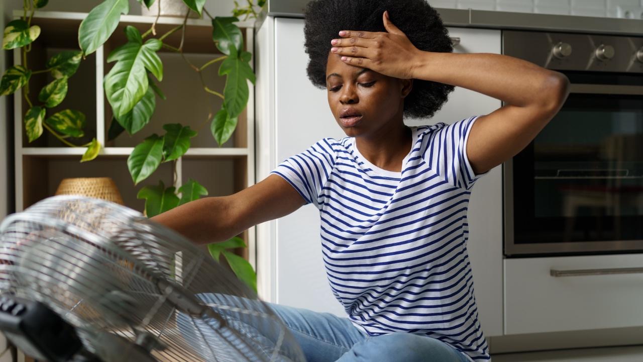
It’s extremely hot and I’m feeling weak and dizzy. Could I have heat stroke?

<p><em><a href="https://theconversation.com/profiles/lily-hospers-1060107">Lily Hospers</a>, <a href="https://theconversation.com/institutions/university-of-sydney-841">University of Sydney</a>; <a href="https://theconversation.com/profiles/james-smallcombe-1412548">James Smallcombe</a>, <a href="https://theconversation.com/institutions/university-of-sydney-841">University of Sydney</a>, and <a href="https://theconversation.com/profiles/ollie-jay-114164">Ollie Jay</a>, <a href="https://theconversation.com/institutions/university-of-sydney-841">University of Sydney</a></em></p> 
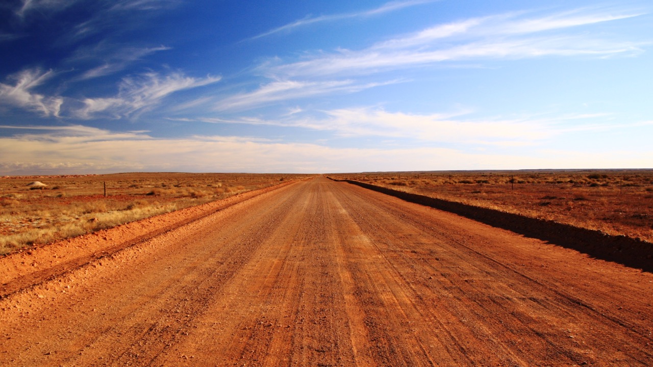
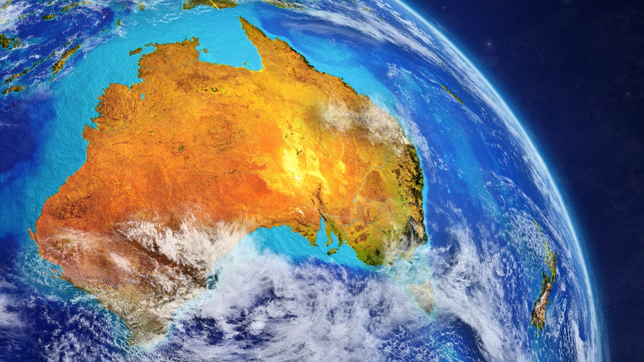
<p>Australia is braced for a hot, dry summer. El Nino is back, and this year it will occur alongside an <a href="https://www.abc.net.au/news/2023-08-22/positive-indian-ocean-dipole-to-coincide-with-el-nino/102756378">Indian Ocean dipole</a>, a climate pattern which will further amplify this hot and dry effect.</p> <p>Hot weather can place great stress on our bodies. When the environmental conditions exceed the limit at which we can adequately cope, we can suffer from heat-related illnesses.</p> <p>Heat illnesses can vary, from relatively mild heat exhaustion to the potentially life-threatening condition of heat stroke.</p> <h2>What are the signs and symptoms?</h2> 
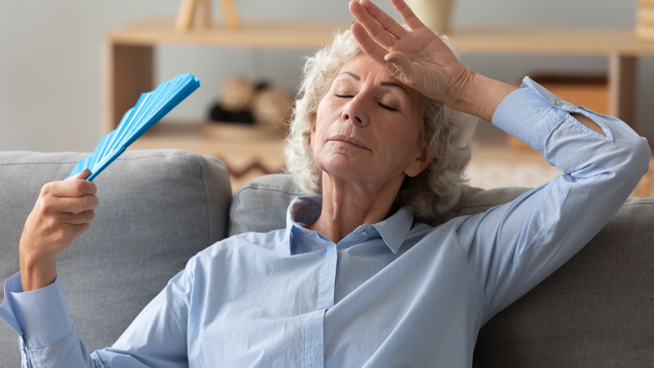
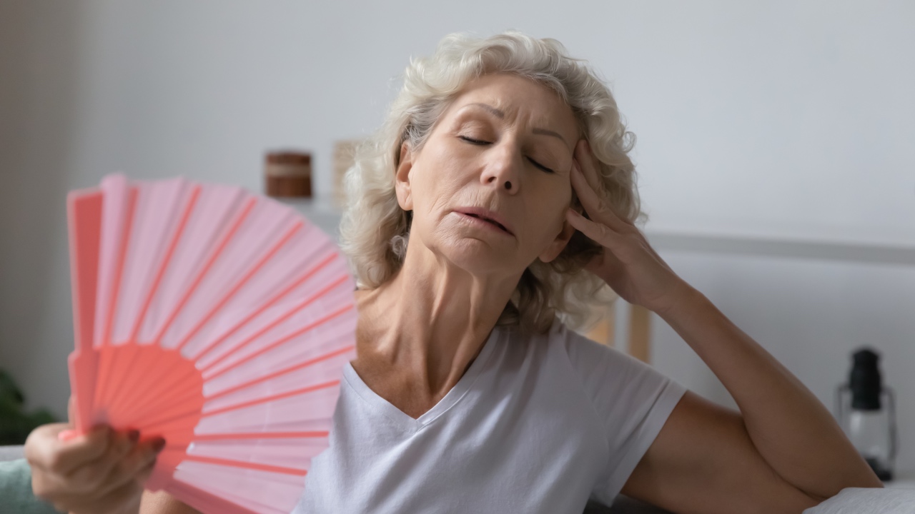
<p>If you’re suffering from heat exhaustion, you may feel weakness, nausea, headaches or dizziness.</p> <p>Mild <a href="https://www.health.nsw.gov.au/environment/beattheheat/Pages/heat-related-illness.aspx">symptoms of heat exhaustion</a> can often be treated at home by reducing your levels of physical activity, finding shade, removing excess clothing, hydrating with water and perhaps even taking a cool shower.</p> <p>If left unchecked, heat exhaustion can progress to the far more serious condition of heat stroke, where your core temperature climbs upwards of 40°C. <a href="https://www.health.nsw.gov.au/environment/beattheheat/Pages/heat-related-illness.aspx">Symptoms</a> can develop rapidly and may include confusion, disorientation, agitation, convulsions, or it could even result in a coma.</p> <p>Heat stroke is a medical emergency and requires urgent treatment. Call an ambulance and start rapid, aggressive cooling by immersing the person in cold water (such as a cold bath). If this isn’t possible, apply ice packs to their neck, armpits and groin and cover the skin with lots of cool water.</p> <p>When it comes to cooling someone with suspected heat stroke, the quicker the better: cool first, transport second.</p> <h2>Why do we overheat?</h2> <p>Environmental conditions play an important role in determining our heat stress risk. If the air temperature, humidity and levels of sun exposure are high, we are much more likely to dangerously overheat.</p> <p>When the body gets hot, the heart pumps more warm blood to our skin to help lose heat. As air temperature rises, this way of shedding heat becomes ineffective. When air temperature is higher than the temperature of the skin (normally around 35°C), we start gaining heat from our surroundings.</p> <p>Sweating is by far our most effective physiological means of keeping cool. However, it is the <em>evaporation</em> of sweat from our skin that provides cooling relief.</p> <p>When the air is humid, it already contains a lot of moisture, and this reduces how efficiently sweat evaporates.</p> <p>Our physical activity levels and clothing also impact heat stress risk. When we move, our bodies generate metabolic heat as a by-product. The more intense physical activity is, the more heat we must lose to avoid dangerous rises in core temperature.</p> <p>Finally, clothing can act as an insulator and barrier for the evaporation of sweat, making it even more difficult for us to keep cool.</p> <h2>Who is most vulnerable in the heat?</h2> <p>Some people <a href="https://www.health.nsw.gov.au/environment/beattheheat/Pages/people-most-at-risk.aspx">are at greater risk</a> of developing heat illness than others. This can result from physiological limitations, such as a decreased capacity to sweat, or a reduced capacity to adapt our behaviour. When these two risk factors coincide, it’s a perfect storm of vulnerability.</p> <p>Take, for example, an elderly outdoor agricultural worker. Being aged over 60, their physiological capacity to sweat is reduced. The worker may also be wearing heavy safety clothing, which may further limit heat loss from the body. If they don’t slow down, seek shelter and adequately hydrate, they become even more vulnerable.</p> <p>When a person dies of heat stroke – which is relatively easy to diagnose – heat will be listed as a cause of death on a death certificate. Between 2001 and 2018 in Australia, 473 heat-related deaths were <a href="https://www.sciencedirect.com/science/article/pii/S2212420921006324">officially reported</a>.</p> <p>However, the true association between heat and death is thought to be far greater, with an <a href="https://www.thelancet.com/journals/lanplh/article/PIIS2542-5196(20)30100-5/fulltext">estimated 36,000 deaths</a> in Australia between 2006 and 2017.</p> <p>This is because most people who die during extreme heat events do not die from heat stroke. Instead, they they die of <a href="https://www.nejm.org/doi/full/10.1056/nejm199607113350203">other medical complications</a> such as cardiovascular or renal collapse, as additional strain is placed on essential organs such as the heart and kidneys.</p> <p>People with underlying health conditions are more likely to succumb to heat-associated complications before they develop critical core temperature (over 40°C) and heat stroke.</p> <p>In such cases, while the additional physiological strain imposed by the heat probably “caused” the death, the official “cause of death” is often listed as something else, such as a heart attack. This can make understanding the true health burden of extreme heat more difficult.</p> <h2>How to stay safe in the heat</h2> <p>Thankfully, there are effective, low-cost <a href="https://twitter.com/TheLancet/status/1677702906789740545">ways</a> of staying safe in the heat. These include: <!-- Below is The Conversation's page counter tag. Please DO NOT REMOVE. --><img style="border: none !important; box-shadow: none !important; margin: 0 !important; max-height: 1px !important; max-width: 1px !important; min-height: 1px !important; min-width: 1px !important; opacity: 0 !important; outline: none !important; padding: 0 !important;" src="https://counter.theconversation.com/content/215084/count.gif?distributor=republish-lightbox-basic" alt="The Conversation" width="1" height="1" /><!-- End of code. If you don't see any code above, please get new code from the Advanced tab after you click the republish button. The page counter does not collect any personal data. More info: https://theconversation.com/republishing-guidelines --></p> <ul> <li>staying adequately hydrated</li> <li>getting out of the heat to a cooler area indoors or shaded area outdoors</li> <li>loosening or removing clothing</li> <li>cooling down any way you can: <ul> <li>using an electric fan (which can be used at 37°C and below, irrespective of age and humidity)</li> <li>using a cold-water spray</li> <li>applying a cool, damp sponge or cloth</li> <li>wetting clothes and skin</li> <li>having a cool shower or bath</li> <li>applying ice packs or crushed ice in a damp towel on the neck, groin and armpits.</li> </ul> </li> </ul> <p><a href="https://theconversation.com/profiles/lily-hospers-1060107"><em>Lily Hospers</em></a><em>, PhD Candidate, <a href="https://theconversation.com/institutions/university-of-sydney-841">University of Sydney</a>; <a href="https://theconversation.com/profiles/james-smallcombe-1412548">James Smallcombe</a>, Post-doctoral Research Associate, <a href="https://theconversation.com/institutions/university-of-sydney-841">University of Sydney</a>, and <a href="https://theconversation.com/profiles/ollie-jay-114164">Ollie Jay</a>, Professor of Heat &amp; Health; Director of Heat &amp; Health Research Incubator; Director of Thermal Ergonomics Laboratory, <a href="https://theconversation.com/institutions/university-of-sydney-841">University of Sydney</a></em></p> <p><em>Image credits: Getty Images</em></p> <p><em>This article is republished from <a href="https://theconversation.com">The Conversation</a> under a Creative Commons license. Read the <a href="https://theconversation.com/its-extremely-hot-and-im-feeling-weak-and-dizzy-could-i-have-heat-stroke-215084">original ar</a><a href="https://theconversation.com/its-extremely-hot-and-im-feeling-weak-and-dizzy-could-i-have-heat-stroke-215084">ticle</a>.</em></p>

Body

Our Partners