Placeholder Content Image

‘It’s time to give up on normal’: what winter’s weird weather means for the warm months ahead

<div class="theconversation-article-body"><em><a href="https://theconversation.com/profiles/david-bowman-4397">David Bowman</a>, <a href="https://theconversation.com/institutions/university-of-tasmania-888">University of Tasmania</a></em></p> <p>Heavy winds struck south-east Australia over the weekend as a series of cold fronts moved across the continent. It followed a <a href="https://www.9news.com.au/national/australia-weather-update-nsw-and-victoria-damaging-winds-high-fire-danger-warnings/0f9b19d8-dc81-44c9-8df4-679cbb67c055">high fire danger</a> in Sydney and other parts of New South Wales last week, and <a href="https://www.abc.net.au/news/2024-08-28/fire-grass-emergency-warning-firefighter-horningsea-park/104281180">a fire in south-west Sydney</a> that threatened homes.</p> <p>The severe weather rounds out a weird winter across Australia. The nation’s <a href="https://www.theguardian.com/australia-news/article/2024/aug/26/winter-heat-records-broken-as-australia-set-for-more-temperatures-over-10c-above-average">hottest ever winter temperature was recorded</a> when Yampi Sound in Western Australia reached 41.6C on Tuesday. Elsewhere across Australia, winter temperatures have been <a href="https://www.theguardian.com/australia-news/article/2024/aug/28/nsw-weather-forecast-fire-danger-warnings-sydney-bom">way above average</a>.</p> <p>We can look to the positives: spring <a href="https://www.theguardian.com/australia-news/article/2024/aug/26/australias-early-spring-brings-budding-flowers-chirping-birds-and-climate-alarm">flowers are blooming early</a>, and people have donned t-shirts and <a href="https://www.smh.com.au/environment/climate-change/spring-comes-early-after-warm-winter-with-more-heat-on-the-way-20240828-p5k63i.html">hit the beach</a>. But there’s a frightening undercurrent to this weather.</p> <p>Earth’s climate has become dangerously <a href="https://science.nasa.gov/climate-change/extreme-weather/">unstable</a>, and it’s only a matter of time before we get the bad combination of hot and dry weather, strong winds and a spark. None of this should come as a surprise. The sooner we stop expecting Australia’s weather to be “normal”, the sooner we can prepare for life in a wild climate.</p> <figure><iframe src="https://www.youtube.com/embed/003XSg5AZBk?wmode=transparent&amp;start=0" width="440" height="260" frameborder="0" allowfullscreen="allowfullscreen"></iframe></figure> <h2>The green is deceiving</h2> <p>The landscape around Sydney – and in fact, across much of south-east Australia – is very green at the moment. That’s because we’ve had a couple of years of good rains which triggered an explosion of vegetation growth.</p> <p>The below NASA satellite image reveals the picture in stark detail. It’s certainly lush out there at the moment.</p> <p>But the problem with climate change is that weather conditions can turn on a dime. This August was a case in point. At month’s end, much of Australia was hit by a record-breaking heatwave and <a href="http://www.bom.gov.au/australia/charts/synoptic_col.shtml">damaging winds</a> – conditions that can dry out a green landscape with devastating efficiency, turning it into fuel for a bushfire.</p> <p>The dangerous fire weather that struck Sydney this week came as a surprise to many. But in reality, these abnormal conditions are the new normal.</p> <p>We must open our minds to this, if we want to be prepared.</p> <h2>A climate off the rails</h2> <p>The year 2023 was Earth’s <a href="https://www.climate.gov/news-features/featured-images/2023-was-warmest-year-modern-temperature-record#:%7E:text=The%20year%202023%20was%20the,decade%20(2014%E2%80%932023).">hottest on record</a>. And <a href="https://www.carbonbrief.org/state-of-the-climate-2024-now-very-likely-to-be-warmest-year-on-record/">2024 looks likely</a> to be hotter still.</p> <p>In Australia, the last 12 months have provided all the evidence we need that our climate is wobbling on its rails.</p> <p>In October 2023, Victoria’s Gippsland region suffered unseasonably early bushfires, then soon after battled <a href="https://www.abc.net.au/news/2023-12-05/gippsland-fires-and-multiple-floods-breeding-resilience/103179368">heavy rain and flooding</a>.</p> <p>And Tasmania, where I live, <a href="https://www.abc.net.au/news/2024-03-07/tas-drought-conditions-as-dry-tasmania-looking-very-brown/103546058">has been gripped by drought</a>. This February was Hobart’s third driest in 143 years. But over the weekend we were hammered by a <a href="https://www.abc.net.au/news/2024-09-01/tas-flood-warnings-severe-weather-sunday/104296092">deluge of rain and wind</a>.</p> <p>This climate instability is setting up bad fire conditions. Not everywhere in south-east Australia will be hit by fire, but it will happen somewhere. It could be the hinterlands or the coast. It will depend on how our erratic climate behaves in the coming months.</p> <p>Let’s stick with the Tasmania example. Sure, the surface soils are now nicely saturated. But that will lead to a burst of grass and other vegetation in spring. If the dry weather returns and the temperatures heat up in summer, the fine fuels will dry out and become dangerously combustible.</p> <p>All we need then is a windy day and a spark, and a nightmare fire will soon be racing across the landscape.</p> <h2>Canada on fire</h2> <p>Of course, Australia is not the only country facing climate instability and a worsening fire risk.</p> <p>Canada suffered a catastrophic wildfire season in 2023 – one of the most severe on record. It burnt almost 15 million hectares and forced the evacuation of 232,000 people.</p> <p>Smoke produced by the fires affected communities up to 1,000 km away, such as in southern Canada and on the east coast of the United States.</p> <p>A <a href="https://www.nature.com/articles/d41586-024-02653-6">recent paper</a> in the journal Nature Communications outlined why. It pinpointed early snowmelt, early-season drought conditions and intense heat. In fact, the average temperature in Canada from May to October last year was 2.2°C higher than the 30-year average.</p> <p>The researchers said human-caused climate change exacerbated the fire’s effects. It went on:</p> <blockquote> <p>The disproportionate effect a few days of extreme weather can have on the total area burned is also evident in this fire season, leading to worrisome prospects given projected future conditions.</p> </blockquote> <h2>Normal no longer exists</h2> <p>It’s always been difficult to forecast fire seasons in Australia, due to our natural climate variability.</p> <p>But now we are seeing climate instability <a href="https://www.csiro.au/en/research/environmental-impacts/climate-change/state-of-the-climate/previous/state-of-the-climate-2018/australias-changing-climate">layering over itself</a>: background dryness, wet seasons bringing a proliferation of fuels, and above-average temperatures.</p> <p>Eventually we’ll get unlucky and experience extremely strong winds thrown into the mix. That’s when catastrophic fires are most likely to occur.</p> <p>As we saw in the <a href="https://theconversation.com/australias-black-summer-of-fire-was-not-normal-and-we-can-prove-it-172506">Black Summer of 2019–20</a>, and again in Canada last year, some fires are so intense they completely overwhelm fire suppression strategies.</p> <p>Under climate change, the likelihood of getting a bad combination of weather conditions is increasing. So what’s the remedy?</p> <p>Australia really must start making our communities more resilient. Serious and sustained adaptation is needed. As my <a href="https://www.science.org/doi/full/10.1126/science.adi8066">research has outlined</a>, this requires the careful integration of:</p> <ul> <li>community education programs</li> <li>research and development to design fire-safe homes, gardens, communities and bushland</li> <li>incentives and penalties to ensure adaptation measures are implemented.</li> </ul> <p>As this winter has shown, Australia’s climate is entering a different phase. It’s time to give up on “normal” weather. The game is changing and we have to adapt.<!-- Below is The Conversation's page counter tag. Please DO NOT REMOVE. --><img style="border: none !important; box-shadow: none !important; margin: 0 !important; max-height: 1px !important; max-width: 1px !important; min-height: 1px !important; min-width: 1px !important; opacity: 0 !important; outline: none !important; padding: 0 !important;" src="https://counter.theconversation.com/content/237857/count.gif?distributor=republish-lightbox-basic" alt="The Conversation" width="1" height="1" /><!-- End of code. If you don't see any code above, please get new code from the Advanced tab after you click the republish button. The page counter does not collect any personal data. More info: https://theconversation.com/republishing-guidelines --></p> <p><em><a href="https://theconversation.com/profiles/david-bowman-4397">David Bowman</a>, Professor of Pyrogeography and Fire Science, <a href="https://theconversation.com/institutions/university-of-tasmania-888">University of Tasmania</a></em></p> <p><em>Image credits: Shutterstock </em></p> <p><em>This article is republished from <a href="https://theconversation.com">The Conversation</a> under a Creative Commons license. Read the <a href="https://theconversation.com/its-time-to-give-up-on-normal-what-winters-weird-weather-means-for-the-warm-months-ahead-237857">original article</a>.</em></p> </div>

Travel Trouble

Placeholder Content Image

40°C in August? A climate expert explains why Australia is ridiculously hot right now

<div class="theconversation-article-body"><a href="https://theconversation.com/profiles/andrew-king-103126">Andrew King</a>, <em><a href="https://theconversation.com/institutions/the-university-of-melbourne-722">The University of Melbourne</a></em></p> <p>It’s winter in Australia, but as you’ve probably noticed, the weather is unusually warm. The top temperatures over large parts of the country this weekend were well above average for this time of year.</p> <p>The outback town of Oodnadatta in South Australia recorded 38.5°C on Friday and 39.4°C on Saturday – about 16°C above average. Both days were well above the state’s previous winter temperature record. In large parts of Australia, the heat is expected to persist into the coming week.</p> <p>A high pressure system is bringing this unusual heat – and it’s hanging around. So temperature records have already fallen and may continue to be broken for some towns in the next few days.</p> <p>It’s no secret the world is warming. In fact, 2024 is shaping up to be <a href="https://www.carbonbrief.org/state-of-the-climate-2024-now-very-likely-to-be-warmest-year-on-record/">the hottest year on record</a>. Climate change is upon us. Historical averages are becoming just that: a thing of the past.</p> <p>That’s why this winter heat is concerning. The warming trend will continue for at least as long as we keep burning fossil fuels and polluting the atmosphere. Remember, this is only August. The heatwaves of spring and summer are only going to be hotter.</p> <figure><iframe src="https://www.youtube.com/embed/GmhMKjxEGQo?wmode=transparent&amp;start=0" width="440" height="260" frameborder="0" allowfullscreen="allowfullscreen"></iframe><figcaption><span class="caption">Widespread heat forecast for Australia in August, 2024 (Bureau of Meteorology)</span></figcaption></figure> <h2>Records broken across Australia</h2> <p>The Bureau of Meteorology was expecting many records to be broken over the weekend across several states. On Thursday, bureau meteorologist Angus Hines described:</p> <blockquote> <p>A scorching end to winter, with widespread heat around the country in coming days, including the chance of winter records across multiple states for maximum temperature.</p> </blockquote> <p>The amount of heat plunging into central Australia was particularly unusual, Hines said.</p> <p>On Friday, temperatures across northern South Australia and southern parts of the Northern Territory were as much as 15°C above average.</p> <p>Temperatures continued to soar across northern parts of Western Australia over the weekend, with over 40°C recorded at Fitzroy Crossing on Sunday. It has been 2–12°C above average from Townsville all the way down to Melbourne for several days in a row.</p> <figure class="align-center zoomable"><a href="https://images.theconversation.com/files/615457/original/file-20240825-18-d8f6ho.gif?ixlib=rb-4.1.0&amp;q=45&amp;auto=format&amp;w=1000&amp;fit=clip"><img src="https://images.theconversation.com/files/615457/original/file-20240825-18-d8f6ho.gif?ixlib=rb-4.1.0&amp;q=45&amp;auto=format&amp;w=754&amp;fit=clip" sizes="(min-width: 1466px) 754px, (max-width: 599px) 100vw, (min-width: 600px) 600px, 237px" srcset="https://images.theconversation.com/files/615457/original/file-20240825-18-d8f6ho.gif?ixlib=rb-4.1.0&amp;q=45&amp;auto=format&amp;w=600&amp;h=412&amp;fit=crop&amp;dpr=1 600w, https://images.theconversation.com/files/615457/original/file-20240825-18-d8f6ho.gif?ixlib=rb-4.1.0&amp;q=30&amp;auto=format&amp;w=600&amp;h=412&amp;fit=crop&amp;dpr=2 1200w, https://images.theconversation.com/files/615457/original/file-20240825-18-d8f6ho.gif?ixlib=rb-4.1.0&amp;q=15&amp;auto=format&amp;w=600&amp;h=412&amp;fit=crop&amp;dpr=3 1800w, https://images.theconversation.com/files/615457/original/file-20240825-18-d8f6ho.gif?ixlib=rb-4.1.0&amp;q=45&amp;auto=format&amp;w=754&amp;h=518&amp;fit=crop&amp;dpr=1 754w, https://images.theconversation.com/files/615457/original/file-20240825-18-d8f6ho.gif?ixlib=rb-4.1.0&amp;q=30&amp;auto=format&amp;w=754&amp;h=518&amp;fit=crop&amp;dpr=2 1508w, https://images.theconversation.com/files/615457/original/file-20240825-18-d8f6ho.gif?ixlib=rb-4.1.0&amp;q=15&amp;auto=format&amp;w=754&amp;h=518&amp;fit=crop&amp;dpr=3 2262w" alt="Animated maximum temperature anomaly map showing heat building across central Australia" /></a><figcaption><span class="caption">Maximum temperature anomalies from August 19-24, showing heat building across Australia.</span> <span class="attribution"><span class="source">Bureau of Meteorology</span>, <a class="license" href="http://creativecommons.org/licenses/by/4.0/">CC BY</a></span></figcaption></figure> <p>Bear in mind, it’s only August. As Hines said, the fire weather season hasn’t yet hit most of Australia – but the current conditions – hot, dry and sometimes windy – are bringing moderate to high fire danger across Australia. It may also bring dusty conditions to central Australia.</p> <p>And for latitudes north of Sydney and Perth, most of the coming week will be warm.</p> <h2>What’s causing the winter warmth?</h2> <p><a href="http://www.bom.gov.au/australia/charts/synoptic_col.shtml">In recent days</a> a stubborn high pressure system has sat over eastern Australia and the Tasman Sea. It has kept skies clear over much of the continent and brought northerly winds over many areas, transporting warm air to the south.</p> <p>High pressure promotes warm weather – both through clearer skies that bring more sunshine, and by promoting the descent of air which <a href="https://media.bom.gov.au/social/blog/2544/explainer-what-influences-air-temperature/">causes heating</a>.</p> <p>By late August, both the intensity of the sun and the length of the day has increased. So the centre of Australia can really warm up when under the right conditions.</p> <p>High pressure in June can be associated with cooler conditions, because more heat is lost from the surface during those long winter nights. But that’s already less of an issue by late August.</p> <p>This kind of weather setup has occurred in the past. Late-winter or early-spring heat does sometimes occur in Australia. However, this warm spell is exceptional, as highlighted by the broken temperature records across the country.</p> <figure class="align-center zoomable"><a href="https://images.theconversation.com/files/615284/original/file-20240823-20-1mu7h0.png?ixlib=rb-4.1.0&amp;q=45&amp;auto=format&amp;w=1000&amp;fit=clip"><img src="https://images.theconversation.com/files/615284/original/file-20240823-20-1mu7h0.png?ixlib=rb-4.1.0&amp;q=45&amp;auto=format&amp;w=754&amp;fit=clip" sizes="(min-width: 1466px) 754px, (max-width: 599px) 100vw, (min-width: 600px) 600px, 237px" srcset="https://images.theconversation.com/files/615284/original/file-20240823-20-1mu7h0.png?ixlib=rb-4.1.0&amp;q=45&amp;auto=format&amp;w=600&amp;h=450&amp;fit=crop&amp;dpr=1 600w, https://images.theconversation.com/files/615284/original/file-20240823-20-1mu7h0.png?ixlib=rb-4.1.0&amp;q=30&amp;auto=format&amp;w=600&amp;h=450&amp;fit=crop&amp;dpr=2 1200w, https://images.theconversation.com/files/615284/original/file-20240823-20-1mu7h0.png?ixlib=rb-4.1.0&amp;q=15&amp;auto=format&amp;w=600&amp;h=450&amp;fit=crop&amp;dpr=3 1800w, https://images.theconversation.com/files/615284/original/file-20240823-20-1mu7h0.png?ixlib=rb-4.1.0&amp;q=45&amp;auto=format&amp;w=754&amp;h=566&amp;fit=crop&amp;dpr=1 754w, https://images.theconversation.com/files/615284/original/file-20240823-20-1mu7h0.png?ixlib=rb-4.1.0&amp;q=30&amp;auto=format&amp;w=754&amp;h=566&amp;fit=crop&amp;dpr=2 1508w, https://images.theconversation.com/files/615284/original/file-20240823-20-1mu7h0.png?ixlib=rb-4.1.0&amp;q=15&amp;auto=format&amp;w=754&amp;h=566&amp;fit=crop&amp;dpr=3 2262w" alt="Graph of August Australian-average temperatures increasing since 1910" /></a><figcaption><span class="caption">August temperatures have been rising over the past century.</span> <span class="attribution"><span class="source">Bureau of Meteorology</span></span></figcaption></figure> <h2>Feeling the heat</h2> <p>The consequences of humanity’s continued greenhouse gas emissions are clear. Australia’s winters are getting warmer overall. And winter “heatwaves” are becoming warmer.</p> <p>Australia’s three warmest Augusts on record have all occurred since 2000 – and <a href="https://theconversation.com/why-is-australia-having-such-a-warm-winter-a-climate-expert-explains-210693">last August was the second-warmest since 1910</a>. When the right weather conditions occur for winter warmth across Australia, the temperatures are higher than a century ago.</p> <p>The warmth we are experiencing now comes off the back of <a href="https://theconversation.com/earth-has-just-ended-a-13-month-streak-of-record-heat-heres-what-to-expect-next-236655">a recent run of global temperature records</a> and <a href="https://theconversation.com/extreme-heat-is-breaking-global-records-why-this-isnt-just-summer-and-what-climate-change-has-to-do-with-it-234249">extreme heat events across the Northern Hemisphere</a>.</p> <p>This warm spell is set to continue, with temperatures above 30°C forecast from Wednesday through to Sunday in Brisbane. The outlook for spring points to continued <a href="http://www.bom.gov.au/climate/outlooks/#/temperature/maximum/median/seasonal/0">above-normal temperatures</a> across the continent, but as always we will likely see both warm and cold spells at times.</p> <p>Such winter warmth is exceptional and already breaking records. Climate change is already increasing the frequency and intensity of this kind of winter heat – and future warm spells will be hotter still, if humanity’s greenhouse gas emissions continue.<!-- Below is The Conversation's page counter tag. Please DO NOT REMOVE. --><img style="border: none !important; box-shadow: none !important; margin: 0 !important; max-height: 1px !important; max-width: 1px !important; min-height: 1px !important; min-width: 1px !important; opacity: 0 !important; outline: none !important; padding: 0 !important;" src="https://counter.theconversation.com/content/237398/count.gif?distributor=republish-lightbox-basic" alt="The Conversation" width="1" height="1" /><!-- End of code. If you don't see any code above, please get new code from the Advanced tab after you click the republish button. The page counter does not collect any personal data. More info: https://theconversation.com/republishing-guidelines --></p> <p><em><a href="https://theconversation.com/profiles/andrew-king-103126">Andrew King</a>, Senior Lecturer in Climate Science, <a href="https://theconversation.com/institutions/the-university-of-melbourne-722">The University of Melbourne</a></em></p> <p><em>Image credits: Shutterstock </em></p> <p><em>This article is republished from <a href="https://theconversation.com">The Conversation</a> under a Creative Commons license. Read the <a href="https://theconversation.com/40-c-in-august-a-climate-expert-explains-why-australia-is-ridiculously-hot-right-now-237398">original article</a>.</em></p> </div>

Domestic Travel

Placeholder Content Image

Swimmer drowns unnoticed during event

<p>An athlete has drowned in the middle of a livestreamed sporting competition in the US, with spectators and competitors alike not realising until it was too late.</p> <p>Lazar Đukić, an athlete from Belgrade, Serbia, was one of many competing at the CrossFit competition in Texas, when he reportedly vanished near the end of a live-streamed 800-metre swim in Fort Worth’s Marine Creek Lake, near Dallas, on Thursday. </p> <p>Spectators, staff and swimmers initially didn't notice the man had drowned, as the Fort Worth Fire Department told AP it was called to assist police because there “was a participant in the water that was down and hadn’t been seen in some point in time”.</p> <p>Two hours after he was last seen, a body was pulled from the lake. </p> <p>One distressed spectator said “people were still swimming over him where he went down”.</p> <p>The organisers of the CrossFit Games issued a statement on Thursday, saying they are "deeply saddened" by the turn of events. </p> <p>“CrossFit is deeply saddened by the death of a CrossFit Games competitor during the swimming portion of Individual Event 1 at the 2024 CrossFit Games,” the statement read.</p> <p>“We are fully co-operating with authorities and doing everything we can to support the family at this time.”</p> <p>Mr Đukić, 28, has been remembered as a “beloved friend and elite athlete”.</p> <p>A <a title="www.gofundme.com" href="https://www.gofundme.com/f/lazar-dukic-support-fund">GoFundMe fundraising page</a> has been set up by one of Mr Đukić sponsors drinks brand Fitaid, to “support his loved ones during this time”, and has already raised $215,000 of $228,000 goal. </p> <p>“Known for his kindness, humour, and supportive nature, Lazar brought a breath of fresh air wherever he went,” state the page.</p> <p>“Beyond his athletic achievements, Lazar was caring, humorous and relentlessly supported those around him. His warm, supportive nature and quick wit left a lasting impression on everyone he met.”</p> <p><em>Image credits: GoFundMe</em></p>

Caring

Placeholder Content Image

Antarctic heat, wild Australian winter: what’s happening to the weather and what it means for the rest of the year

<div class="theconversation-article-body"><em><a href="https://theconversation.com/profiles/martin-jucker-379172">Martin Jucker</a>, <a href="https://theconversation.com/institutions/unsw-sydney-1414">UNSW Sydney</a></em></p> <p>Australia’s south and east have seen <a href="https://theconversation.com/southern-australia-is-freezing-how-can-it-be-so-cold-in-a-warming-climate-233977">freezing temperatures</a> and <a href="https://www.theguardian.com/australia-news/article/2024/jul/29/australia-winter-weather-forecast-east-coast-colder-records">wild weather</a> this winter. At the same time, the continent as a whole – and the globe – have <a href="https://www.abc.net.au/news/2024-08-03/australia-suffers-cold-winter-weather-despite-mild-forecast/104176284">continued to warm</a>.</p> <p>What’s going on? As ever, it’s hard to pinpoint a single cause for weather events. But a key player is likely an event unfolding high above Antarctica, which itself may have been triggered by a heatwave at surface level on the frozen continent.</p> <p>Here’s what’s happening – and what it might mean for the rest of this year’s weather.</p> <h2>When the stratosphere heats up</h2> <p>Out story begins in the cold air over Antarctica. July temperatures in the stratosphere, the layer of air stretching between altitudes of around 10 and 50 kilometres, are typically around –80°C.</p> <p>The winds are also very strong, averaging about 300 kilometres per hour in winter. These cold, fast winds loop around above the pole in what is called the <a href="https://sites.krieger.jhu.edu/waugh/research/polarvortex">stratospheric polar vortex</a>.</p> <p>Occasionally, persistent high air pressure in the lower atmosphere can influence large-scale waves that extend around the globe and up into the stratosphere. There they cause the strong winds to slow down, and the air high above the pole to become much warmer than normal.</p> <p>In extreme situations the stratospheric winds can completely break down, in what is called a “sudden stratospheric warming” event. These events occur every few years in the northern hemisphere, but only one has ever been observed in the south, in 2002 (though another <a href="https://theconversation.com/the-air-above-antarctica-is-suddenly-getting-warmer-heres-what-it-means-for-australia-123080">almost happened in 2019</a>).</p> <h2>Pushing polar weather our way</h2> <p>Once the polar vortex is disturbed, it can in turn influence the weather at the surface by steering weather systems from the Southern Ocean towards the Equator. However, this is a slow process.</p> <p>The impact at the surface may not be felt until <a href="https://doi.org/10.1175/JCLI-D-22-0425.1">a few weeks or even months</a> after the initial weakening of the stratospheric polar vortex. Once it begins, the stratospheric influence can prevail for more weeks or months, and helps meteorologists make <a href="https://doi.org/10.5194/acp-22-2601-2022">long-range weather forecasts</a>.</p> <p>In climate science terms, the weak stratospheric winds put an atmospheric system called the <a href="http://www.bom.gov.au/climate/sam/">Southern Annular Mode</a> into a negative phase. The main effect of this on surface weather is to bring westerly winds further north.</p> <p>In winter, this means polar air outbreaks can reach places like Sydney more easily. As a result, we see more <a href="https://doi.org/10.1175/JCLI4134.1">rain over much of southern Australia</a>, and snowfall in alpine regions. In spring and summer it means westerly winds blow over the continent before reaching the east coast, bringing warm and dry air to southeastern Australia.</p> <p>The exact impact of a weaker polar vortex depends on how much and for how long the weather systems are being pushed further northward. It will also depend on other weather influencers such as El Niño and the Indian Ocean Dipole.</p> <h1>This winter’s weirdness</h1> <p>Unpicking exactly why any weather event occurs is tricky at the moment, because global weather has been absolutely crazy over the past 12 months or so. Global temperatures are <a href="https://theconversation.com/we-just-blew-past-1-5-degrees-game-over-on-climate-not-yet-213364">much higher than usual</a>, which is making unusual weather very common.</p> <p>But there are indications that the stratosphere is having some influence on our weather this winter.</p> <p>The stratospheric polar vortex started to warm in mid-July, and is about 20°C warmer than the long-term average. At the time of writing, the winds slowed down to about 230 kilometres per hour, 70 kilometres per hour slower than average.</p> <p>These numbers mean that, technically, the event does not qualify as a sudden stratospheric warming. However, further warming may still occur.</p> <p>If we look at how southern hemisphere winds have evolved in the past few weeks, we see a pattern which looks like what we would expect from a sudden stratospheric warming.</p> <p>First, we see warming in the stratosphere which is <a href="https://doi.org/10.1029/2021GL095270">at first accompanied by a poleward shift of weather systems</a>.</p> <p>The stratosphere’s influence then propagates downward and seems to <a href="https://doi.org/10.1175/JCLI-D-22-0425.1">induce many weeks</a> of weather systems shifted towards the equator.</p> <p>This coincides with the period of cold and rainy weather along Australia’s east coast in late July and the beginning of August. Forecasts suggest the Southern Annular Mode will be a long way from normal conditions in the first half of August – four standard deviations below average, which is extremely rare.</p> <figure class="align-center zoomable"><a href="https://images.theconversation.com/files/611211/original/file-20240804-19-sp862a.png?ixlib=rb-4.1.0&amp;q=45&amp;auto=format&amp;w=1000&amp;fit=clip"><img src="https://images.theconversation.com/files/611211/original/file-20240804-19-sp862a.png?ixlib=rb-4.1.0&amp;q=45&amp;auto=format&amp;w=754&amp;fit=clip" sizes="(min-width: 1466px) 754px, (max-width: 599px) 100vw, (min-width: 600px) 600px, 237px" srcset="https://images.theconversation.com/files/611211/original/file-20240804-19-sp862a.png?ixlib=rb-4.1.0&amp;q=45&amp;auto=format&amp;w=600&amp;h=300&amp;fit=crop&amp;dpr=1 600w, https://images.theconversation.com/files/611211/original/file-20240804-19-sp862a.png?ixlib=rb-4.1.0&amp;q=30&amp;auto=format&amp;w=600&amp;h=300&amp;fit=crop&amp;dpr=2 1200w, https://images.theconversation.com/files/611211/original/file-20240804-19-sp862a.png?ixlib=rb-4.1.0&amp;q=15&amp;auto=format&amp;w=600&amp;h=300&amp;fit=crop&amp;dpr=3 1800w, https://images.theconversation.com/files/611211/original/file-20240804-19-sp862a.png?ixlib=rb-4.1.0&amp;q=45&amp;auto=format&amp;w=754&amp;h=377&amp;fit=crop&amp;dpr=1 754w, https://images.theconversation.com/files/611211/original/file-20240804-19-sp862a.png?ixlib=rb-4.1.0&amp;q=30&amp;auto=format&amp;w=754&amp;h=377&amp;fit=crop&amp;dpr=2 1508w, https://images.theconversation.com/files/611211/original/file-20240804-19-sp862a.png?ixlib=rb-4.1.0&amp;q=15&amp;auto=format&amp;w=754&amp;h=377&amp;fit=crop&amp;dpr=3 2262w" alt="Diagram showing atmospheric warming and winds" /></a><figcaption><span class="caption">How initial warming high in the stratosphere ends up changing winds near the surface and pushing polar weather further north.</span> <span class="attribution"><a class="source" href="https://stratobserve.com">Z.D. Lawrence / StratObserve / Annotated by Martin Jucker</a></span></figcaption></figure> <h1>A surface disturbance</h1> <p>The main reason for the polar vortex to slow down is disturbances from the surface. Weather over the Amundsen Sea near Antarctica in the South Pacific is <a href="https://doi.org/10.1175/JCLI-D-22-0425.1">an important source</a> of these disturbances.</p> <p>This year, we have seen disturbances of this sort. There have been <a href="https://www.theguardian.com/world/article/2024/aug/01/antarctic-temperatures-rise-10c-above-average-in-near-record-heatwave">near-record surface temperatures around Antarctica</a>.</p> <p>These disturbances may be due to the globally high ocean temperatures, or even lingering effects of the <a href="https://doi.org/10.1175/JCLI-D-23-0437.1">eruption of the Hunga Tonga volcano in 2022</a>. But more research will be required to confirm the causes.</p> <h1>What should we expect for the rest of the year?</h1> <p>There are two pathways until the end of the year. One is that the stratospheric winds and temperatures recover to their usual values and no longer influence surface weather. This is what the forecasts from <a href="https://ozonewatch.gsfc.nasa.gov">Ozone Watch</a> seem to suggest.</p> <p>Another is that the stratosphere keeps warming and the winds keep being slower all the way into summer. In this scenario, we would expect a persistent negative Southern Annular Mode, which would mean a spring and potentially even summer with warmer and drier than usual weather over southeastern Australia, and a small ozone hole.</p> <p>The seasonal forecasting models from the European Centre for Medium Range Weather Forecasts <a href="https://x.com/drahbutler/status/1819142206348759170?s=46&amp;t=sayfGwpo3_s310BwYpcdcQ">seem to favour this second scenario</a>.<!-- End of code. If you don't see any code above, please get new code from the Advanced tab after you click the republish button. The page counter does not collect any personal data. More info: https://theconversation.com/republishing-guidelines --></p> <p><em><a href="https://theconversation.com/profiles/martin-jucker-379172">Martin Jucker</a>, Senior Lecturer in Atmospheric Science, <a href="https://theconversation.com/institutions/unsw-sydney-1414">UNSW Sydney</a></em></p> <p><em>Image credits: Shutterstock </em></p> <p><em>This article is republished from <a href="https://theconversation.com">The Conversation</a> under a Creative Commons license. Read the <a href="https://theconversation.com/antarctic-heat-wild-australian-winter-whats-happening-to-the-weather-and-what-it-means-for-the-rest-of-the-year-236067">original article</a>.</em></p> </div>

Travel Trouble

Placeholder Content Image

Is Australia’s climate confusing you? Here’s why rainfall and temperatures don’t always behave as expected

<div class="theconversation-article-body"><em><a href="https://theconversation.com/profiles/carly-tozer-1404662">Carly Tozer</a>, <a href="https://theconversation.com/institutions/csiro-1035">CSIRO</a> and <a href="https://theconversation.com/profiles/james-risbey-2011">James Risbey</a>, <a href="https://theconversation.com/institutions/csiro-1035">CSIRO</a></em></p> <p>In the past few years in Australia, seasonal rainfall and temperatures have left a lot of people confused. Sometimes, the hot, dry conditions usually associated with an El Niño have not eventuated. Similarly, there have been years where a La Niña did not lead to the cool, wet conditions expected.</p> <p>It’s important for scientists to better understand all weather processes at play, so we can manage expectations around what Australia might experience when climate drivers such as El Niño and La Niña are forecast in future. That’s where our <a href="https://journals.ametsoc.org/view/journals/mwre/aop/MWR-D-23-0112.1/MWR-D-23-0112.1.xml">new research</a> comes in.</p> <p>We examined the state of play in November 2020 and November 2021. La Niña conditions occurred in both years. November 2021 followed the La Niña script and was wet and cool, but November 2020 departed from expectations and was dry and warm. We set out to determine why.</p> <p>We found the differences could be explained by fluctuations in the path of storms over the Australian continent. These fluctuations can be hard to predict well in advance, which makes it difficult to say for certain how a particular La Niña or El Niño event will affect Australia.</p> <h2>A tale of two Novembers</h2> <p>For large parts of Australia, the presence of a La Niña or El Niño <a href="https://theconversation.com/what-to-expect-when-youre-expecting-an-el-nino-the-answer-might-surprise-you-198510">shifts the odds</a> of experiencing wet or dry conditions. Our analysis of Novembers 2020 and 2021 shows how actual outcomes can differ from, or align with, expectations.</p> <p>The first step in our analysis was to examine <a href="https://theconversation.com/what-does-el-nino-do-to-the-weather-in-your-state-218257">other climate drivers</a>, including the Indian Ocean Dipole and Southern Annular Mode. We wanted to know if these drivers were in the same phase – negative, neutral or positive – during those two Novembers a year apart.</p> <p>So what did we find? In addition to La Nina, both Novembers occurred during positive Southern Annular Mode phases and very weak negative Indian Ocean Dipole phases. These phases are typically associated with more rainfall in Australia. So this didn’t explain why November 2020 was hot and dry.</p> <p>Next, we looked to the <a href="http://www.bom.gov.au/climate/about/?bookmark=mjo">Madden Julian Oscillation</a>. When this driver is located in the Australian region, it has been linked to more rainfall in Australia. Although the oscillation was in different phases during November 2020 and 2021, we found in general, this driver does not strongly influence rainfall across all of Australia in November.</p> <p>It was time to look for answers elsewhere.</p> <h2>Jet streams: a key piece in the puzzle</h2> <p>Next, we examined weather systems – in other words, the movement of high and low pressure systems across the globe.</p> <p>These systems are partly controlled by jet streams, which are bands of wind in the upper atmosphere. The effect of jet streams on weather systems, including storms, means they influence rainfall in the regions they pass over.</p> <p>We found there was a strong jet stream over Australia in November 2021. This would have assisted the development of any rain-bearing low-pressure systems moving in from the west, allowing these systems to travel across the Australian continent. These systems brought rain and contributed to the very wet conditions.</p> <p>In November 2020, the jet stream was largely absent over Australia. Instead, it was pushed south of the continent, which means rainfall systems received little help and were also largely steered south. That contributed to the dry month.</p> <p>But why did the jet streams develop in the first place? They form in part due to temperature differences, and are found in the zones where the temperature contrast between warm and cool air is strongest.</p> <p>In November 2021, Australia experienced cooler temperatures over land, but above-average sea surface temperatures in the waters off northern Australia. This pattern set up the zone of strongest temperature contrasts over the continent, which led to a persistent jet stream there.</p> <p>In November 2020, Australia was relatively warm both over land and on the sea surface to the north. This meant that the strongest temperature contrasts (and the jet stream) now sat at the junction between the warm continent and cooler Southern Ocean.</p> <h2>But wait, there’s more</h2> <p>So why were temperatures over Australia so different?</p> <p>To help answer this question we shifted our analysis from the monthly timescale to the daily timescale. That’s because atmospheric features such as jet streams vary strongly from day to day.</p> <p>We found for about the first three weeks of November 2021, a large low-pressure system – also known as a trough – was sitting south of Australia. It pumped cold air onto the continent, cooling it down.</p> <p>This maximised the north-south temperature difference between the warm sea surface temperatures to the north of Australia and the cool of the continent. And as we know, this aided the development of the jet stream over Australia.</p> <p>In November 2020, the continent started off relatively warm. And for a large portion of the month, there was a large high-pressure system over Australia, pulling warmer air from the tropics over the continent.</p> <p>This system would have also promoted clear skies over Australia and enhanced heating coming from the sun, contributing to the warm Australian continent in November 2020.</p> <h2>More puzzle pieces to fit</h2> <p>November 2020’s hot, dry conditions were not the only time a climate driver has failed to bring the conditions some had anticipated. Just last year El Niño <a href="https://www.theguardian.com/australia-news/2024/jan/03/experts-warned-el-nino-was-likely-to-bring-australia-a-hot-dry-summer-what-happened">did not deliver</a> expected dry conditions, leaving many people scratching their heads.</p> <p>Climate drivers play an important role in shaping rainfall. But they’re not the whole story. As our research shows, sometimes they are confounded by changes in weather patterns, which might mean that our expectations of a wet month or season don’t always play out.</p> <p>When it comes to Australia’s climate puzzle, these findings show there’s more to understand about the role of weather.<!-- Below is The Conversation's page counter tag. Please DO NOT REMOVE. --><img style="border: none !important; box-shadow: none !important; margin: 0 !important; max-height: 1px !important; max-width: 1px !important; min-height: 1px !important; min-width: 1px !important; opacity: 0 !important; outline: none !important; padding: 0 !important;" src="https://counter.theconversation.com/content/233345/count.gif?distributor=republish-lightbox-basic" alt="The Conversation" width="1" height="1" /><!-- End of code. If you don't see any code above, please get new code from the Advanced tab after you click the republish button. The page counter does not collect any personal data. More info: https://theconversation.com/republishing-guidelines --></p> <p><em><a href="https://theconversation.com/profiles/carly-tozer-1404662">Carly Tozer</a>, Senior Research Scientist, <a href="https://theconversation.com/institutions/csiro-1035">CSIRO</a> and <a href="https://theconversation.com/profiles/james-risbey-2011">James Risbey</a>, Researcher, Oceans and Atmosphere, <a href="https://theconversation.com/institutions/csiro-1035">CSIRO</a></em></p> <p><em>Image credits: Shutterstock </em></p> <p><em>This article is republished from <a href="https://theconversation.com">The Conversation</a> under a Creative Commons license. Read the <a href="https://theconversation.com/is-australias-climate-confusing-you-heres-why-rainfall-and-temperatures-dont-always-behave-as-expected-233345">original article</a>.</em></p> </div>

Domestic Travel

Placeholder Content Image

Southern Australia is freezing. How can it be so cold in a warming climate?

<div class="theconversation-article-body"><em><a href="https://theconversation.com/profiles/andrew-king-103126">Andrew King</a>, <a href="https://theconversation.com/institutions/the-university-of-melbourne-722">The University of Melbourne</a></em></p> <p>People living in southern Australia won’t have failed to notice how cold it is. Frosty nights and chilly days have been the weather for many of us since the start of July.</p> <p>As winter continues, we are left wondering how unusual the cold is and whether we can expect several more months of this. Warmer conditions are in the forecast but winter has a long way to go. Further cold snaps could occur.</p> <p>Cold conditions have been in place across southern Australia for the past few days. Temperatures have fallen below zero overnight in many places.</p> <p>It’s not just the nights that have been cold. Maximum temperatures have also been below or well below average across most of the country.</p> <figure class="align-center zoomable"><a href="https://images.theconversation.com/files/604809/original/file-20240704-20-l50kpt.gif?ixlib=rb-4.1.0&amp;q=45&amp;auto=format&amp;w=1000&amp;fit=clip"><img src="https://images.theconversation.com/files/604809/original/file-20240704-20-l50kpt.gif?ixlib=rb-4.1.0&amp;q=45&amp;auto=format&amp;w=754&amp;fit=clip" sizes="(min-width: 1466px) 754px, (max-width: 599px) 100vw, (min-width: 600px) 600px, 237px" srcset="https://images.theconversation.com/files/604809/original/file-20240704-20-l50kpt.gif?ixlib=rb-4.1.0&amp;q=45&amp;auto=format&amp;w=600&amp;h=412&amp;fit=crop&amp;dpr=1 600w, https://images.theconversation.com/files/604809/original/file-20240704-20-l50kpt.gif?ixlib=rb-4.1.0&amp;q=30&amp;auto=format&amp;w=600&amp;h=412&amp;fit=crop&amp;dpr=2 1200w, https://images.theconversation.com/files/604809/original/file-20240704-20-l50kpt.gif?ixlib=rb-4.1.0&amp;q=15&amp;auto=format&amp;w=600&amp;h=412&amp;fit=crop&amp;dpr=3 1800w, https://images.theconversation.com/files/604809/original/file-20240704-20-l50kpt.gif?ixlib=rb-4.1.0&amp;q=45&amp;auto=format&amp;w=754&amp;h=518&amp;fit=crop&amp;dpr=1 754w, https://images.theconversation.com/files/604809/original/file-20240704-20-l50kpt.gif?ixlib=rb-4.1.0&amp;q=30&amp;auto=format&amp;w=754&amp;h=518&amp;fit=crop&amp;dpr=2 1508w, https://images.theconversation.com/files/604809/original/file-20240704-20-l50kpt.gif?ixlib=rb-4.1.0&amp;q=15&amp;auto=format&amp;w=754&amp;h=518&amp;fit=crop&amp;dpr=3 2262w" alt="" /></a><figcaption><span class="caption">Maximum temperatures have been below average across most of the continent since the last day of June.</span> <span class="attribution"><a class="source" href="http://www.bom.gov.au/jsp/awap/temp/index.jsp">Bureau of Meteorology</a>, <a class="license" href="http://creativecommons.org/licenses/by/4.0/">CC BY</a></span></figcaption></figure> <h2>What’s causing the cold?</h2> <p>A <a href="http://www.bom.gov.au/australia/charts/synoptic_col.shtml">persistent and strong high-pressure system</a> has been hanging around over southeast Australia. The atmospheric pressure was so high it approached the Australian record of 1,044.3 hPa set on June 7 1967. An <a href="https://www.abc.net.au/news/2024-07-04/australias-highest-air-pressure-recorded-weather/104055462">initial observation</a> of a new record has since been disregarded, but nonetheless this is an exceptional, near-record high-pressure pattern.</p> <p>This high-pressure system has kept the weather dry but clear nights have allowed strong cooling of the land surface. The long nights and short days of early July mean that temperatures struggle to rise during the day and can fall quickly in the evenings.</p> <p>In winter we expect cold weather across most of Australia and occasional cold snaps that bring widespread frosty and icy conditions. However, this current cold weather is pretty unusual and we are seeing some records fall.</p> <p>Notably, Tasmania has had its <a href="https://www.weatherzone.com.au/news/tasmanias-2ndcoldest-night-on-record/1889603">lowest July temperature on record</a> and the second-lowest minimum temperature for any time of year with –13.5°C at Liawenee in central Tasmania early on Thursday morning.</p> <p>While Tasmania has produced the most remarkable records, the cold conditions have been unusual elsewhere too. Adelaide recorded its lowest temperature in 18 years on Wednesday morning. And many suburbs of Melbourne experienced a sub-zero night and consecutive nights of <a href="https://www.metoffice.gov.uk/weather/learn-about/weather/types-of-weather/frost-and-ice/frost">ground frost</a>.</p> <h2>Winters are warming but cold spells still occur</h2> <p>As the world is warming, it might seem surprising we can still break cold records. Indeed, across Australia <a href="http://www.bom.gov.au/cgi-bin/climate/change/timeseries.cgi?graph=tmean&amp;area=aus&amp;season=0608&amp;ave_yr=0&amp;ave_period=6190">winters have been warming</a>. The <a href="http://www.bom.gov.au/cgi-bin/climate/change/extremes/trendmaps.cgi?map=CN05&amp;period=1950">frequency</a> and <a href="http://www.bom.gov.au/cgi-bin/climate/change/extremes/trendmaps.cgi?map=TNmn&amp;period=1950">intensity</a> of very low temperatures have been decreasing over the past few decades.</p> <p>We also see many more hot records than cold records being set in Australia and around the globe. This is <a href="https://theconversation.com/why-hot-weather-records-continue-to-tumble-worldwide-86158">due to human-caused climate change</a>. However, when we have the right weather conditions, cold records are still occasionally broken locally.</p> <p>As we continue to warm the planet, it’s getting harder for us to find cold records, particularly over larger regions or longer time periods. While we still see record cold temperatures at individual weather stations, we won’t see another cold record in the global average temperature and probably not even in the Australian average temperature.</p> <p>As this week shows, we still occasionally get daily cold records in the current climate. But it’s much harder to get record cold months, and record cold years at a given location are almost impossible.</p> <p>As we average weather conditions across locations or over time, the climate change signal becomes clearer over background weather variability. It makes new cold records much less likely to occur.</p> <figure class="align-center zoomable"><a href="https://images.theconversation.com/files/605048/original/file-20240704-21-7ep1rt.png?ixlib=rb-4.1.0&amp;q=45&amp;auto=format&amp;w=1000&amp;fit=clip"><img src="https://images.theconversation.com/files/605048/original/file-20240704-21-7ep1rt.png?ixlib=rb-4.1.0&amp;q=45&amp;auto=format&amp;w=754&amp;fit=clip" sizes="(min-width: 1466px) 754px, (max-width: 599px) 100vw, (min-width: 600px) 600px, 237px" srcset="https://images.theconversation.com/files/605048/original/file-20240704-21-7ep1rt.png?ixlib=rb-4.1.0&amp;q=45&amp;auto=format&amp;w=600&amp;h=426&amp;fit=crop&amp;dpr=1 600w, https://images.theconversation.com/files/605048/original/file-20240704-21-7ep1rt.png?ixlib=rb-4.1.0&amp;q=30&amp;auto=format&amp;w=600&amp;h=426&amp;fit=crop&amp;dpr=2 1200w, https://images.theconversation.com/files/605048/original/file-20240704-21-7ep1rt.png?ixlib=rb-4.1.0&amp;q=15&amp;auto=format&amp;w=600&amp;h=426&amp;fit=crop&amp;dpr=3 1800w, https://images.theconversation.com/files/605048/original/file-20240704-21-7ep1rt.png?ixlib=rb-4.1.0&amp;q=45&amp;auto=format&amp;w=754&amp;h=536&amp;fit=crop&amp;dpr=1 754w, https://images.theconversation.com/files/605048/original/file-20240704-21-7ep1rt.png?ixlib=rb-4.1.0&amp;q=30&amp;auto=format&amp;w=754&amp;h=536&amp;fit=crop&amp;dpr=2 1508w, https://images.theconversation.com/files/605048/original/file-20240704-21-7ep1rt.png?ixlib=rb-4.1.0&amp;q=15&amp;auto=format&amp;w=754&amp;h=536&amp;fit=crop&amp;dpr=3 2262w" alt="A graphic showing the increase in annual average temperature for Australia from 1910 to 2023" /></a><figcaption><span class="caption">The climate change signal is becoming clearer as Australia’s annual average temperature continues to increase with each decade, widening the difference from the long-term mean.</span> <span class="attribution"><a class="source" href="http://www.bom.gov.au/climate/current/annual/aus/#tabs=Temperature">Bureau of Meteorology</a>, <a class="license" href="http://creativecommons.org/licenses/by/4.0/">CC BY</a></span></figcaption></figure> <h2>How much longer will this cold snap last?</h2> <p>Southern Australia is experiencing a cold snap at close to the coldest time of year. It’s not long after the winter solstice, when we experience the longest night of the year. We still have a few more cold days and nights ahead in parts of southeastern Australia.</p> <p>By early next week, the forecast suggests <a href="http://www.bom.gov.au/australia/charts/viewer/index.shtml">warmer conditions</a> will return as the high-pressure system moves east and winds turn northerly.</p> <p>The outlook for the rest of winter points firmly to <a href="http://www.bom.gov.au/climate/outlooks/#/overview/summary">above-average daytime and night-time temperatures</a>. This is partly because a historical average (1981–2018) is used and warming since then means above-average temperatures are going to happen most of the time.</p> <p>In any winter, Australia has cold outbreaks. So, even if the next few months are likely to be warmer than normal, we should expect a few cold days and nights at some point. Learning to live with the cold and improving the <a href="https://www.theguardian.com/news/ng-interactive/2024/jul/03/why-so-many-australian-homes-are-either-too-hot-or-too-cold">quality of insulation in Australian homes</a> would help make our winter cold snaps seem a lot less harsh.<!-- Below is The Conversation's page counter tag. Please DO NOT REMOVE. --><img style="border: none !important; box-shadow: none !important; margin: 0 !important; max-height: 1px !important; max-width: 1px !important; min-height: 1px !important; min-width: 1px !important; opacity: 0 !important; outline: none !important; padding: 0 !important;" src="https://counter.theconversation.com/content/233977/count.gif?distributor=republish-lightbox-basic" alt="The Conversation" width="1" height="1" /><!-- End of code. If you don't see any code above, please get new code from the Advanced tab after you click the republish button. The page counter does not collect any personal data. More info: https://theconversation.com/republishing-guidelines --></p> <p><a href="https://theconversation.com/profiles/andrew-king-103126"><em>Andrew King</em></a><em>, Senior Lecturer in Climate Science, <a href="https://theconversation.com/institutions/the-university-of-melbourne-722">The University of Melbourne</a></em></p> <p><em>Image credits: Shutterstock </em></p> <p><em>This article is republished from <a href="https://theconversation.com">The Conversation</a> under a Creative Commons license. Read the <a href="https://theconversation.com/southern-australia-is-freezing-how-can-it-be-so-cold-in-a-warming-climate-233977">original article</a>.</em></p> </div>

Domestic Travel

Placeholder Content Image

Former pilot accused of murder shares his version of events

<p>Former Jetstar pilot Greg Lynn has shared his version of events from the day Russell Hill and Carol Clay were allegedly murdered. </p> <p>Mr Lynn, who is on trial for the murders of the elderly campers, claimed Mr Hill, 74, knifed himself in a struggle after he accidentally shot his childhood sweetheart Ms Clay, 73, in the head.</p> <p>Police allege Mr Hill and Ms Clay were murdered while camping in the remote Wonnangatta Valley in Victoria's Alpine region more than four years ago, with Crown prosecutor Daniel Porceddu telling the jury at the opening of the trial exactly how and why Lynn allegedly killed the couple.</p> <p>"The precise circumstances of the killing are unknown, nor is the motivation," he said.  </p> <p>The jury heard it was most likely a dispute over the use Mr Hill's drone, as Mr Porceddu said, "There might have been an argument or confrontation between the men. It is not known how Mr Hill was killed."</p> <p>But in providing a brief defence, Lynn's barrister Dermot Dann KC, claimed Mr Hill and Ms Clay's death was the result of a tragic accident, telling the jury, "We say not a case of murder, this is a case of two accidental, tragic deaths."</p> <p>"Tragic accidental deaths in circumstances that were not of Mr Lynn's making and not of his choosing."</p> <p>Mr Dann told the jury that Mr Hill allegedly stole Lynn's shotgun after he became enraged about Lynn playing loud music on the night he was killed. </p> <p>The barrister then detailed how a fight over the gun ensued, which resulted in Mr Hill accidentally shooting Ms Clay in the head, as Mr Lynn tried to disarm him. </p> <p>Mr Dann said Lynn picked up the gun and fired its remaining ammunition into the air before being set upon by an enraged Mr Hill. </p> <p>"The next thing is Mr Hill's advancing towards him with a knife screaming at him 'she's dead'," Mr Dann said. </p> <p>"A struggle developed over the knife. Mr Lynn trying to defend himself - they're locked in this struggle - and as part of that struggle the two men fall to the ground  and the knife goes through the chest of Mr Hill."</p> <p>Upon his arrest, Mr Dann claimed Lynn co-operated with detectives, telling them where to find the bodies of the campers, and once again telling the jury that Mr Lynn is not guilty of murder or manslaughter.</p> <p class="mol-para-with-font" style="margin: 0px 0px 16px; padding: 0px; min-height: 0px;"><em>Image credits: Supplied / Facebook </em></p>

Legal

Placeholder Content Image

"A step too far": Grandparents barred from school event for bizarre reason

<p>A Melbourne school has come under fire for refusing to let a group of grandparents into the classroom for a special event because they did not have a Working With Children Check (WWCC). </p> <p>Furious grandparents have slammed St Joseph’s Primary School in Yarra Junction for taking it "a step too far" when they asked them to provide the WWCC after being invited to attend the “Inquiry Afternoon”. </p> <p>The event was held for year one and two students to speak about “technology and the world has changed over time”, according to <em>The Herald Sun.</em></p> <p>Grandparents were asked to provide a WWCC on the back of the invitation, which some of them missed. </p> <p>“The Working With Children Check isn’t set up for the one-off visit — it is a step too far,” founder of the National Grandparent Movement Ian Barnett told <em>Sunrise</em>. </p> <p>“I understand we’re living in a time when we want more checks and balances, but it is unrealistic to think that grandparents attending such a day would actually need to go and provide a Working With Children Check."</p> <p>The grandparents without a WWCC were forced to sit in the principal's office and do their show-and-tell via a video call. </p> <p>“I’m sure they had very good intentions — no one set out for this to happen,” <em>Herald Sun</em> education editor Susie O’Brien said. </p> <p>“But imagine turning up, arranging your entire week, your day to come to your grandchild’s event … and the child’s school refuses entry.”</p> <p>She added that although schools did have some discretion over such requirements, when a group of people are invited for a specific event, it is usually not required. </p> <p>Barnett also said that "for such visits you don’t need a Working With Children Check,” in most states. </p> <p>“I haven’t heard of this in NSW. I have to admit, I’m from NSW. So it is really going a bit extreme. Schools do have the right to decide who comes onsite. But it just seems it’s not required.</p> <p>“To actually drag the child out from the classroom to sit with nana or grandad, it’s a step too far and embarrassing, I think, for the school as well.”</p> <p>A spokesperson for the primary school acknowledged that although there was some confusion, the school had to comply with the child safe standards. </p> <p>“There was advance notice to all St Joseph’s families on this requirement, with 29 grandparents signing in on Friday with a working with children clearance," they told the Herald Sun. </p> <p>“We acknowledge the disappointing experience of the four grandparents who couldn’t attend the grandparents’ day and are attempting to call these families this morning.”</p> <p><em>Images: Sunrise/ The Herald Sun</em></p>

Legal

Placeholder Content Image

Does hosting the Olympics, the World Cup or other major sports events really pay off?

<div class="theconversation-article-body"><em><a href="https://theconversation.com/profiles/ivan-savin-678930">Ivan Savin</a>, <a href="https://theconversation.com/institutions/escp-business-school-813">ESCP Business School</a></em></p> <p>After a long battle, <a href="https://www.france24.com/en/europe/20240213-paris-booksellers-stay-olympics-macron-bouquiniste-france">Paris’s beloved <em>bouquinistes</em> will be staying put</a> this summer. The decision, announced on 13 February by the French government, came after considerable public backlash to the police prefecture’s original plan to move part of the iconic Seine booksellers elsewhere for the inauguration of the Olympics Games on 26 July.</p> <p>Meanwhile, less than six months away from the event, Parisians continue to grumble over a <a href="https://www.ouest-france.fr/jeux-olympiques/cest-aberrant-ce-maire-vient-dapprendre-que-sa-ville-accueillera-les-jeux-de-paris-ab1fa968-cfd1-11ee-89c0-6cefac77e04a">lack of consultations</a> with locals, warnings of <a href="https://www.rfi.fr/en/france/20231130-paris-vehicle-traffic-to-be-heavily-restricted-during-2024-olympic-games">gridlocked traffic</a>, closed metro stations, extensive video surveillance and other grievances. So for host countries, what was the point of the Olympics, again?</p> <p>In academia, the debate about the potential positive and negative effects of large-scale sporting events is ongoing. Although these events are often associated with substantial economic losses, the long-term benefits are the main argument in favour of hosting them. These include the development of material and soft infrastructure such as hotels, restaurants or parks. Big games can also help put the host region on the map as an attractive place for sports and cultural events, and inspire a better entrepreneurial climate.</p> <h2>The pros and the cons of big sporting events?</h2> <p>The cost of these benefits, as the Parisians have realised, is steep. Host countries appear to suffer from increased tax burdens, low returns on public investments, high construction costs, and onerous running cost of facilities after the event. Communities can also be blighted by noise, pollution, and damage to the environment, while increased criminal activity and potential conflicts between locals and visitors can take a toll on their quality of life. As a result, in the recent past several major cities, including Rome and Hamburg, <a href="https://www.dw.com/en/6-cities-that-rejected-the-olympics/a-46289852">withdrew their bids to host the games</a>.</p> <p>A common feature of the economics of large-scale sporting events is that our expectations of them are more optimistic than what we make of them once they have taken place. Typically, expenditure tends to tip over the original budget, while the revenue-side indicators (such as the number of visitors) are rarely achieved.</p> <p>When analysing the effect of hosting large-scale sporting events on tourist visits, it is important to take into consideration both the positive and negative components of the overall effect. While positive effects may be associated with visitors, negative effects may arise when “regular” tourists refuse to visit the location due to the event. This might be because of overloaded infrastructure, sharp increases in accommodation costs, and inconveniences associated with overcrowding or raucous or/and violent visitors. On top of that, reports of poverty or crime in the global media can actually undermine the location’s attractiveness.</p> <h2>When big sporting events crowd out regular tourists</h2> <p>In an <a href="https://doi.org/10.1177/1527002523120639">article published in the <em>Journal of Sports Economics</em></a> with Igor Drapkin and Ilya Zverev, I assess the effects of hosting large-scale sporting events, such as Winter and Summer Olympics plus FIFA World Cups, on international tourist visits. We utilise a comprehensive dataset on flow of tourists covering the world’s largest destination and origin countries between 1995 and 2019. As a first step, we built an econometric model that effectively predicts the flow of tourists between any pair of countries in our data. Subsequently we compared the predicted tourist inflow in a hypothetical scenario where no large-scale sporting event would have taken place with the actual figures. If the actual figures exceed the predicted ones, we consider the event to have a net positive impact. Otherwise, we consider that it had a “crowding out” effect on “regular” tourists. While conducting this analysis, we distinguished between short-term (i.e., focusing just on the year of the event) and mid-term (year of the event plus three subsequent years).</p> <p>Our results show that the effects of large-scale sporting events vary a lot across host countries: The World Cup in Japan and South Korea 2002 and South Africa 2010 were associated with a distinct increase in tourist arrivals, whereas all other World Cups were either neutral or negative. Among the Summer Olympics, China in 2008 is the only case with a significant positive effect on tourist inflows. The effects of the other four events (Australia 2000, Greece 2004, Great Britain 2012, and Brazil 2016) were found to be negative in the short- and medium-term. As for the Winter Olympics, the only positive case is Russia in 2014. The remaining five events had a negative impact except the one-year neutral effect for Japan 1998.</p> <p>Following large-scale sporting events, host countries are therefore typically less visited by tourists. Out of the 18 hosting countries studied, 11 saw tourist numbers decline over four years, and three did not experience a significant change.</p> <h2>The case for cautious optimism</h2> <p>Our research indicates that the positive effect of hosting large-scale sporting events on tourist inflows is, at best, moderate. While many tourists are attracted by FIFA World Cups and Olympic games, the crowding-out effect of “regular” tourists is strong and often underestimated. This implies that tourists visiting for an event like the Olympics typically dissuade those who would have come for other reasons. Thus, efforts to attract new visitors should be accompanied by efforts to retain the already existing ones.</p> <p>Large-scale sporting events should be considered as part of a long-term policy for promoting a territory to tourists rather than a standalone solution. Revealingly, our results indicate that it is easier to get a net increase in tourist inflows in countries that are less frequent destinations for tourists – for example, those in Asia or Africa. By contrast, the United States and Europe, both of which are traditionally popular with tourists, have no single case of a net positive effect. Put differently, the large-scale sporting events in Asia and Africa helped promote their host countries as tourist destinations, making the case for the initial investment. In the US and Europe, however, those in the last few decades brought little return, at least in terms of tourist inflow.<!-- Below is The Conversation's page counter tag. Please DO NOT REMOVE. --><img style="border: none !important; box-shadow: none !important; margin: 0 !important; max-height: 1px !important; max-width: 1px !important; min-height: 1px !important; min-width: 1px !important; opacity: 0 !important; outline: none !important; padding: 0 !important;" src="https://counter.theconversation.com/content/222118/count.gif?distributor=republish-lightbox-basic" alt="The Conversation" width="1" height="1" /><!-- End of code. If you don't see any code above, please get new code from the Advanced tab after you click the republish button. The page counter does not collect any personal data. More info: https://theconversation.com/republishing-guidelines --></p> <p><em><a href="https://theconversation.com/profiles/ivan-savin-678930">Ivan Savin</a>, Associate professor of quantitative analytics, research fellow at ICTA-UAB, <a href="https://theconversation.com/institutions/escp-business-school-813">ESCP Business School</a></em></p> <p><em>Image credits: Getty Images </em></p> <p><em>This article is republished from <a href="https://theconversation.com">The Conversation</a> under a Creative Commons license. Read the <a href="https://theconversation.com/does-hosting-the-olympics-the-world-cup-or-other-major-sports-events-really-pay-off-222118">original article</a>.</em></p> </div>

Travel Tips

Placeholder Content Image

Dog care below freezing − how to keep your pet warm and safe from cold weather, road salt and more this winter

<div class="theconversation-article-body"> <p><em><a href="https://theconversation.com/profiles/erik-christian-olstad-1505284">Erik Christian Olstad</a>, <a href="https://theconversation.com/institutions/university-of-california-davis-1312">University of California, Davis</a></em></p> <p>Time outside with your dog in the spring, summer and fall can be lovely. Visiting your favorite downtown café on a cool spring morning, going to a favorite dog park on a clear summer evening or going on walks along a river when the leaves are changing color are all wonderful when the weather is favorable. But in much of the country, when winter rolls around, previously hospitable conditions can <a href="https://theconversation.com/is-winter-miserable-for-wildlife-108734">quickly turn chilly and dangerous</a> for people and pups alike.</p> <p>Winter brings some unique challenges for dog owners, since dogs still need activity and socialization during colder seasons. Studies have shown that dog owners are almost 50% less likely to walk their dogs <a href="https://doi.org/10.3390/ani11113302">when the weather gets cold</a>. Knowing the basics of winter safety is critical to maintaining a healthy lifestyle for your dog.</p> <p>I am an <a href="https://www.vetmed.ucdavis.edu/faculty/erik-olstad">assistant professor</a> at the University of California Davis School of Veterinary Medicine who weathered polar vortexes with my dog while living in Michigan early in my career. While I’ve since moved to sunny California, I’ve seen how quickly frigid temperatures can turn dangerous for pets.</p> <h2>Breed and age differences</h2> <p>Not all dogs have the same abilities to deal with cold weather. A short-coated dog like a Chihuahua is much more susceptible to the dangers of cold weather than a thick-coated husky. When the weather dips below 40 degrees Fahrenheit (4 degrees Celsius), the well-acclimated husky may be comfortable, whereas the Chihuahua would shiver and be at risk of hypothermia.</p> <p>Additionally, if your dog is used to warm weather, but you decide to move to a colder region, the dog will need time to acclimate to that colder weather, even if they have a thick coat.</p> <p>Age also affects cold-weather resilience. Puppies and elderly dogs can’t withstand the chill as well as other dogs, but every dog is unique – each may have individual health conditions or physical attributes that make them more or less resilient to cold weather.</p> <h2>When is my dog too cold?</h2> <p>Pet owners should be able to recognize the symptoms of a dog that is getting too cold. Dogs will shiver, and some may vocalize or whine. Dogs may resist putting their feet down on the cold ground, or burrow, or try to find warmth in their environment when they are uncomfortable.</p> <p>Just like people, <a href="https://vcahospitals.com/know-your-pet/frostbite-in-dogs">dogs can get frostbite</a>. And just like people, the signs can take days to appear, making it hard to assess them in the moment. The most common sites for frostbite in dogs are their ears and the tips of their tails. Some of the initial signs of frostbite are skin discoloring, turning paler than normal, or purple, gray or even black; red, blistered skin; swelling; pain at the site; <a href="https://www.britannica.com/science/ulcer">or ulceration</a>.</p> <p>Other <a href="https://vcahospitals.com/know-your-pet/frostbite-in-dogs">serious signs of hypothermia</a> include sluggishness or lethargy, and if you observe them, please visit your veterinarian immediately. A good rule to live by is if it is too cold for you, it is too cold for your dog.</p> <p>Getting your dog a <a href="https://www.cnn.com/cnn-underscored/pets/best-winter-dog-coats-jackets">sweater or jacket</a> and <a href="https://www.akc.org/expert-advice/vets-corner/protect-dogs-paws-snow-ice-salt/">paw covers</a> can provide them with protection from the elements and keep them comfortable. Veterinarians also recommend closely monitoring your dog and limiting their time outside when the temperature nears the freezing point or drops below it.</p> <h2>Road salt dangers</h2> <p>Road salt that treats ice on streets and sidewalks <a href="https://www.cbc.ca/news/canada/kitchener-waterloo/ice-salt-toxic-for-pets-1.5020088">can also harm dogs</a>. When dogs walk on the salt, the sharp, rough edges of the salt crystals can irritate the sensitive skin on their paws.</p> <p>Dogs will often lick their feet when they’re dirty, wet or irritated, and if they ingest any salt doing that, they may face GI upset, dehydration, kidney failure, seizures or even death. Even small amounts of pure salt can <a href="https://www.petpoisonhelpline.com/pet-tips/my-dog-ate-road-salt-will-they-be-okay/">disrupt critical body functions</a> in dogs.</p> <p>Some companies make pet-safe salt, but in public it can be hard to tell what type of salt is on the ground. After walking your dog, wash off their feet or boots. You can also keep their paw fur trimmed to prevent snow from balling up or salt collecting in the fur. Applying a thin layer of petroleum jelly or <a href="https://www.akc.org/expert-advice/lifestyle/how-to-make-your-own-paw-balm-for-winter/">paw pad balm</a> to the skin of the paw pads can also help protect your pet’s paws from irritation.</p> <h2>Antifreeze risks</h2> <p><a href="https://www.britannica.com/science/antifreeze-chemical-substance">Antifreeze, or ethylene glycol</a>, is in most vehicles to prevent the fluids from freezing when it gets cold out. Some people pour antifreeze into their toilets when away from their home to prevent the water in the toilet from freezing.</p> <p>Antifreeze is an exceptionally dangerous chemical to dogs and cats, as it tastes sweet but can be deadly when ingested. If a pet ingests even a small amount of antifreeze, the substance causes a chemical cascade in their body that results in severe kidney damage. If left untreated, the pet may have <a href="https://www.petpoisonhelpline.com/pet-owner-blog/antifreeze-poisoning/">permanent kidney damage or die</a>.</p> <p>There are safer antifreeze options on the market that use ingredients other than ethylene glycol. If your dog ingests antifreeze, please see your veterinarian immediately for treatment.</p> <p>When temperatures dip below freezing, the best thing pet owners can do is keep the time spent outside as minimal as possible. Try some <a href="https://www.akc.org/expert-advice/lifestyle/great-indoor-games-to-play-with-your-dog/">indoor activities</a>, like hide-and-seek with low-calorie treats, fetch or even an interactive obstacle course. Food puzzles can also keep your dog mentally engaged during indoor time.</p> <p>Although winter presents some unique challenges, it can still be an enjoyable and healthy time for you and your canine companion.<!-- Below is The Conversation's page counter tag. Please DO NOT REMOVE. --><img style="border: none !important; box-shadow: none !important; margin: 0 !important; max-height: 1px !important; max-width: 1px !important; min-height: 1px !important; min-width: 1px !important; opacity: 0 !important; outline: none !important; padding: 0 !important;" src="https://counter.theconversation.com/content/221709/count.gif?distributor=republish-lightbox-basic" alt="The Conversation" width="1" height="1" /><!-- End of code. If you don't see any code above, please get new code from the Advanced tab after you click the republish button. The page counter does not collect any personal data. More info: https://theconversation.com/republishing-guidelines --></p> <p><em><a href="https://theconversation.com/profiles/erik-christian-olstad-1505284">Erik Christian Olstad</a>, Health Sciences Assistant Professor of Clinical Veterinary Medicine, <a href="https://theconversation.com/institutions/university-of-california-davis-1312">University of California, Davis</a></em></p> <p><em>Image credits: Getty Images </em></p> <p><em>This article is republished from <a href="https://theconversation.com">The Conversation</a> under a Creative Commons license. Read the <a href="https://theconversation.com/dog-care-below-freezing-how-to-keep-your-pet-warm-and-safe-from-cold-weather-road-salt-and-more-this-winter-221709">original article</a>.</em></p> </div>

Family & Pets

Placeholder Content Image

Sydneysiders witnessed horrific scenes on Saturday. How do you process and recover from such an event?

<p><em><a href="https://theconversation.com/profiles/kim-felmingham-9075">Kim Felmingham</a>, <a href="https://theconversation.com/institutions/the-university-of-melbourne-722">The University of Melbourne</a></em></p> <p>Like many, I watched the reports of the violent attack at Bondi Junction yesterday with shock, horror and disbelief. My heart goes out to the people involved, the courageous first responders and to those who have lost loved ones in this tragic event.</p> <p>I also feel for those who witnessed the horror and will be working out how to get through the initial shock and, over time, put it behind them.</p> <p>Distress and strong emotional reactions are <a href="https://kclpure.kcl.ac.uk/portal/en/publications/the-psychological-and-psychiatric-effects-of-terrorism-lessons-fr">common</a> after these types of mass violent events.</p> <p>But different people will have <a href="https://www.ptsd.va.gov/understand/types/mass_violence_help.asp">different emotional reactions</a> – and some may experience a range of shifting emotions.</p> <h2>The first few days and weeks</h2> <p>In the days and weeks after traumatic events like these, people <a href="https://www.ptsd.va.gov/understand/isitptsd/common_reactions.asp#:%7E:text=All%20kinds%20of%20trauma%20create,stop%20thinking%20about%20what%20happened.">often experience</a> a <a href="https://www.sciencedirect.com/science/article/abs/pii/S0306457320308670">range of emotions</a>: from fear and anxiety, anger, sadness and grief, disbelief and numbness, guilt and worry about safety. They may be jittery, more irritable or on edge, or it may affect their sleep.</p> <p>For many, their sense of risk may be heightened, particularly as such random violence occurred during such an ordinary event – shopping on a Saturday afternoon. This <a href="https://www.ptsd.va.gov/understand/types/mass_violence_help.asp">can lead to</a> a heightened awareness of danger and concern for safety.</p> <h2>What’s likely to happen over time?</h2> <p>For most people, as they begin to process and make sense of what happened, these feelings will gradually reduce in intensity and people will begin to recover. <a href="https://pubmed.ncbi.nlm.nih.gov/25311288/">Research shows</a> the majority of people recover from mass violent events within the initial few months.</p> <p>However, for people with more direct exposure to the trauma, these events and reactions may be more difficult to process. Some people <a href="https://pubmed.ncbi.nlm.nih.gov/26084284/">may go on</a> to develop mental health difficulties, most commonly anxiety, depression and post-traumatic stress disorder (PTSD).</p> <p>Understandably, those <a href="https://pubmed.ncbi.nlm.nih.gov/26084284/">more at risk</a> are people who were present during the trauma and experienced a direct threat, as well as those who witnessed the violence or aftermath, first responders (paramedics and police) and those who had loved ones injured or lost during the event.</p> <p>People who had more intense emotional responses during the trauma, or previous psychological difficulties or traumatic experiences, may also be <a href="https://pubmed.ncbi.nlm.nih.gov/26084284/">at greater risk</a>.</p> <h2>What helps – and hinders – your recovery?</h2> <p>To help process these traumatic events and promote recovery, social support is <a href="https://www.ptsd.va.gov/understand/types/mass_violence_help.asp">particularly important</a>.</p> <p>Spending time with trusted family and friends can help people process the events and their emotional reactions. Talking about your feelings with supportive people can help you understand and accept them. But even if you don’t want to talk about your feelings, spending time with loved ones is helpful.</p> <p>It is also fine to need some time to be alone, but try not to isolate yourself or withdraw.</p> <p>If you can’t talk about your feelings, try not to bottle them up or deal with them by using alcohol or drugs. Find <a href="https://www.ncbi.nlm.nih.gov/pmc/articles/PMC7957853/">another way to express them</a> – whether through writing, art or music, or exercise.</p> <p>Give yourself permission and time to feel these emotions. Remind yourself you have just been through something extremely traumatic, take things day by day, and don’t expect too much of yourself. Try not to judge yourself for your actions or how you are coping.</p> <p>Keep some structure in your day, setting small goals, and increase your self-care: eat well, rest (even if you can’t sleep well), try yoga or relaxation. When you’re ready, try to get back to your normal routine.</p> <p>Seek out information from <a href="https://www.ncbi.nlm.nih.gov/pmc/articles/PMC7957853/">trusted sources</a>, but try to <a href="https://journals.sagepub.com/doi/10.1177/0886260517742915">avoid</a> being saturated by images or stories about the trauma, particularly graphic footage or speculation common on social media.</p> <h2>What if children have witnessed it, too?</h2> <p>If your children have been impacted, reassure them that they are safe and loved. When they are ready, talk to them gently about the trauma, acknowledge it and answer their questions.</p> <p>Encourage them to express their feelings and spend more time together doing family activities.</p> <p>Importantly, try to limit their exposure to graphic footage and images of the events in the media, and on social media.</p> <h2>When to seek mental health care</h2> <p>Reach out for professional mental health support if you experience ongoing difficulty with your emotional reactions, or if you’re having distressing memories of the trauma, difficulty sleeping or nightmares, or you want to avoid things that remind you of the traumatic event.</p> <p>Not everyone requires professional mental health support, but if you are experiencing these types of post-traumatic stress reactions a few weeks after the trauma, it’s important to speak to your GP to seek out professional support from psychologists or counselling services.</p> <p><em>If this article has raised issues for you, or if you’re concerned about someone you know, call Lifeline on 13 11 14.</em><!-- Below is The Conversation's page counter tag. Please DO NOT REMOVE. --><img style="border: none !important; box-shadow: none !important; margin: 0 !important; max-height: 1px !important; max-width: 1px !important; min-height: 1px !important; min-width: 1px !important; opacity: 0 !important; outline: none !important; padding: 0 !important;" src="https://counter.theconversation.com/content/227867/count.gif?distributor=republish-lightbox-basic" alt="The Conversation" width="1" height="1" /><!-- End of code. If you don't see any code above, please get new code from the Advanced tab after you click the republish button. The page counter does not collect any personal data. More info: https://theconversation.com/republishing-guidelines --></p> <p><em><a href="https://theconversation.com/profiles/kim-felmingham-9075">Kim Felmingham</a>, Chair of Clinical Psychology, <a href="https://theconversation.com/institutions/the-university-of-melbourne-722">The University of Melbourne</a></em></p> <p><em>Image credits: Getty Images </em></p> <p><em>This article is republished from <a href="https://theconversation.com">The Conversation</a> under a Creative Commons license. Read the <a href="https://theconversation.com/sydneysiders-witnessed-horrific-scenes-on-saturday-how-do-you-process-and-recover-from-such-an-event-227867">original article</a>.</em></p>

Caring

Placeholder Content Image

Major festival event cancelled after deadly find

<p>Mardi Gras Fair Day has been cancelled four days out from the event after asbestos was discovered in Victoria Park, Sydney CBD. </p> <p>The organisers of the event, were informed of the site's contamination on Monday, with EPA officers finding positive results for bonded asbestos after undertaking tests earlier this week. </p> <p>Mardi Gras chef executive Gil Beckwith said that they are heartbroken after the decision was made, but the community's wellbeing is more important. </p> <p>“Fair Day is one of our most loved events, and is attended by over 70,000 people each year,” Beckwith said. </p> <p>“It breaks our heart to see this Sunday not go ahead, but given the safety concerns, we must put our communities’ wellbeing first.</p> <p>“The rest of our festival continues unchanged, offering many chances over the 17 days for our communities to come together in celebration and solidarity.”</p> <p>Other highlights including the Mardi Gras Parade and Bondi Beach Party will still go ahead as planned. </p> <p>This comes after the EPA confirmed that there is a widespread asbestos contamination with 22 sites across Sydney being affected, prompting the closure of parks, building sites, schools and train stations. </p> <p>Asbestos is a fibrous substance that can be trapped in the lungs if it's breathed in, and can lead to an increased risk in developing lung, ovary and throat cancer, according to the cancer council. </p> <p>Lord Mayor of Sydney Clover Moore said that it was an “incredibly disappointing” decision.</p> <p>“The NSW government and the EPA must make sure this never happens again,” she said. </p> <p>Asbestos has been found in two other city parks including Belmore Park in Haymarket and Harmony Park in Surry Hills. </p> <p>The Sydenham to Bankstown Rail Corridor sites including Campsie, Hurlstone Park, Dulwich Hill, Belmore, Wiley Park, Punchbowl and Marrickville have also been affected, with licensed removalists working hard to clear the sites. </p> <p>Over the coming week 32 more parks will be closed off, as they conduct more tests for contamination. </p> <p>“We urge everyone to avoid the mulched garden beds and mulched areas under trees at these parks while the inspections are being carried out,” a City of Sydney spokesperson said.</p> <p><em>Images: Getty</em></p>

Travel Trouble

Placeholder Content Image

"Eventful walk home": Barnaby Joyce explains why he was found collapsed on footpath

<p>Barnaby Joyce, the Nationals frontbencher, has recently found himself at the centre of public attention after a video surfaced showing him lying on a footpath in Canberra, seemingly in an inebriated state.</p> <p>In a statement to Seven's <em>Sunrise</em> on Monday morning, Joyce attributed the incident to mixing alcohol with prescription medication.</p> <p>“It was a very eventful walk home, wasn’t it,” he said to host Nat Barr. "I’m on a prescription drug, and they say certain things may happen to you if you drink, and they were absolutely 100 per cent right. They did.”</p> <p>Barr then replied: “So you mixed alcohol with prescription medication, did you, and this is what happened?”</p> <p>“That’s exactly what I said, yep,” Joyce responded.</p> <p>In the video footage captured on Lonsdale Street in Braddon, initially obtained by <em>The Daily Mail</em>, <span style="font-family: -apple-system, BlinkMacSystemFont, 'Segoe UI', Roboto, Oxygen, Ubuntu, Cantarell, 'Open Sans', 'Helvetica Neue', sans-serif;">Joyce can be seen lying on his back, mumbling into his phone, prompting concerns from passersby.</span></p> <p>Prime Minister Anthony Albanese urged Joyce to provide a credible explanation. “People will certainly make their own judgements on that," Albanese told the ABC. "People will see that footage, they will look for an explanation that has some credibility and they’ll look for leadership from the leader of the Liberal Party and the leader of the National Party about this.”</p> <p>Treasurer Jim Chalmers expressed concern for Joyce's wellbeing, calling for an explanation while refraining from personal attacks.</p> <p>The incident has prompted discussions within political circles, with Nationals leader David Littleproud stating that Joyce would receive the necessary support. However, Joyce's decision to skip a party meeting where the incident was to be discussed indicates ongoing uncertainty surrounding the situation.</p> <p><em>Images: Sunrise / Seven</em></p>

News

Placeholder Content Image

Yes, it’s getting more humid in summer. Here’s why

<p><em><a href="https://theconversation.com/profiles/steven-sherwood-272">Steven Sherwood</a>, <a href="https://theconversation.com/institutions/unsw-sydney-1414">UNSW Sydney</a></em></p> <p>Has Sydney felt more like Cairns lately? You’re not imagining it – millions of Australians up and down the east coast have sweltered through exceptionally high humidity in recent weeks.</p> <p>It’s due to normal weather patterns combined with a boost from global warming. Right now, the temperature of the sea surface is <a href="http://www.bom.gov.au/products/IDYOC052.Aus.SSTAnomaly.shtml">1–3°C above normal</a> for this time of year up and down the east coast. It’s particularly hot around the Queensland-New South Wales border and Tasmania’s east coast.</p> <p>When we have high ocean temperatures, we get more water evaporating. This is taken up by the air, which can hold more moisture when the air is hotter. This moist air is then carried to us by winds, and the sweating begins.</p> <h2>Where does humidity come from?</h2> <p>Humidity is just gaseous water held in the air after evaporating from liquid water or ice. It is called a vapour because it condenses into rain — the more humid, the more likely rain is.</p> <p>Higher humidity makes us feel hotter in warm weather, and slows the drying of laundry on a clothesline or of plants in the garden.</p> <p>How do we measure it? Two common ways are the “dew point” and “relative humidity”.</p> <p>At any given air temperature, there’s a limit to how much vapour the air will retain. Any vapour above this limit will just condense out. But the limit roughly doubles with every 10°C of warming; the dew point is the temperature where the vapour would hit the limit. The less vapour there is in the air, the colder the dew point.</p> <p>Relative humidity is the ratio of how much vapour the air has compared to the maximum it would retain.</p> <p>If you’re in Tasmania and see that relative humidity is at 100%, you might be confused. But this measure essentially tracks how “full” the air is. At 100% relative humidity, the dew point matches the actual temperature and no more vapour can be added. If the dew point is 10°C below the actual temperature, relative humidity is about 50%.</p> <p>How do we measure it? The dew point can be measured directly using a chilled mirror and a laser to detect condensation. More often it’s calculated from measurements of relative humidity and temperature.</p> <p>Relative humidity determines whether material exposed to the air will moisten or dry out. That’s why relative-humidity sensors use cheap water-absorbing materials (early ones used a strand of human hair!).</p> <h2>What does a changing climate mean for humidity?</h2> <p>The world’s higher ocean temperatures are unambiguously attributable to global warming, largely from the greenhouse gases we have added by burning fossil fuels. To date, more than 90% of all the extra heat thereby trapped has gone into the oceans.</p> <p>The amount of water vapour over the oceans has increased by roughly 5% since the industrial era began, in lockstep with global warming.</p> <p>Global warming will continue until we stop it. That means the atmosphere will keep getting more humid.</p> <p>If the world manages to keep global warming below 2°C, we should avoid the worst health outcomes from more humidity. But even then, we would expect up to another 5% increase in peak water vapour.</p> <p>Right now, we are seeing higher-than-normal temperatures in most of our surrounding oceans, with only a few exceptions. The areas hit hardest by rising humidity are mostly those that are already humid, like Queensland and the Northern Territory.</p> <p>Although peak dew points are rising, you may be confused to hear average relative humidity is actually <a href="https://www.pnas.org/doi/full/10.1073/pnas.1722312115">falling over land</a>. That’s because the land is warming so fast the average dew points aren’t quite keeping up with temperature, lowering the ratio.</p> <p>That means, alas, that Australia faces a double whammy: increasing water stress and bushfire risk as well as sweatier summers.</p> <h2>Humidity can be very dangerous</h2> <p>Our natural cooling system in hot weather is evaporation of sweat. Sweat forms on your skin, and the air evaporates it, taking the heat with it.</p> <p>But this only works to a point. When the dew point is higher, our self-cooling methods get less and less effective. How important this is depends on how hot you feel. On a moderate but muggy day, you might feel fine until you need to climb four flights of stairs and end up sweaty and exhausted. On a hotter but less muggy day you’d feel the heat at the outset, but would more easily handle the stairs.</p> <p>The Bureau of Meteorology uses something called “<a href="https://media.bom.gov.au/social/blog/1153/apparent-feels-like-temperature/">apparent temperature</a>” to capture the combined effect of temperature and humidity, although this assumes you’re not exerting yourself.</p> <p>How you feel with more exertion can be captured by other measures, such as the “wet bulb globe temperature” now being used at sporting events such as the Australian Open.</p> <p>The Bureau has recently begun providing <a href="http://www.bom.gov.au/places/nsw/sydney/forecast/detailed/">humidity and apparent temperature forecasts</a> as a beta product, which is great for activity planning.</p> <p>This type of information will become more important as the heat builds. As humidity increases during peak humid heat episodes, it makes heat stress worse and moves us toward our body’s physical limits.</p> <p><a href="https://www.pnas.org/doi/10.1073/pnas.2316003120">Recent research</a> has shown the combination of humidity and heat could make parts of the planet unlivable if Paris Agreement targets are not met, beginning in India and spreading elsewhere in the tropics – including the Top End of Australia.</p> <p>We need to prepare now for increasing heat, while doing everything we can to stop the routine burning of fossil fuels as soon as possible to maintain a margin of safety for humanity.<!-- Below is The Conversation's page counter tag. Please DO NOT REMOVE. --><img style="border: none !important; box-shadow: none !important; margin: 0 !important; max-height: 1px !important; max-width: 1px !important; min-height: 1px !important; min-width: 1px !important; opacity: 0 !important; outline: none !important; padding: 0 !important;" src="https://counter.theconversation.com/content/221748/count.gif?distributor=republish-lightbox-basic" alt="The Conversation" width="1" height="1" /><!-- End of code. If you don't see any code above, please get new code from the Advanced tab after you click the republish button. The page counter does not collect any personal data. More info: https://theconversation.com/republishing-guidelines --></p> <p><a href="https://theconversation.com/profiles/steven-sherwood-272"><em>Steven Sherwood</em></a><em>, Professor of Atmospheric Sciences, Climate Change Research Centre, <a href="https://theconversation.com/institutions/unsw-sydney-1414">UNSW Sydney</a></em></p> <p><em>This article is republished from <a href="https://theconversation.com">The Conversation</a> under a Creative Commons license. Read the <a href="https://theconversation.com/yes-its-getting-more-humid-in-summer-heres-why-221748">original article</a>.</em></p>

Domestic Travel

Placeholder Content Image

What does El Niño do to the weather in your state?

<p><em><a href="https://theconversation.com/profiles/kimberley-reid-767059">Kimberley Reid</a>, <a href="https://theconversation.com/institutions/monash-university-1065">Monash University</a></em></p> <p>You’ve probably heard El Niño brings hot and dry weather to the eastern states, but what about the rest of Australia? Are we all in for a scorcher this summer?</p> <p>El Niño is what scientists call a <a href="https://www.climatechangeinaustralia.gov.au/en/overview/climate-system/australian-climate-influences/">climate driver</a>. But it’s just one of many.</p> <p>These climate drivers control year-to-year variations in the weather. Some years are hotter and drier, while others are cooler and wetter.</p> <p>Australia is particularly prone to weather whiplash because our continent is buffeted by climate drivers to our north, south, east and west. The dominant driver in your state may be one of the lesser-known influences.</p> <figure><iframe src="https://www.youtube.com/embed/iVhi1wq2sTY?wmode=transparent&amp;start=0" width="440" height="260" frameborder="0" allowfullscreen="allowfullscreen"></iframe><figcaption><span class="caption">Understanding Climate Drivers (Bureau of Meteorology)</span></figcaption></figure> <h2>East: El Niño Southern Oscillation</h2> <p>The El Niño Southern Oscillation (ENSO) is the resident climate driver in the Pacific Ocean and the driver with the biggest influence over Australian weather. Differences in sea surface temperatures and winds across the Pacific determine whether we swing towards El Niño (the boy) or La Niña (the girl).</p> <p><a href="http://www.bom.gov.au/climate/about/?bookmark=enso">During the El Niño phase</a>, sea surface temperatures near South America are warmer than normal and they are cooler than normal off the coast of eastern Australia. Additionally, trade winds that blow from east to west across the Pacific weaken.</p> <p>El Niño brings hotter daytime temperatures, but often <a href="http://www.bom.gov.au/climate/enso/#tabs=Pacific-Ocean&amp;pacific=History">cooler nights</a>. That’s because reduced cloud cover allows more heat to escape into space overnight. So the same process that increases the chances of heatwaves can also raise the <a href="https://www.agric.wa.gov.au/climate-weather/historical-frost-and-heat-maps-south-west-land-division">risk of frost</a> in Western Australia, New South Wales, the Australian Capital Territory and Victoria.</p> <p>Australia as a whole is typically drier during an El Niño event. In the tropical regions, El Niño can delay the <a href="http://www.bom.gov.au/climate/updates/articles/a008-el-nino-and-australia.shtml">onset of the monsoon and reduce the likelihood of tropical cyclones</a>. In the southern states, the hot and dry conditions increase the chance of intense bushfires.</p> <p>La Niña is the opposite phase. Waters off eastern Australia are warmer than usual, increasing the <a href="http://www.bom.gov.au/climate/enso/#tabs=Pacific-Ocean&amp;pacific=History&amp;enso-impacts=La-Ni%C3%B1a-impacts">chance of tropical cyclones</a> and an earlier start to the monsoon for WA, the Northern Territory and Queensland.</p> <p>So what does El Niño do to the weather in your state? Hover over your state in the interactive map to find out.</p> <p><iframe id="tc-infographic-1008" class="tc-infographic" style="border: none;" src="https://cdn.theconversation.com/infographics/1008/7f37ae91389db072906b320ffd54d0fefd840c0d/site/index.html" width="100%" height="400px" frameborder="0"></iframe></p> <h2>West: Indian Ocean Dipole</h2> <p>The <a href="http://www.bom.gov.au/climate/about/?bookmark=iod">Indian Ocean Dipole</a> is like ENSO’s Indian Ocean cousin. A positive Indian Ocean Dipole is declared when ocean temperatures near Africa are warmer than normal and ocean temperatures off the coast of Sumatra are cooler than usual.</p> <p>A positive dipole tends to bring warmer and drier conditions, particularly to western and central Australia. A negative Indian Ocean Dipole is the reverse and is associated with wetter than normal weather and an increase in <a href="https://pursuit.unimelb.edu.au/articles/why-more-clouds-can-mean-less-rain-in-australia">northwest cloudbands</a>.</p> <h2>North: Madden-Julian Oscillation</h2> <p>The <a href="http://www.bom.gov.au/climate/about/?bookmark=mjo">Madden-Julian Oscillation</a> is a pulse of storms that start in the Indian Ocean, travel over Northern Australia and Indonesia and die in the Pacific Ocean. Ahead of the pulse, the air sinks, causing sunny and dry weather. Under the pulse is high storm activity and typically heavy rainfall.</p> <p>We describe the Madden-Julian Oscillation based on whether the pulse of storms is <a href="http://www.bom.gov.au/climate/mjo/">active or inactive</a> and where the storm activity is located on its path between the Indian and Pacific Oceans. As well as causing rainfall, the Madden-Julian Oscillation can control the timing of the monsoon onset and <a href="http://www.bom.gov.au/climate/about/?bookmark=tc">tropical cyclone formation</a>.</p> <h2>South: Southern Annular Mode</h2> <p>The <a href="http://www.bom.gov.au/climate/about/?bookmark=sam">Southern Annular Mode</a> controls the north and south position of the westerly winds that whizz around the globe in the Southern Ocean. When the winds are further north than usual, we call this the negative phase. But when the westerly wind move towards Antarctica, we call this the positive phase.</p> <p>The phase of the Southern Annular Mode <a href="https://rmets.onlinelibrary.wiley.com/doi/abs/10.1002/joc.1370">affects how many weather systems</a>, like cold fronts, make landfall over southern Australia. A positive mode may also draw tropical moist air south, which happened in 2022 during the extensive flooding over eastern Australia.</p> <h2>Climate drivers control the odds, but not the result</h2> <p>These four key climate drivers affect the weather on average (over months and seasons), but they do not dictate the exact day-to-day weather we experience. As the Gippsland region of Victoria <a href="https://www.theguardian.com/australia-news/2023/oct/05/victoria-floods-flooding-warnings-gippsland-region-flood-and-fires-evacuation">saw in October</a>, heavy rainfall can still occur during an El Niño.</p> <figure class="align-center zoomable"><a href="https://images.theconversation.com/files/561494/original/file-20231124-16-ip8fja.png?ixlib=rb-1.1.0&amp;q=45&amp;auto=format&amp;w=1000&amp;fit=clip"><img src="https://images.theconversation.com/files/561494/original/file-20231124-16-ip8fja.png?ixlib=rb-1.1.0&amp;q=45&amp;auto=format&amp;w=754&amp;fit=clip" sizes="(min-width: 1466px) 754px, (max-width: 599px) 100vw, (min-width: 600px) 600px, 237px" srcset="https://images.theconversation.com/files/561494/original/file-20231124-16-ip8fja.png?ixlib=rb-1.1.0&amp;q=45&amp;auto=format&amp;w=600&amp;h=407&amp;fit=crop&amp;dpr=1 600w, https://images.theconversation.com/files/561494/original/file-20231124-16-ip8fja.png?ixlib=rb-1.1.0&amp;q=30&amp;auto=format&amp;w=600&amp;h=407&amp;fit=crop&amp;dpr=2 1200w, https://images.theconversation.com/files/561494/original/file-20231124-16-ip8fja.png?ixlib=rb-1.1.0&amp;q=15&amp;auto=format&amp;w=600&amp;h=407&amp;fit=crop&amp;dpr=3 1800w, https://images.theconversation.com/files/561494/original/file-20231124-16-ip8fja.png?ixlib=rb-1.1.0&amp;q=45&amp;auto=format&amp;w=754&amp;h=512&amp;fit=crop&amp;dpr=1 754w, https://images.theconversation.com/files/561494/original/file-20231124-16-ip8fja.png?ixlib=rb-1.1.0&amp;q=30&amp;auto=format&amp;w=754&amp;h=512&amp;fit=crop&amp;dpr=2 1508w, https://images.theconversation.com/files/561494/original/file-20231124-16-ip8fja.png?ixlib=rb-1.1.0&amp;q=15&amp;auto=format&amp;w=754&amp;h=512&amp;fit=crop&amp;dpr=3 2262w" alt="Map of Australia showing the difference from normal rainfall during October 2023, with a large wet patch around Gippsland, Victoria." /></a><figcaption><span class="caption">Difference from normal rainfall during October 2023, showing defined wet area around Gippsland, Victoria surrounded by drier conditions.</span> <span class="attribution"><span class="source">The Bureau of Meteorology</span></span></figcaption></figure> <p>Climate drivers are like a football coach. They can select the best players and develop ingenious strategies, but that doesn’t guarantee a win every time.</p> <p>Players can get injured on the field or simply have a bad game. These uncontrollable factors are challenging to predict and may change the result from what we would expect. Scientists call this stochasticity. The climate drivers are the football coach, but the day-to-day weather systems are the players.</p> <p>The Bureau of Meteorology <a href="http://www.bom.gov.au/climate/enso/">releases an update</a> on all of these drivers every two weeks. The update explains which drivers are currently active and the forecast for the next few weeks.</p> <p>So, if you are wondering why the weather is cooler during summer, or it’s raining in the middle of the dry season, perhaps take a look at which driver is steering Australia’s weather at the moment.<!-- Below is The Conversation's page counter tag. Please DO NOT REMOVE. --><img style="border: none !important; box-shadow: none !important; margin: 0 !important; max-height: 1px !important; max-width: 1px !important; min-height: 1px !important; min-width: 1px !important; opacity: 0 !important; outline: none !important; padding: 0 !important;" src="https://counter.theconversation.com/content/218257/count.gif?distributor=republish-lightbox-basic" alt="The Conversation" width="1" height="1" /><!-- End of code. If you don't see any code above, please get new code from the Advanced tab after you click the republish button. The page counter does not collect any personal data. More info: https://theconversation.com/republishing-guidelines --></p> <p><em><a href="https://theconversation.com/profiles/kimberley-reid-767059">Kimberley Reid</a>, Postdoctoral Research Fellow in Atmospheric Sciences, <a href="https://theconversation.com/institutions/monash-university-1065">Monash University</a></em></p> <p><em>Image credits: Shutterstock</em></p> <p><em>This article is republished from <a href="https://theconversation.com">The Conversation</a> under a Creative Commons license. Read the <a href="https://theconversation.com/what-does-el-nino-do-to-the-weather-in-your-state-218257">original article</a>.</em></p>

Domestic Travel

Placeholder Content Image

Manu Feildel forced to pull out of major event after health emergency

<p dir="ltr">Manu Feildel has explained a recent health scare, after he was forced to pull out of appearing at a major event. </p> <p dir="ltr">The celebrity chef and <em>My Kitchen Rules</em> judge was set to make a guest appearance at Sydney’s Tour de Cure Spring Lunch at Doltone House on Friday, but was hospitalised before he was expected to arrive. </p> <p dir="ltr">Feildel took to Instagram to explain his mysterious absence from the event, which was a charity luncheon to raise money for cancer research. </p> <p dir="ltr">“I wish I could be there celebrating with you, but unfortunately I have to go for surgery tomorrow,” he said in a video message.</p> <p dir="ltr">Whilst the cook did not say what his condition was, he later posted a video showing his leg in a heavy brace.</p> <p dir="ltr">Manu’s knee looked especially red and swollen, with dressing across the kneecap.</p> <p dir="ltr">“I’ve had some surgery done and I can’t cook for myself as I usually do,” he said in the clip. </p> <p dir="ltr">Fans flocked to the comments section to wish Manu well. </p> <p dir="ltr">“Look after your leg mon ami!” wrote fellow chef Luca Ciano. “Hope you’re ok.”</p> <p dir="ltr">“Manu, oh no. What happened?” wondered another follower, while one person quipped, “Too much sauce, and u slipped on it?”</p> <p dir="ltr">Another concerned fan asked: “What have you done to yourself now? Wishing you a speedy recovery,” while others posted a simple, “Get well soon.”</p> <p dir="ltr"><em>Image credits: Instagram</em></p>

Caring

Placeholder Content Image

Extreme weather is landing more Australians in hospital – and heat is the biggest culprit

<p><em><a href="https://theconversation.com/profiles/amy-peden-1136424">Amy Peden</a>, <a href="https://theconversation.com/institutions/unsw-sydney-1414">UNSW Sydney</a></em></p> <p>Hospital admissions for injuries directly attributable to extreme weather events – such as heatwaves, bushfires and storms – have increased in Australia over the past decade.</p> <p>A new <a href="https://www.aihw.gov.au/reports/injury/extreme-weather-injuries/contents/about">report</a> from the Australian Institute of Health and Welfare (AIHW) shows 9,119 Australians were hospitalised for injuries from extreme weather from 2012-22 and 677 people died from these injuries in the decade up to 2021.</p> <p>In 2021-22, there were 754 injury hospitalisations directly related to extreme weather, compared to 576 in 2011-12.</p> 
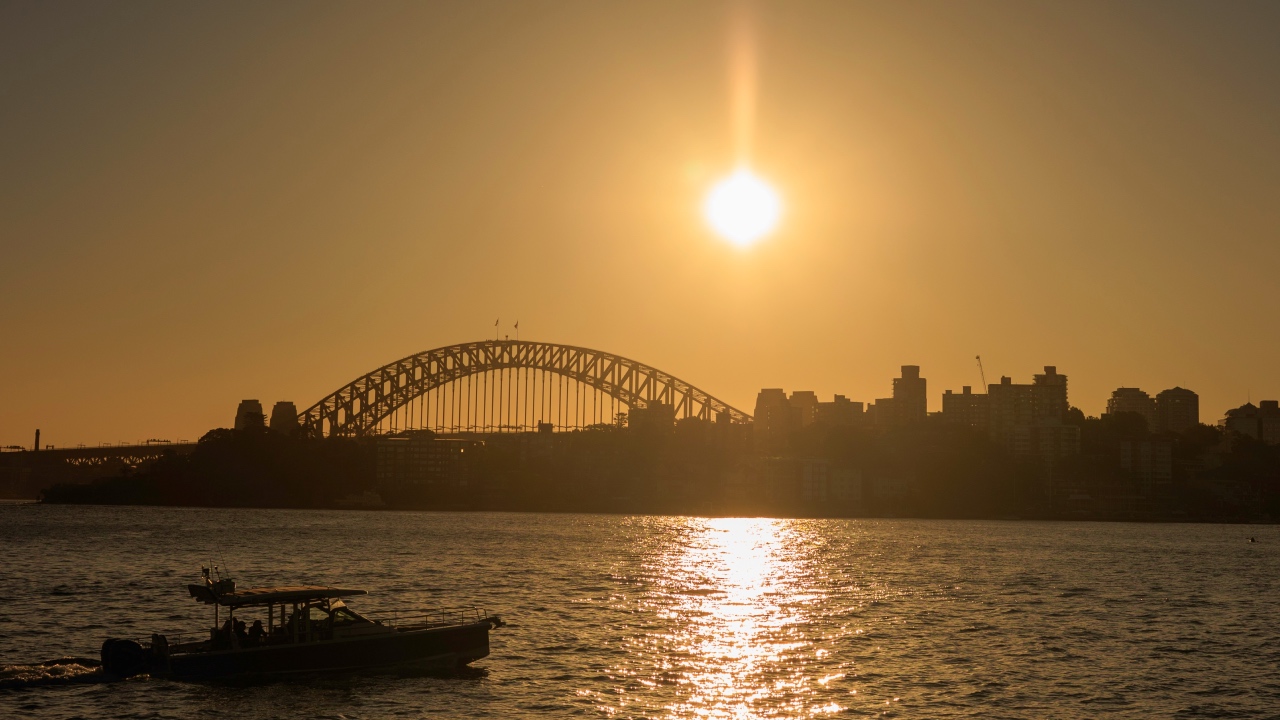
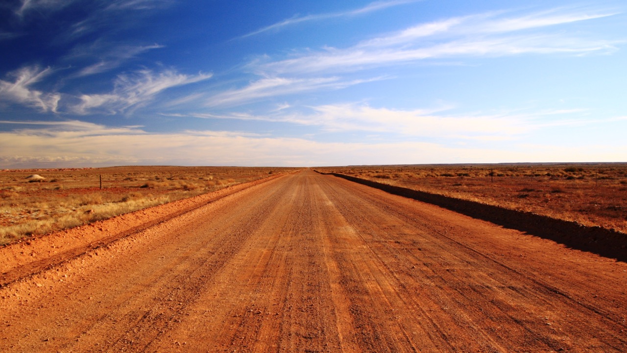
<p>Extreme heat is responsible for most weather-related injuries. Exposure to prolonged natural heat can result in physical conditions ranging from mild heat stroke, to organ damage and <a href="https://www.dea.org.au/wp-content/uploads/2021/01/DEA-Fact-Sheet_HeatwavesWEB.pdf">death</a>.</p> 
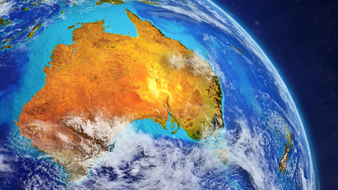
<p>As Australia heads into summer with an El Niño, it’s important understand and prepare for the health risks associated with extreme weather.</p> <h2>A spike every three years</h2> <p>Extreme weather-related hospitalisations have spiked at more than 1,000 cases every three years, with the spikes becoming progressively higher. There were:</p> <ul> <li>1,027 injury hospitalisations in 2013–14</li> <li>1,033 in 2016–17</li> <li>1,108 in 2019–20.</li> </ul> <p><iframe id="vLaas" class="tc-infographic-datawrapper" style="border: none;" src="https://datawrapper.dwcdn.net/vLaas/1/" width="100%" height="400px" frameborder="0"></iframe></p> <p>In each of these three years, extreme heat had the biggest impact on hospital admissions and deaths.</p> <p><iframe id="P03sm" class="tc-infographic-datawrapper" style="border: none;" src="https://datawrapper.dwcdn.net/P03sm/1/" width="100%" height="400px" frameborder="0"></iframe></p> <p>Extreme heat accounted for 7,104 injury hospitalisations (78% of all injury hospitalisations) and 293 deaths (43% of all injury deaths) in the ten year period analysed.</p> <p>In 2011-12, there were 354 injury hospitalisations directly related to extreme heat. This rose to 579 by 2021-22.</p> <h2>El Niño and La Niña</h2> <p>Over the past three decades, extreme weather events have increased in <a href="https://www.ipcc.ch/report/ar5/syr/">frequency</a> and <a href="http://www.bom.gov.au/state-of-the-climate/">severity</a>.</p> 
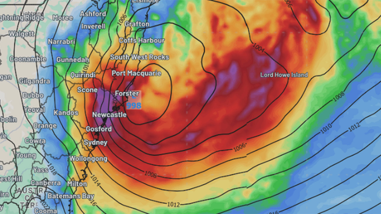
<p>In Australia, El Niño drives a period of reduced rainfall, warmer temperatures and increased bushfire danger.</p> 
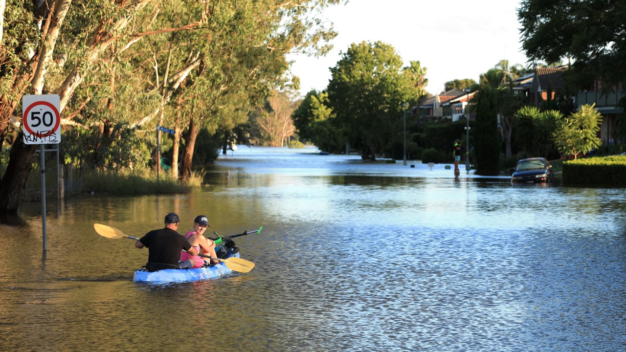
<p>La Niña, on the other hand, is associated with above average rainfall, cooler daytime temperatures and increased chance of tropical cyclones and flood events.</p> <p>Although similar numbers of heatwave-related hospitalisations occurred in El Niño and La Niña years studied, the number of injuries related to bushfires was higher in El Niño years.</p> <p>During the 2019–20 bushfires, in the week beginning January 5 2020, there were 1,100 more hospitalisations than the previous five-year average, an 11% increase.</p> <p>Although El Niño hasn’t directly been proved as the cause for these three spikes, according to the Bureau of Meteorology, two of the three years (2016-17 and 2019-20) were El Niño summers. And the other year (2013-14) was the warmest neutral year on record at that time.</p> <h2>Regional differences</h2> <p>Exposure to excessive natural heat was the most common cause leading to injury hospitalisation for all the mainland states and territories. From 2019 to 2022, there were 2,143 hospital admissions related to extreme heat, including:</p> <ul> <li>717 patients from Queensland</li> <li>410 from Victoria</li> <li>348 from NSW</li> <li>267 from South Australia</li> <li>266 from Western Australia</li> <li>73 from the Northern Territory</li> <li>23 from the ACT</li> <li>19 from Tasmania.</li> </ul> <figure class="align-center "><img src="https://images.theconversation.com/files/556987/original/file-20231101-27-3c98xm.png?ixlib=rb-1.1.0&amp;q=45&amp;auto=format&amp;w=754&amp;fit=clip" sizes="(min-width: 1466px) 754px, (max-width: 599px) 100vw, (min-width: 600px) 600px, 237px" srcset="https://images.theconversation.com/files/556987/original/file-20231101-27-3c98xm.png?ixlib=rb-1.1.0&amp;q=45&amp;auto=format&amp;w=600&amp;h=632&amp;fit=crop&amp;dpr=1 600w, https://images.theconversation.com/files/556987/original/file-20231101-27-3c98xm.png?ixlib=rb-1.1.0&amp;q=30&amp;auto=format&amp;w=600&amp;h=632&amp;fit=crop&amp;dpr=2 1200w, https://images.theconversation.com/files/556987/original/file-20231101-27-3c98xm.png?ixlib=rb-1.1.0&amp;q=15&amp;auto=format&amp;w=600&amp;h=632&amp;fit=crop&amp;dpr=3 1800w, https://images.theconversation.com/files/556987/original/file-20231101-27-3c98xm.png?ixlib=rb-1.1.0&amp;q=45&amp;auto=format&amp;w=754&amp;h=794&amp;fit=crop&amp;dpr=1 754w, https://images.theconversation.com/files/556987/original/file-20231101-27-3c98xm.png?ixlib=rb-1.1.0&amp;q=30&amp;auto=format&amp;w=754&amp;h=794&amp;fit=crop&amp;dpr=2 1508w, https://images.theconversation.com/files/556987/original/file-20231101-27-3c98xm.png?ixlib=rb-1.1.0&amp;q=15&amp;auto=format&amp;w=754&amp;h=794&amp;fit=crop&amp;dpr=3 2262w" alt="" /><figcaption><span class="attribution"><a class="source" href="https://www.aihw.gov.au/reports-data/latest-reports">AIHW National Hospital Morbidity Database</a>, <a class="license" href="http://creativecommons.org/licenses/by/4.0/">CC BY</a></span></figcaption></figure> 
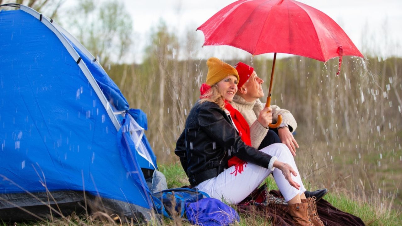
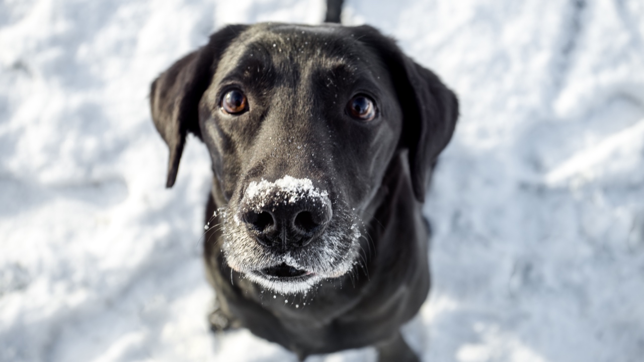
<p>The report also includes state and territory data on hospitalisations related to extreme cold and storms.</p> <p>During the ten-year period analysed, there were 773 injury hospitalisations and 242 deaths related to extreme cold. Extreme rain or storms accounted for 348 injury hospitalisations and 77 deaths.</p> <p>From 2019 to 2022, there were 191 hospitalisations related to extreme cold, with Victoria recording the highest number (51, compared to 40 in next-placed NSW). During the same period there were 111 hospitalisations related to rain and storms, with 52 occurring in NSW and 28 in Queensland.</p> <h2>What about for bushfires?</h2> <p>Over the ten-year period studied, there were 894 hospitalisations and 65 deaths related to bushfires.</p> <p>Bushfire-related injury hospitalisations and deaths peaked in 2019–20, an El Niño year with 174 hospitalisations and 35 deaths. The two most common injuries that result from bushfires are smoke inhalation and burns.</p> <p>During the 2019–20 bushfires, in the week beginning 5 January 2020 there were 1,100 more respiratory hospitalisations than the previous five-year average, an 11% increase.</p> <p>The greatest increase in the hospitalisation rate for burns was 30% in the week beginning December 15 2019 — 0.8 per 100,000 persons (about 210 hospitalisations), compared with the previous 5-year average of 0.6 per 100,000 (an average of 155 hospitalisations).</p> <h2>Some people are particularly vulnerable</h2> <p>Anyone can be affected by extreme weather-related injuries but some population groups are more at risk than others. This includes older people, children, people with disabilities, those with pre-existing or chronic health conditions, outdoor workers, and those with greater <a href="https://www.mdpi.com/2071-1050/15/1/813">socioeconomic disadvantage</a>.</p> <p>People in these groups may have reduced capacity to avoid or reduce the health impacts of extreme weather conditions, for example older people taking medication may be less able to regulate their body temperature. “Thermal inequity” includes people living in poor quality housing who have difficulty accessing adequate heating and cooling.</p> <p>For heat-related injuries between 2019–20 and 2021–22, people aged 65 and over were the most commonly admitted to hospital, followed by people aged 25–44.</p> <p>Across age groups, men had higher numbers of heat related injury hospitalisations than women. This difference was most notable among those aged 25-44 and 45-64 years, where over twice as many men were hospitalised due to extreme heat as women.</p> <h2>We still don’t have a full picture</h2> <p>The AIHW data only includes injuries which were serious enough for patients to be admitted to hospital; it doesn’t include cases where patients treated in an emergency department and sent home without being admitted.</p> <p>It includes injuries that were directly attributable to weather-related events but does not include injuries that were indirectly related. For example, it doesn’t include injuries from road traffic accidents that occur due to wet weather, since the primary cause of injury would be recorded as “transport”.</p> <p>Improved surveillance of weather-related injuries could help the health system and the community better prepare for responding to extreme weather conditions. For example, better data aids communities in predicting what resources will be needed during periods of extreme weather.</p> <p>A more complete picture of injuries during weather events could also be used to inform people of actions they can take to protect their own health. Given a predicted hot summer, this could be a matter of life or death.</p> <p><em>This article was co-authored by Sarah Ahmed and Heather Swanston from the Injuries and System Surveillance Unit at the Australian Institute of Health and Welfare.</em><!-- Below is The Conversation's page counter tag. Please DO NOT REMOVE. --><img style="border: none !important; box-shadow: none !important; margin: 0 !important; max-height: 1px !important; max-width: 1px !important; min-height: 1px !important; min-width: 1px !important; opacity: 0 !important; outline: none !important; padding: 0 !important;" src="https://counter.theconversation.com/content/216440/count.gif?distributor=republish-lightbox-basic" alt="The Conversation" width="1" height="1" /><!-- End of code. If you don't see any code above, please get new code from the Advanced tab after you click the republish button. The page counter does not collect any personal data. More info: https://theconversation.com/republishing-guidelines --></p> <p><em><a href="https://theconversation.com/profiles/amy-peden-1136424">Amy Peden</a>, NHMRC Research Fellow, School of Population Health &amp; co-founder UNSW Beach Safety Research Group, <a href="https://theconversation.com/institutions/unsw-sydney-1414">UNSW Sydney</a></em></p> <p><em>Image credits: Getty Images</em></p> <p><em>This article is republished from <a href="https://theconversation.com">The Conversation</a> under a Creative Commons license. Read the <a href="https://theconversation.com/extreme-weather-is-landing-more-australians-in-hospital-and-heat-is-the-biggest-culprit-216440">original article</a>.</em></p>

Caring

Placeholder Content Image

"It was beautiful": Rare rainbow cloud stuns small farming town

<p>The locals of a small farming town in Western Australia have been delighted with the sighting of a rare rainbow cloud. </p> <p>The colourful weather phenomenon appeared above the town of Goomalling, about 130km northwest of Perth in Western Australia, on Tuesday morning.</p> <p>Jenni Shaw was at her family-owned business when she got a text from a friend instructing her to look up at the sky. </p> <p><span style="font-size: 16px; font-family: abcsans, -apple-system, BlinkMacSystemFont, 'Segoe UI', Roboto, 'Helvetica Neue', Arial, sans-serif;">"We all went out the front and had a look and there was some bright, rainbow-type clouds in the sky that we hadn't seen before," she </span>told <em><a href="https://www.abc.net.au/news/2023-10-24/rainbow-cloud-iridescence-irisation-delights-wheatbelt-community/103016928" target="_blank" rel="noopener">ABC</a></em><span style="font-size: 16px; font-family: abcsans, -apple-system, BlinkMacSystemFont, 'Segoe UI', Roboto, 'Helvetica Neue', Arial, sans-serif;">.</span></p> <p>“It was beautiful,” she said.</p> <p>“But we were a bit like ‘why is that like that? Should we still be outside looking or not?’”</p> <p><iframe style="border: none; overflow: hidden;" src="https://www.facebook.com/plugins/post.php?href=https%3A%2F%2Fwww.facebook.com%2Flang.lefroy.7%2Fposts%2Fpfbid02h2HTyVYSVda8NkewrireTWPS4P6wKTnuJxhBWfkNhbxGn3QzHweELRNFQczM8GsPl&show_text=true&width=500" width="500" height="645" frameborder="0" scrolling="no" allowfullscreen="allowfullscreen"></iframe></p> <p>Ms Shaw said the rainbow-coloured cloud was visible for just a few minutes.</p> <p>"It was not there long, just long enough for us all to get some photos," she said.</p> <p class="paragraph_paragraph__3Hrfa" style="font-size: 16px; box-sizing: border-box; margin-bottom: 1rem; font-family: abcsans, -apple-system, BlinkMacSystemFont, 'Segoe UI', Roboto, 'Helvetica Neue', Arial, sans-serif;">Jessica Lingard from the Bureau of Meteorology said rainbow clouds, known as cloud iridescence, form in the same way as rainbows - when sunlight diffracts off water or ice crystals in the sky.</p> <p>"It's quite a rare phenomenon to catch in person," she said.</p> <p>"It's the perfect storm of conditions: the sun's at the right angle, the clouds are not too thin and not too thick that they're being blocked out, and the sunlight has just created this spectacle of coloured light."</p> <div data-component="EmphasisedText"> <p>"It's an absolutely stunning photo."</p> </div> <p>Lucky local residents said it wasn’t the first time they’d seen the special clouds in the area.</p> <p>“I have seen clouds like this a few times in my travels, mostly in the Wheatbelt,” Jill Lefroy wrote on Facebook. </p> <p>“Pretty awesome seeing a rainbow with no rain!”</p> <p><em>Image credits: Facebook</em></p>

Domestic Travel

Placeholder Content Image

It’s warming up and mozzies are coming. Here’s how to mosquito-proof your backyard

<p><em><a href="https://theconversation.com/profiles/cameron-webb-6736">Cameron Webb</a>, <a href="https://theconversation.com/institutions/university-of-sydney-841">University of Sydney</a></em></p> <p>The weather is warming up and that means more time in the backyard. It also means more mosquitoes.</p> <p>Here are five ways you can mosquito-proof your backyard that <a href="https://theconversation.com/the-battle-against-bugs-its-time-to-end-chemical-warfare-111629">don’t rely on spraying insecticides</a>.</p> <h2>1. Get rid of water</h2> <p>Mosquitoes need water to complete their life cycles. They <a href="https://theconversation.com/feel-like-youre-a-mozzie-magnet-its-true-mosquitoes-prefer-to-bite-some-people-over-others-128788">need blood</a> – but water and warmth are just as important.</p> <p>Getting rid of water around your backyard will go a long way to keeping mosquitoes away. Water trapped in blocked roof gutters, drains and tarpaulin covering boats and trailers can be a great home for mosquitoes.</p> <p>Mosquitoes can exploit the tiniest of water sources too. It may just be the upturned lid of a discarded plastic drink bottle. If it traps water, mosquitoes will find it and lay eggs in it.</p> <p>Flush out your bird bath once a week to disrupt the mosquito’s life cycle.</p> <p>If you have a pond, installing a fountain will discourage mosquitoes. If you can’t keep water clean and circulating, consider filling it with sand and gravel to create an interesting garden bed for succulents or other plants.</p> <p>Mosquitoes will avoid clean and chlorinated swimming pools but will quickly move into “green pools”. If you’re not using your pool, consider <a href="https://www.krg.nsw.gov.au/Environment/Your-local-environment/Wildlife/Living-with-wildlife/Pool-to-pond/How-to-convert-your-pool">converting it to a “pond”</a> so that fish can help keep mosquito numbers down.</p> <h2>2. Screen up – windows, doors and rainwater tanks</h2> <p>If you can’t get rid of permanent water, at least stop mosquitoes getting to it (or you).</p> <p>Ensure <a href="https://www.brisbane.qld.gov.au/clean-and-green/natural-environment-and-water/water/water-smart-homes/rainwater-tanks/using-your-rainwater-tank">rainwater and septic tanks</a> have screens to stop mosquitoes entering.</p> <p>Screen windows and doors to stop mosquitoes entering the home. There are plenty of flexible screening options for windows, doors and balconies.</p> <p>If you live in a mosquito-prone area, creating a screened outdoor area (such as a pergola, courtyard, or balcony) will give you the opportunity to spend time outdoors without being hassled by mozzies.</p> <h2>3. Choose your garden plants carefully</h2> <p>Some plants <a href="https://bioone.org/journals/Journal-of-the-American-Mosquito-Control-Association/volume-25/issue-3/09-0016.1/Are-Commercially-Available-Essential-Oils-from-Australian-Native-Plants-Repellent/10.2987/09-0016.1.short">contain essential oils and other chemicals</a> that, when extracted and concentrated, provide protection against biting mosquitoes. But there isn’t a lot of evidence that the whole plant will keep mosquitoes away from your garden.</p> <p>Some types of plants are even marketed as “mozzie blockers” or “mosquito repelling”. But there isn’t <a href="https://www.veranda.com/outdoor-garden/a40592197/do-mosquito-repelling-plants-work/">any evidence of effectiveness</a>. In fact, some of these plants, <a href="https://onlinelibrary.wiley.com/doi/full/10.1111/j.1440-6055.2009.00736.x">such as melaleucas</a>, also happen to be associated with <a href="https://academic.oup.com/jme/article/36/4/515/903838">hot spots of mosquito breeding</a> in coastal Australia.</p> <p>The plants to <em>avoid</em> around the home are those that help mosquitoes breed, such as <a href="https://onlinelibrary.wiley.com/doi/abs/10.1111/j.1440-6055.2008.00641.x">bromeliads</a>, which trap water.</p> <h2>4. Encourage the animals that eat mosquitoes</h2> <p>Mosquitoes are food for a range of animals including birds, bats, fish, frogs, lizards, insects, spiders and <a href="https://besjournals.onlinelibrary.wiley.com/doi/abs/10.1111/1365-2656.13965">dragonflies</a>. But don’t expect them to eat enough to keep all mosquitoes away.</p> <p>Bats are often promoted as a good “biological control” options but studies have shown mosquitoes are <a href="https://journals.plos.org/plosone/article?id=10.1371/journal.pone.0077183">more likely to be a snack food</a> for small bats, not an irresistible staple of their diet.</p> <p>For garden ponds, frogs will eat a few adult mosquitoes but tadpoles of Australian frogs generally <a href="https://bioone.org/journals/journal-of-the-american-mosquito-control-association/volume-21/issue-4/8756-971X(2006)21%5b492%3aTOFCAF%5d2.0.CO%3b2/TADPOLES-OF-FOUR-COMMON-AUSTRALIAN-FROGS-ARE-NOT-EFFECTIVE-PREDATORS/10.2987/8756-971X(2006)21%5B492:TOFCAF%5D2.0.CO;2.short">don’t eat many mosquito “wrigglers”</a>.</p> <p>Australian native fish <a href="https://pubmed.ncbi.nlm.nih.gov/15532929/">will readily eat mosquitoes</a> and may be useful for backyard ponds.</p> <p>But not all fish are good. While “mosquitofish” (aka “plague minnow”) is distributed overseas to assist in mosquito control, <a href="https://meridian.allenpress.com/australian-zoologist/article/30/3/316/134508/Does-predation-by-the-fish-Gambusia-holbrooki">it’s a disaster for local wildlife</a> and, <a href="https://www.dpi.nsw.gov.au/fishing/aquatic-biosecurity/pests-diseases/freshwater-pests/finfish-species/gambusia">along with other exotic fish species</a>, should not be released into local waterways.</p> <p><a href="https://link.springer.com/article/10.1007/s13157-019-01133-2">Healthier habitats promote fewer mosquitoes</a> so the best thing you can do is create habitats for the animals that eat mosquitoes.</p> <h2>5. Avoid traps and other gadgets</h2> <p>There are lots of devices purported to catch, kill, or repel mosquitoes from your garden. Some may catch a mosquito or two but they’re not very effective in knocking out big numbers.</p> <p>“Bug zappers” with bright lights will collect lots of flying insects. It’s just that mosquitoes make up a very small proportion of collections.</p> <p>Electrocuting devices, again, don’t seem to attract a lot of mosquitoes.</p> <p>Devices that <a href="https://theconversation.com/the-buzz-from-your-smartphone-wont-stop-mosquito-bites-92611">emit high frequency sounds</a> won’t help either.</p> <p>The best devices are typically those that are baited with carbon dioxide. These are a mainstay of state and territory <a href="https://www.health.nsw.gov.au/Infectious/mosquito-borne/Pages/surveillance.aspx">mosquito and arbovirus surveillance programs</a>. For a mosquito, the C0₂ tricks them into thinking the trap is a warm-blooded animal. The only problem is these can be expensive to run and don’t seem quite as effective for mosquito control <a href="https://bioone.org/journals/journal-of-the-american-mosquito-control-association/volume-22/issue-3/8756-971X(2006)22%5b490%3aTATTFA%5d2.0.CO%3b2/Traps-and-Trapping-Techniques-for-Adult-Mosquito-Control/10.2987/8756-971X(2006)22%5B490:TATTFA%5D2.0.CO;2.short">unless used in large numbers</a>.</p> <h2>Yes, you’ll still need repellent</h2> <p>Perhaps the best way to avoid mosquito bites is to pick an insect repellent <a href="https://www.phrp.com.au/issues/december-2016-volume-26-issue-5/a-review-of-recommendations-on-the-safe-and-effective-use-of-topical-mosquito-repellents/">recommended by health authorities</a> and <a href="https://theconversation.com/mozzies-biting-heres-how-to-choose-a-repellent-and-how-to-use-it-for-the-best-protection-150183">apply it</a> to ensure all exposed areas of skin are covered. These products and safe, affordable and effective.<!-- Below is The Conversation's page counter tag. Please DO NOT REMOVE. --><img style="border: none !important; box-shadow: none !important; margin: 0 !important; max-height: 1px !important; max-width: 1px !important; min-height: 1px !important; min-width: 1px !important; opacity: 0 !important; outline: none !important; padding: 0 !important;" src="https://counter.theconversation.com/content/212711/count.gif?distributor=republish-lightbox-basic" alt="The Conversation" width="1" height="1" /><!-- End of code. If you don't see any code above, please get new code from the Advanced tab after you click the republish button. The page counter does not collect any personal data. More info: https://theconversation.com/republishing-guidelines --></p> <p><a href="https://theconversation.com/profiles/cameron-webb-6736"><em>Cameron Webb</em></a><em>, Clinical Associate Professor and Principal Hospital Scientist, <a href="https://theconversation.com/institutions/university-of-sydney-841">University of Sydney</a></em></p> <p><em>Image credits: Getty Images</em></p> <p><em>This article is republished from <a href="https://theconversation.com">The Conversation</a> under a Creative Commons license. Read the <a href="https://theconversation.com/its-warming-up-and-mozzies-are-coming-heres-how-to-mosquito-proof-your-backyard-212711">original article</a>.</em></p>

Home & Garden

Placeholder Content Image

10 driving tips to stay safe in wet weather

<p><strong>Driving in the rain? Follow these tips for safe driving in wet weather </strong></p> <p>This should go without saying, but reducing your speed – as long as you continue to keep with the flow of traffic, of course – is imperative when driving in the rain.</p> <p>After all, between the downpour and spray from other vehicles, heavy rain reduces visibility in all directions, and you need more time to react.</p> <p><strong>Keep your distance </strong></p> <p>Driving in the rain can be hazardous, and if ever there is an incident that requires you – or the driver in front you – to brake unexpectedly, you’ll want to have ample stopping distance on wet roads.</p> <p><strong>Avoid heavy breaking </strong></p> <p>While driving in the rain, you may find yourself in situations – whether you’re hydroplaning or finding yourself in a skid – that will tempt you to hit the brakes abruptly. Do your best to curb that impulse.</p> <p>Brakes can be affected greatly by water, losing a bit of their power when wet, which can be disastrous in an emergency. Easing off the brakes, slowing down and maintaining control of your vehicle is your best bet.</p> <p><strong>Keep both hands on the wheel </strong></p> <p>Control is of utmost importance when driving in the rain. After all, you need to be in command of your vehicle should an incident occur, and having both hands on the wheel while driving in the rain (no snacking or fiddling with the radio!) will ensure you can get out of a sticky situation quickly and efficiently.</p> <p><strong>Keep windows from fogging up</strong></p> <p>When driving in rain, windows tend to fog up as a result of the difference in temperatures inside and outside the car and can lead to decreased visibility. To stay safe and avoid accidents, simply press your car’s defrost button to clear-up the window.</p> <p>Turn on your A/C or roll down the windows by a couple of centimetres to remove the humidity from the vehicle and lower the temperature inside the car. If the issue persists, you may want to purchase a windshield cleaner and defogger.</p> <p><strong>Beware of hydroplaning </strong></p> <p>Hydroplaning happens when your car travels above the water without touching the ground. Given that a driver is left with little-to-no grip with the road and, thus, less control, this can be a dangerous set of circumstances. If you find yourself in such a situation, stay calm, ease off the brakes and do not turn your steering wheel; let your car slow down and the tires reattach to the road surface.</p> <p><strong>Avoid puddles</strong></p> <p>Windshield wipers should always be in working condition. Be vigilant about replacing them once per year, or whenever they start to leave streaks on the glass. Having wipers blades in tip-top shape ensures the best possible visibility when driving in the rain.</p> <p><strong>Stay home if you can </strong></p> <p>If you have no choice but to head outside during a heavy downpour, be sure to follow these driving tips. However, if you don’t have anywhere pressing to be, consider staying home and waiting it out until the storm subsides.</p> <p><strong>Keep your headlights on</strong></p> <p>With wet weather often comes fog and overall gloominess. With your surroundings slightly darkened, turning on your headlights ensures that you can see the road in front of you, and that other drivers can see you.</p> <p><strong>Ensure windshield wipers are in working order</strong></p> <p>Windshield wipers should always be in working condition. Be vigilant about replacing them once per year, or whenever they start to leave streaks on the glass. Having wipers blades in tip-top shape ensures the best possible visibility when driving in the rain.</p> <p><em>Image credits: Getty Images</em></p> <p><em>This article originally appeared on <a href="https://www.readersdigest.com.au/food-home-garden/home-tips/10-driving-tips-to-stay-safe-in-wet-weather" target="_blank" rel="noopener">Reader's Digest</a>. </em></p>

Travel Tips

Our Partners